5/25 – Night Rob’s “One More Round” Wednesday Evening Forecast
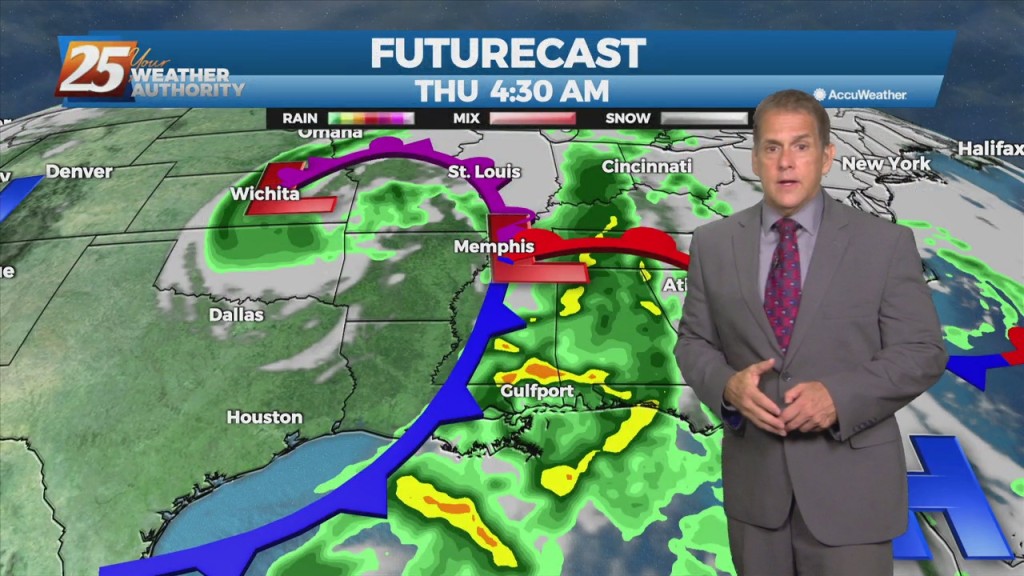
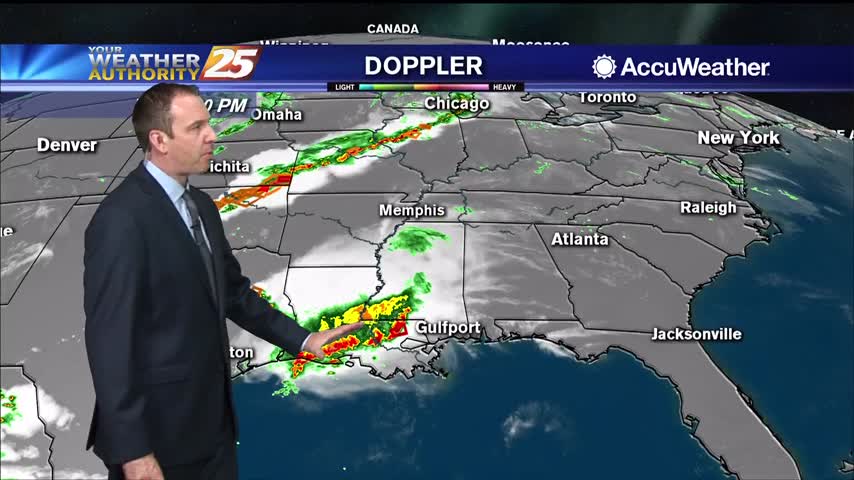
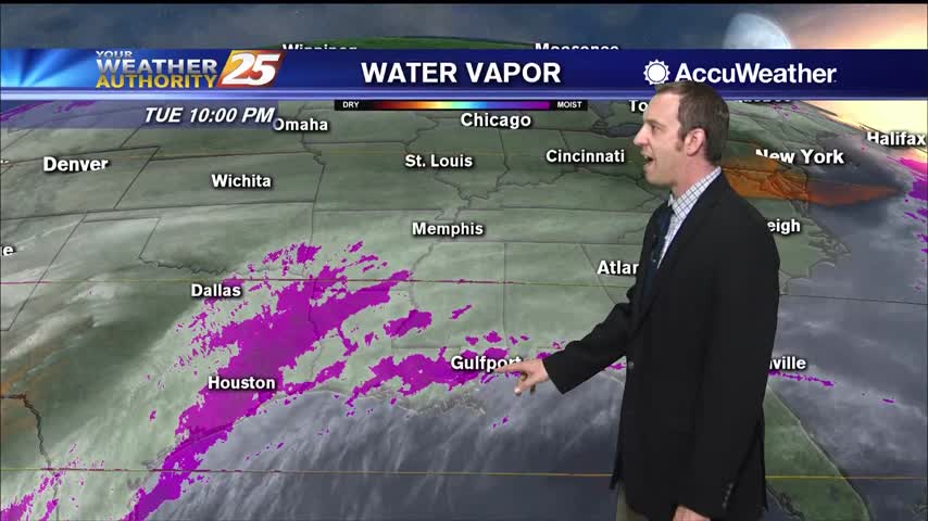
The main concerns are for heavy rain in the first 12-18 hours of the forecast…round one came through this afternoon, with round two overnight into Thursday…
The main concerns are for heavy rain in the first 12-18 hours of the forecast…round one came through this afternoon, with round two overnight into Thursday…
The warmest temperatures of the season are on the horizon, but first we have to deal with a few thunderstorms. Some showers will develop late…

Not much will change tonight other than some increasing cloud cover, but stormy, potentially severe weather is expected tomorrow.
Nice and quiet for now, but the potential for severe weather ramps up quickly tomorrow afternoon...
A small convective system brought a few thunderstorms before midnight, but we'll see the strongest activity with this frontal system move in tomorrow morning.
They dry conditions haven't helped in regards to the Canal Road fire, but the humidity is slowly rising and rain is expected overnight and tomorrow.
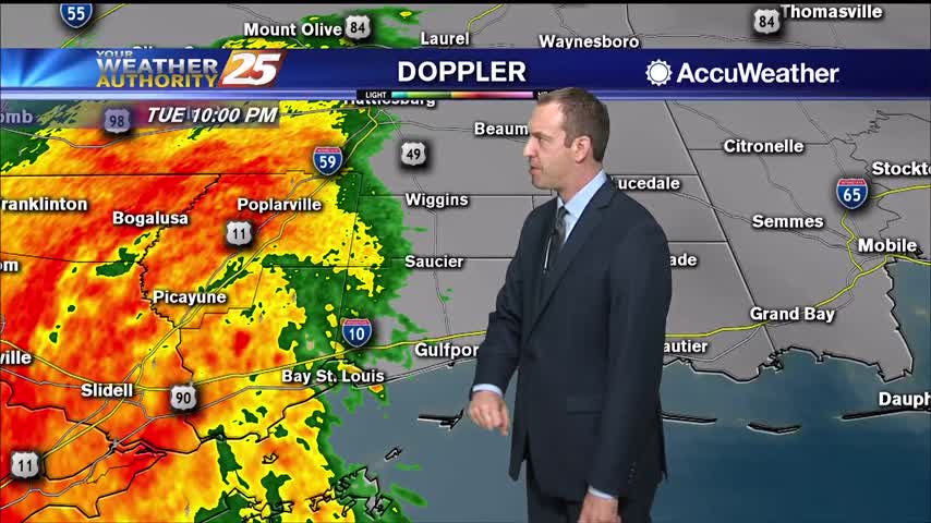
Expecting showers to get going a little after midnight, but stronger, potentially severe storms are likely before sunrise.
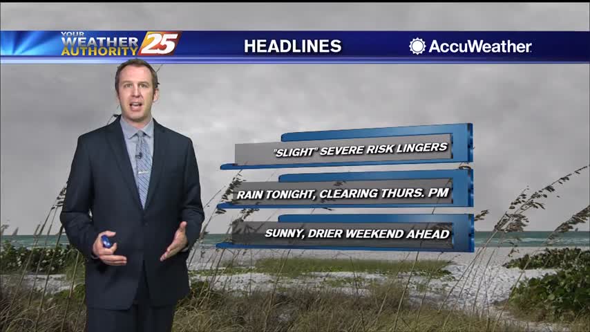
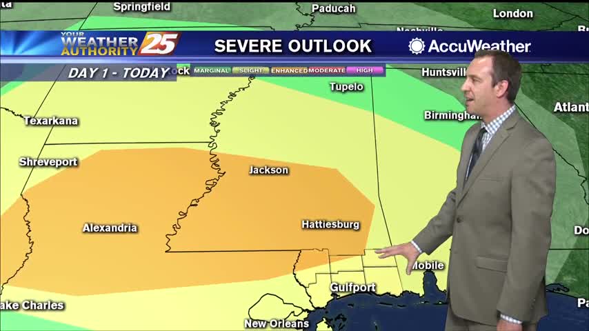
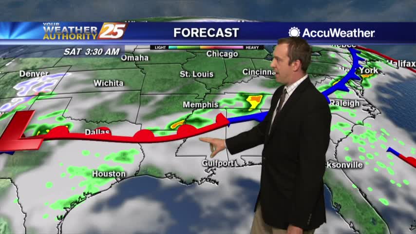
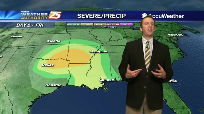
Slight risk of severe weather lingers in South MS though all the activity so far has been to the north.
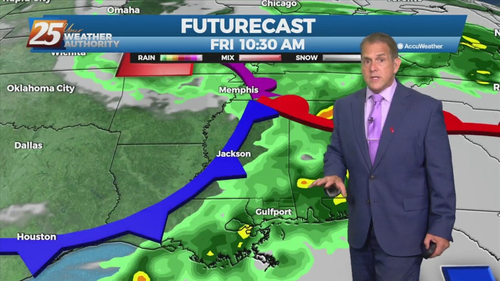
Active, potentially severe weather is moving in for all of Wednesday, but will clear quickly before the weekend.
The new year arrived rather quietly, but active, potentially severe weather moves in quickly.
Ugly weather moved in today and won't be in any hurry to leave. Expect showers and thunderstorms through the night, but things clear rapidly tomorrow....

Starting off the week on the wet side, but much better, more fall-like days lie ahead....
The rain continued today after lines of stronger storms moved in just after noon. Expect even more in the days ahead....
Only clouds so far today, but storms aren't far away....
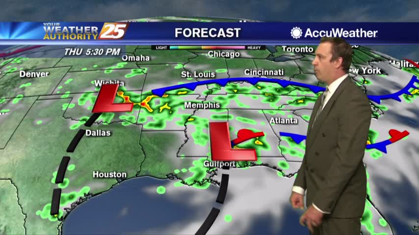
Clouds increased a bit today, but we'll see a big increase tomorrow as a front moves towards South Mississippi....
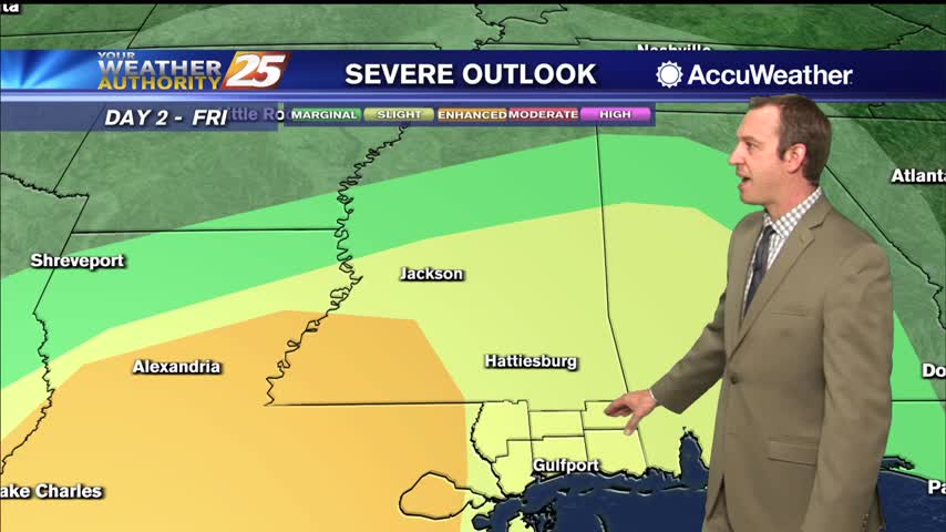
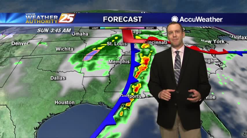
Yesterday's clouds remained and we even saw a few showers this evening, but the real rain won't move in until Friday night and could be severe....

The cold front is still on the way, and while most of the severe weather is still off to the North we may see some early morning activity overnight....

It's much more cloudy today, but will clear quickly tomorrow after overnight storms which bring a slight risk of severe weather to the Coast....

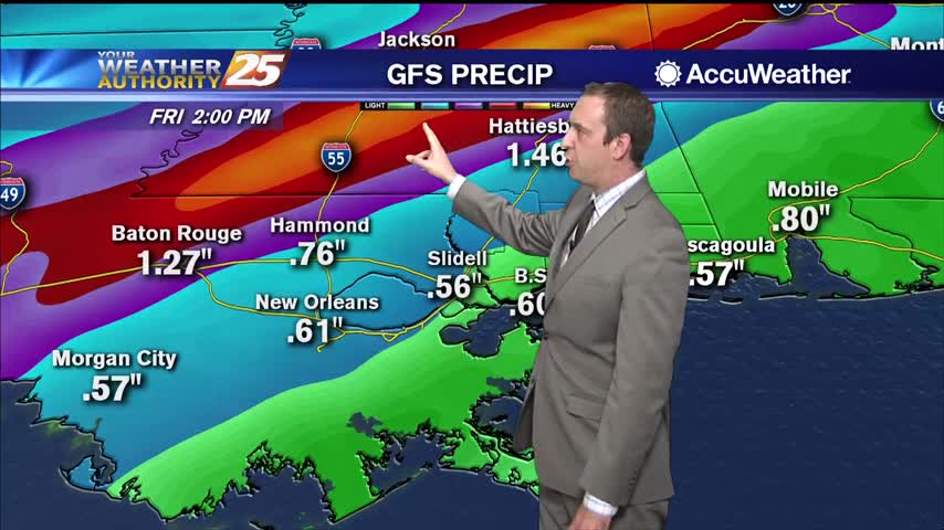
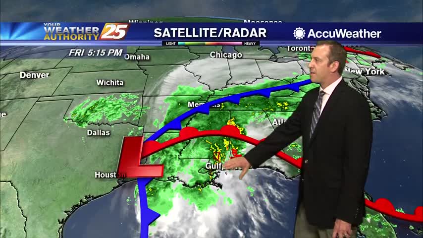
Tropical storm Cindy officially formed this afternoon and continues to pummel South MS with rain. Don't expect that to change for quite some time, meaning flooding woes will begin to arise. Watch the full forecast for more.