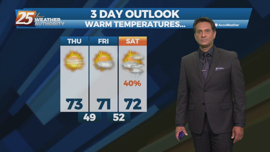
3/31 - Rob Knight's "Beautiful" Thursday Afternoon Forecast
High-pressure will begin moving in from the NW, ushering a colder/drier air mass. Pleasant condition will continue through Friday before high-pressure moves SE allowing for the next system…
High-pressure will begin moving in from the NW, ushering a colder/drier air mass. Pleasant condition will continue through Friday before high-pressure moves SE allowing for the next system…
The front is now well east of the area after leaving extensive damage through the region including South Mississippi. Multiple areas were hit by damaging straight…
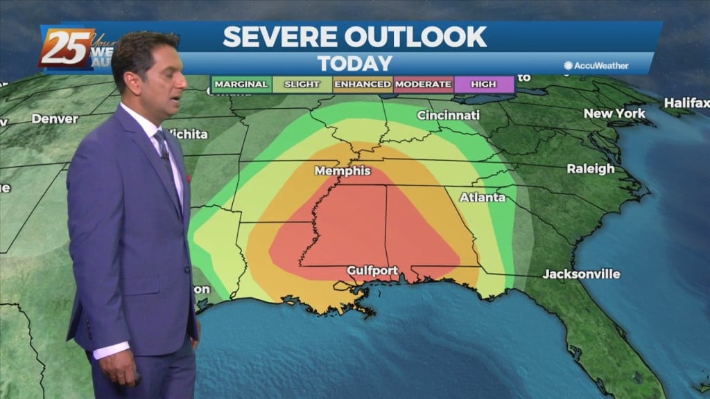
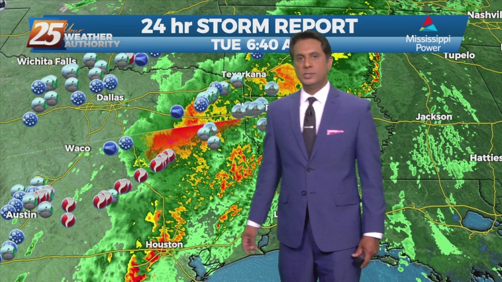
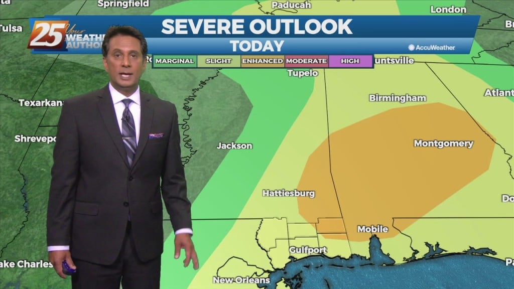
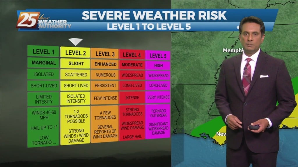
THE AREA/STATE IS UNDER A MODERATE (LEVEL 4 OF 5) SEVERE POTENTIAL THROUGH TONIGHT... A cold front to the west with a squall line in advance…
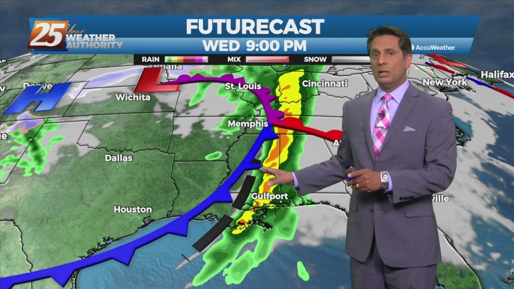
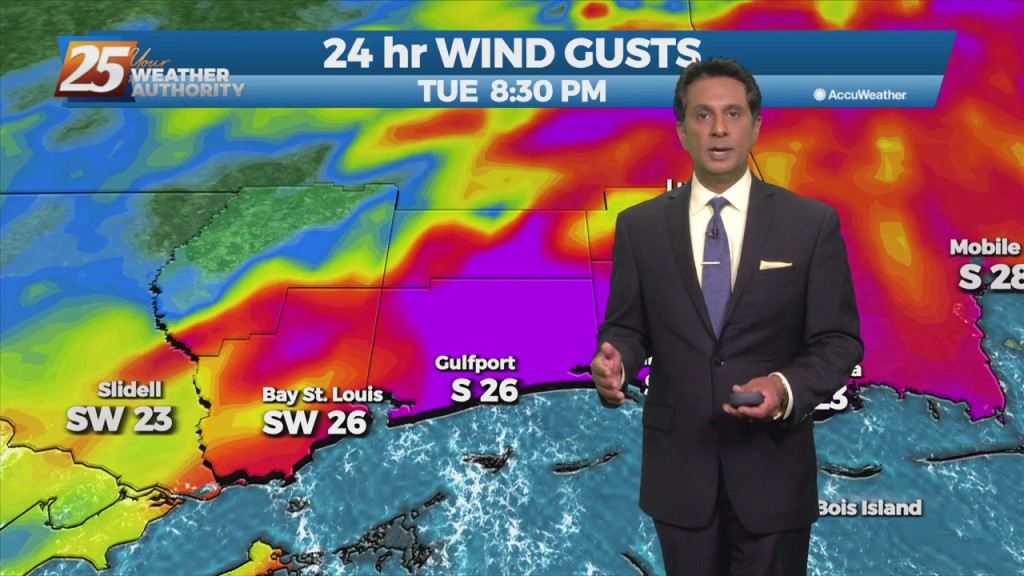
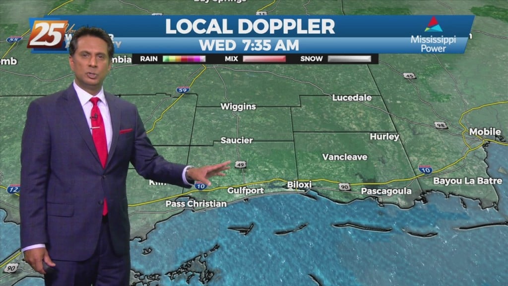
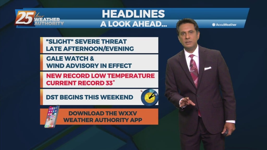
Very strong wind event and severe weather potential is expected Wednesday and Wednesday night... A quiet day with the exception of fog this morning but…
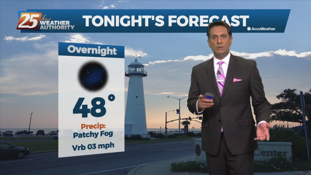
A pleasant afternoon with a few clouds and plenty of sunshine. Fog will be a factor the next few morning but not in every location and may be…
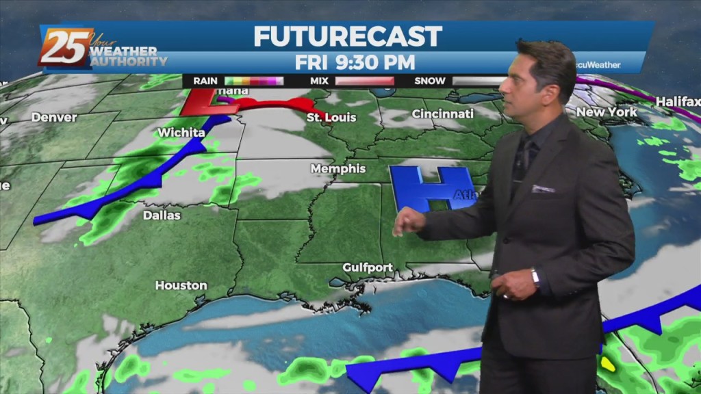
Upper level moisture/disturbance will move only slowly eastward over the next couple of days, and may take until about Friday to totally clear the region. Lower…
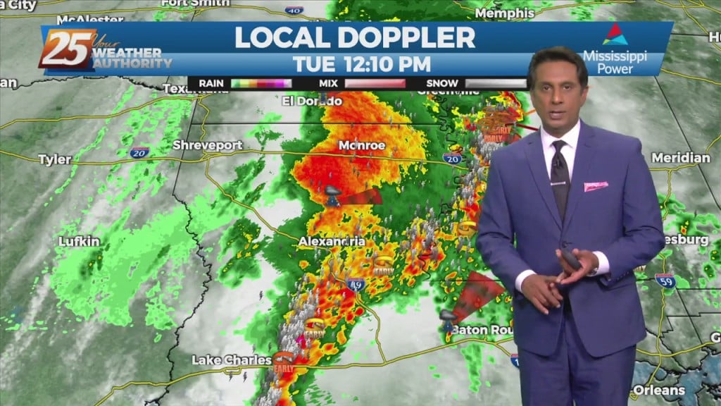
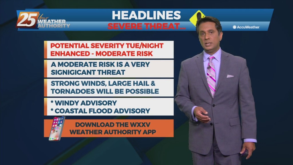
The area is under an ENHANCED/MODERATE threat for severity...especially noon through midnight A TORNADO WATCH IS IN EFFECT UNTIL 7 PM... Looking at the main event,…
The area is under an ENHANCED/MODERATE threat for severity...especially noon through midnight WATCHES/WARNINGS include: Wind Advisory, Flood Watch, Coastal Flood Advisory & Small Craft Advisory. Some prefrontal…
Today very nice but will be a transition day for deeper moisture and much better dynamics. Instability starts to increase today until a cold front moves through the…
Behind the front, drier and cooler air will move in for the weekend. The front may linger over the coastal waters for about 24 hours, so…
A vigorous system is in the area moving to the east. The area is under a TORNADO WATCH until 10 AM. All form of SEVERITY will…
Today is looking like a very nice day as high-pressure shifts to the east and return flow begins ahead of the next system. Timing is a virtue…
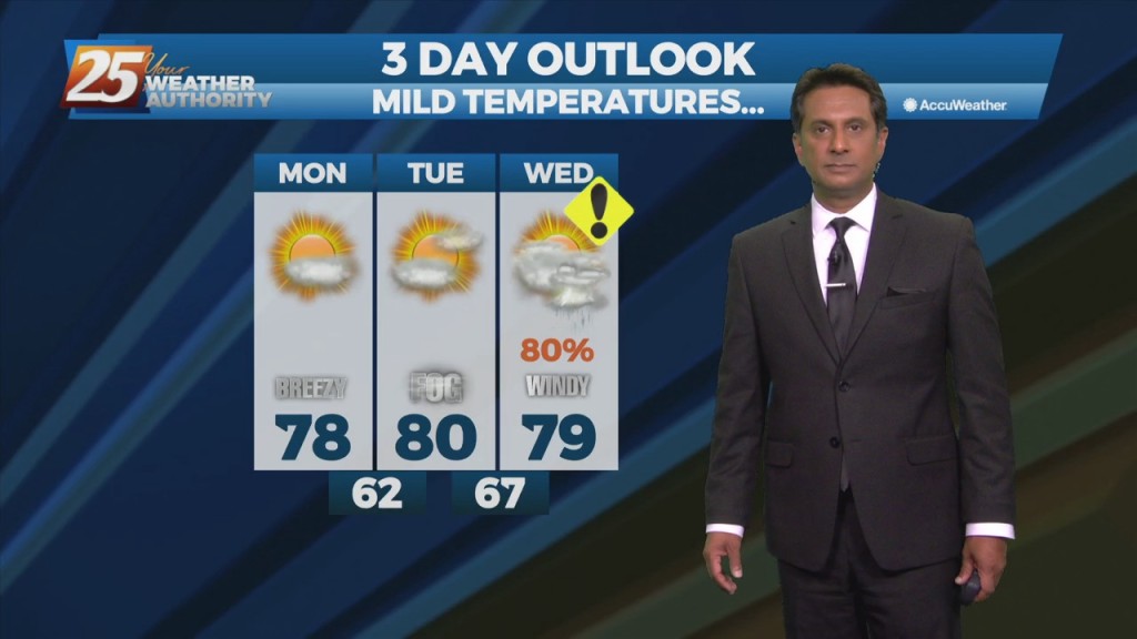
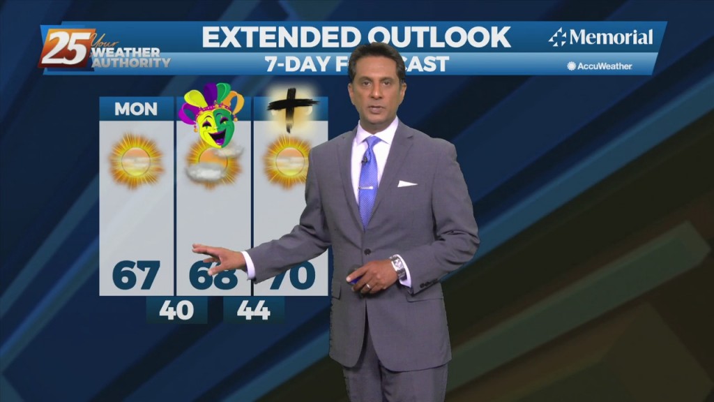
Quiet conditions through St. Patrick's day with linger cloud coverage and mild temperatures In the 70s. The forecast gets active again Thursday night and early Friday. Our next…
Instability is still not impressive with this system as it moves east across the Mississippi Gulf Coast this morning. Scattered showers/t-storms will move across the area this morning…
Scattered to numerous showers and storms will be possible this afternoon/tonight. Strong to possibly severe storms will be possible along the MS coastal areas and east.…
Today, an upper level disturbance/frontal boundary is expected to influence the area. Scattered to numerous showers and storms will be possible, mainly in the afternoon hours looking…
A stationary front to the east will continue to be the focal point for showers and t-storms again today. The development over land will be elevated…

The frontal boundary will stall just off the northern Gulf Coast thanks to high-pressure to the SE. Isolated rain with a few t-storms possible this morning with…
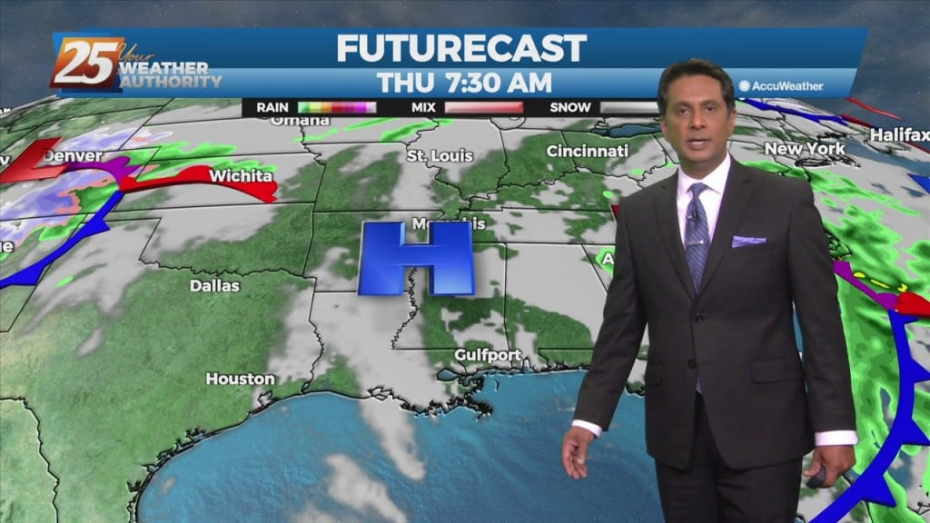
Low pressure is currently over southern Indiana with a cold front southwestward to near Memphis and Shreveport. As the surface low continue to lift northeastward, the cold…
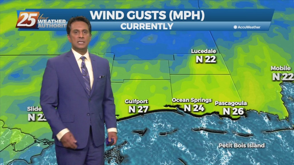
This afternoon winds will gradually come around to the southeast by this afternoon. Little in the way of cloud cover is expected today, and high temperatures should…
As the high pressure continues to shift east of the area today, winds will gradually come around to the southeast by this afternoon. Little in the…
High-pressure currently over the Rockies will move eastward across the Gulf of Mexico Friday and Saturday. This will gradually allow our surface flow to turn onshore and allow moisture…
It's a rather quiet forecast the next few days with cool and dry conditions today slowly moderating over the next few days. High-pressure will quickly move…
A cold front is no east of the area with light precipitation behind the front expected to be out of the area by moon. Forecast guidance indicates…