10/19 - Rob Knight's "Frosty Start" Wednesday Morning Forecast
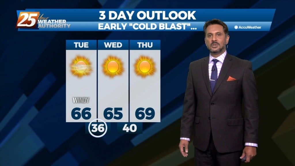
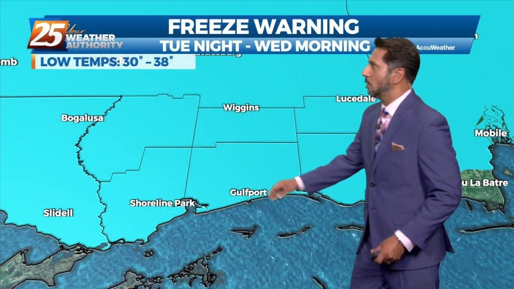
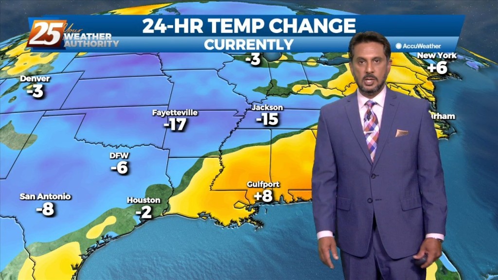
A FREEZE WARNING CONTINUES THROUGH 9 AM. A cold airmass continues to shape our forecast over the next couple of days. Temperatures will warm into the mid-60s…
A FREEZE WARNING CONTINUES THROUGH 9 AM. A cold airmass continues to shape our forecast over the next couple of days. Temperatures will warm into the mid-60s…
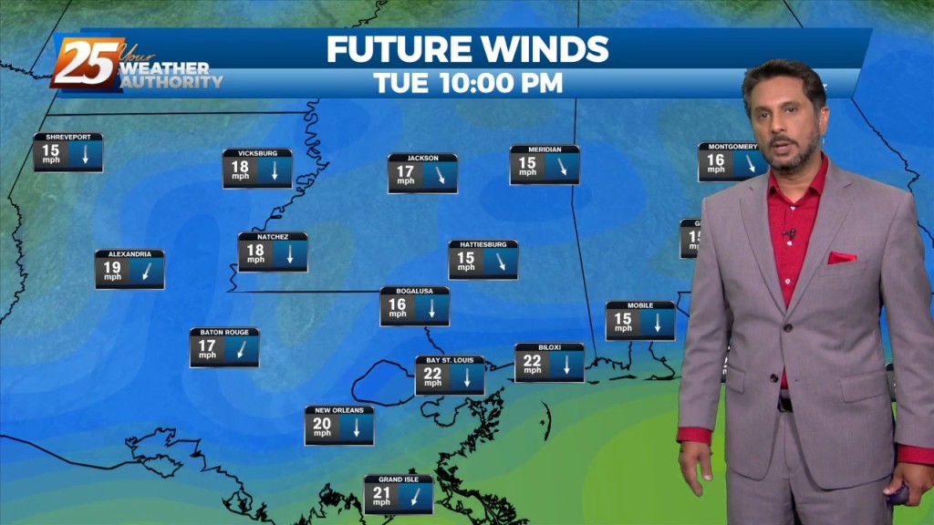
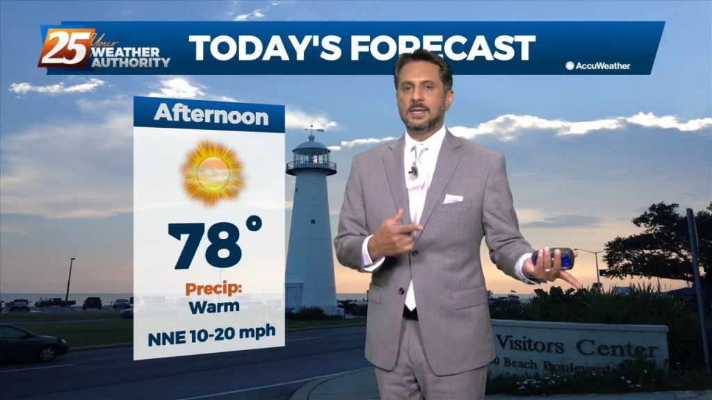
Cooler, drier air along with gusty winds will be in place this afternoon. Winds will be out of the North at 10-20 MPH with higher gusts…
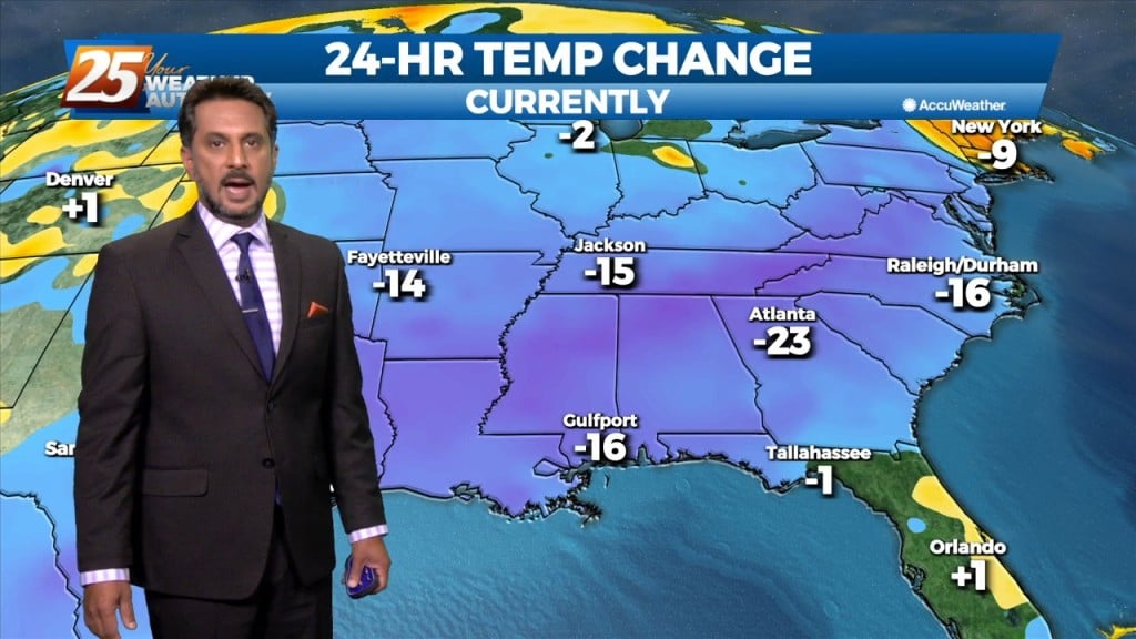
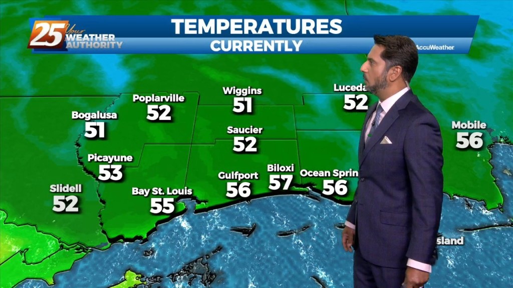
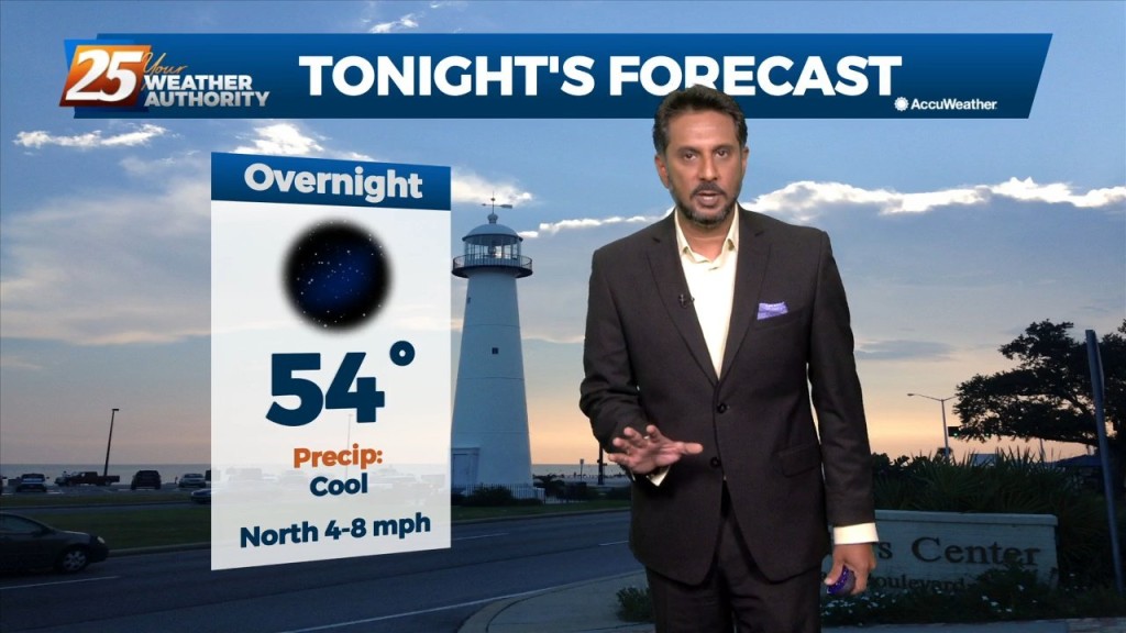
It is a much cooler start this morning with temperatures in the 40s inland, and in the 50s along the beach. Behind the cold front,…
A cold front overhead will move southeast and continue to provide cloud coverage along with a few spotty showers. With a lack of atmospheric moisture and a…
With an approaching cold front to the NW positioned to move through the area, widespread dense fog is affecting South Mississippi this morning. A dense fog…

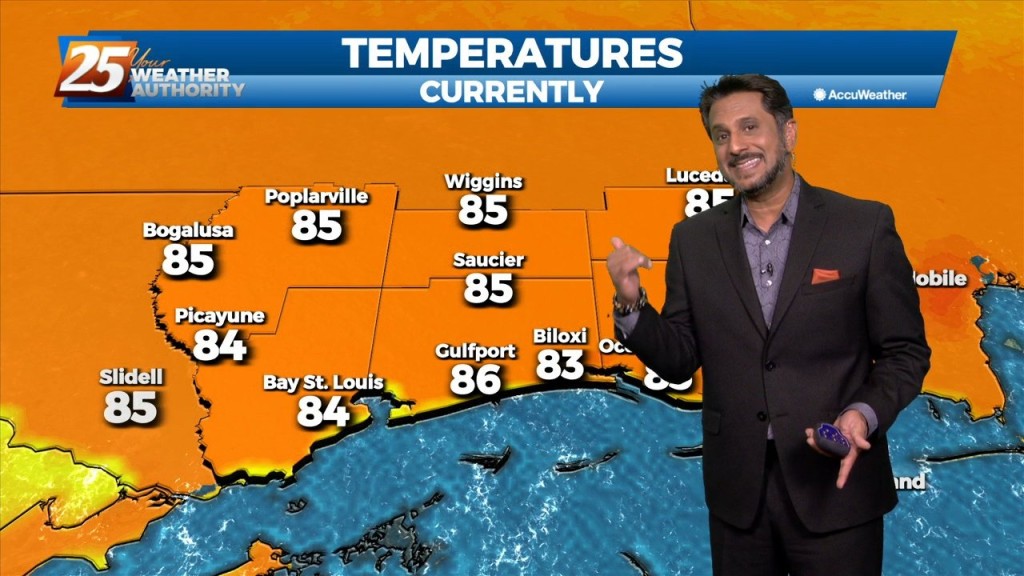
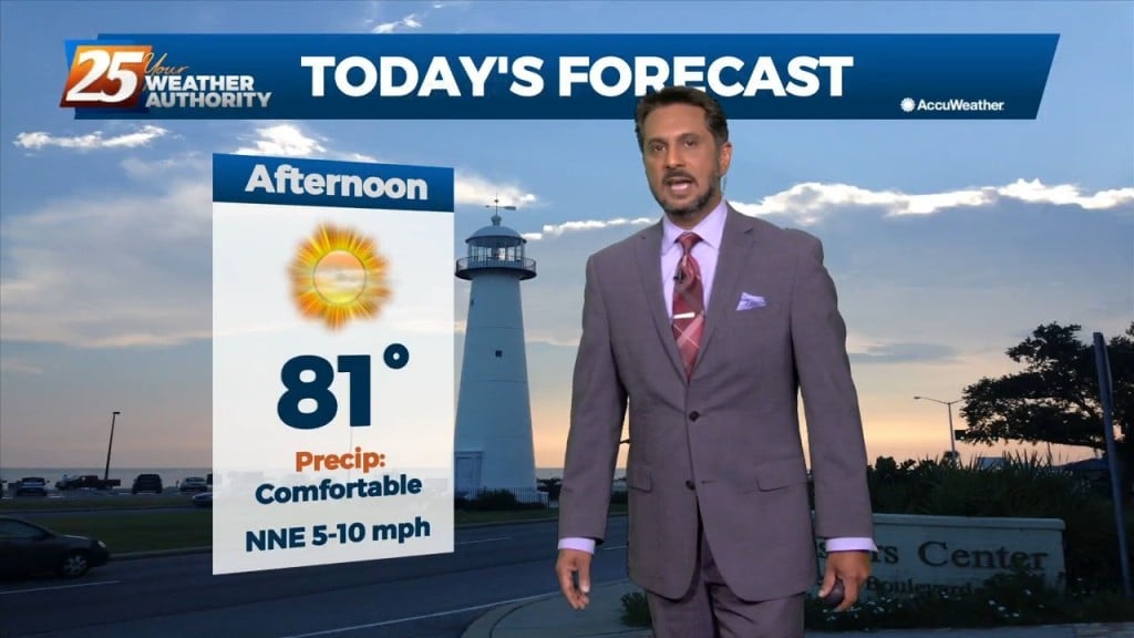
Temperatures have warmed quickly today under a dry airmass. It will get to around 80 degrees this afternoon with east winds shifting to southeast at 8 to 12…
This morning we have clear skies and cooler temperatures in the area. The airmass overhead is a drier one and it is being aided by high pressure…
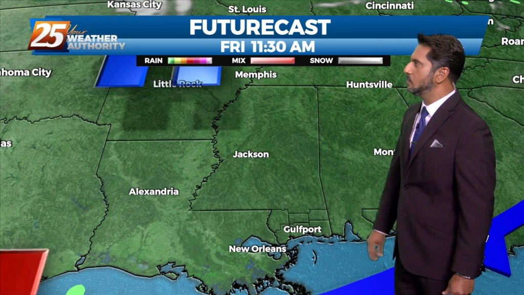
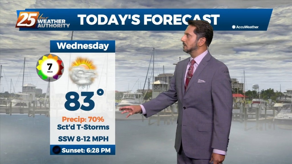
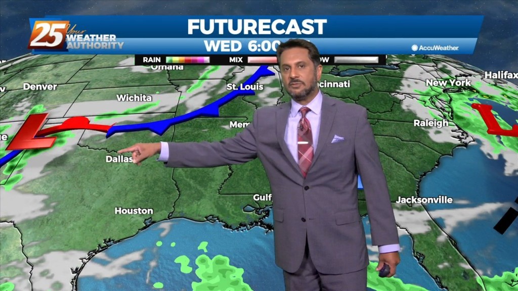
Cold frontal passage will occur this morning with a 30% chance of showers and thunderstorms associated with it. Mostly cloudy skies will clear this afternoon…
An approaching cold front from the northwest coupled with daytime heating will continue to increase shower and thunderstorm activity this afternoon. Upper level high pressure…
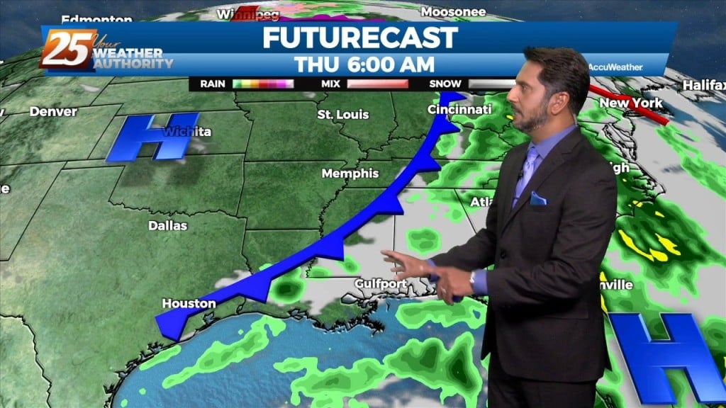
Main focus on the short term is upcoming rain chances today into tonight. A developing upper level disturbance near the Pacific Northwest will dig south and amplifying…
The pattern will moderate from the recent dry air pattern to a more humid flow through the day today. This morning, we will find clear skies…
High pressure to our north is in control of today’s weather and will remain in control most of tomorrow. It will be breezy at times with…
High pressure to our north will control the area's weather today and most of Tuesday. It will be breezy at times with highs in the low 80s…
After a warm and humid afternoon, a cold front will move into and through the area just before midnight. Winds will shift to a…
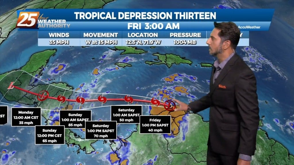
Tropical Depression 13 has formed overnight near Aruba and north of Venezuela. The structure of it has not changed much. Most of the thunderstorm activity is on…
A weak disturbance from earlier this afternoon has push through the area but the upper level clouds will continue overnight. Upper clouds coupled with increased moisture…
A weak disturbance along the North/Central Gulf will continue to push upper level clouds across the area...at times putting south Mississippi under partly/mostly cloudy skies. the upper…
High pressure continues to dominate our weather pattern across the area. A weak disturbance will move across the area this morning into this afternoon. With…
After a cool start, temperatures have warmed into the upper 70s/low-80s. A quiet weather pattern will continue through the workweek prior to the next frontal boundary…
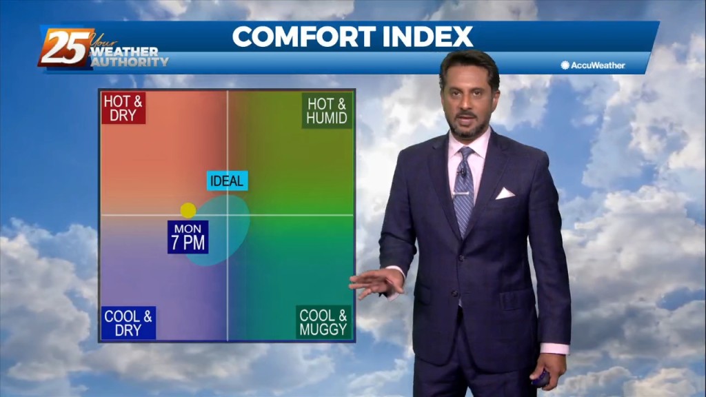
As an area of high pressure sneaks into the area on the backside of distant low pressure, a warmer pattern takes hold. It’s only a small adjustment…
We could not ask for more pleasant weather heading into the 1st weekend of October. It has been breezy and dry with the minimum relative humidity dropping from…
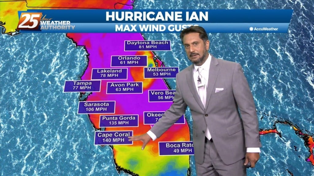
As Ian continue to affect the region with a combined flow from the NNE, the drier air will shape the forecast through the weekend. Low relative…
Fall is in the air! No rainfall is expected for the next few days. We are still experiencing some impacts across the area from pressure gradient…
Fall is in the air! No rainfall is expected for the next few days. We are still experiencing some impacts across the area from pressure…