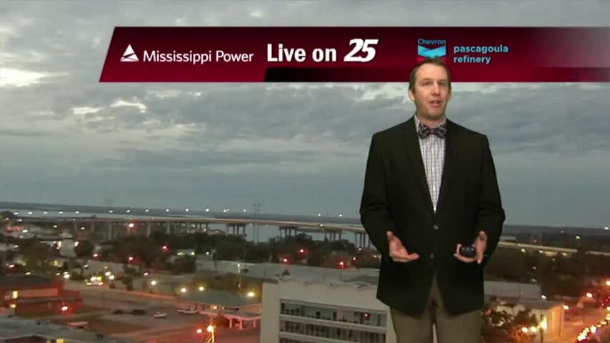
11/19 Ryan's "Weak Front" Monday Evening Forecast
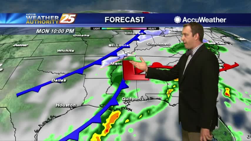
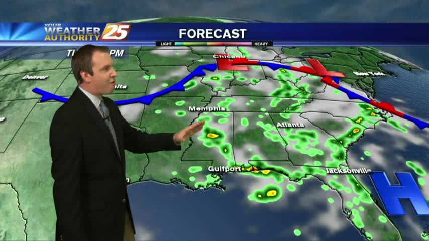
We've seen a long string of clear and sunny days, so it doesn't feel too bad we're seeing clouds and rain moving in tonight....
We've seen a long string of clear and sunny days, so it doesn't feel too bad we're seeing clouds and rain moving in tonight....
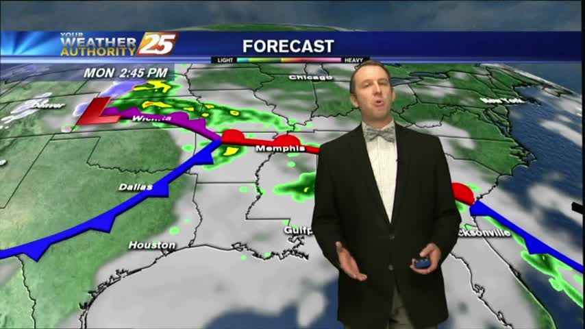
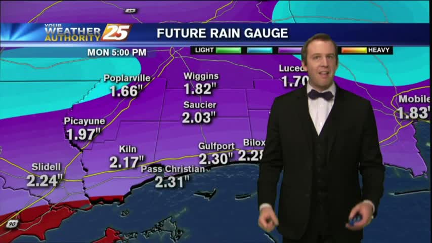
The rain continues, but it's gotten much colder and will continue to cool as drier air moves in for the weekend....
The light rain will continue through the night and into the next few days before much drier weather moves in....
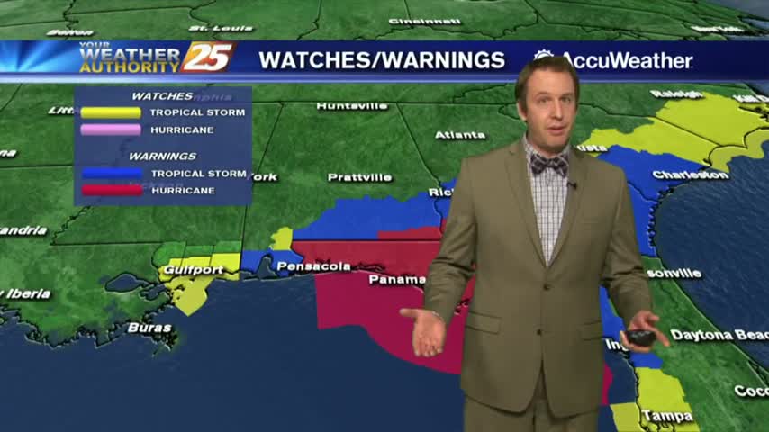
Scattered showers and and thunderstorms will continue through the night and into tomorrow, but Hurricane Michael will be pulling all the warm moist air to the East....
It's been cloudy and rainy all day long, and I expect similar conditions tomorrow. Next week looks drier though....
This afternoon's disturbed weather is subsiding, but we'll see more each day this weekend....
Today began a trend of grey and stormy days, but we'll see drier and warmer days soon....
Expect many rainy days ahead as we return to our typical "summertime" pattern....
The weekend was relatively drier, but we're in for a rainy week ahead....
This week's weather was too good to last forever, so now we're seeing warm and humid conditions moving in and lingering through the weekend. It clears up again next week though!
After a gloriously long week of sunshine and dry air, rain and humidity has moved in quickly today. It does get better next week though....
A cold front is slowly moving through the area, so we'll have at least one more round of showers before clearing overnight. Watch the full forecast for details.
Winter weather is moving into South MS, but it remains to be seen just how much we will actually see and whether it will accumulate. Watch the full forecast for the latest and stay tuned for updates.
The rain has already begun to fall, but the front won't arrive for a few more hours. We'll begin cooling now, but much colder temperatures are ahead. Click the forecast link for more.
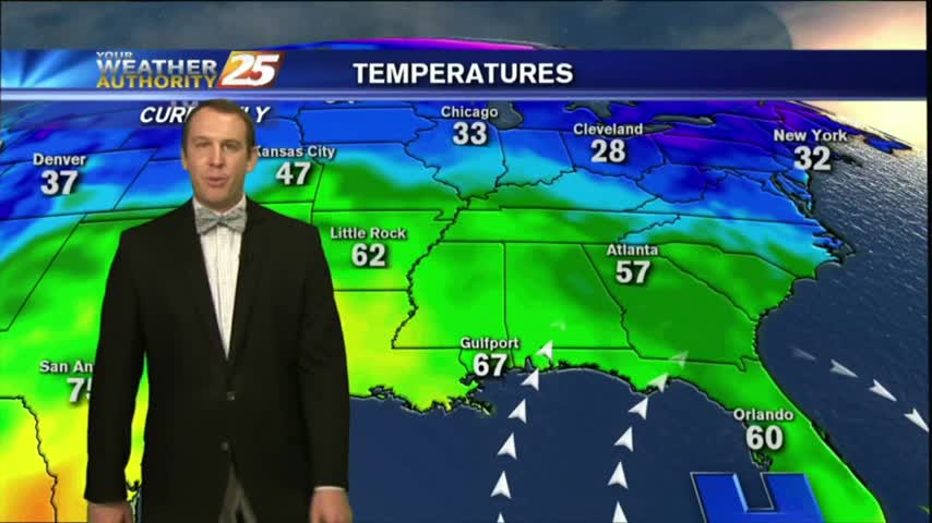
It was a chilly and dry start to the morning with temperatures in the mid 50s to lower 60s.
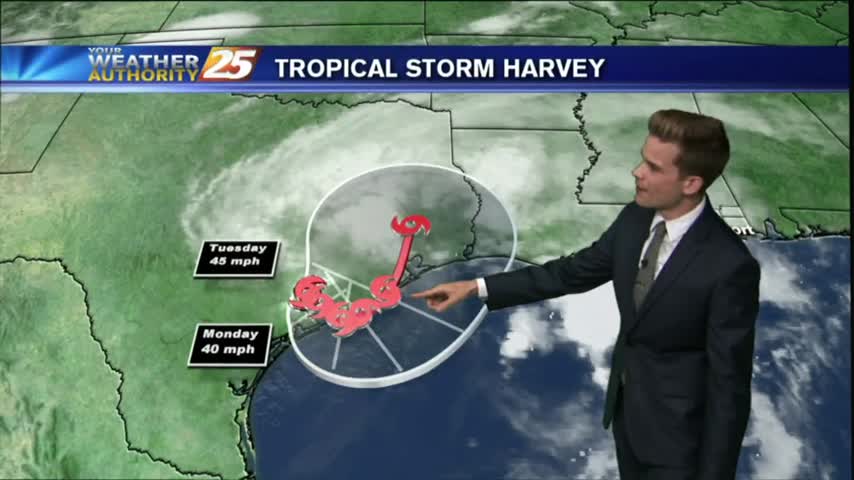
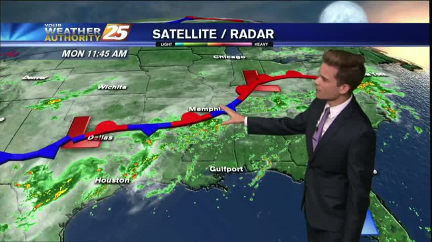
Harvey will continue to linger in Southern Texas, but eventually will start to move gradually off to the north and east.

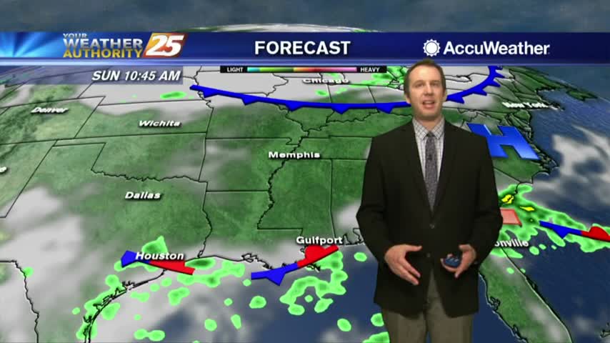
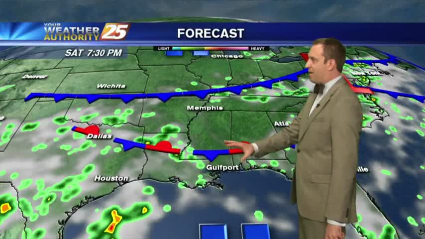
Very isolated activity across the area this afternoon as a stationary front along the Mississippi Gulf Coast stretching west to east will continue to linger in the region through the rest of the workweek.
We continue to see isolated showers and thunderstorms starting to develop.
Isolated showers and thunderstorms are possible this afternoon.
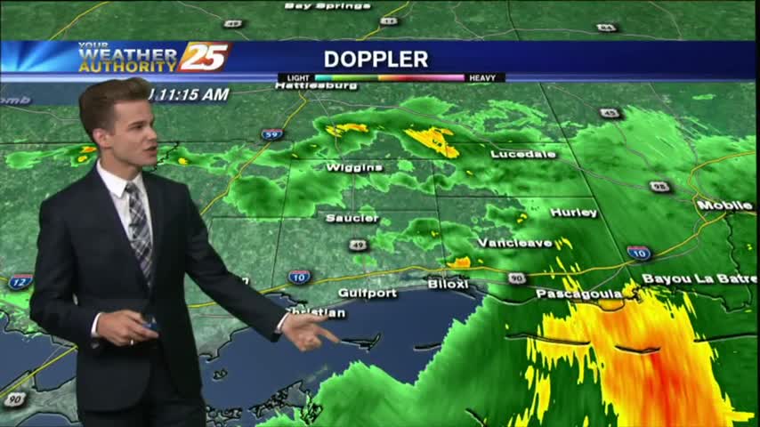
Most of the activity is staying to our south today as it fights drier air as it moves north, but scattered showers are possible for the remainder of the day.
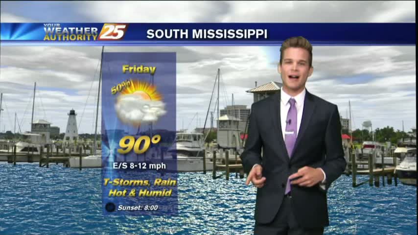
Showers and thunderstorm chances today as a surge of deep tropical moisture into the region.
Today will be much like yesterday with hot/humid conditions with isolated showers and thunderstorms.
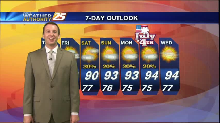
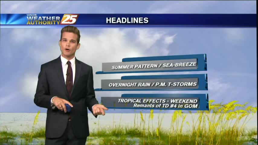
Storms moved in earlier today, but will wait until the early morning overnight hours before bringing in round 2. Best to get it out of the way now, leading to a sunny holiday! Details inside.
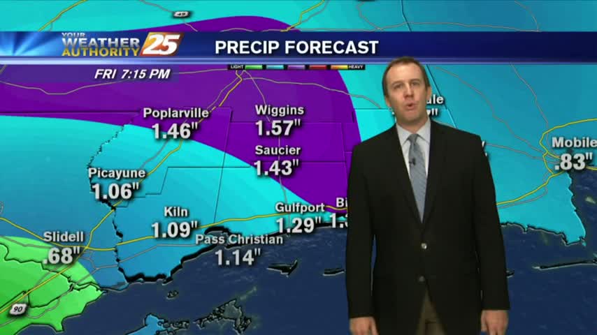
It was a wet day on the Mississippi Gulf Coast this afternoon, as showers began just before noon and continued throughout the day. Tonight, we're seeing those showers weakening and eventually dissipating, but we'll remain warm & humid with a…