04/30 Ryan's "Finally Cooling" Friday Night Forecast
Finally saw our rain moving in earlier today, and now the clouds will slowly clear through the night as things cool and dry....
Finally saw our rain moving in earlier today, and now the clouds will slowly clear through the night as things cool and dry....
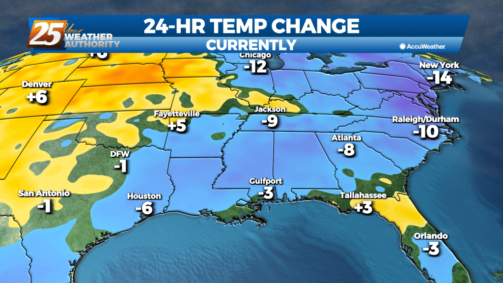
We've gotten as warm as we're going to this week as the thermometer begins to fall in the days ahead. It just won't be by very much....

Another warm, humid night ahead as moisture continues to pile up ahead of an end-of-week front.
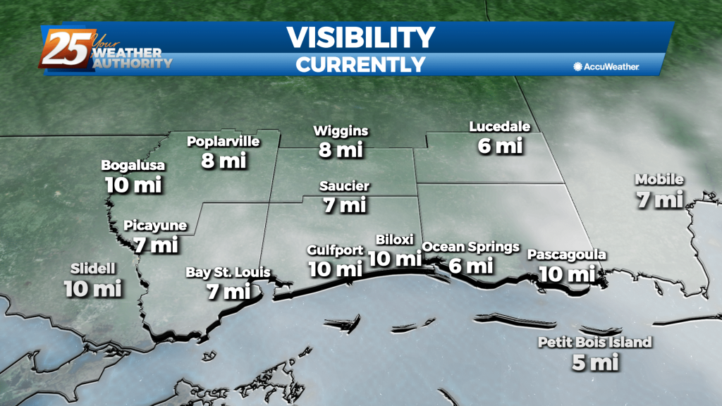
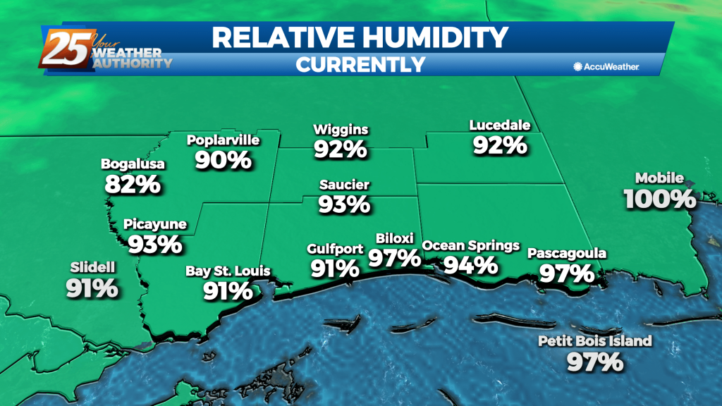
Another foggy night ahead as a slow moving front piles up moisture in the South MS area, with little change until the weekend.

Didn't dry much after our weekend front and now the humidity will slowly rise for most of the week, so get ready for some muggy, foggy evenings....
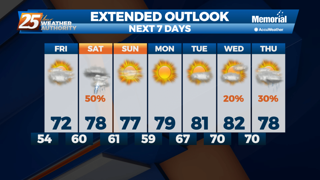
Today was the last of the week we'll see clear, blue skies, but our cloudy, stormy weather won't last too long into the weekend.
One of the coolest nights we've seen in a while is moving in later, but we'll begin warming from there until our next front moves in Saturday morning.
Expect a few clouds through the night, but much more sun and dry weather for most of the rest of the week. Not all of it though....
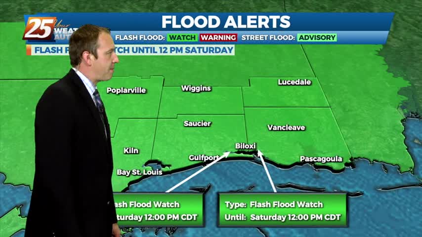
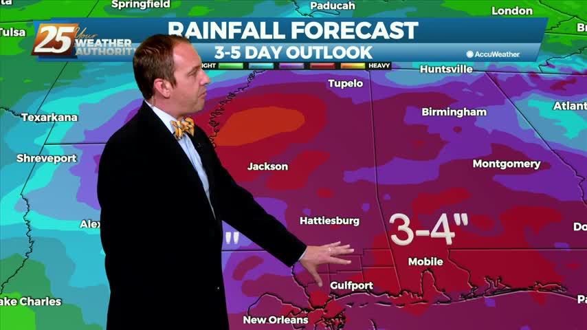
Sad to say we have a wet weekend ahead after our ridiculously wet week, but things will begin drying up quickly as we head into the next....
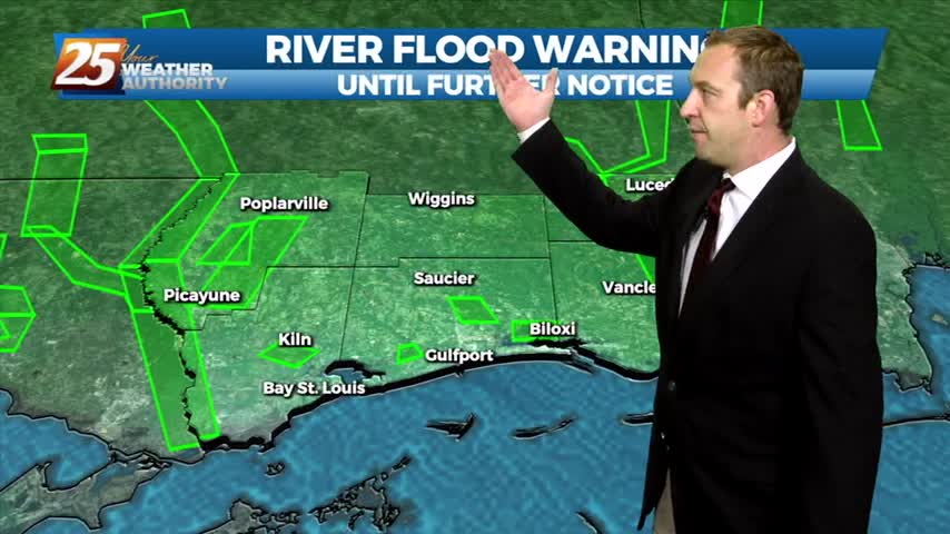
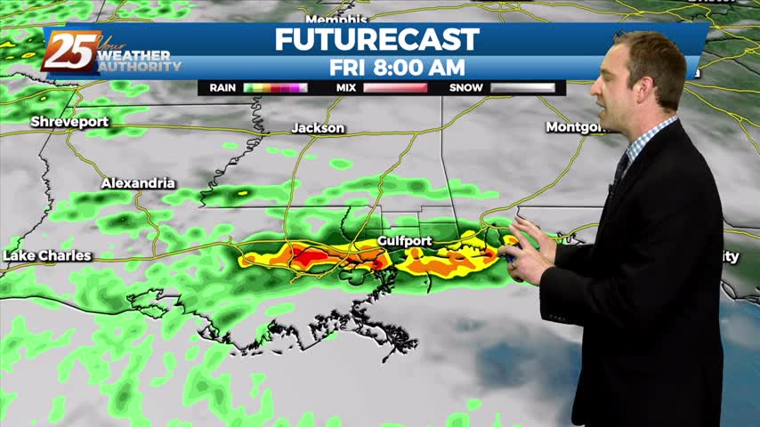
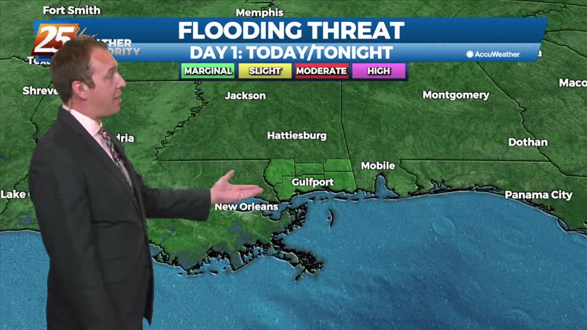
It's already quite damp out there with flooding issues popping up, and we still have at least a day or so of rain left!
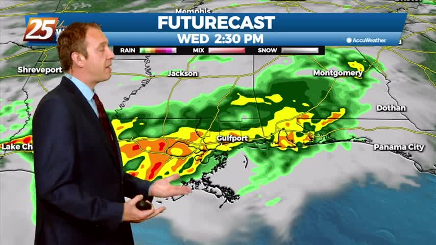
Finding ourselves in the midst of a familiar pattern as a lingering boundary with frequent impulses bringing rain each day. The sun will return soon though....

Strong, gusting winds followed our active afternoon as showers and thunderstorms moved through. The rain will dry up through the night, but come back quickly tomorrow.
Expect to have seen the last clear skies for most of the week as clouds and rain move in, but they'll be on their way out by the weekend.
Nice today after a wild start to the weekend yesterday, but the clouds and rain won't stay gone for much longer....

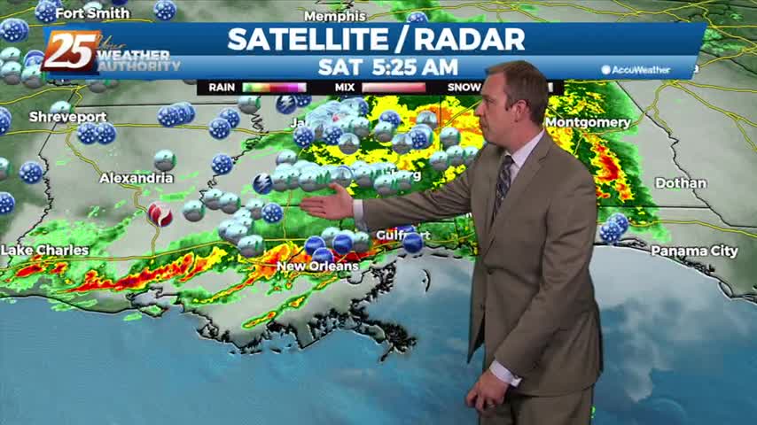
We have a "moderate" (level 4 of 5) severe threat inching into South MS during the overnight hours, leading to a stormy start to another day this week.
Quite a wild turn-around today as we began with tornadoes and lightning, but ended calm and sunny with another quick turn-around on the way.
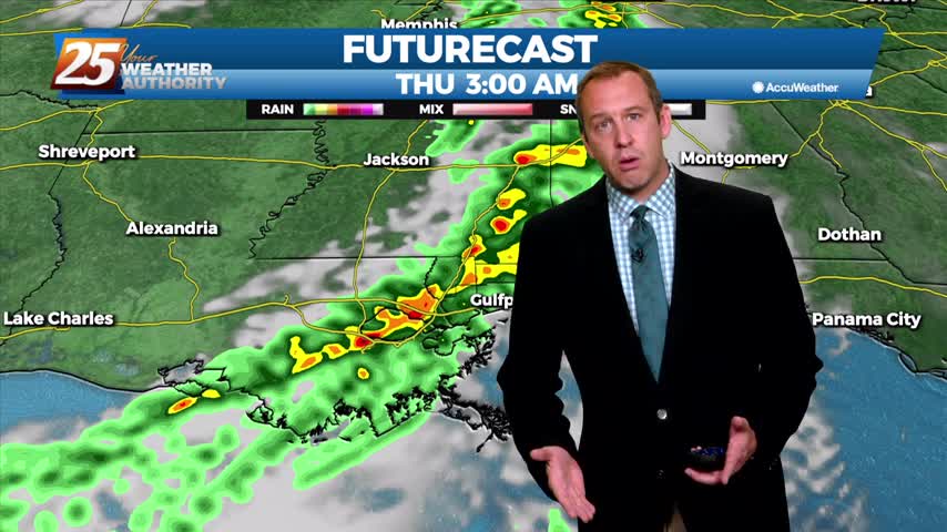
It has been several days since our last round of active weather, but that changes now as showers and storms move in quickly overnight.
The humidity and temperature continue to rise, but we're rapidly approaching the limit as thunderstorms begin to build....
The weekend was sunny, dry, and mild, though it has continued to get warmer and more humid each day....
Cold front brought a chilly night last night and we're in for more of the same tonight, but then a significant warm-up begins.

Drastically different from the last few nights as cold, dry air moves in and frost is likely later tonight....

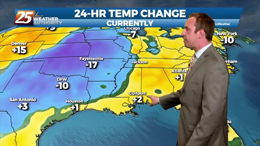
A front has finally moved in and and will push through, bringing cooler and drier air...an event we haven't seen much of over the last few weeks.

Wasn't very calm earlier today as a developing thunderstorm brought hail and gusting winds to the area, but it's going to quiet a bit through the night before another round moves in.

The weather is being a bit tricky again this week as we begin the week sunny and clear with rain moving in overnight.