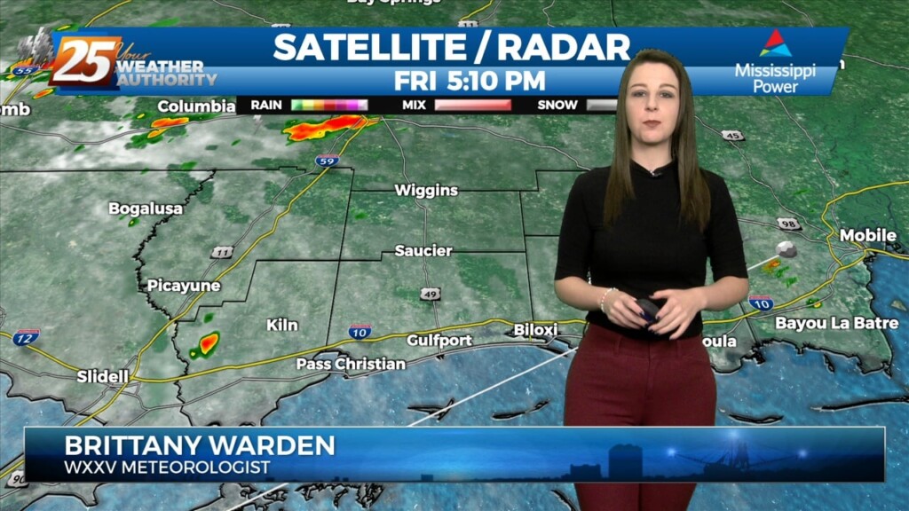
3/24 - Brittany's "Cold Front Approaching" Friday Evening Forecast
Scattered showers have developed generally along and north of the I10/12 corridor over the last few hours. The special 18z sounding shows plenty of instability. However, a…
Scattered showers have developed generally along and north of the I10/12 corridor over the last few hours. The special 18z sounding shows plenty of instability. However, a…
Some weak convection has developed over the MS Sound and near the Pearl River this afternoon. This is likely in response to steel low level lapse rates/enhanced…
Some weak convection has developed over the MS Sound and near the Pearl River this afternoon. This is likely in response to steel low level lapse rates/enhanced…
A cold front moves through Thursday and should enter the area around 9am and out of the area around 4pm. Instability and shear values are at the lower…
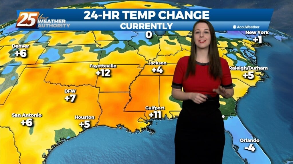
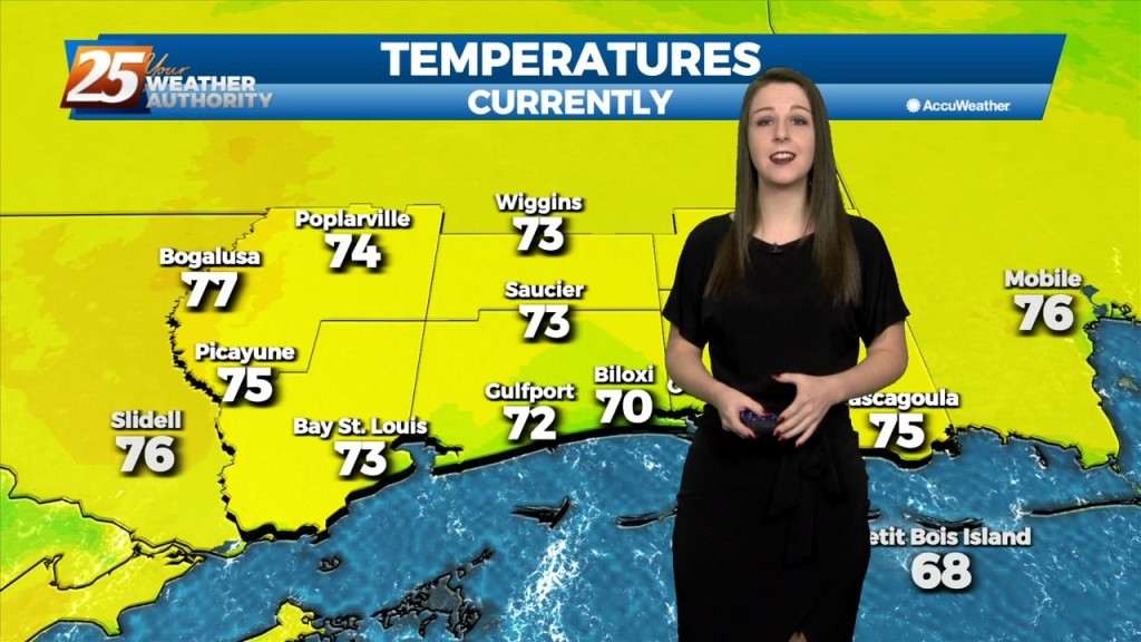
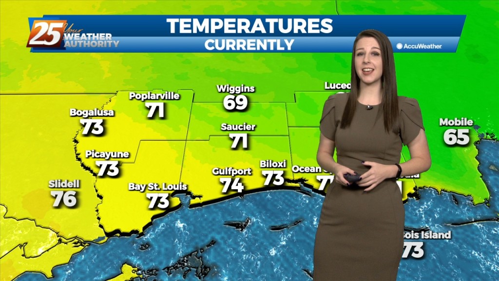
High pressure has shifted eastward and winds have already returned to a southerly direction. Dewpoints have been rising steadily throughout the day especially in western areas where a surface…
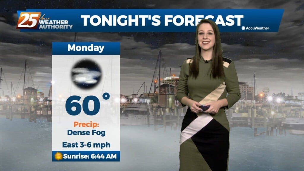
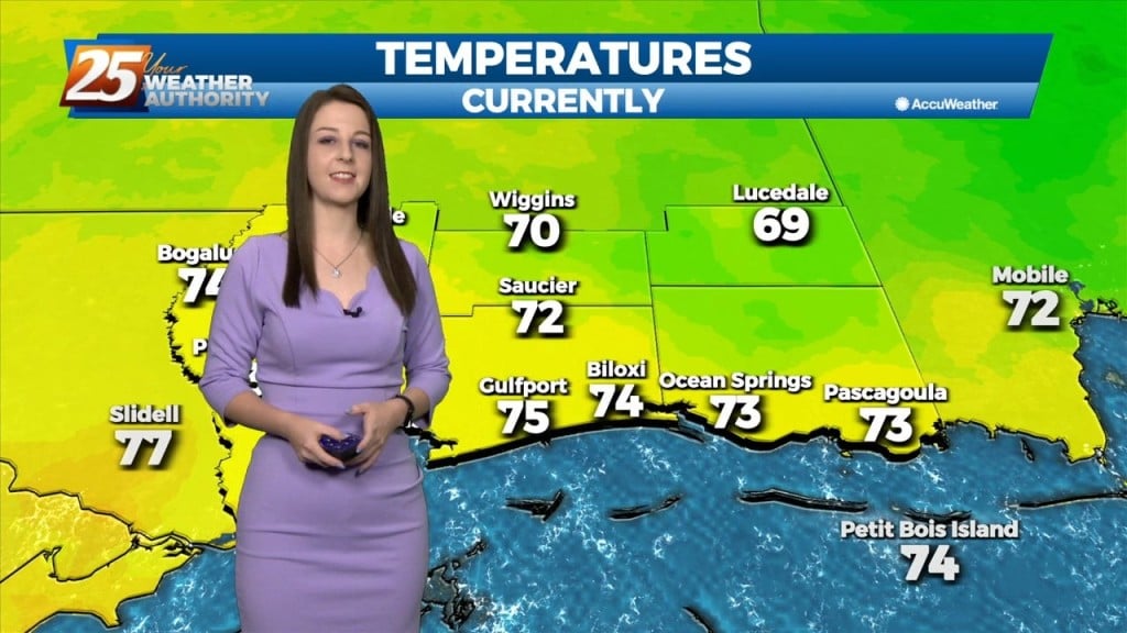
We're on tap for yet another cool and muggy evening. Temperatures will bottom out to the low 60's this evening and once again, we'll have fog in…
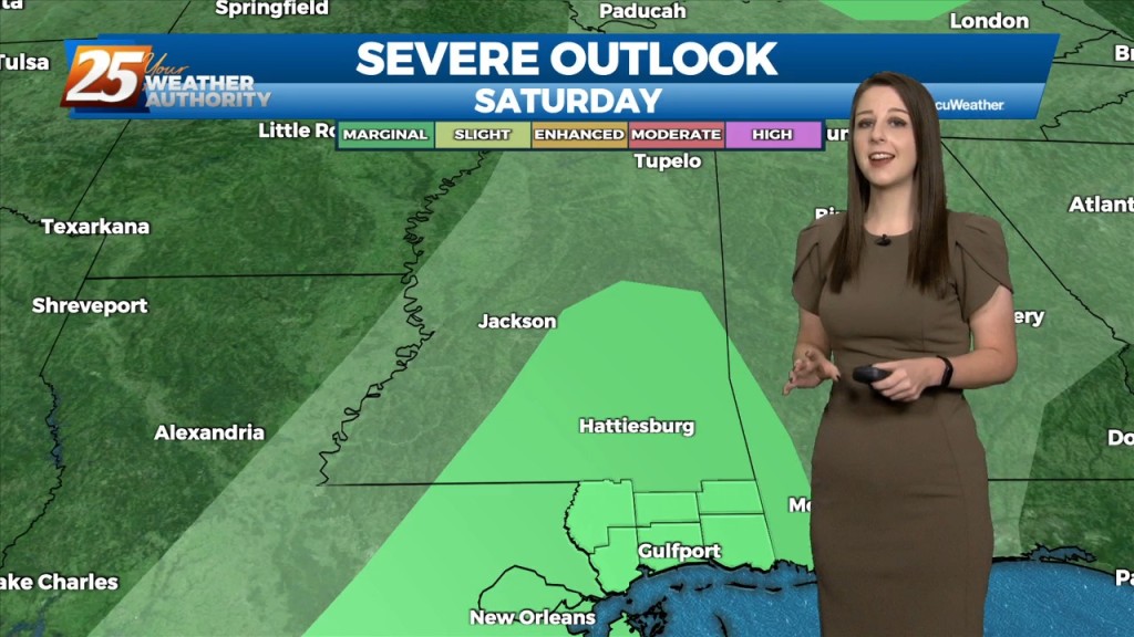
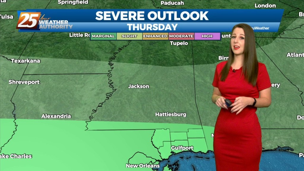
Tonight, we can expect cool temperatures and foggy conditions yet again. Heading into tomorrow though, we'll see the potential for severe weather in our area.…
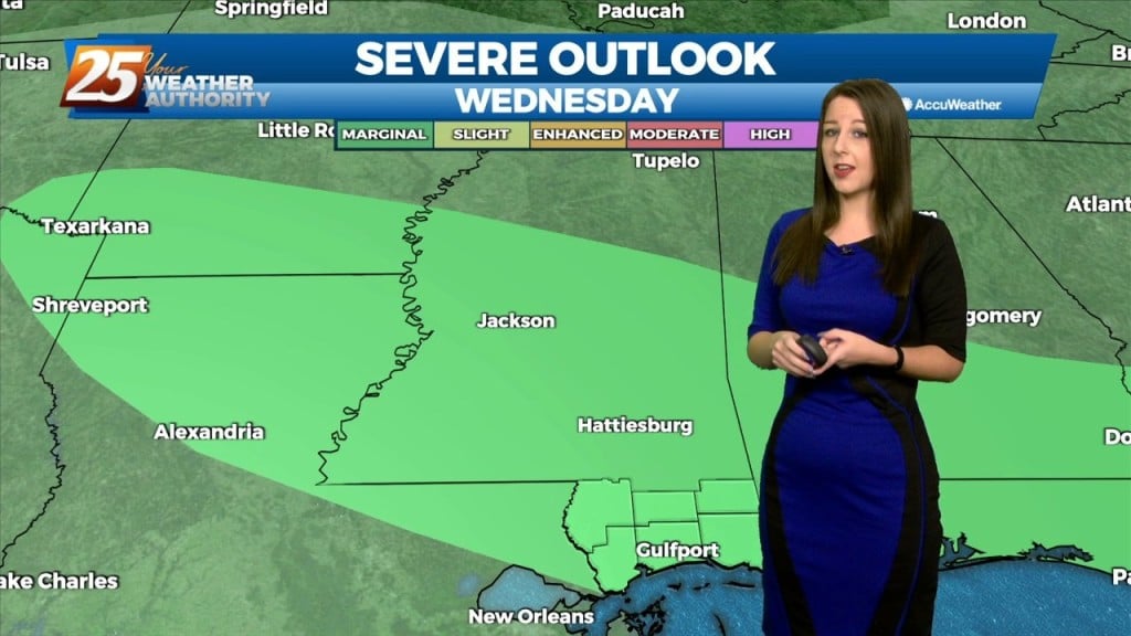
We've managed to remain relatively quiet thus for for our evening but that will be subject to change as we'll see an increasing chance for showers and…
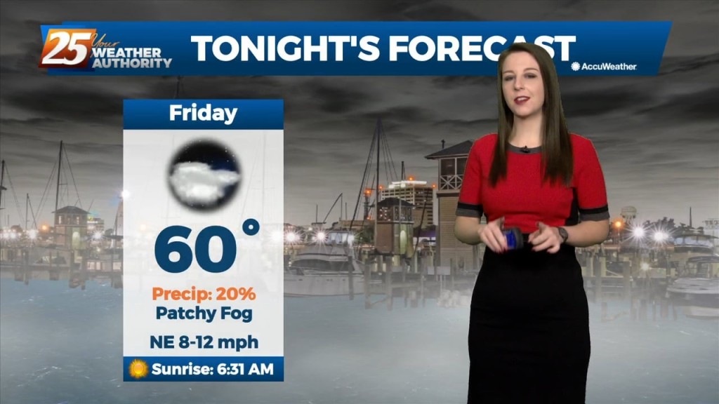
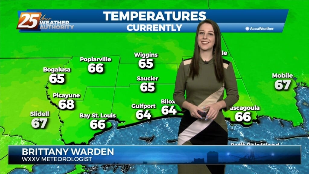
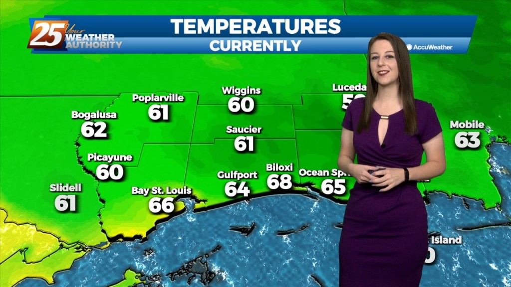
After a gloomy day, the dreary conditions will stick around throughout the rest of our night. We'll see cloudy skies tonight with temperatures bottoming out around 60…
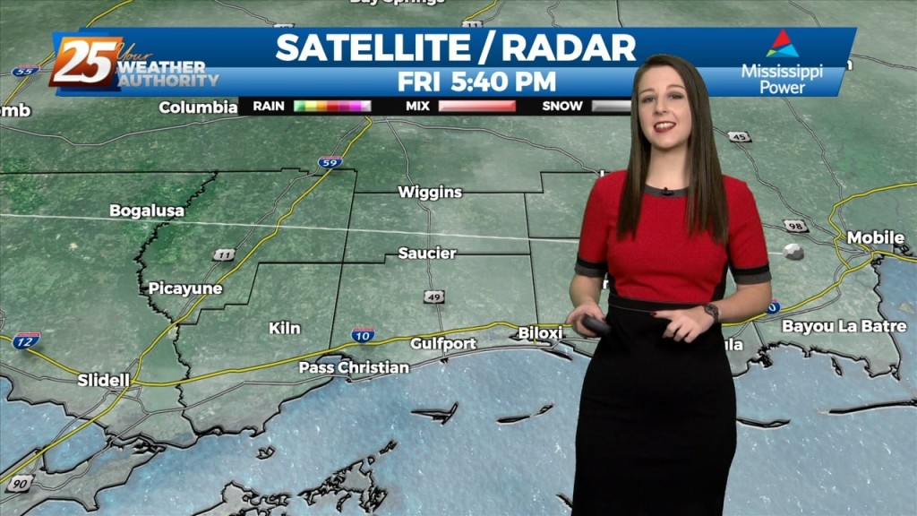
Latest radar shows scattered light showers/mist across portions of the local area. Deeper analysis shows an undular bore/gravity wave initiated this activity by providing enough lift to…
We've managed to stay rain free thus far but tonight, we'll see a 20% chance for isolated showers in the area. Heading into tomorrow, we'll see further…
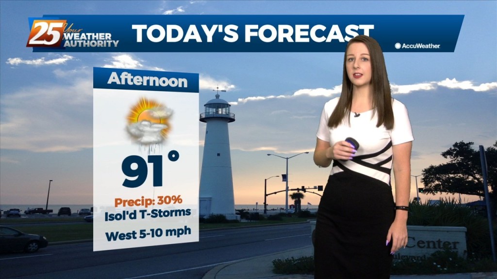
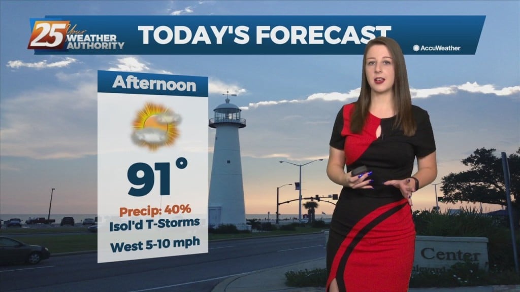
Throughout the day today we've seen a gradual increase in cloud coverage in advance of an approaching cold front. We've managed to stay rain free thus far…
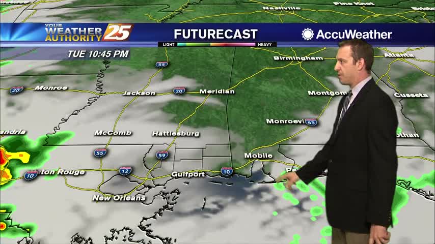
The main feature to note in the short term is the passage of a frontal boundary through the day on Tuesday which will have ample moisture and forcing to…
One last quiet day allowing for another pleasant Sunday and weekend as a whole. Not expecting much in the way of impacts for the…
The overall current pattern is fairly interesting across the Lower Mississippi River Valley. A surface "frontal" boundary resides generally along and north of the I20 corridor. As the…
Hot and dry again for most of the day today. Focus this evening will be on convective development to our north and east, with short-range guidance identifying a…
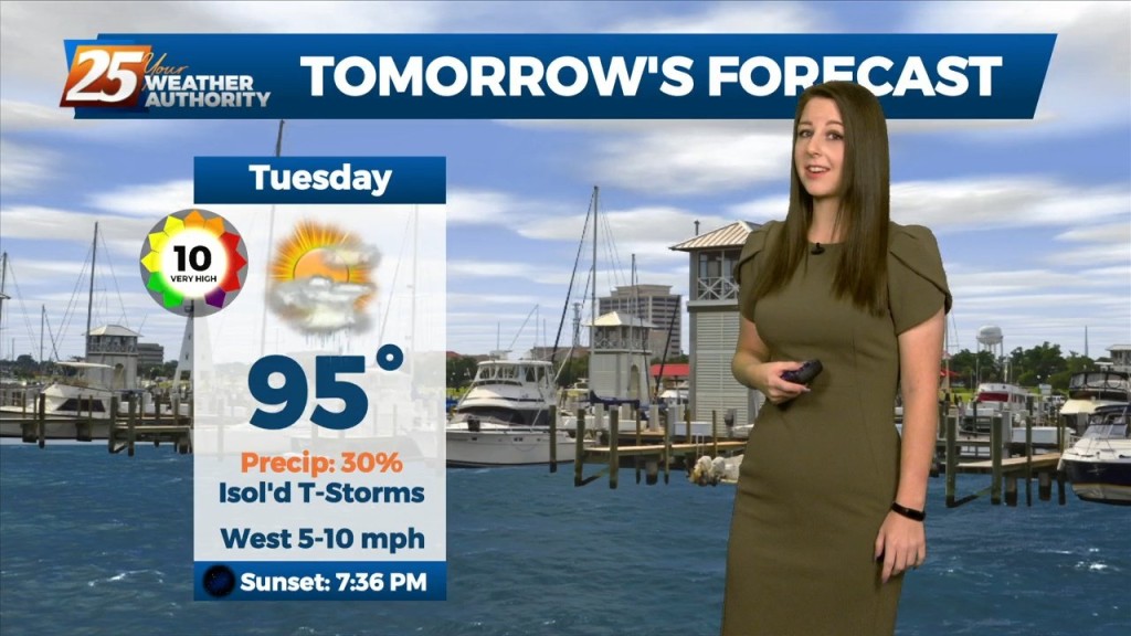
The main focus of the short term forecast will be the warmer temperatures heading into Tuesday and likely again Wednesday. It has been a while since we`ve…
Upper ridging forecast to drift slowly westward over the next few days to be centered over Kansas/Oklahoma by Friday. Main forecast question is whether ridging is far enough…
A weak boundary still forecast to sink southward and stall near the coast for today and tomorrow. While widespread showers and storms are not expected, the boundary should…
A weak boundary still forecast to sink southward and stall near the coast for today and tomorrow. While widespread showers and storms are not expected, the boundary should provide…
A brief dry period today will change overnight as the stationary front drifts north, along with a vigorous cold front approaching from the NW. Rain will move back…
High pressure still shaping the forecast today, however cloud coverage will start making its way into the area beginning tonight. Wednesday and Thursday mornings will have…
Strong storms are expected before sunrise tomorrow and the showers continue after....

The rain we expected moved into MS and brought deadly flooding to the North, but stalled before moving over the Gulf Coast....