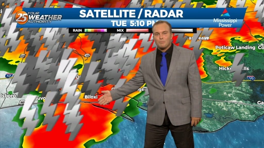
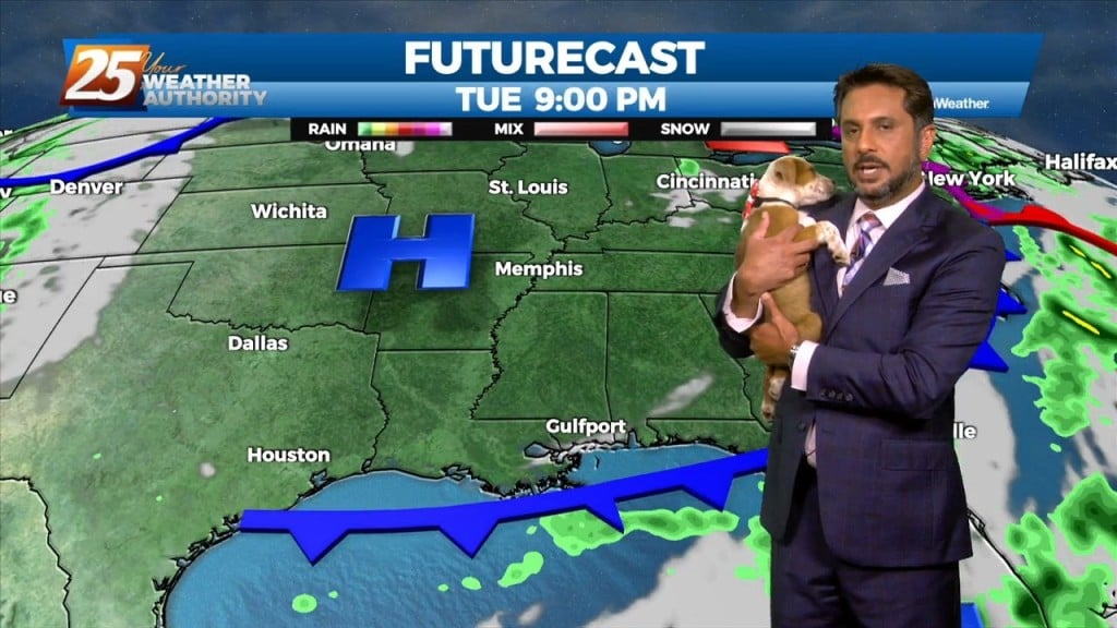
8/15 - Jeff Vorick's "Thunderstorms Early" Tuesday Evening Forecast
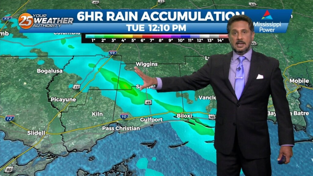
Scattered showers and thunderstorms are in the area ahead of an approaching cold front. Some heavy rainfall, frequent lightning, and non-severe wind gusts of 30-40 MPH. Rain…
Scattered showers and thunderstorms are in the area ahead of an approaching cold front. Some heavy rainfall, frequent lightning, and non-severe wind gusts of 30-40 MPH. Rain…
A strong upper disturbance is near Chicago early this afternoon, extending southwest to near Oklahoma City. At the surface, a cool (NOT COLD) front extended from…
A strong upper disturbance is near Chicago early this morning, extending southwest to near Oklahoma City. At the surface, a cool (NOT COLD) front…
Another day of manageable heat and more in the way of sunshine is in store for the southern six counties. Currently a cold front is to…
With a weak cold front overhead and drier airmass, showers and thunderstorms will pop a little later this afternoon. The activity will get started farther NW and…
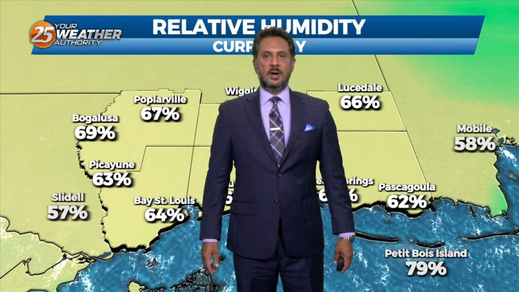
Relative humidity has been rather low the past few days…and that trend will continue heading into the weekend. The current weak upper low pressure over…
A drier day today as additional dry air advects into the region as northwesterly flow continues to take shape. Temperature will likely be a bit…
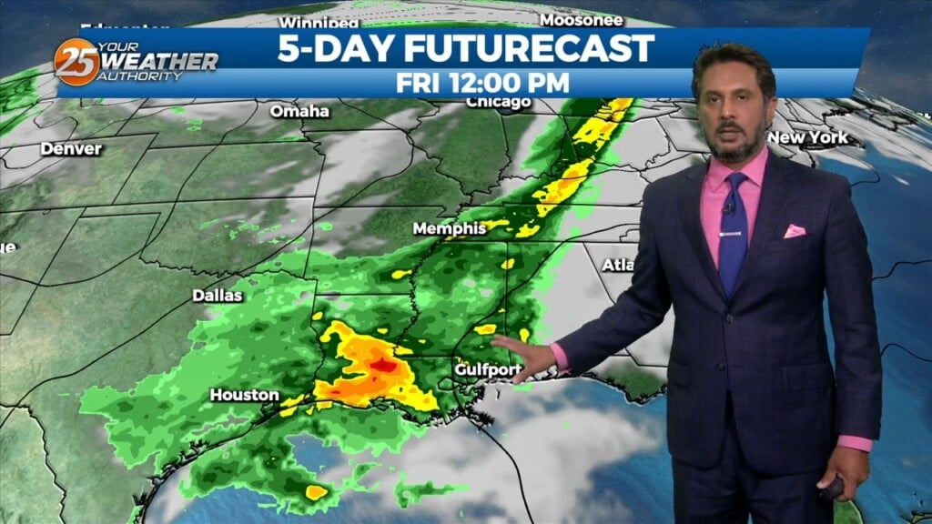
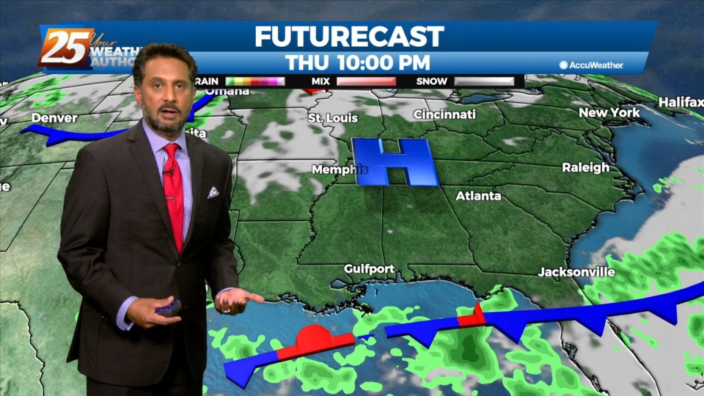
Showers and a few thunderstorms continue over portions of the Gulf waters this morning. This area is also the most favored for convection a disturbance south…
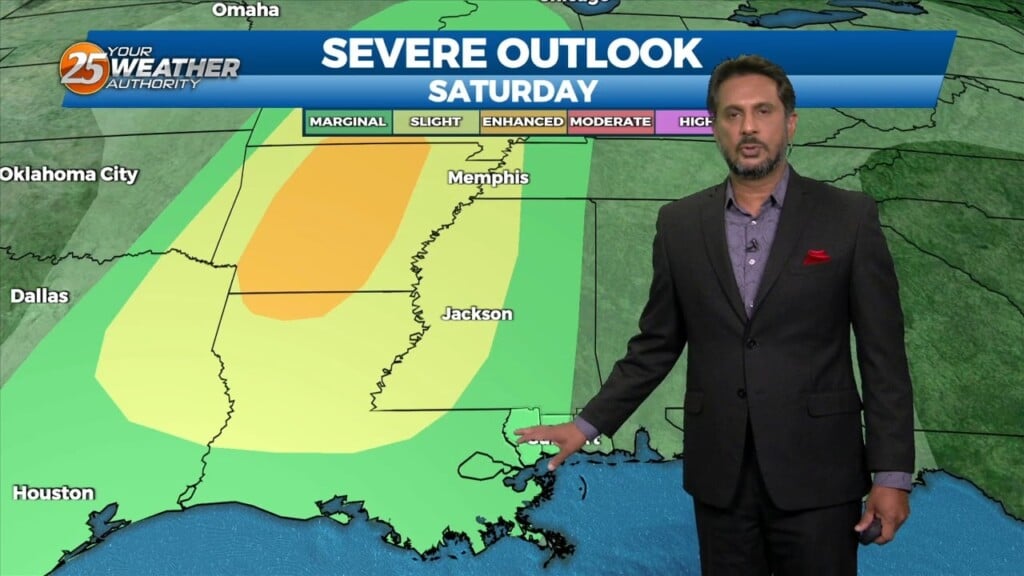
With the cooler upper levels and amplifying disturbance, expect a continuation of lower end rain chances despite being on the drier side with upper level flow becoming…
With high pressure in control of the region, we won’t see much in the way of moderation through at least through Tuesday as we will basically…

As high pressure will shape the forecast, the next few days is primarily a temps and cloud cover forecast. As the deep closed low continue to…
Things will be rather quiet today, with mostly sunny skies and drier conditions making for a nice day as high temperatures reach the mid-70s to low…
As last night’s cold front continues downstream, cold air advection will continue to be the story, along with decreasing clouds later in the afternoon from…
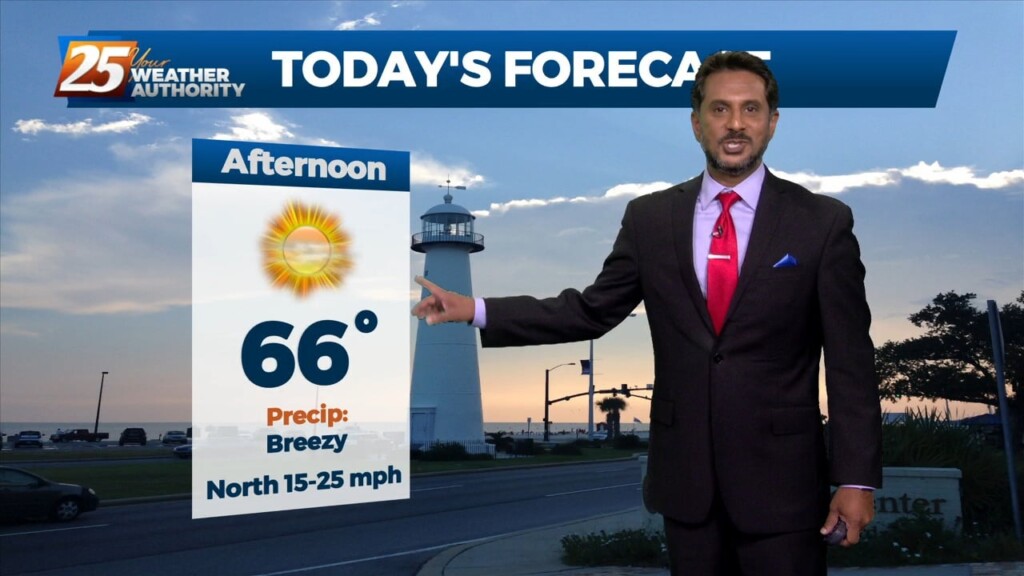
TOP TIER WEEKEND AHEAD... Behind the front this afternoon, winds will be gusty and we return back to more normal temperatures. These gusty winds and…
The cold front is now east with high pressure shifting eastward across the area today and Friday in a very progressive upper pattern. This will provide a mostly…
High pressure will continue to bring in a colder drier air mass which will begin to modify Thursday afternoon/evening. The upper flow is expected to remain zonal…
A cold front east of the area continue to move east as high pressure to the NW will shape the short term forecast. Most of the…
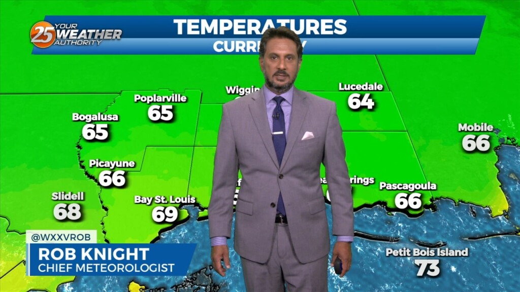
This morning we have clear skies and cooler temperatures in the area. The airmass overhead is a drier one and it is being aided by high pressure…
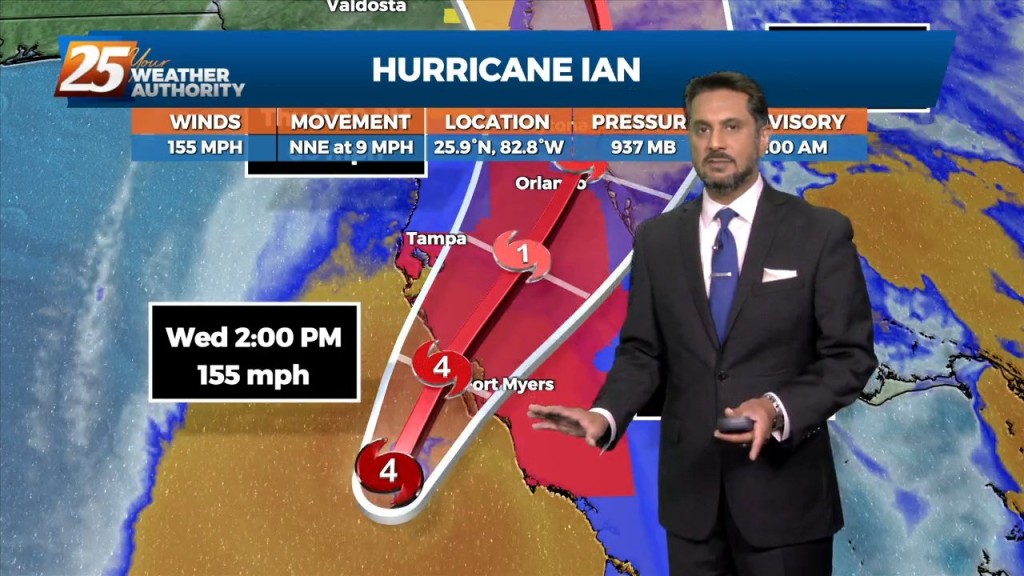
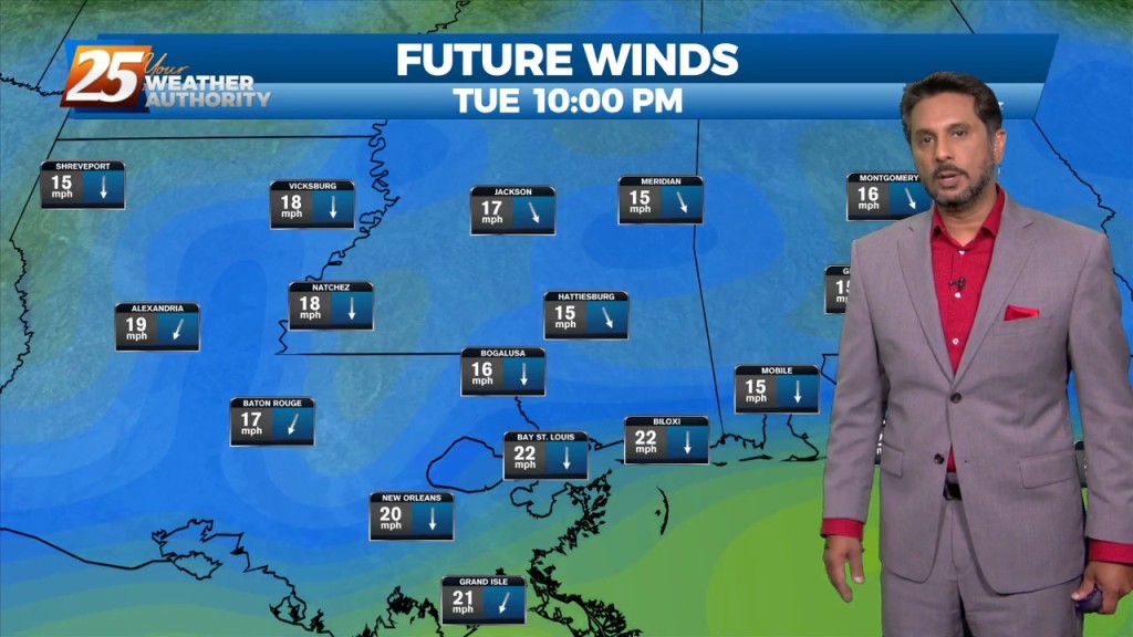
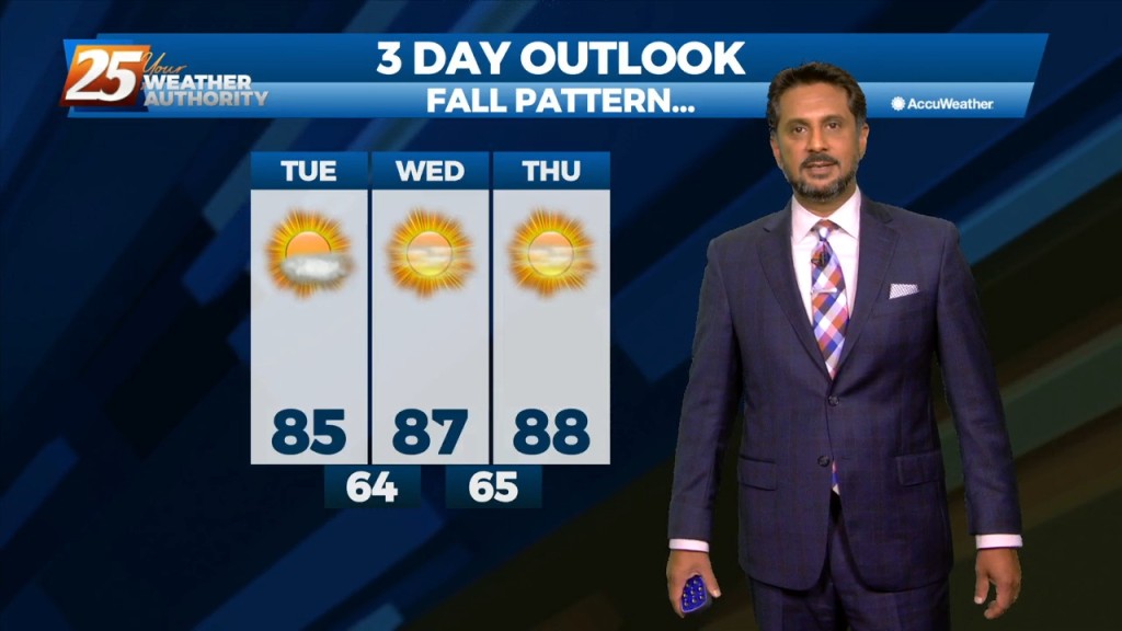
Drier and cooler temperatures are here, and Fall-like feeling is in the air! No rainfall is expected for the next few days. And while the Hurricane Ian is…
With a surface cold front to the south going stationary, drier air north of the front will continue to keep the area under pleasant conditions…

Surface high pressure continues to build in from the north, ushering in post-frontal cool and dry airmass. Observations across the local area show…
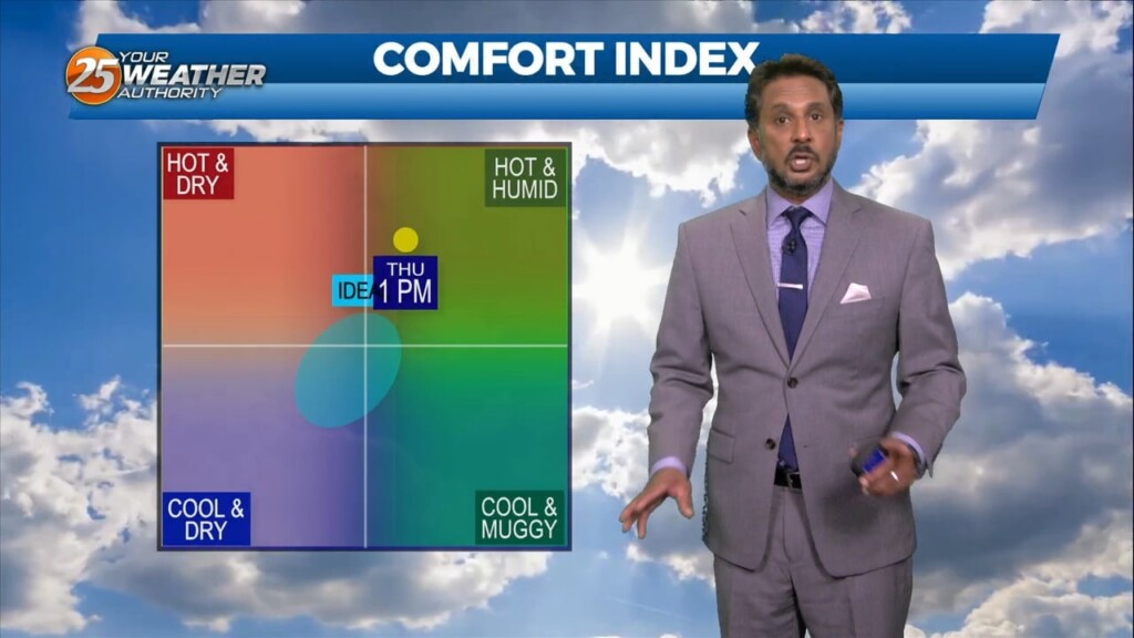
Lovely conditions ahead this afternoon as temperatures in the mid-80s and relative humidity in the 30/40% range will make it feel comfortable. As the evening and overnight…
Here at News 25 we love our fur-babies...but Rob Knight goes beyond that. Here is the FURcast with Rob & Freckles. WE believe Freckles did it better!

The base of the upper level disturbance and surface cold front is now in the northern Gulf of Mexico. Other than some outer coastal convection south of…