5/24 - The Chief's "Changing Weather Pattern" Wednesday Morning Forecast
Under a further amplifying disturbance, the region will remain on the dry side of this feature. The best lift and instability will be through the Gulf South.…
Under a further amplifying disturbance, the region will remain on the dry side of this feature. The best lift and instability will be through the Gulf South.…
The main story is a cold front overhead moving SE. The upstream support will press east allowing the high to surge the front south and east through our…
A weakness/subtle mid-level inverted trough over the northern Gulf continues a slow retrograding motion towards the WSW along the outer periphery of a mid-level high pressure…
A broad upper level high pressure centered near the 4-Corners region extends from Mexico to Canada and CA to around MS. It will generally be…
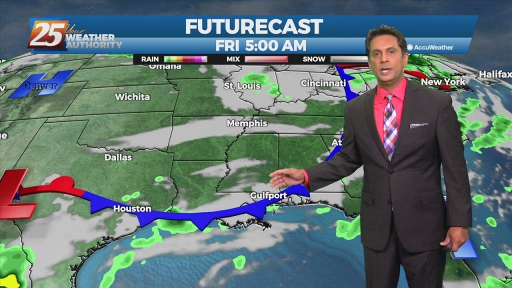
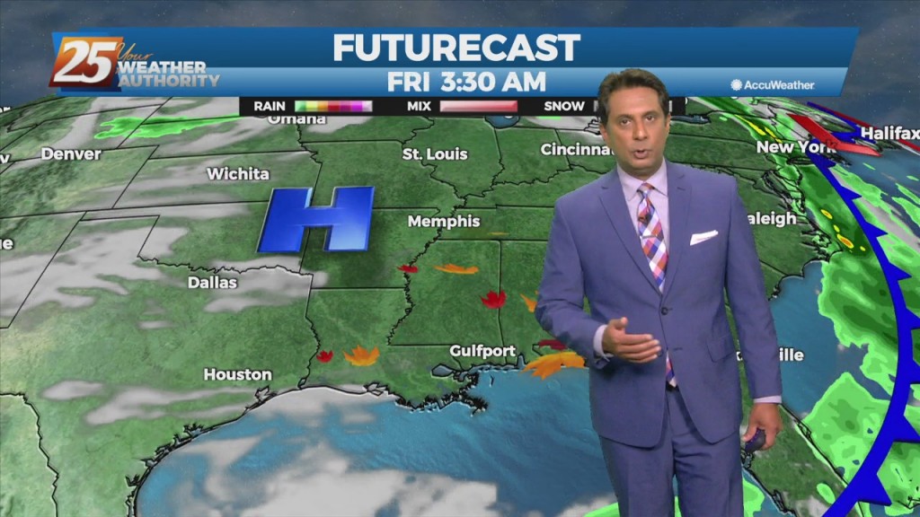
A cold front from the NW will drive south to central LA and MS late in the day. Showers and thunderstorms along/ahead of the boundary should be…
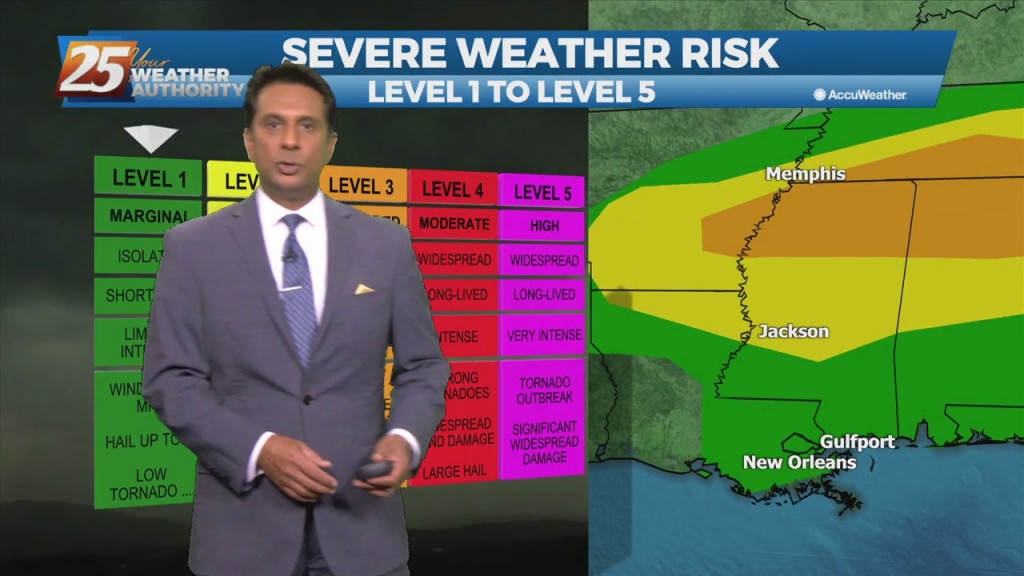
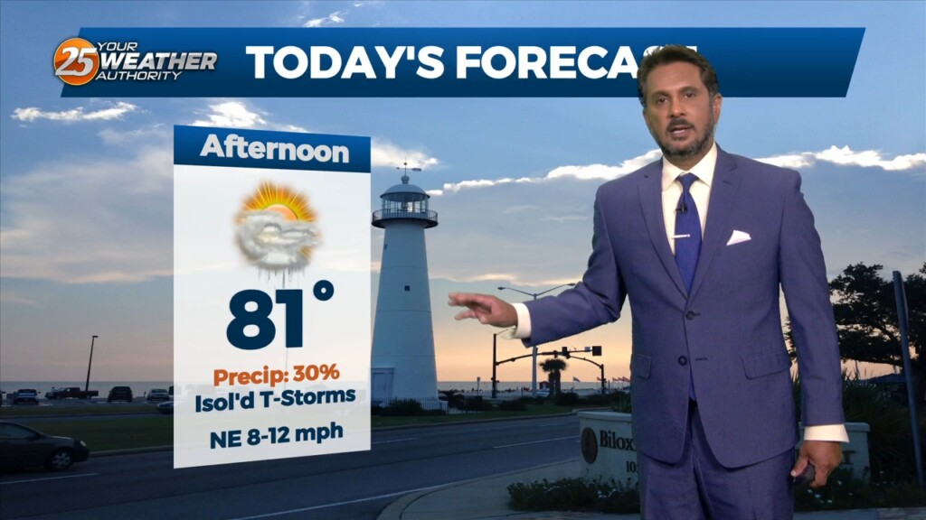
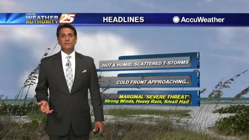
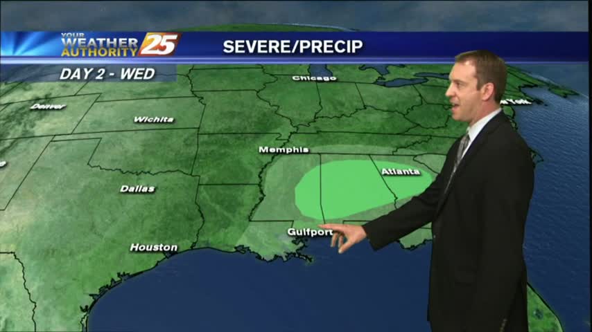
Isolated t-storms will affect the area this afternoon with a low-end threat for severity. If we get a strong thunderstorm, a damaging wind gust may be possible or…
The upper level pattern shows a trough racing eastward through the upper Mississippi Valley towards the Great Lakes. It will be too shallow to bring the associated…
There is one last day of uncomfortable weather before a welcome changes. The disturbance moving through the Great Plains this morning will be over the Ohio River Valley by midday tomorrow. The cold front associated with this disturbance is expected…
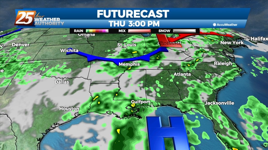
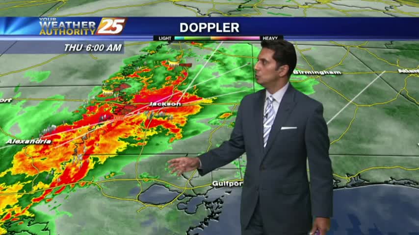
A surface low associated with Tropical Depression Ida will continue to move NE, dragging a weak cold front into south Mississippi Thursday morning. Northwesterly flow aloft will develop across the area today between the upper level High pressure over Texas…
The forecast today through the weekend will be similar to the last few days however there is one hiccup that may keep convection from being as widespread. High-pressure in the western Atlantic and over the western CONUS west of the…
Another day of afternoon shower and thunderstorm activity is on tap with precipitation chances a good deal higher overall than they were yesterday, mainly during the peak heating of the afternoon hours. The main concern with the rainfall today will…
Quite a wild turn-around today as we began with tornadoes and lightning, but ended calm and sunny with another quick turn-around on the way.
A warm and humid afternoon ahead with isolated t-storms expected...
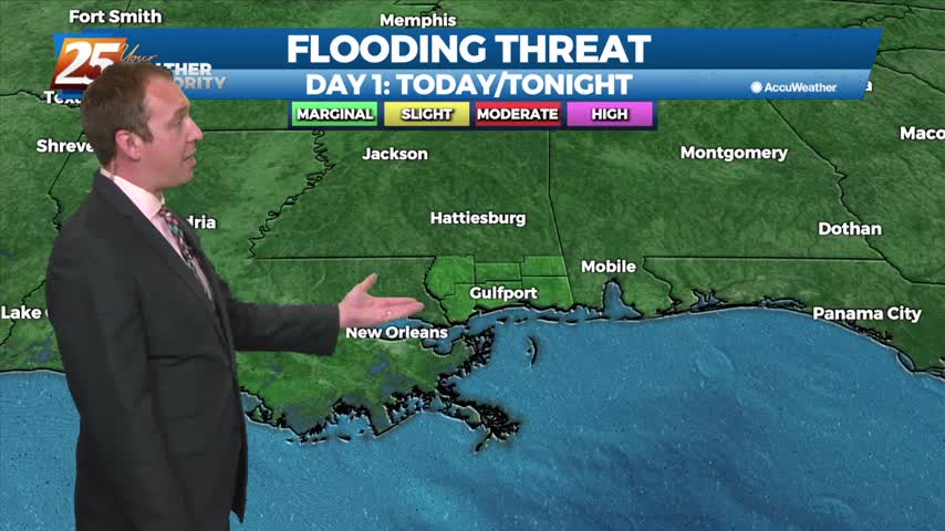
The area has already seen heavy rainfall this morning, with more to come this afternoon...
We saw a few showers today but tomorrow will be far more cloudy and wet. These conditions aren't in a hurry to leave the area either.
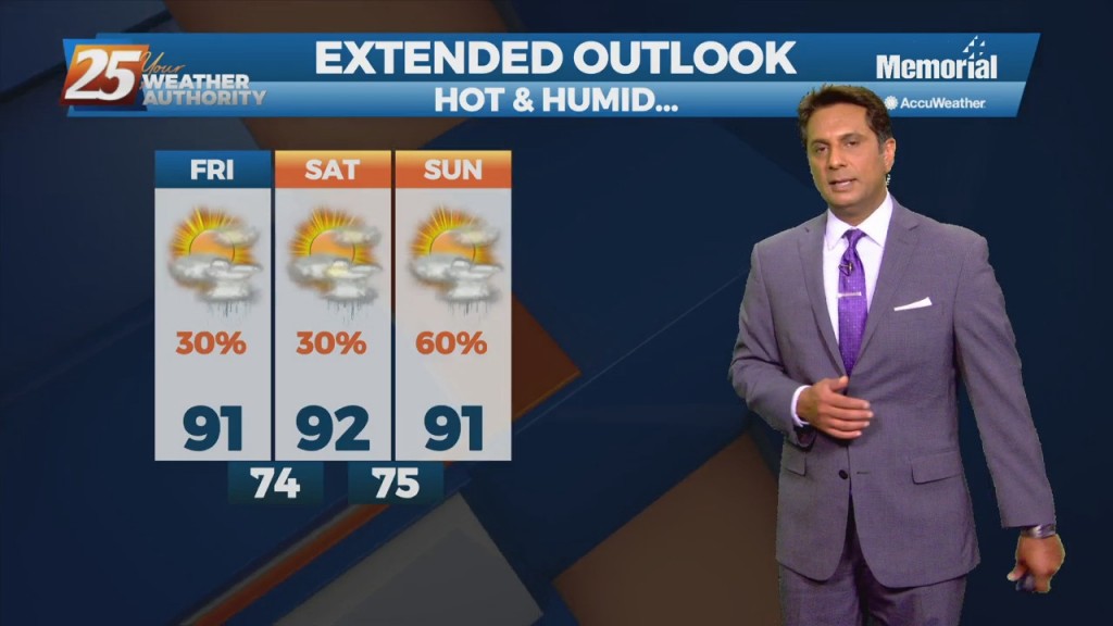
Hot temperatures heading into the final afternoon of August...
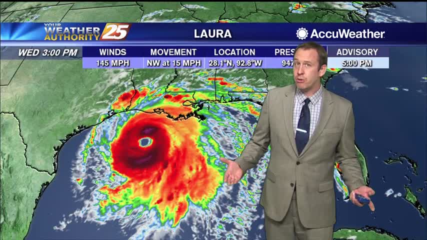
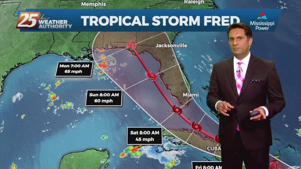
Hurricane Laura has continued to strengthen, and will make landfall later tonight as a major hurricane on the TX/LA border.
Isolated showers and t-storms are moving across south Mississippi this morning with an approaching cold front north...
Another morning with a few light showers moving into the area from the northern Gulf of Mexico...
Isolated overnight activity continues to linger with areas of light patchy fog...
Dense fog advisories remain in place for all six coastal counties and the surrounding area, but after tonight's frontal passage we shouldn't see those again for a few days. Rain will return before the weekend though, details within.
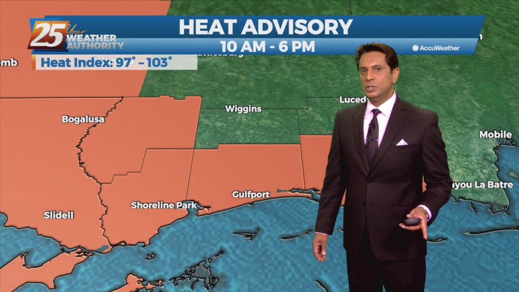
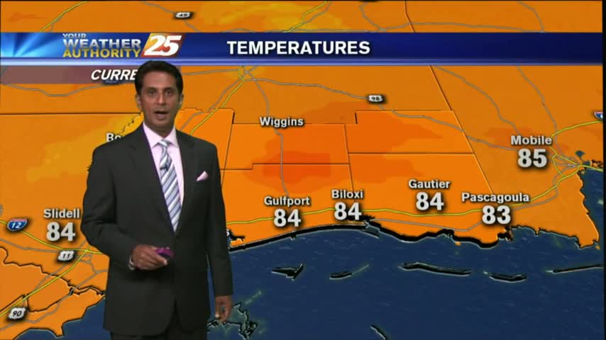
HOT conditions continues along the Mississippi Gulf Coast with the HEAT INDICES pushing the 100 degree mark once again this afternoon...
After a HUMID start to the day, isolated showers have been moving into the area along with a few T-Storms for this afternoon...
Dense fog is in the area with isolated showers and t-storms which continue from last night...