05/08 Ryan's "Record Tying" Tuesday Evening Forecast
We at least tied our record temperature today, but slight cooling will keep the rest of the week's out of reach....
We at least tied our record temperature today, but slight cooling will keep the rest of the week's out of reach....
Today was the warmest day we've had this year, and we'll also see some of the warmest nights later this week!
We're seeing the warmest temperatures of the year so far over the next few days with rain no where in sight!
Temperatures are already soaring into the mid to 80s!
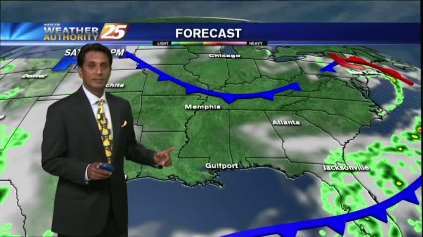
Precipitation should stay low as we approach the weekend with a few passing showers possible from day to day.
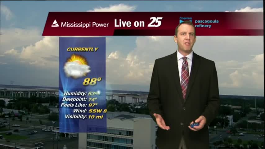
After a mild start to the day with decreased humidity...temps continue to warm into the upper 80s/90 degrees under SUNNY skies.

The summertime weather continues to linger in South Mississippi, but we're finally starting to see some fall-like conditions popping up on the 7-day forecast. Click the link for details.
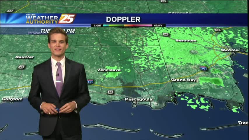
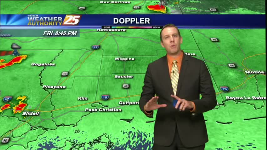
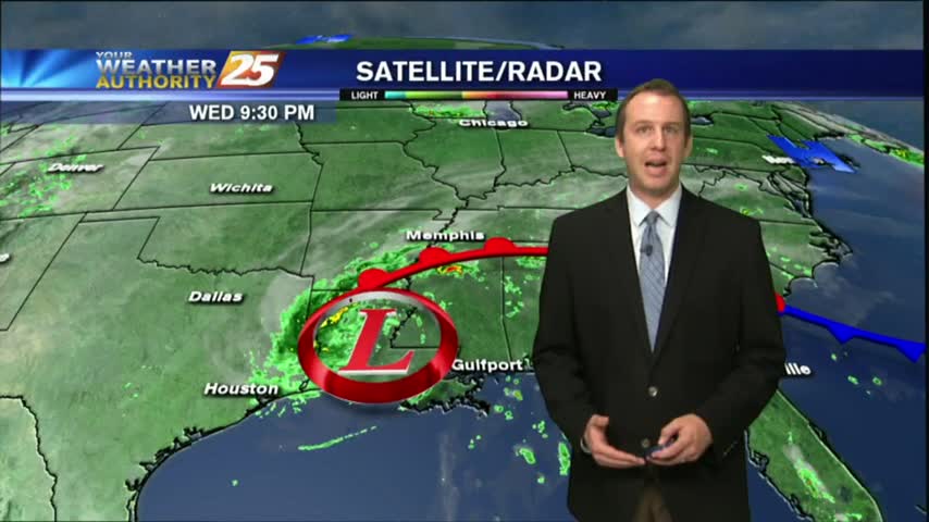
Showers and thunderstorms that moved off the waters this morning continue to slowly dissipate, but we could see more this afternoon.
Seeing a few showers in the area this morning ,but drier weather is on the way.
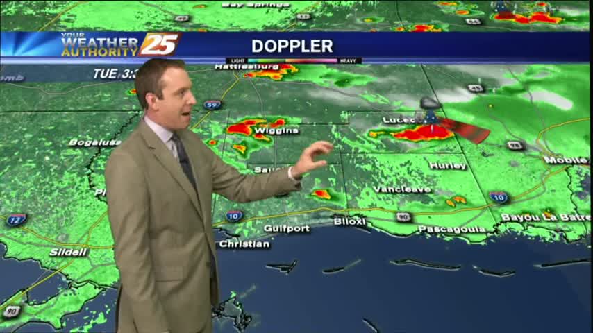
Showers and thunderstorms are starting to develop across the area this afternoon.
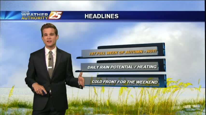
Today was the first offical day of fall, but you wouldn't know that from the temperature or humidity. Those days are ahead, but we've got several more summer-like days first. Click link for the forecast.

Today may have been the last full day of summer, but don't expect fall weather just yet. Full forecast within.
The local weather has returned to our normal "Summertime" pattern, but there's only about a day and a half of Summer left! Don't expect any sudden changes, but cooler days are ahead. Details inside.
We're still expecting more predictable "summertime" weather for the rest of the week, but Fall officially begins on Friday so changes are on the way. Details within.
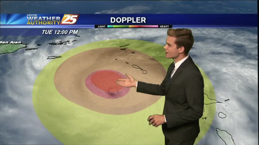
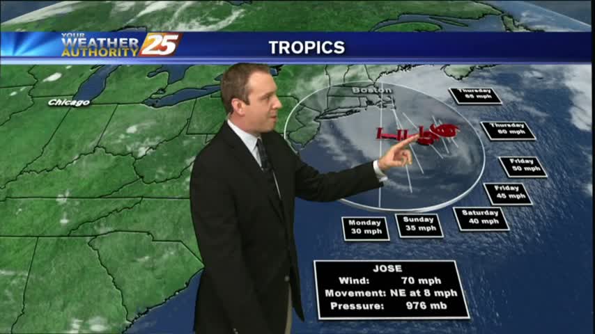
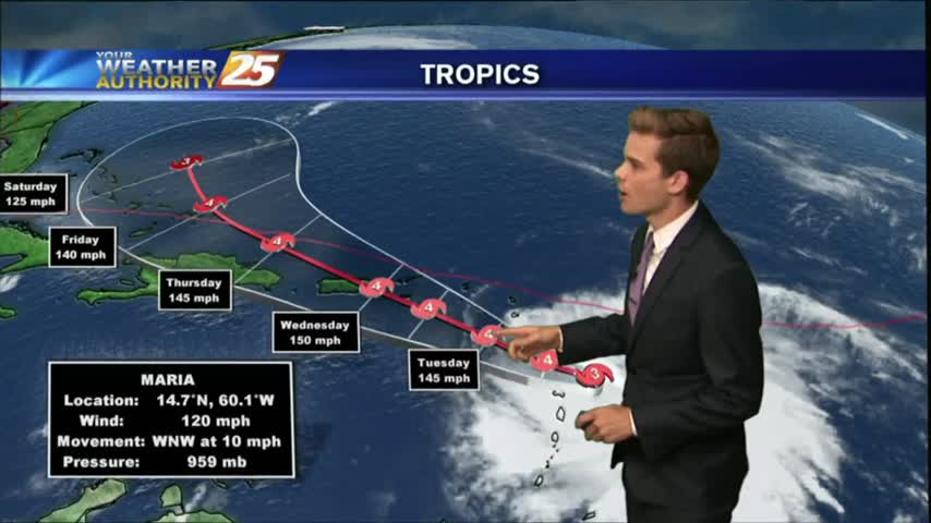
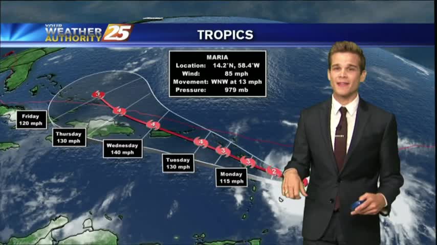
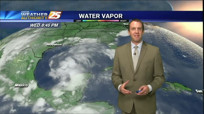
HURRICANE MARIA: CATEGORY 5 (MAJOR HURRICANE) EXPECTED TO MAKE LANDFALL IN PUERTO RICO WEDNESDAY MORNING...
Hurricane Maria dominates the Atlantic weather headlines, while local weather remains consistently hot & humid. Watch the full forecast for details.
It's now officially the home stretch for Summer, as Fall arrives just in time for the weekend. Don't expect any drastic changes right away though; forecast details within.
We continue to see a few showers and thunderstorms popping across the area as High-pressure centered directly over the Gulf.
It was a hot & muggy weekend with occasional isolated showers and thunderstorms.
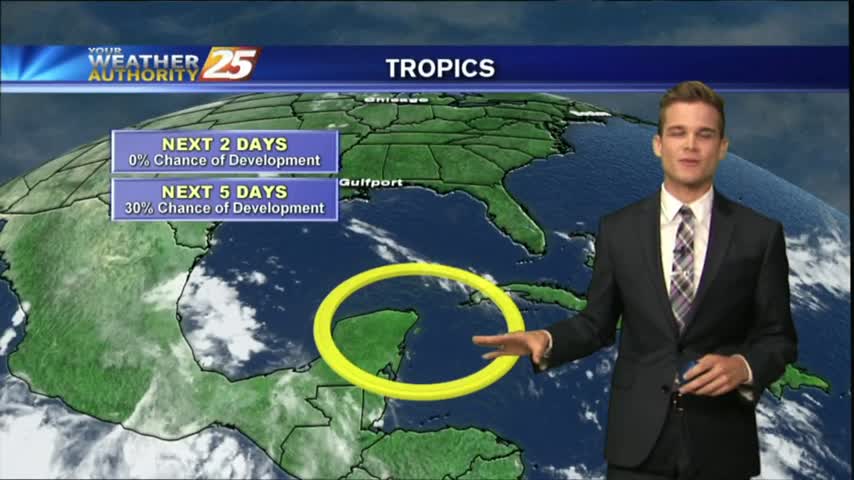
Sadly, the humidity returned as expected today, and that will lead to some muggy conditions in the coming week. The tropics are getting crowded again as well, so watch the forecast for details.
Harvey has finally moved on and drier air is moving in bringing clear and sunny days. Click the forecast link for details.
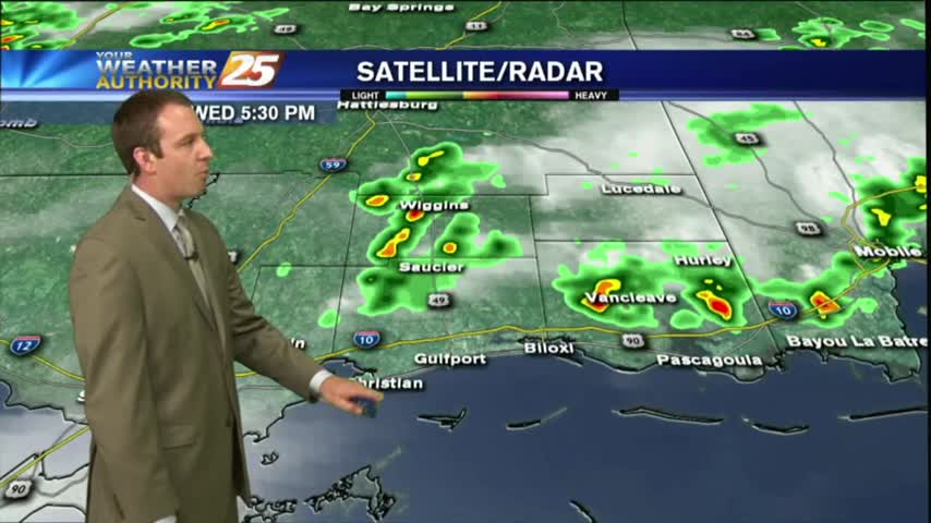
Severe weather began popping up in the early afternoon, but didn't see much more through the evening and only a few showers & storms are likely overnight. Full forecast inside.
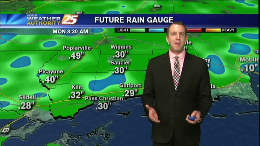
Rainfall totals will likely be high through the weekend, but some depends on tropical moisture from Harvey. We'll continue to hope for the best while preparing for the worst as we watch this developing situation. Details inside.
It was another hot & humid day with short-lived afternoon showers and thunderstorms. Expect more of the same as we approach the weekend, but heavy rains after. Details within.