6/28 - Rob Knight's "Midday News" Afternoon Forecast
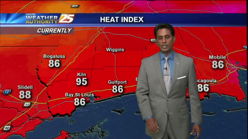
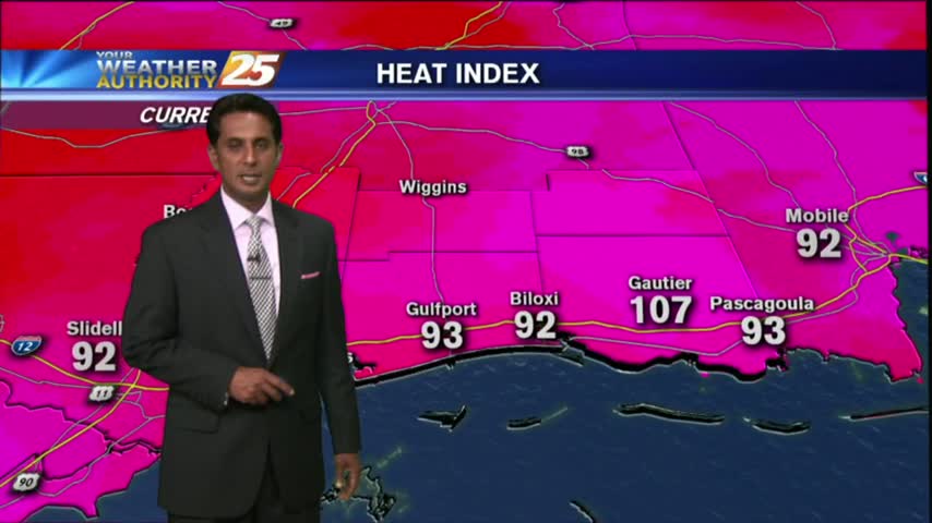
We are still under rain-free conditions for now...as the heat indices are again in the triple digits...

We are still under rain-free conditions for now...as the heat indices are again in the triple digits...
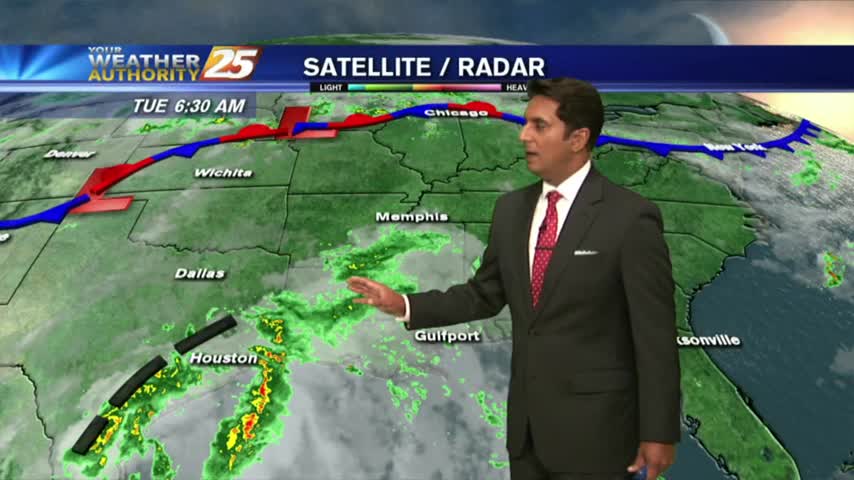
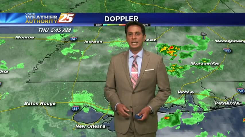
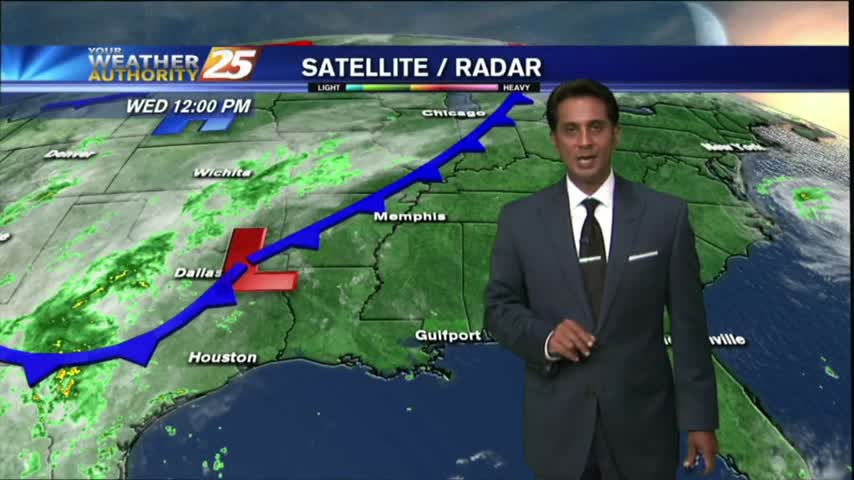
Another morning with a few light showers moving into the area from the northern Gulf of Mexico...
After a few showers shortly after sunrise this morning, t-storms are now beginning to develop...
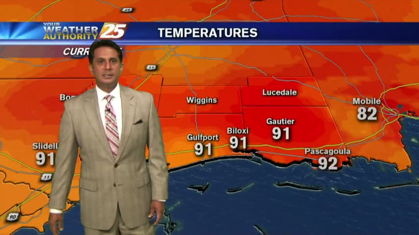
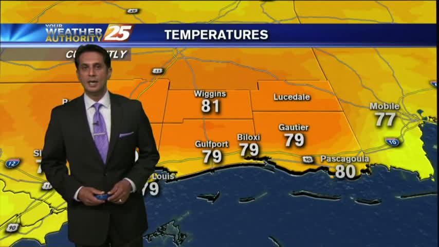
A VERY WARM start to the new season as several locations are in the low 80s this morning...

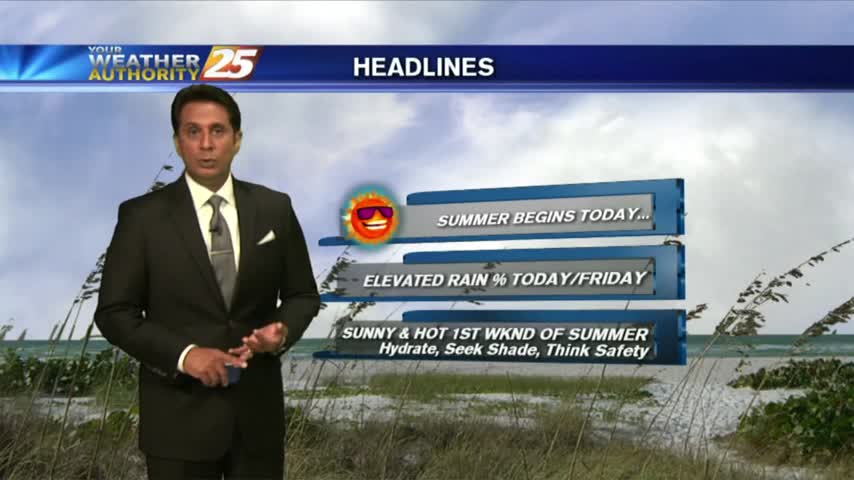
The final day of Spring is shaping up nicely with much more sunshine and HOT conditions...
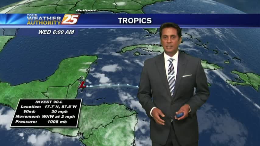
A tropical wave has moved ashore E'tern Texas with warm & humid conditions along S. Mississippi...
Another HUMID start to the day with isolated activity in the vicinity...
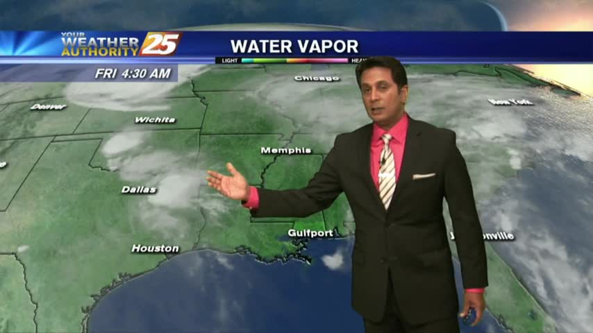
After a mostly clear start, low-level clouds continue to develop along with a possible afternoon shower/t-storm ahead...
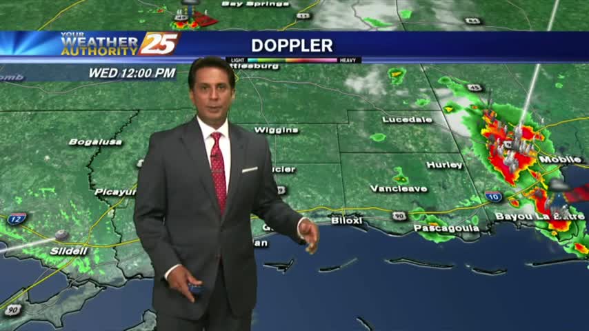
T-storms are developing along the coastal counties, moving very slowly to the NNW...
Overnight t-storms over the sound continue to move south, away from he area as drier air moves in...
Showers and t-storms beginning to pop in the local area due to intense daytime heating...
After a warm start, it's getting hot and humid with isolated showers/t-storms developing...
After a mild start to the day, the mercury is rising into the 80s along with elevating humidity...
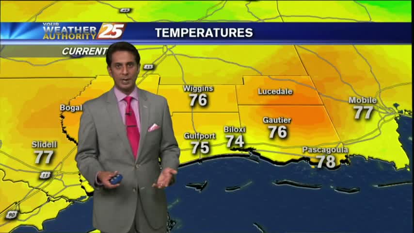
Fog is out of the area as temps continue to warm into the mid/upper 70s under partly/mostly cloudy skies...
This morning started off with warm/humid conditions along with DENSE FOG, this afternoon and the weekend will bring Summer-like conditions...
Warming temperatures and VERY HUMID conditions this afternoon, but no showers/t-storms just yet...
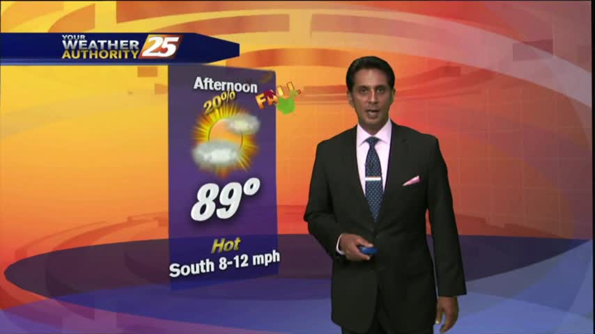
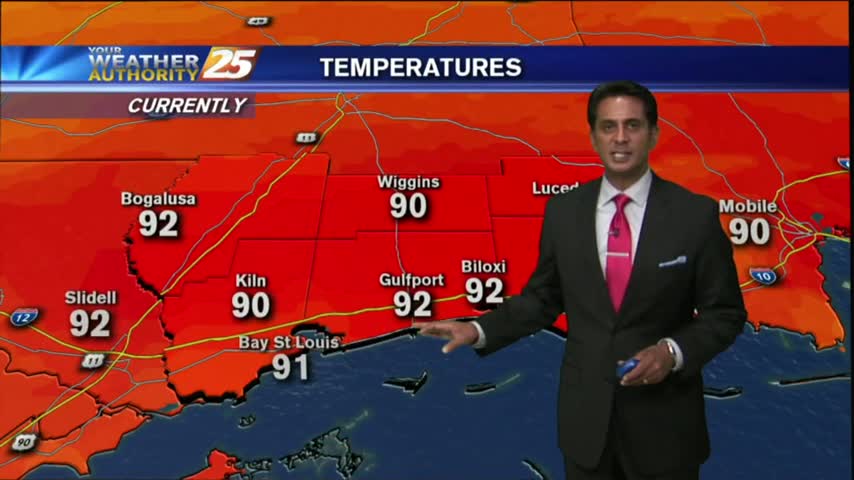
After a mild and humid start to the day, temperatures continue to warm...and expected in the upper 80s to low 90s this afternoon as we ring in Autumn...
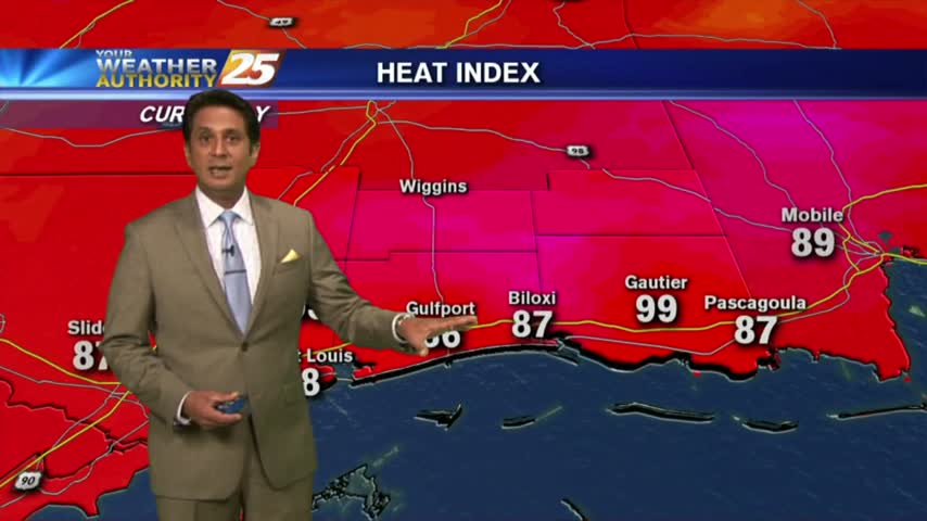
It's a HOT late summer afternoon as temperatures area climbing into the upper 80s...BUT, the HEAT INDEX is much higher...
After a HUMID start to the day...warming temps has EXTREMELY HOT and HUMID under a few/partly cloudy skies on this Friday afternoon...
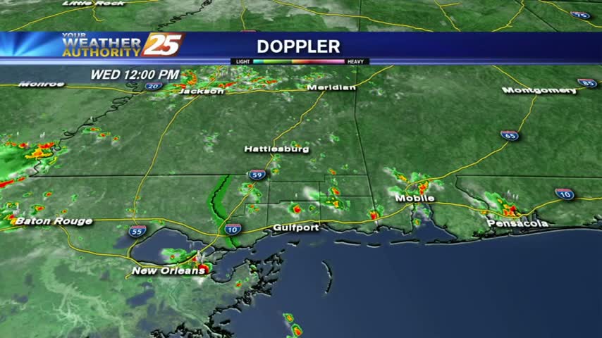
After a rain-free start to the day, showers and t-storms are moving into and developing along the viewing area...
A clear start to the day has changed as clouds have moved in from the west and SW...along with isolated showers/t-storms...
After a warm and humid start to your Friday, its downright HOT in the viewing area and through the region...
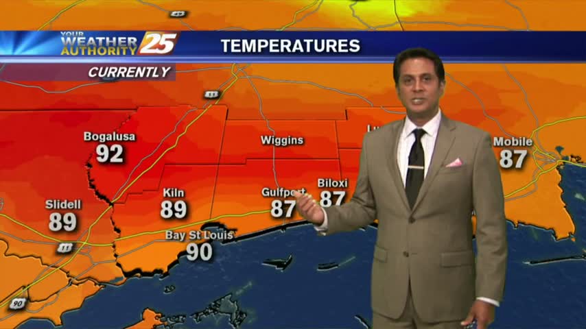
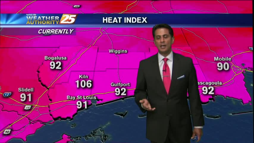
Skies continue to be clear as the mercury climbs into the low/mid 90s...but feels SO MUCH hotter with the heat index.
Another warm and humid start to the day, but rain-free. DANGEROUS HEAT will be in the region through Friday evening...