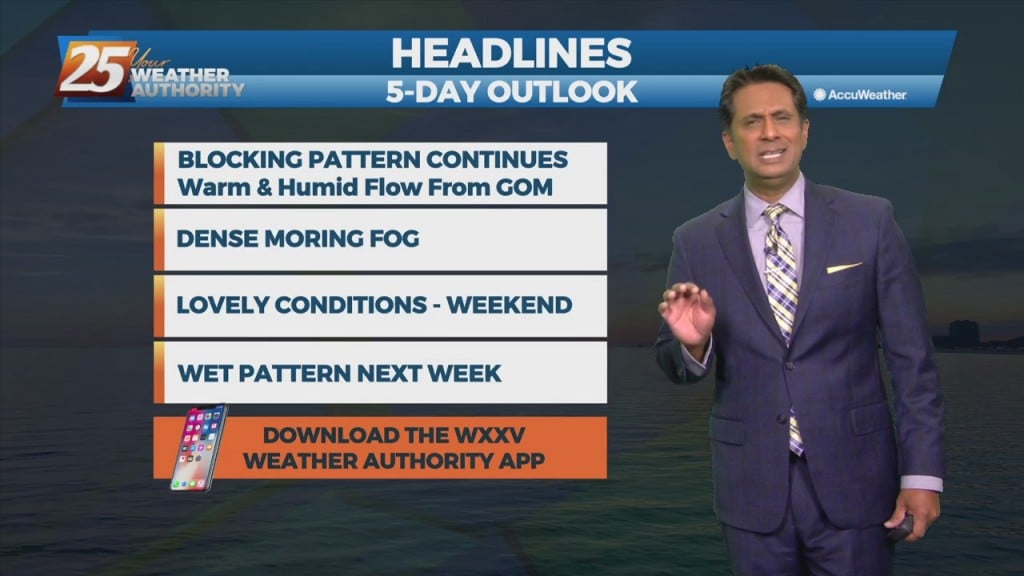
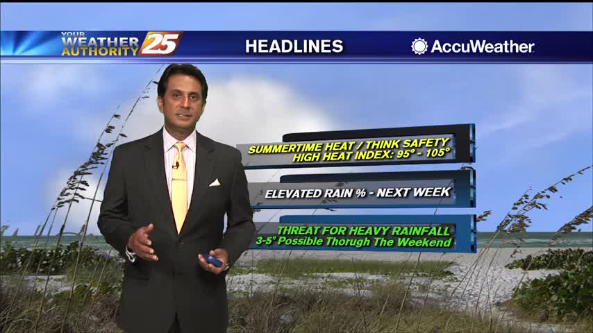
12/2 - Rob Knight's "VERY WARM" Thursday Afternoon Forecast
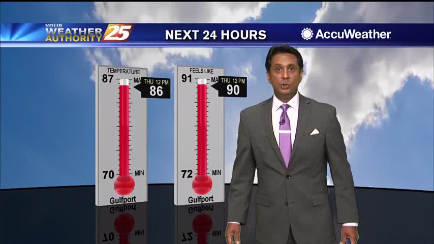
Not much change in forecast parameters for the next 24 hours, with fog threat being rather high again overnight tonight. There should be enough air movement Friday…
Not much change in forecast parameters for the next 24 hours, with fog threat being rather high again overnight tonight. There should be enough air movement Friday…
Today will bring advance moisture flow to the area in advance of a front now moving east across the southern plains. As instability slowly decreases, a few showers will be possible through tonight. A few showers will also affect the…
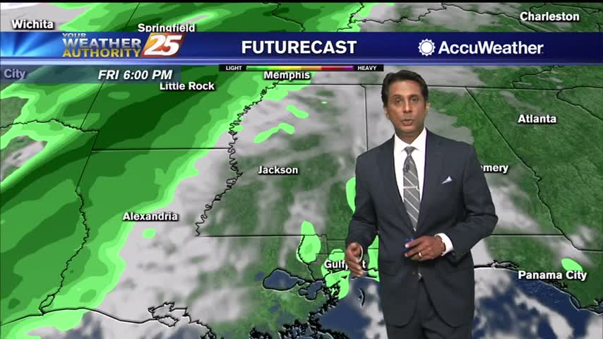
A mid-level disturbance will dip southward over the frontal zone and this will start an initial round of scattered showers and thunderstorms in coastal MS counties through the late morning hours. The frontal zone will shift further southwest into southern…
Today and Friday, the lingering frontal boundary will continue to move southward into the open Gulf waters. Upper level high-pressure will build in on Thursday followed by a short wave upper level weakness moving through Friday overnight. Overall rain chances…
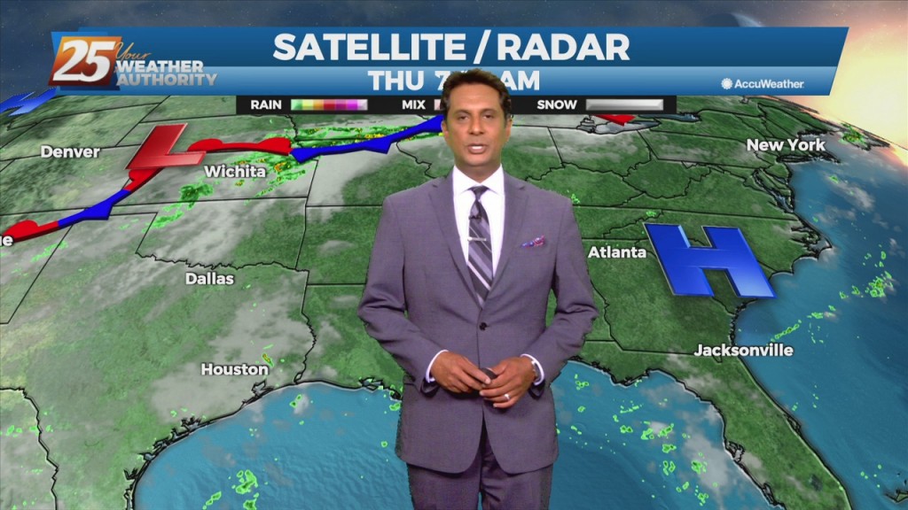
The Bermuda high-pressure is at the surface and aloft, extending westward across the Gulf Coast into east Texas early this morning. The eastern portions of the area may squeeze out one more relatively dry day today, as moisture flow will…
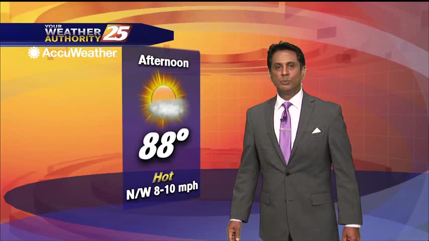
lovely afternoon ahead with breezy conditions...
Warm temperatures this afternoon with upper level clouds moving in...

Rain is out of the area but the cloud coverage and gusting winds will continue through early Friday morning...
A warmer start to the day with spring-like conditions ahead...

Overnight temps stayed slightly elevated with persistent cloud coverage...
A slightly warmer start to the day with pockets of DENSE FOG burning off...
The blanket of cloud from earlier has thinned as sunshine returns...
A warmer start this morning as upper-level clouds are moving east across the region...
A warm afternoon ahead with increasing humidity and a few spotty showers possible...
Patchy fog is dissipating along with low-level clouds here in south Mississippi...
Slightly warmer temperatures this morning as the humid flow has returned...
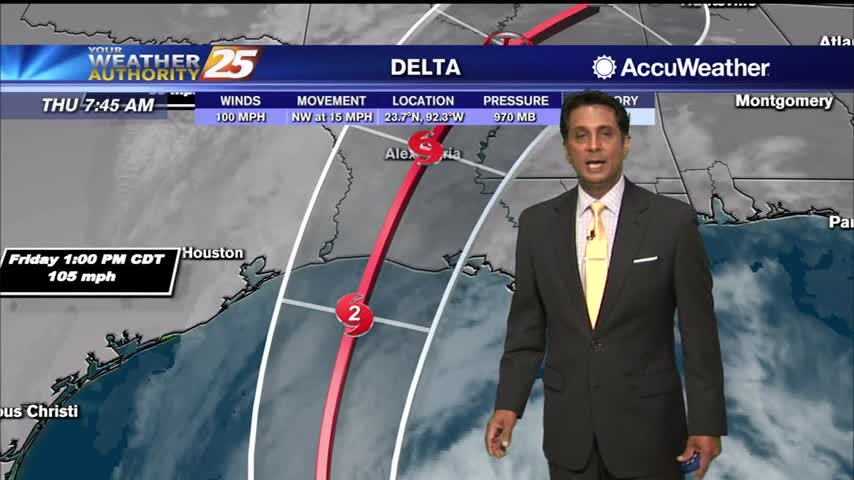
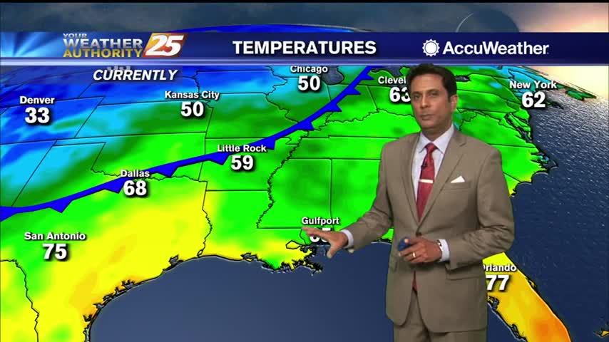
Upper clouds continues to move across the area stemming from Hurricane Delta in the West Central GOM...
As the remnants of Beta moves across N'tern Mississippi, conditions in the viewing area will continue to improve...

Mid/Upper level no rain producing clouds continue to move into the area...
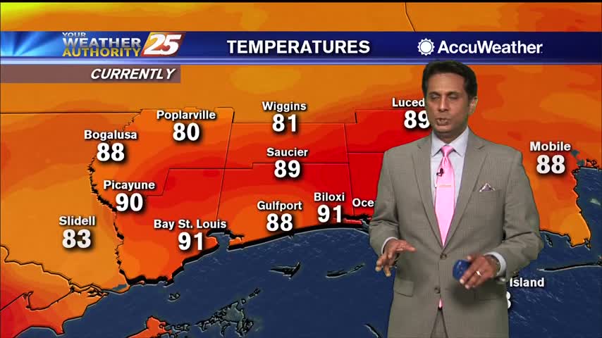
Hot temperatures heading into the afternoon as showers/t-storms are popping...

A warm and humid start with areas of very light fog and a few upper-level clouds...
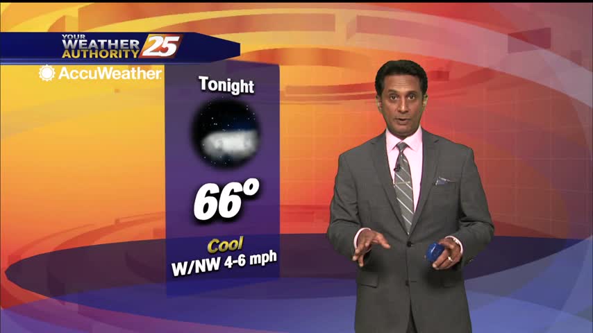
Cooler temperatures this morning due to pockets of heavy rainfall yesterday afternoon...
After a beautiful morning, temperature continue to warm into the upper 80s...
Another beautiful start to the day with lower humidity and light winds from the north...