6/13 - The Chief's "Getting HOTTER" Thursday Morning Forecast
Today will bring increasing subsidence through the area.as high pressure begins to expand eastward from the southern Plains and Texas. At most, some fair weather cumulus cloud…
Today will bring increasing subsidence through the area.as high pressure begins to expand eastward from the southern Plains and Texas. At most, some fair weather cumulus cloud…
The strong solar insolation expected this afternoon will allow highs to climb to near average this afternoon, but low tonight will quickly plunge into the 40s north…
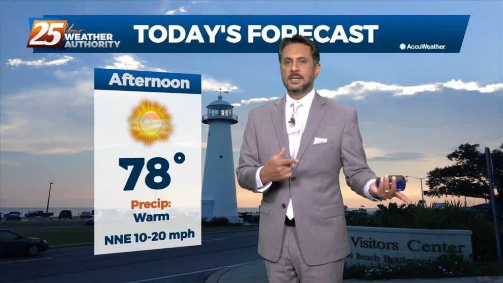
Some sunshine returns this afternoon, particularly along the beachfront. Temperatures will be slightly warmer and right at the average high temperature this afternoon. Winds will also back…
Dense fog has developed again across portions of the area this morning. Smoke from the wildfire in New Orleans East could reduce visibility to less than…
The upper level ridge axis that has been dominating the region over the past several days will weaken tomorrow as a progressive upper level trough passes through. The…
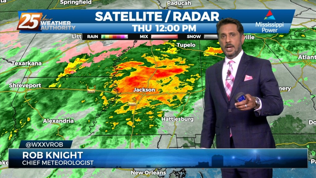
Isolated t-storms will continue this morning with partial sunshine moving in this afternoon. Concerns overnight will be the prospect of locally dense fog forming. The near record…
The upper system is quickly lifting northeastward through Missouri toward the Great Lakes, with the next disturbance quickly on its heels moving through the northern Rockies. Line…
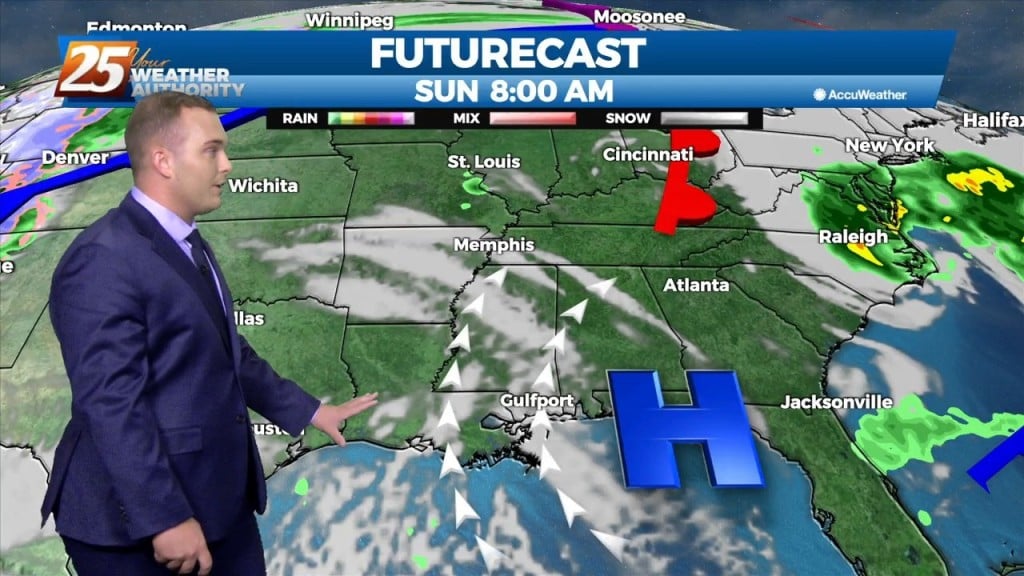
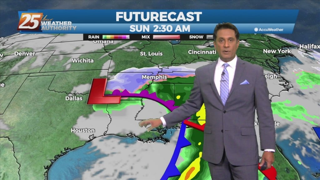
Areas of rain including a few t-storms will move in this afternoon as a low pressure and attendant cold front lifts NE. The low pressure will move…
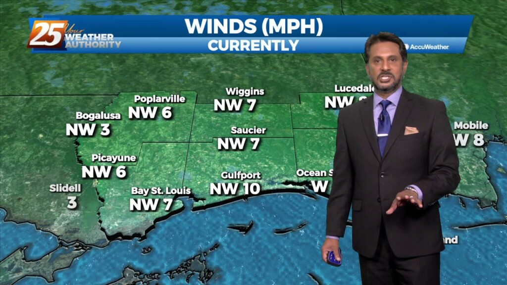
Surface high pressure will continue to spread into the region, which should limit surface winds keeping things light and variable through the short term period.…
High pressure has begun to shift to its southeast throughout today. Westerly winds continue tonight dropping to 3-6 MPH overnight. Even though we will see cold…
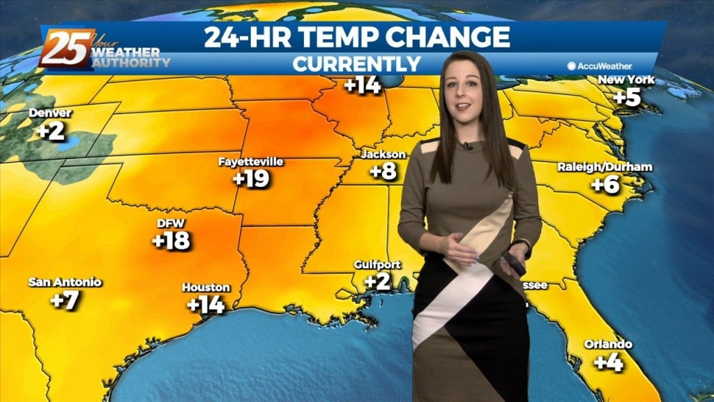
The bulk of the cold airmass has begun to slide east. High pressure to our north will continually move to its southeast which will provide for…
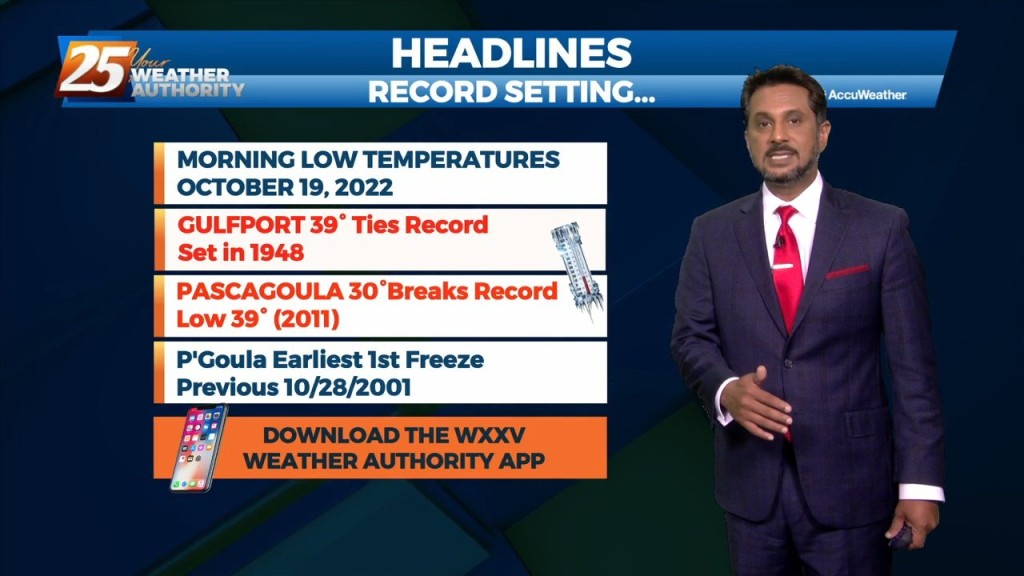
A FREEZE WARNING CONTINUES THROUGH 9 AM. As the bulk of the cold airmass starts to slide east, an area of high pressure will move in…
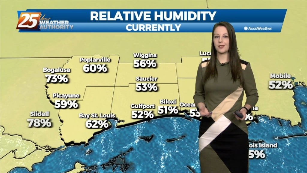
The pleasant, calm, and chilly conditions continue this evening. It has been breezy and dry with the min RH dropping from near 40% to as low as 25%. Lowest…
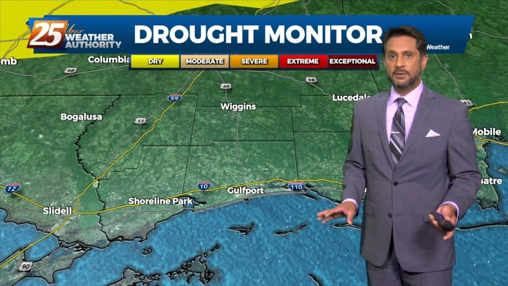
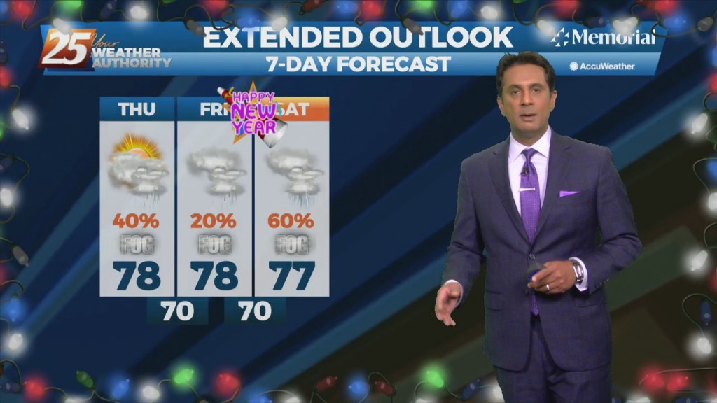
Fall is in the air! No rainfall is expected for the next few days. We are still experiencing some impacts across the area from pressure gradient…
Through the end of the week, an upper level low is expected to influence the area, enhancing rain chances for the region. There are still some…
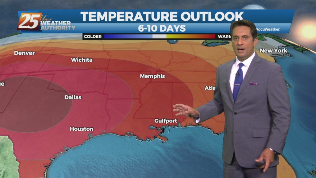
A broad upper level high pressure centered near the 4-Corners region extends from Mexico to Canada and CA to around MS. It will generally be…

Not a lot of change as all indications for a frontal boundary to sag into the area and stall through Saturday. The interaction between the Caribbean…
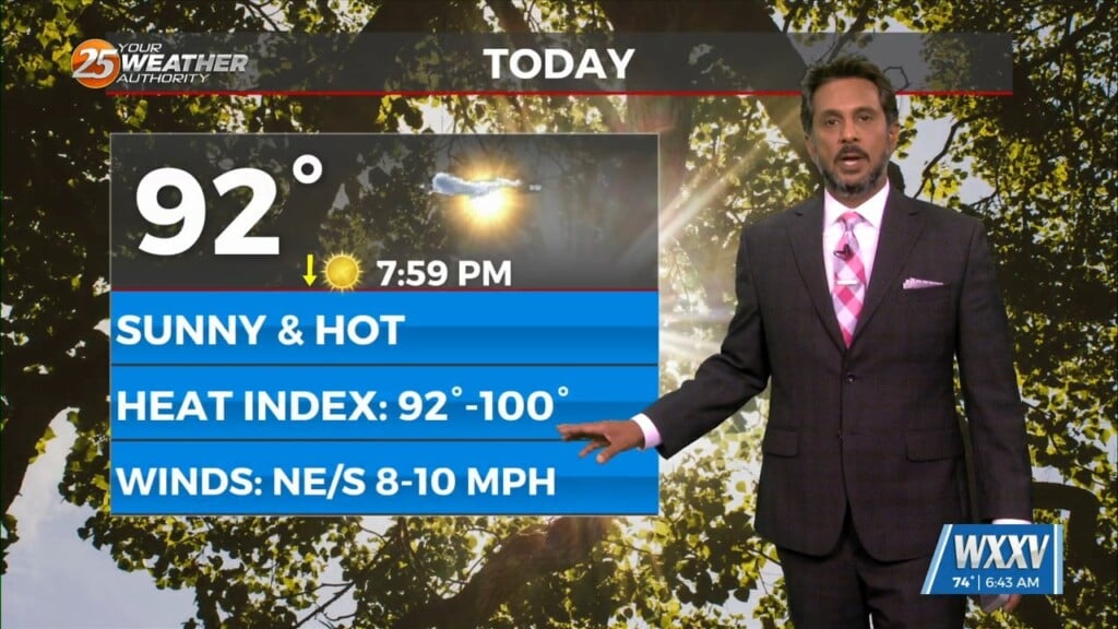
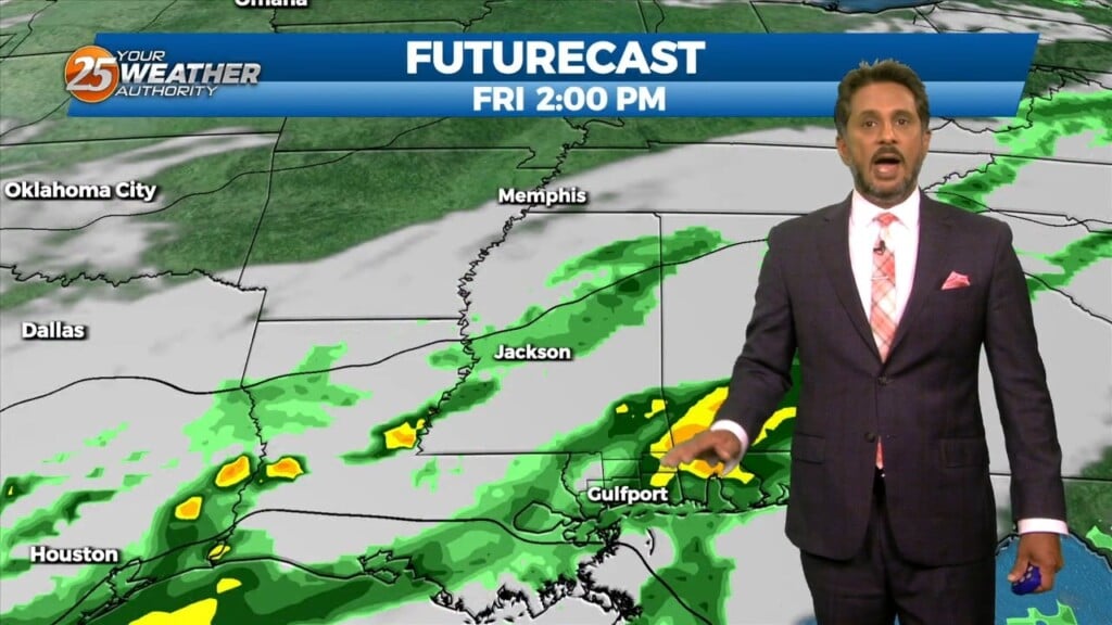
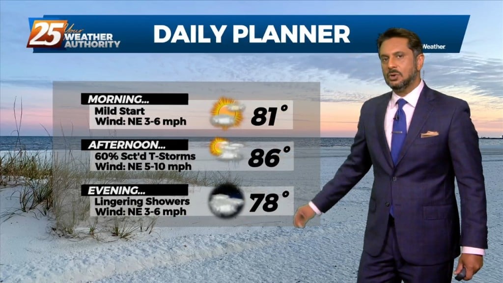
Today will be quiet, humid, and warm with HI readings mostly in the mid to upper 90s and a few 100s. Saturday the chance for rain will increase. Southwest…
The front is now well east of the area after leaving extensive damage through the region including South Mississippi. Multiple areas were hit by damaging straight…
Above seasonal average temperatures will continue until a cold front makes its way through our area early tomorrow morning. Ahead of the front, isolated showers…
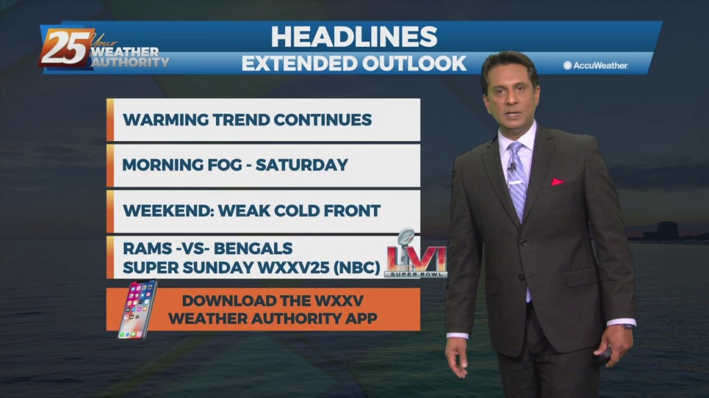
Conditions will be clear, dry, and on a warming trend into the weekend. Pockets of dense fog will be in the area on Friday and Saturday mornings.…
Today will be a quiet weather day locally while high-pressure to the west shapes the forecast. Any significant moisture return isn't likely to occur until…
Rain showers and unseasonably warm temps continue through the next few days. As the high pressure remains seated over the Bahamas warm and moist air advection continues…
Today will continue the trend of quiet conditions as high pressure located just east of our area remains dominant over the forecast. High temperatures today are…