6/7 - Rob Knight's 2 PM TS Cristobal Update
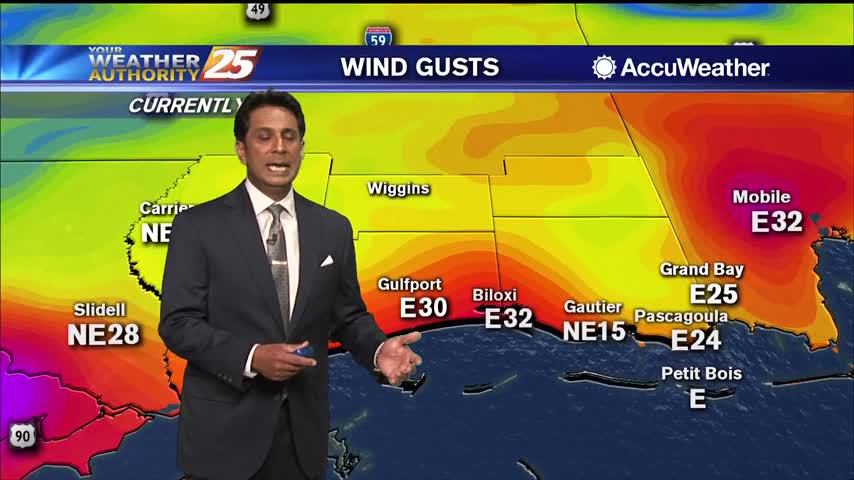
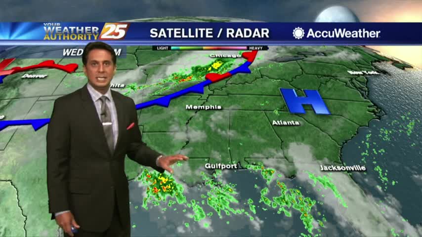
Feeder bands of heavy rain and strong winds continue to move ashore South Mississippi...
Feeder bands of heavy rain and strong winds continue to move ashore South Mississippi...
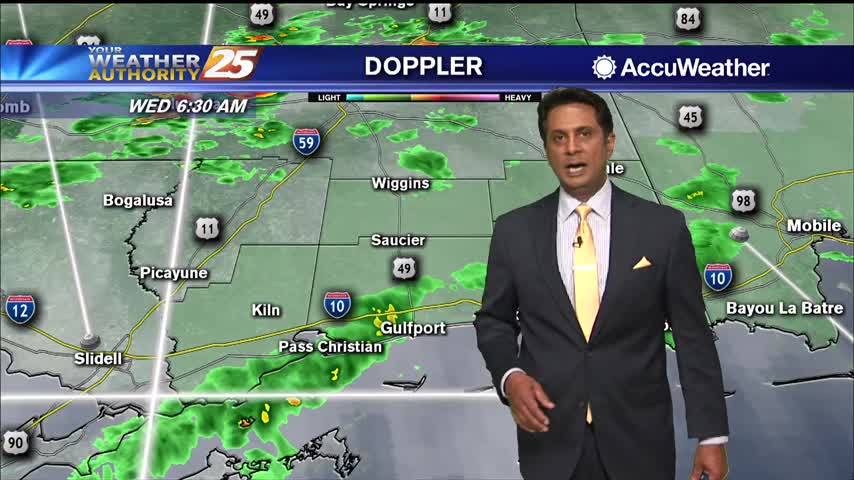
South Mississippi continue to be under a TROPICAL STORM watch...
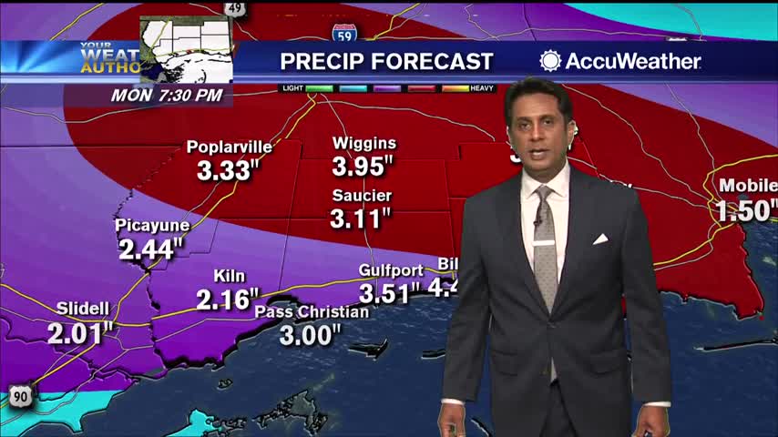
Numerous areas in South Mississippi dealing with flash flooding and flooding along Hwy 90...

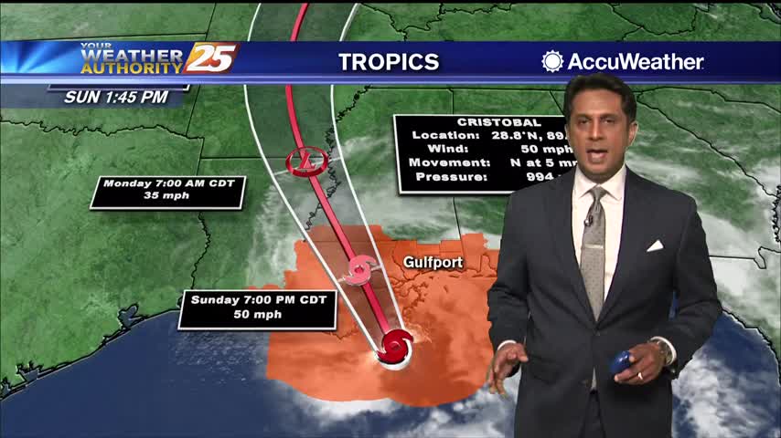
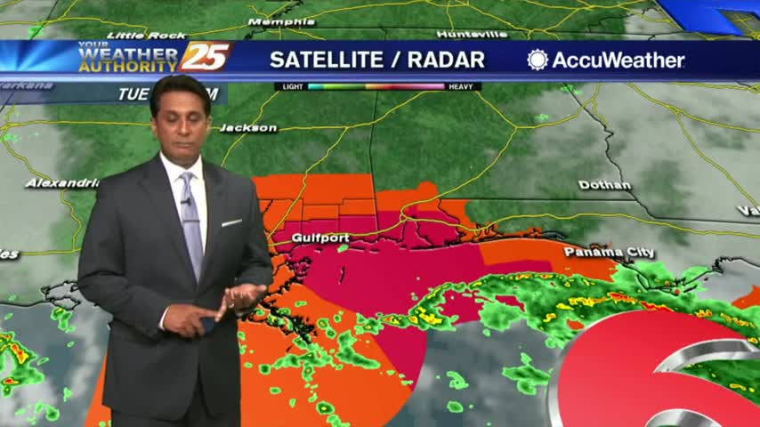
TS Cristobal continues to move closer to the SE Louisiana coast with landfall a bit earlier than projected...

Mississippi has been no stranger to severe weather in the last few years and weather officials say 2020 won’t be any different. The upcoming spring months are expected to be an active time for severe weather so Governor Tate Reeves…
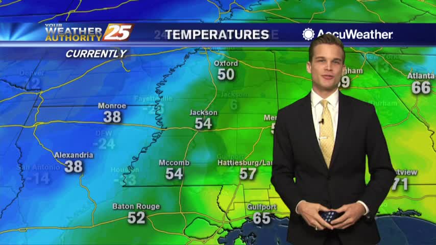
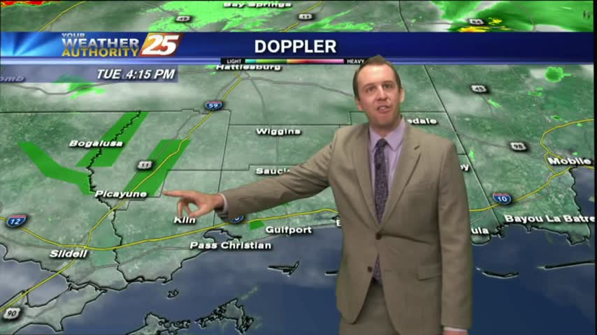
A mild and humid start with isolated rain and areas of patchy fog...
Rain will continue through the night, but will clear quickly tomorrow....
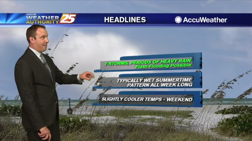
Flash flooding possible this afternoon
Heavy rain expected tonight and Monday
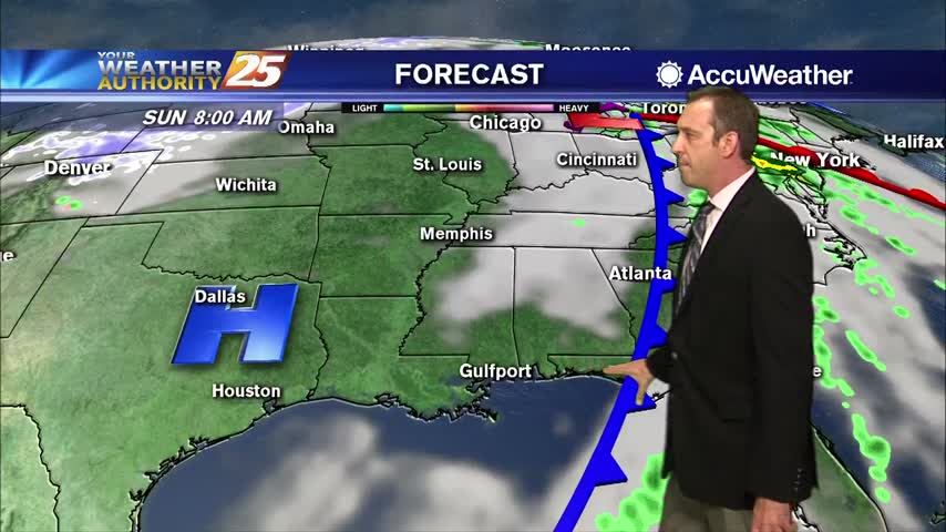
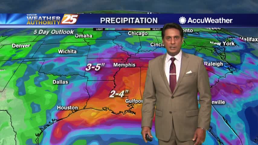
More afternoon rain today...and the next day...and the next day...and the next day....
Major changes have occurred with the pattern and this morning rain is moving in from the SW...
Heavy rain this afternoon...cold by tonight.

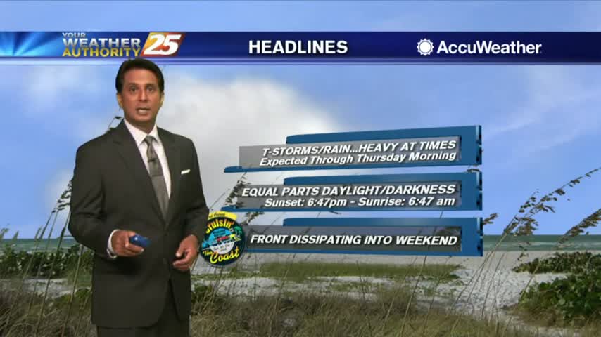
The rain we've been talking about for days has finally arrived, and is bringing some potentially dangerous weather along with it....

As the first batch of rainfall move to the NE, VERY WINDY CONDITIONS continue to affect the viewing area...
A VERY WET start to the day as a plume of moisture is bringing showers/t-storms with HEAVY RAINFALL and frequent lightning...
Only a few very light showers moving in the mornings as we continue to keep an eye on TS GORDON and its track towards S. Mississippi...
HEAVY RAINFALL has already moved across the viewing area this morning, with more to come...
Another humid start to the day with very light rain moving in from the Gulf of Mexico...
We expect more showers and thunderstorms through the night, but the end of Harvey is in sight. Click the forecast link for more details.
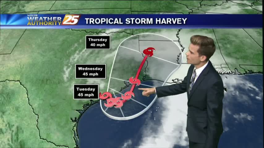
Tropical Storm Harvey will continue to be the main weather feature impacting the forecast through Wednesday as the system slowly moves offshore today and eventually pushes back inland near Houston tomorrow.
As expected, we saw a little more rain overnight with more showers this afternoon. Things will begin clearing up tonight, so expect some sunny & drier weather! Details within.

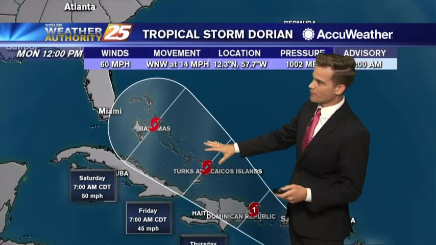
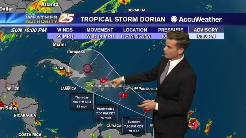
Not much rain over the last few days but we'll be making up for it as a potential tropical system funnels moisture into South MS. Watch the full forecast for details.

On and off showers are possible this afternoon as we continue to get daytime heating. The strongest storms could have gusty winds, lightning and heavy downpours.

SEVERE WEATHER continues to move across the Southern 6...