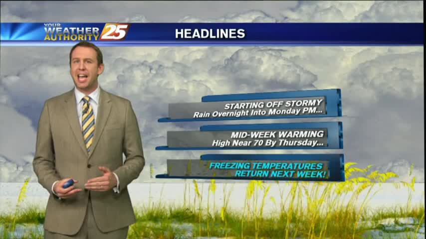
07/27 Ryan's "Cooler & Damp" Monday Night Forecast
More wet weather today and on the way as we begin this week, but sunny days will return soon.

More wet weather today and on the way as we begin this week, but sunny days will return soon.
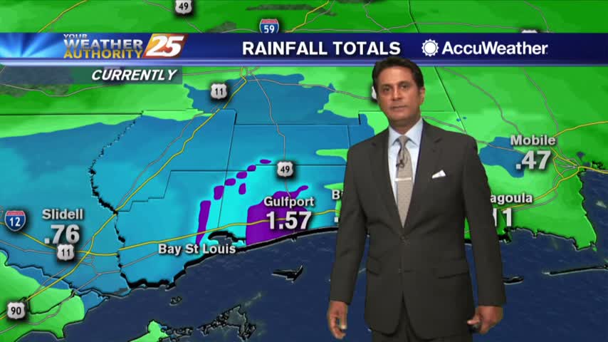
Rainy weather continues to be in the forecast for today and tomorrow. There’s around an 80 percent chance of showers and thunderstorms for both Monday and Tuesday on the Coast and we could see some minor flooding. The good news…
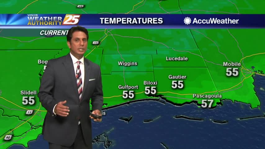
A warm and muggy start to the day with patchy fog and spotty light rain...

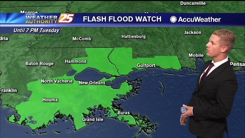
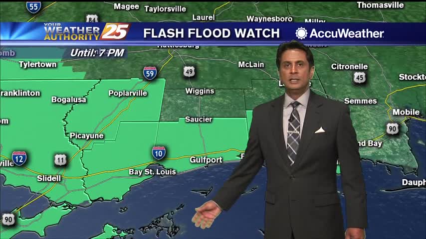
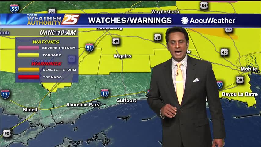
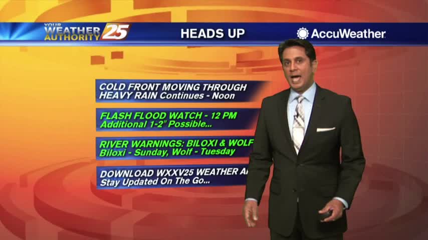
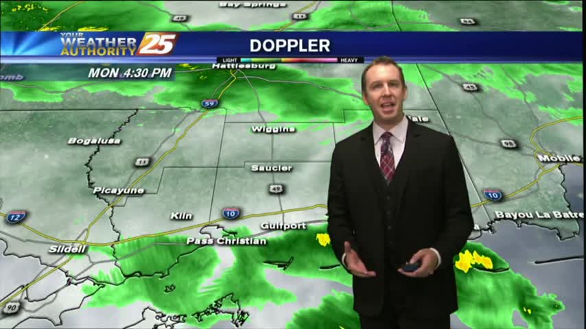
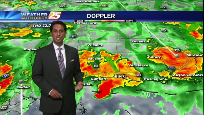
A Flash Flood Watch is in effect until 8 p.m. Monday for Hancock, Harrison, Jackson, and Pearl River Counties. Localized amounts of 4 to 6 inches of rain will be possible as heavy showers and thunderstorms continue to roll across…
A humid start with areas of light rain moving across the area...
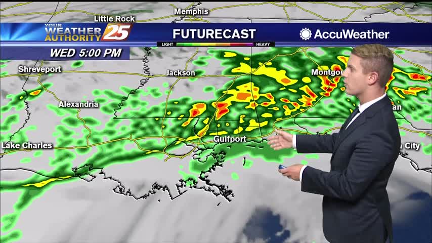
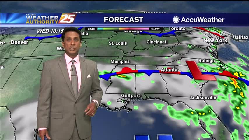
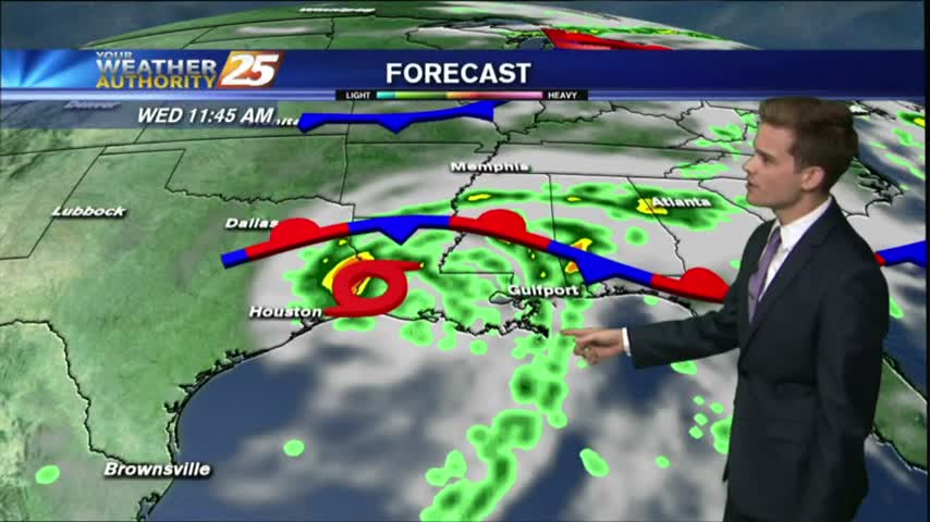
Wednesday afternoon and evening, everyone in South Mississippi will likely see showers and thunderstorms. Some thunderstorms may produce heavy rainfall, gusty winds, and an isolated tornado or two. The most likely time of arrival for any strong to severe storms…
What will likely be the most impactful weather of the week is expected take place over the next 24 hours. An upper-level low pressure system is currently tracking across northern Mexico. A frontal boundary that moved into the region yesterday…
Another wet start to the day with t-storms and rain along with areas of DENSE fog...

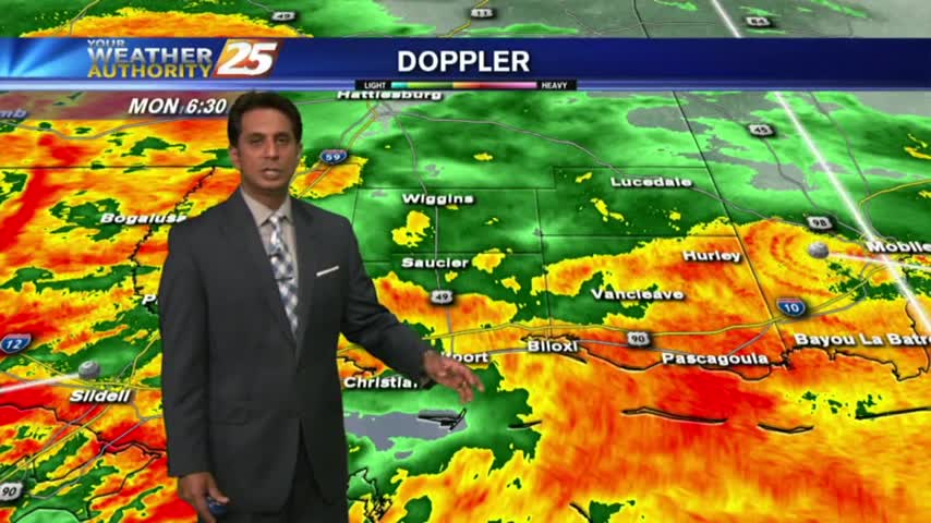
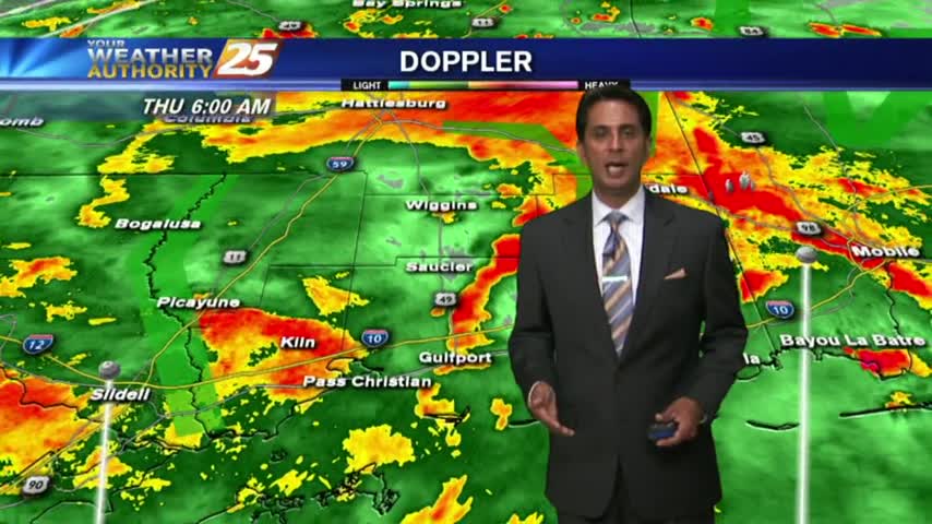
Moderate to heavy rain is moving across south Mississippi with t-storms and frequent lightning...
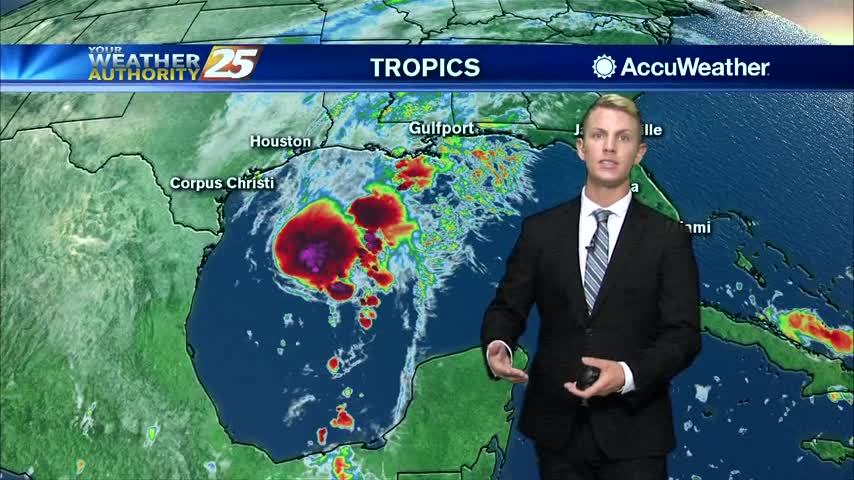
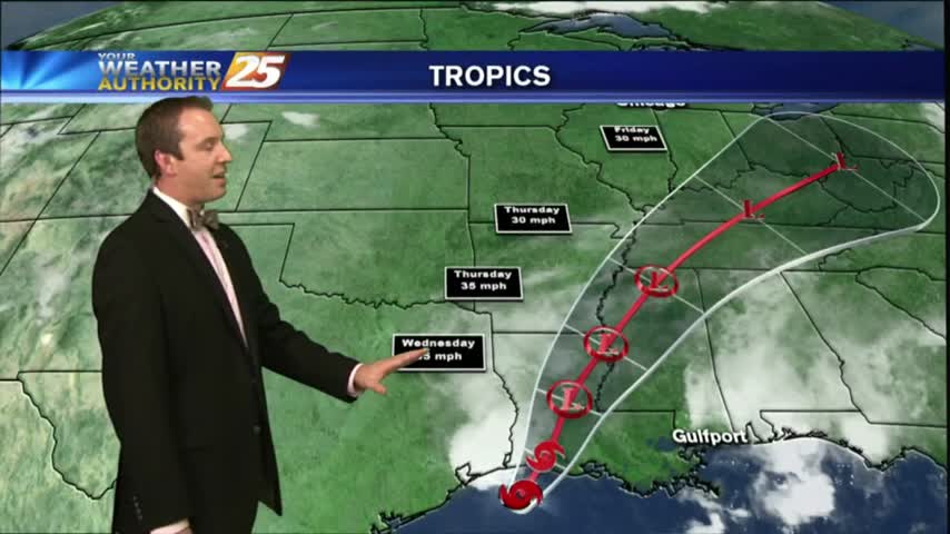
We’re continuing to track a tropical disturbance in the Gulf of Mexico that is expected to collide with a cold front before reaching our area. At the time of this post (7:15 a.m.), there was a 70 percent chance of…
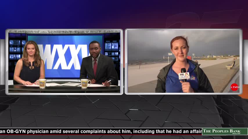
Tropical Storm Barry Raises Hazardous for Your Regular Commute A flash flood watch has been issued for all six southern counties in our state as tropical storm Barry moves through the Gulf. News 25 Today's Gabby Easterwood hit the streets,…
Another wet start to the day with HEAVIER RAIN expected later today...
A cloudy start to the day with areas of light fog and drizzle as a warm front is over the area...
A VERY WET start to the day as HEAVY RAINFALL continues to move across the viewing area...
An area of low-pressure west drifting east will continue to bring rainfall to the viewing area with a FLASH FLOOD WATCH remains in effect...
After an extended period of cold and dry weather, we're finally seeing warm and moist air move in along with some active weather. Click this tab for the full forecast.

As TS Harvey continues to move NE after landfall this morning...rain continues to move in from the south with HEAVY ACTIVITY at times with a TORNADO WATCH in effect...
Tropical Storm Harvey continues to push East, and comes close to home on the anniversary of Katrina before moving inland. Rains expected locally, but you'll have to watch the full forecast for details.
Flash Flood Watch for the area until Thursday night. Turn around, don't drown!
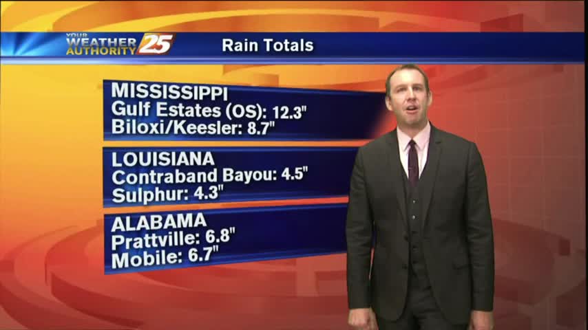
Rain was expected to begin the week, but we saw some ridiculously high rainfall totals from this afternoon's thunderstorms. Drier air moves in soon, watch the forecast for details.
HEAVY RAINFALL has been in the area since last night...and will continue though tonight as a FLASH FLOOD watch continues...
A gray/gloomy start to the day as an area of low-pressure west of Lake Pontchartrain is bringing HEAVY RAIN into the area...
Cindy has all but moved on, though we'll continue to see a few showers in the forecast through the weekend due to an approaching frontal system. Watch the full forecast for more.
Most of the weather watches and warnings have expired as Tropical Depression Cindy continues to weaken, but more rain still expected through the weekend. Watch the forecast for more.