08/06 Ryan's "Still Dry" Thursday Evening Forecast
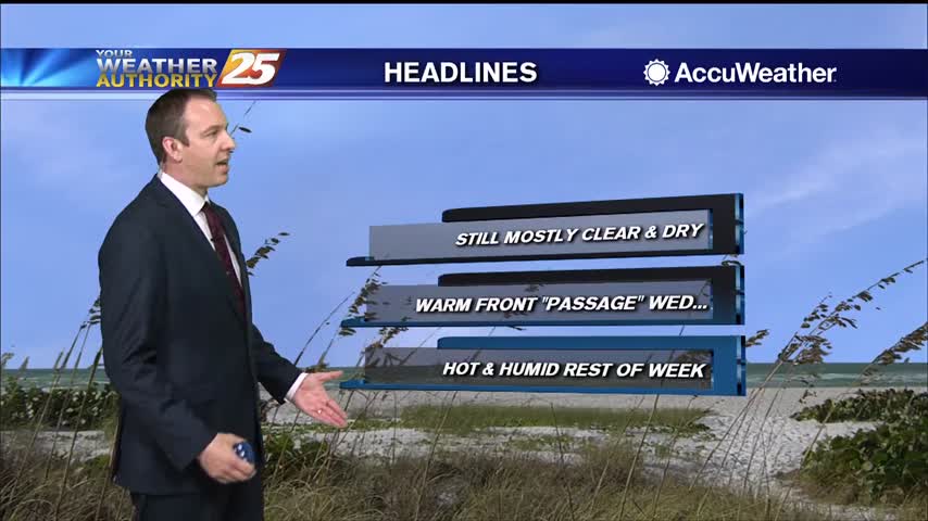
Our hot and dry streak continues, but at least one of those conditions will change in the days ahead....
Our hot and dry streak continues, but at least one of those conditions will change in the days ahead....
Not really any cooler, but it'll feel that way as slightly drier air makes its way to the surface.
Continuing our beautiful weather from the weekend into the week, and drier air is going to keep things nice and sunny for a while!
We've begun the final week of Spring, so I guess it's appropriate it won't be very "spring-like."

Beautiful, cloud-free skies have moved in, and will largely remain consistent for the weekend and most of next week.
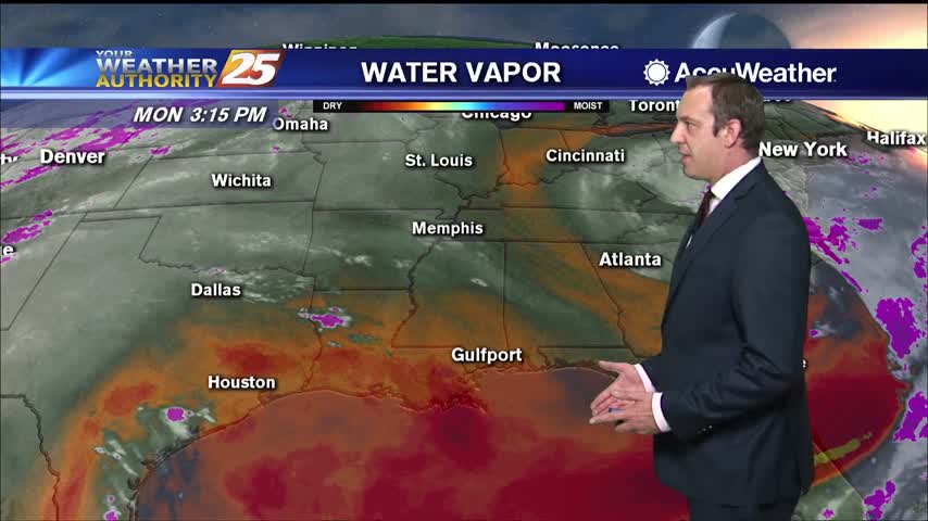
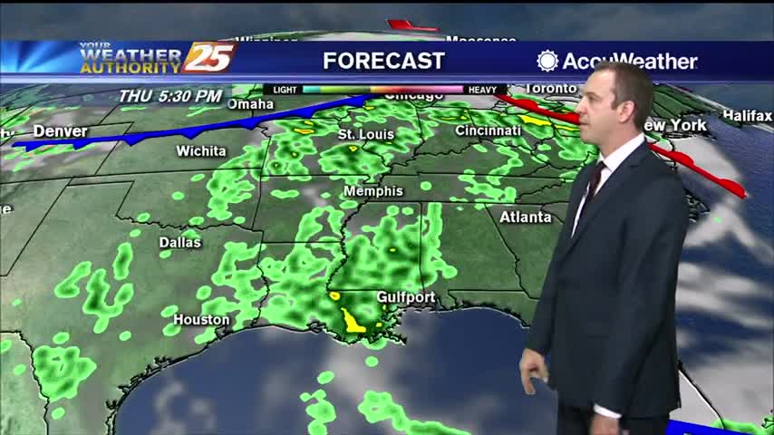
The dry and hot pattern will persist into the short term with only a slight chance of showers and storms. There appears to be some lingering moisture. With the movement of the afternoon sea breeze an isolated shower or thunderstorm…
Not much changes to discuss as we roll into the day today. We have begun to see a slow transition from post-frontal dry air filtered in by northerly winds to now a slow and steady moistening trend. As we get…
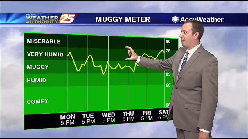
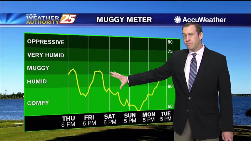
Going to be a good bit warmer than it was last night, but the humidity won't increase dramatically until later in the week.
It's warmed steadily through the weekend, but the humidity hasn't risen much. That changes quickly later on this week.
Overall weather pattern remains quiet in the short-term. We will see a weak cold front swinging in from the north later this morning, which will not have much impact to the weather across the area other than keeping winds continued…
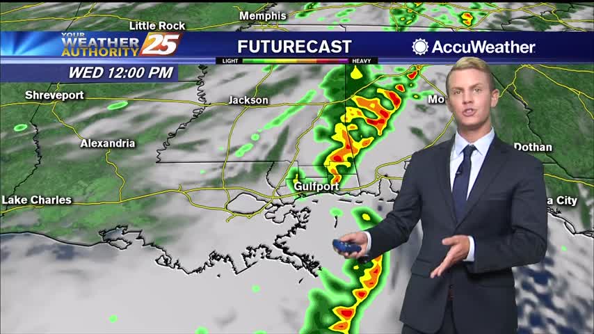
Still clear and dry tonight, but clouds, rain, and higher humidity move in quickly tomorrow afternoon!
Dry air remains in place, but we'll see rapid changes to that and even potential thunderstorms moving in tomorrow.

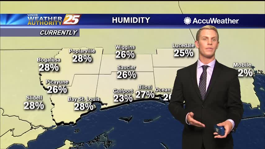
Dry conditions will continue for at least one more day before some much needed rain arrives. Humidity levels are still low, but gradually increasing across the Gulf Coast with mild temperatures in the mid 70s. This afternoon, winds will switch…

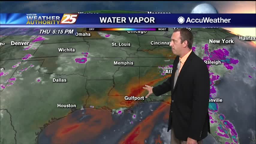
Hot, dry conditions aren't helping the multiple fires in the South MS area, but showers are on the way...just not immediately.

It's been quite hot over the last few days and still was today, but cooler air is on the way.
After a hot day yesterday, temperatures will be cooler today topping out only in the lower 80s this afternoon. Dry conditions are expected with very low humidity and gusty winds up to 25 miles per hour. Tonight, temperatures drop to…

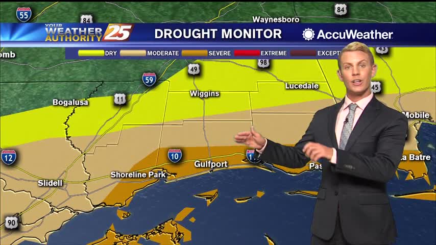
(WXXV) — Severe drought conditions along the Mississippi Coast have led to drier than normal soil and dehydrated vegetation, creating plenty of fuel for any wildfires that develop. The National Weather Service said Wednesday morning, "Low afternoon minimum relative humidity…

This morning will bring clearing skies as the cold front to the south continues to move away from south Mississippi. A tightening gradient will bring windy conditions from the north at times gusting into the upper teen to low 20…

Dry air will linger a little longer before things get humid on us again, just before another front moves though.
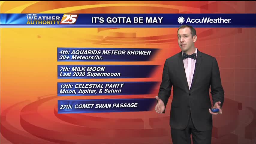
Happy first of May everyone! The beautiful weather is in no hurry to leave, so be sure to enjoy it before those muggy conditions return.
If you liked today, there isn't much you won't like about the rest of the week and most of the next....
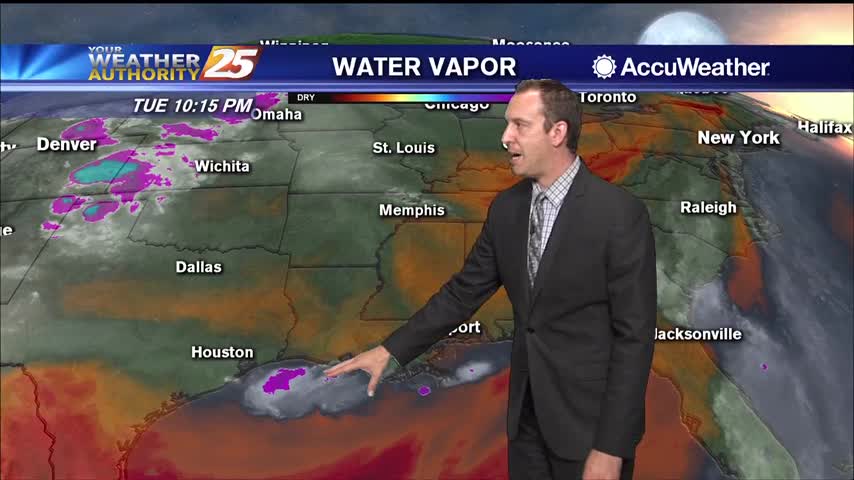
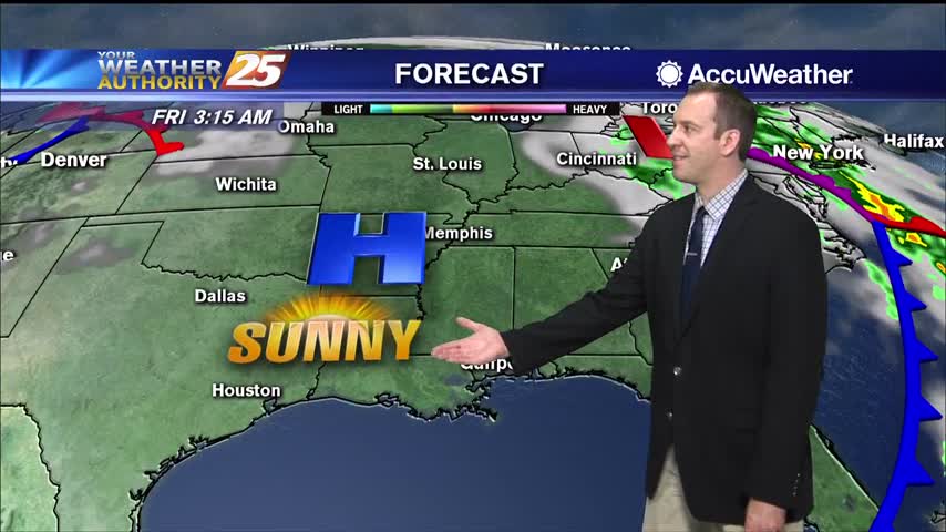
Sunny, dry conditions will continue through Tuesday afternoon. Winds are blowing out of the southeast at 10 to 20 miles per hour, with gusts up to around 25 miles per hour. Those winds are bringing in more moisture, but what…

Our beautiful weather isn't helping firefighters battle the blaze in Harrison County, but at least some rain is on the way.
Thunderstorms pushed through South MS early this morning bringing a possible tornado to George County, but things are clearing quickly into the night.