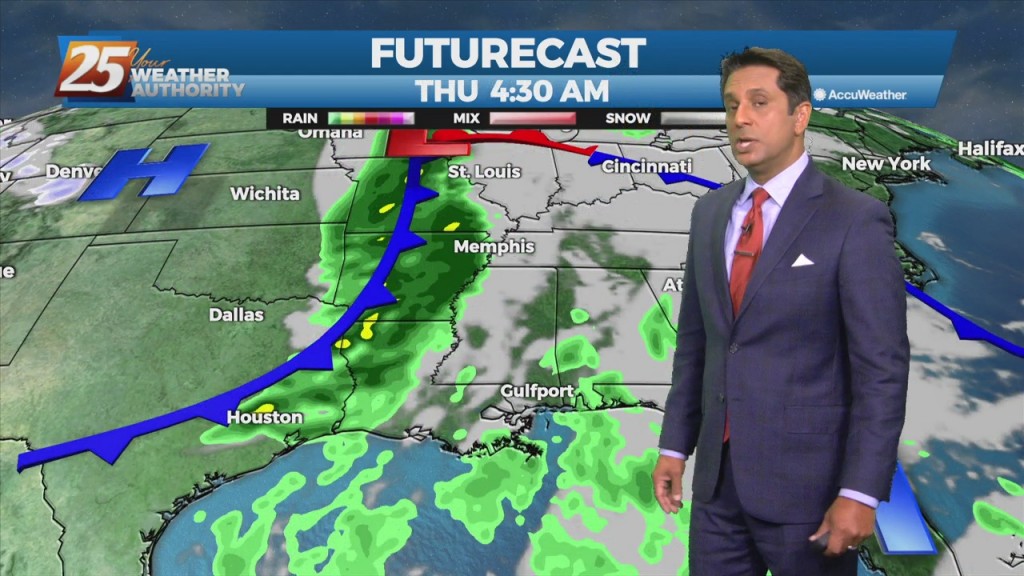
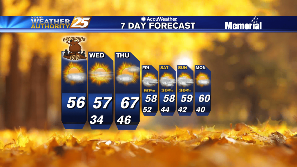
11/14 - The Chief's "Heavy Rain Tonight" Monday Morning Forecast
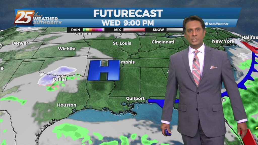
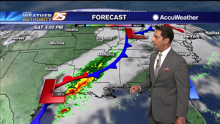
The main weather maker for the week is the system that will impact the local area over the next 24 hours. Dry air will modify quickly…
The main weather maker for the week is the system that will impact the local area over the next 24 hours. Dry air will modify quickly…
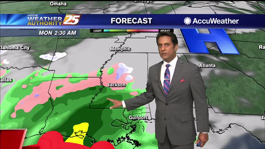
A cold front east of the area continue to move east as high pressure to the NW will shape the short term forecast. Most of the…
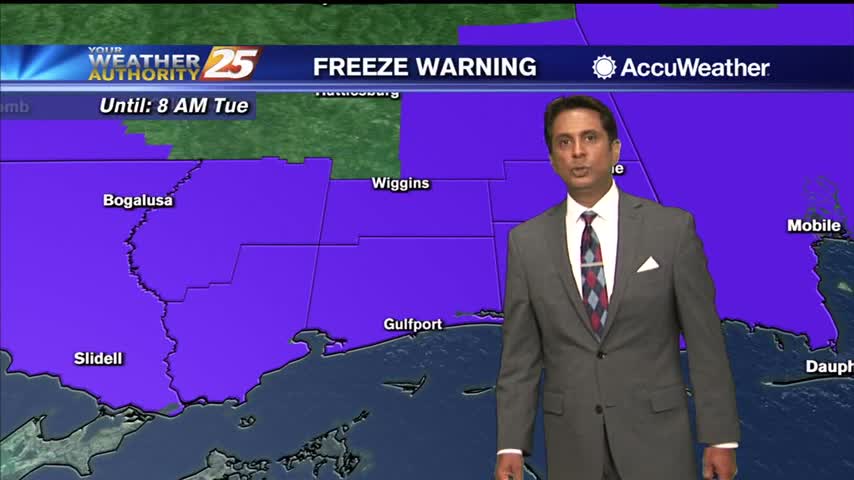
A FREEZE WARNING CONTINUES THROUGH 9 AM. As the bulk of the cold airmass starts to slide east, an area of high pressure will move in…
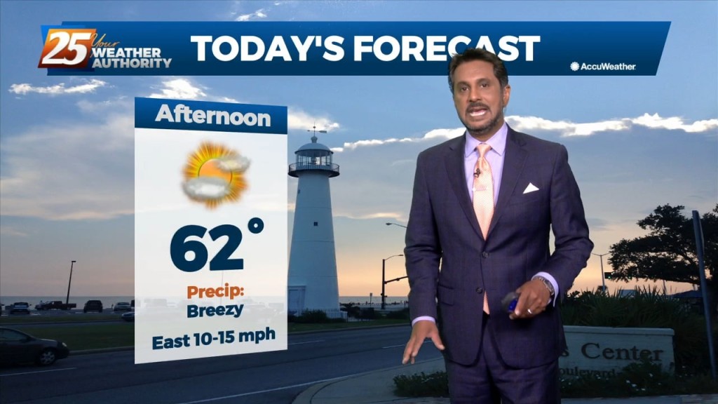
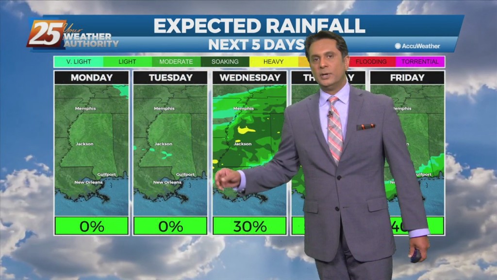
It's a rather quiet forecast the next few days with cool and dry conditions today slowly moderating over the next few days. High-pressure will quickly move…
A surface high-pressure has given us the coldest temps so far this season and year will quickly shift east today and clouds will begin to invade from…
The first 36 hours of the forecast is pretty straight forward as high-pressure moves eastward across the area, with onshore flow returning Tuesday. Abundant sunshine will…
Surface high-pressure extended from Illinois to east Texas. This high-pressure will shift eastward today and Wednesday. Expect sunny skies and cool temperatures today with winds continuing from…
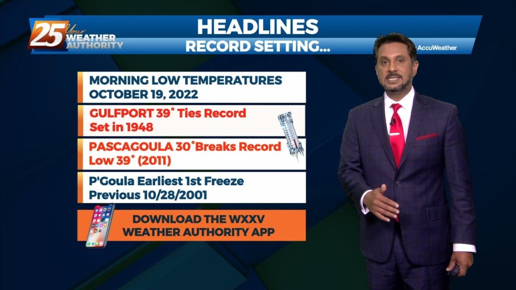
Strong cold and dry air advection has allowed for freezing temperatures across the entire area this morning and is expected again on Tuesday morning. A…
Surface high pressure remains in control of the northern Gulf coast, with a broad center/axis extending from across SE LA, northeast into MS/AL and central TN. The…
Starting out with early this morning, surface high pressure has built in across the southern MS valley region/NW GOMEX. The high center is just to our west…
Very nice conditions will remain through the workweek, with the main issue over the next few nights being fog formation. This morning, conditions support low level layered…
Rapidly increasing temperatures today will jump by several degrees along with increasing cloudiness. Low level moisture will also begin to return as high-pressure continues east, a splitting trough…
Clear skies and high-pressure to the north will shape the forecast though Wednesday evening. Colder and drier air mass will begin to modify later today with the high-pressure…
High pressure in the upper/mid-levels will remain the driving force of the short term forecast period. Much of the workweek remains a temperature forecast as surface high pressure…
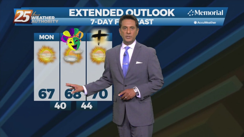
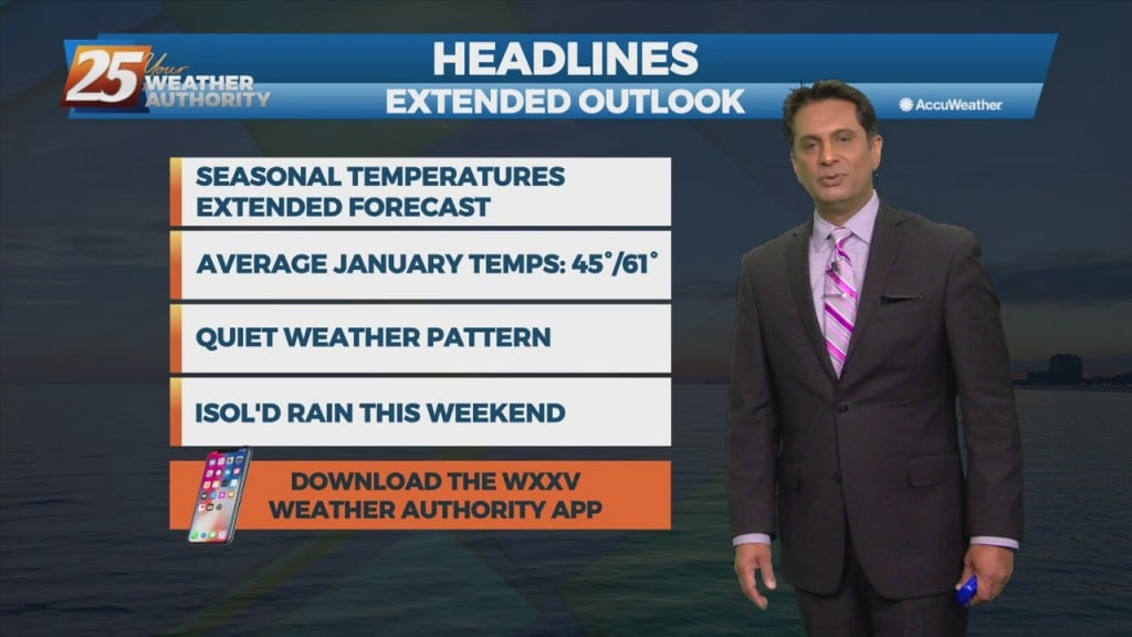
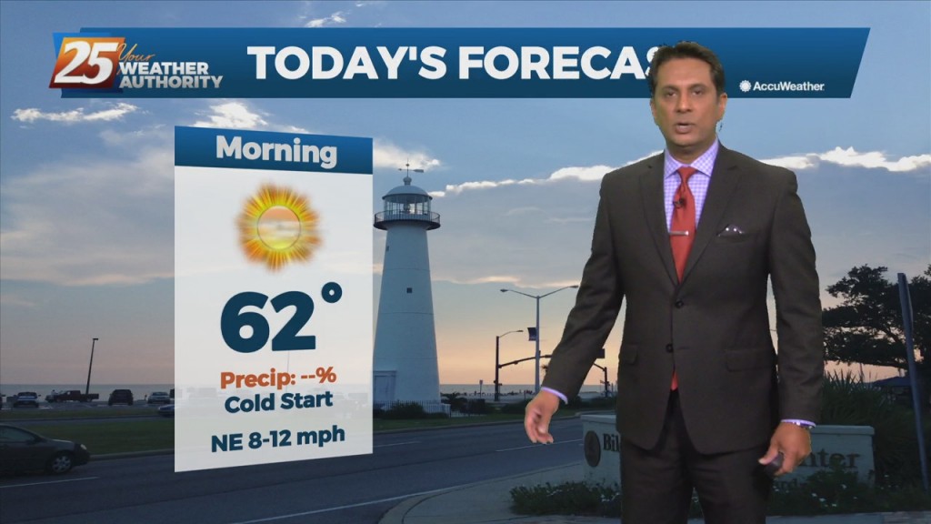
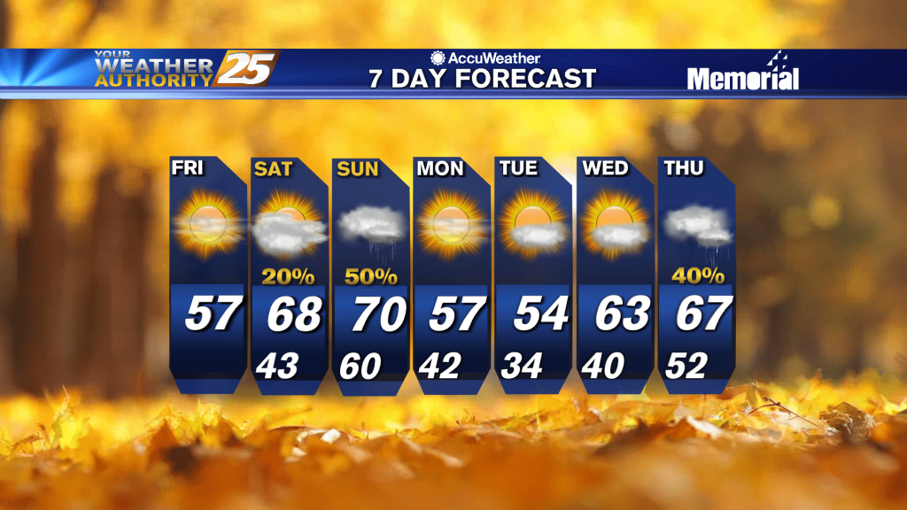
A cold start this morning with much warmer temperatures through the weekend...
A very cold start as a blanket of clouds continue to linger overhead...
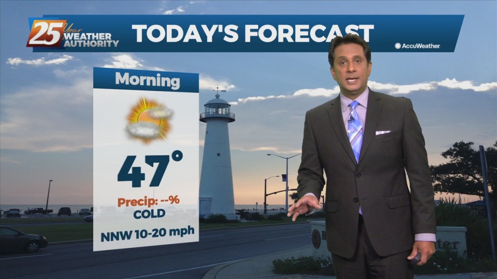
A very cold start to day day with light winds continuing from the NNW...
A very cold start this morning with rebounding temperatures later today...
A cold start as cloud coverage continues trough much of the region...
A COLD start to the day/workweek with the warm-up beginning this afternoon...
A VERY COLD start to the day with major changes in the near term...
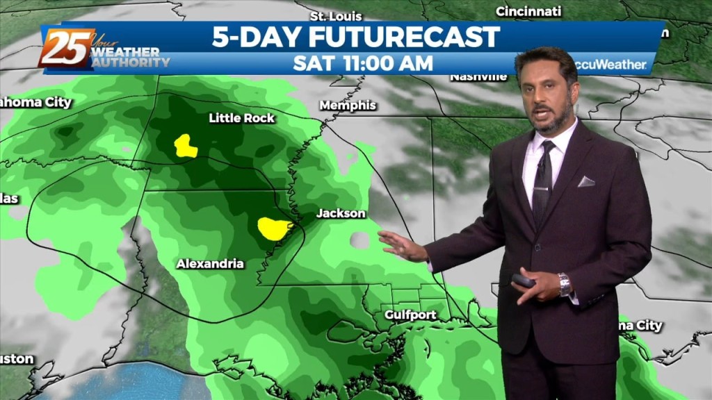
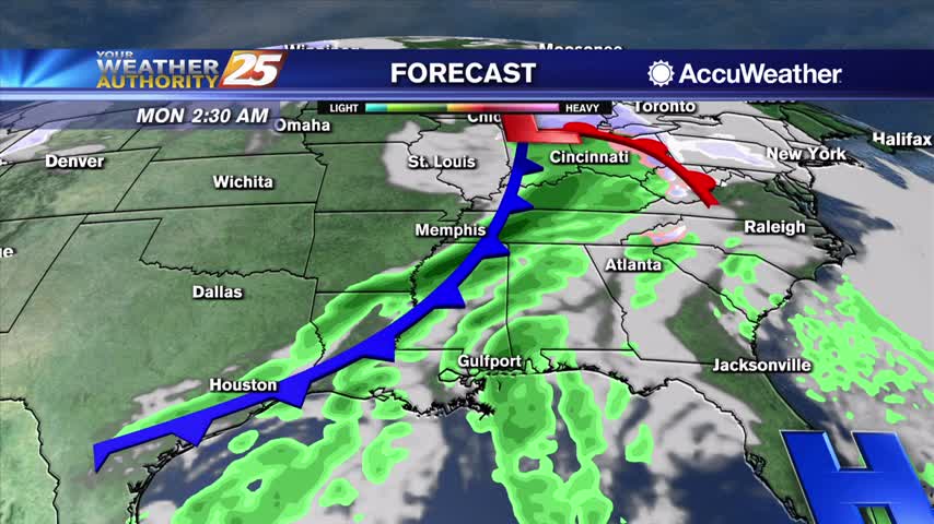
In general, zonal flow has taken hold aloft over the northern Gulf coast as an upper trough makes its way towards the east coast. This will persist until Friday morning when a brief period of weak ridging then moves over…
A very cold start this morning but the warm-up will begin later today...
A cloudy and cool start to the day as winds are starting to elevate...