10/27 Ryan's "Stormy" Friday Night Forecast
The front we've been expecting all week long is finally here, but the severe weather threat has diminished as the day wore on. Be sure to watch the full forecast for details.
The front we've been expecting all week long is finally here, but the severe weather threat has diminished as the day wore on. Be sure to watch the full forecast for details.
Doesn't seem like active, dangerous weather is just over 24 hours away, but a cold front is racing through the plains and brings a "marginal" risk to the area tomorrow night. Watch the forecast for details.
Beautiful weather for the second day in a row!
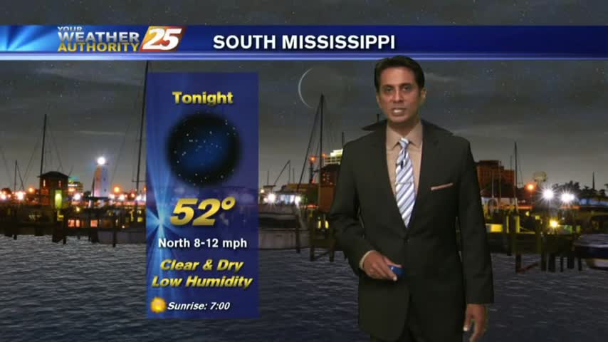
Tonight's low will fall into the lower 50s on the waterfront and upper 40s inland, but much cooler nights are ahead. Click the link for the full forecast.
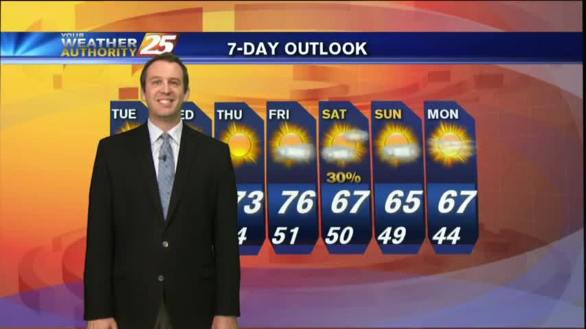
The weather improved rapidly after the front moved through yesterday, and we'll see even cooler and drier days ahead! Watch the full forecast for details.
Get ready for a very nice week with drier weather and cooler temperatures.
After severe weather today, beautiful is on the way.

Severe weather this morning..
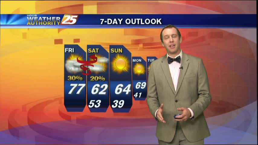
Our nice run of fall weather is already coming to an end as the temperature and humidity continue to increase ahead of a Sunday cold front. Watch the full forecast for details.
Today's weather warmed slightly but remained clear & sunny, a trend which will continue through the end of the week before rain moves in. Watch the forecast for details.
The beautiful weather continues for South Mississippi, and it's going to last a few more days.
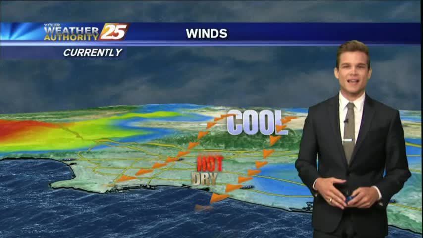
A cold front moved through just after midnight last night, and the cooler/drier air continues to pour in. Watch the full forecast for details.
The cold front has passed, and fall weather is finally here!
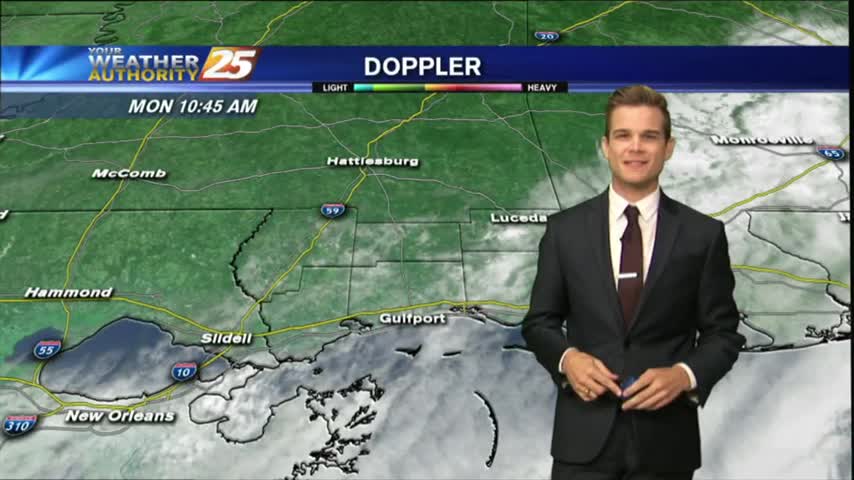
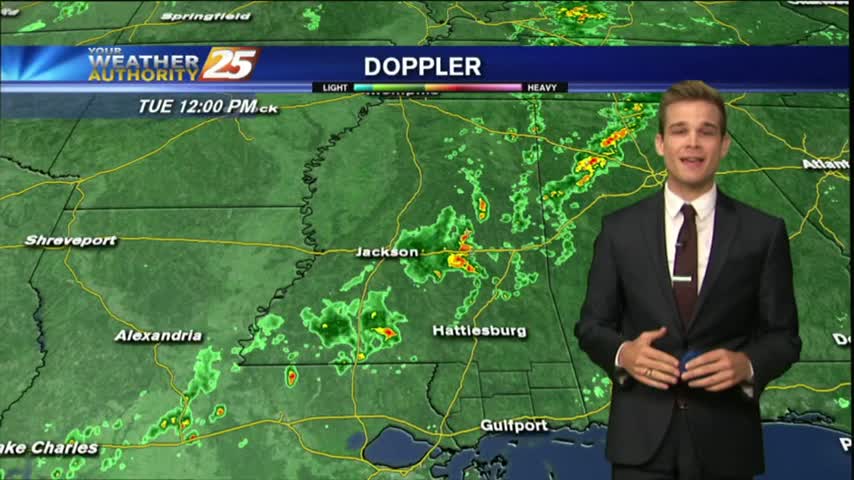
With a cold front clearing the area, this morning brings cloudy skies and isolated showers/t-storms moving east...
Fall weather is finally coming to South Mississippi!
We saw a few drier days but the humidity is beginning to build again ahead of a cold front, which will finally bring some fall-like weather by next week. Details within.
A nice night as dry air continues to move into the area, but rain returns soon..
The cold front has finally moved through bringing drier weather, but it's not going to stick around long.
After showers and thunderstorms this evening, most of the area has cleared.
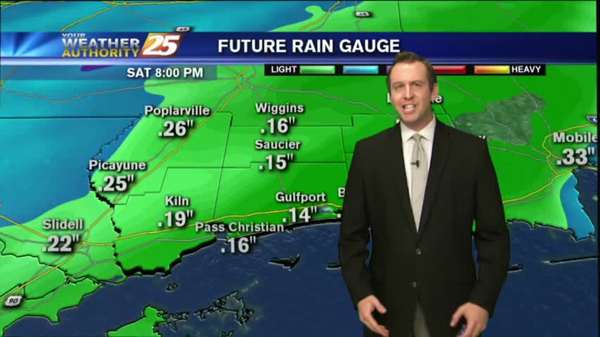
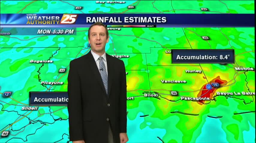
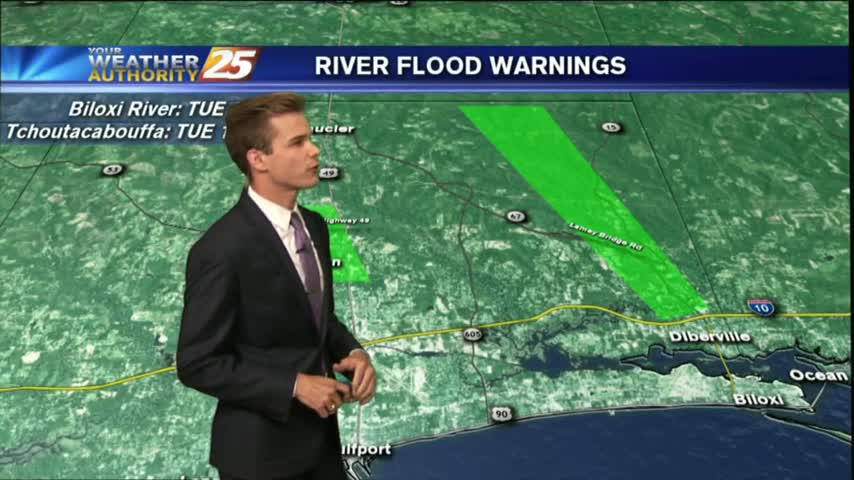
Flash Flood Warning for Harrison County until 7:30 pm, but the rain will start to dissipate into the evening.
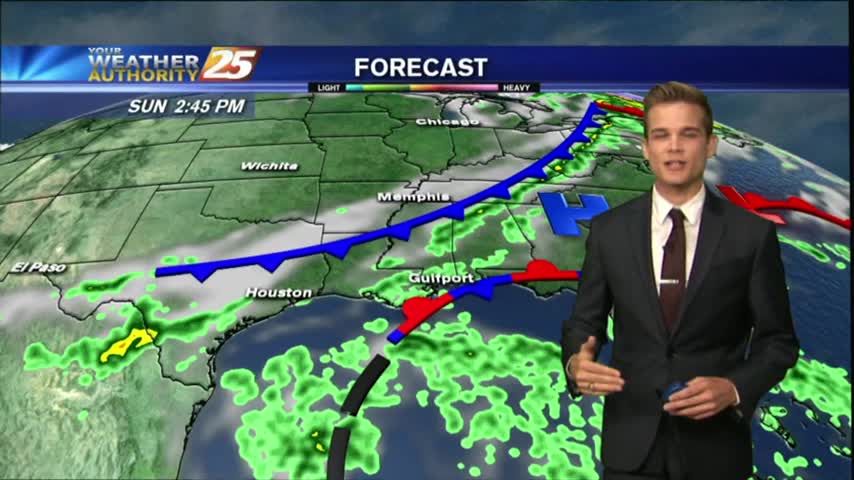
A very weak cold front is approaching the area from the west…currently located in Eastern Tx.
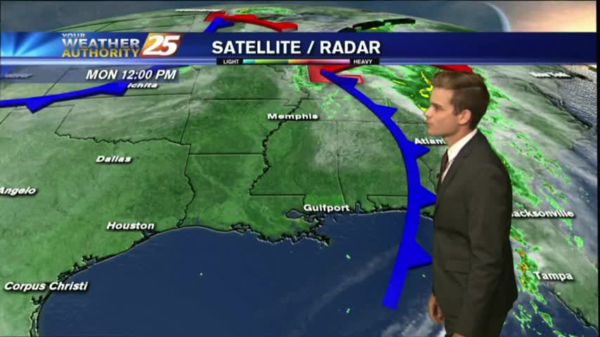
After a relatively quiet day behind Hurricane Nate yesterday and last night, but rain has returned today.
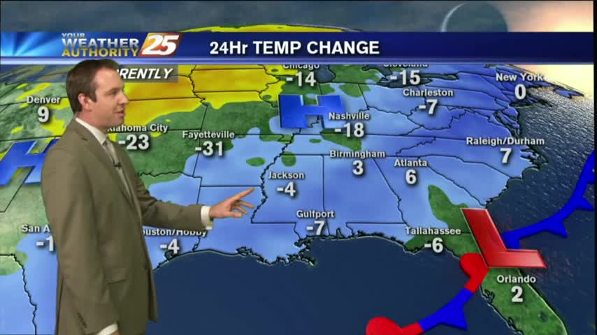
Cold front moved through earlier today, but the cooler air will take a bit longer to filter in. Watch the full forecast for details.
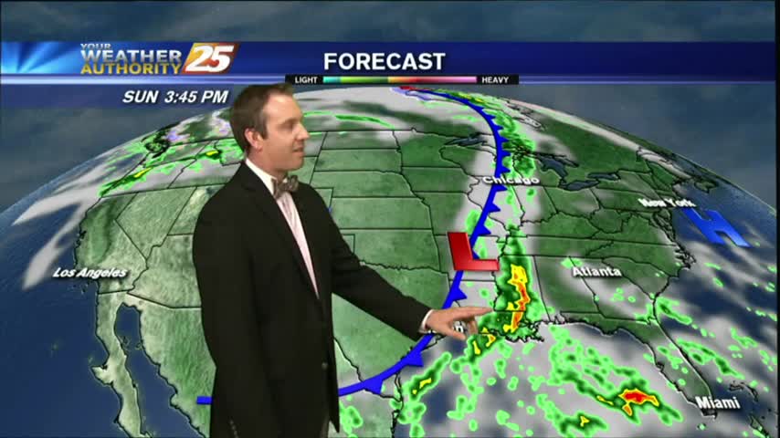
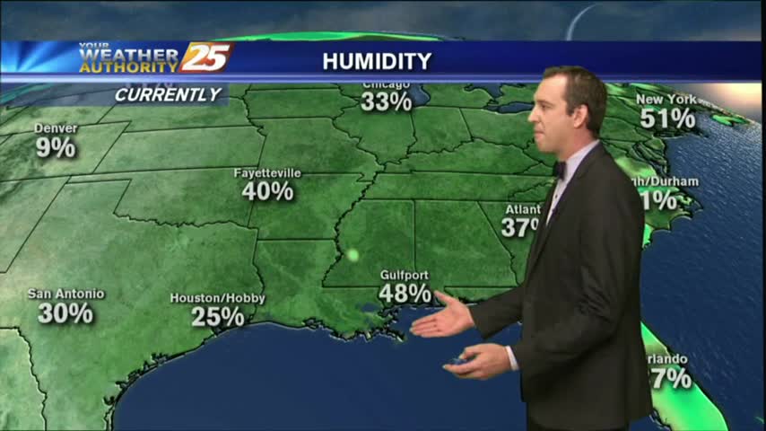
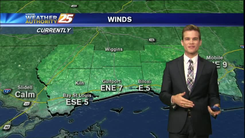
Temperatures remain warm, and the humidity is high tonight, but a cold front is expected tomorrow that will finally shake things up. Click the link for details.