6/10 - Chris's "Afternoon T-Storms" Monday Afternoon Forecast
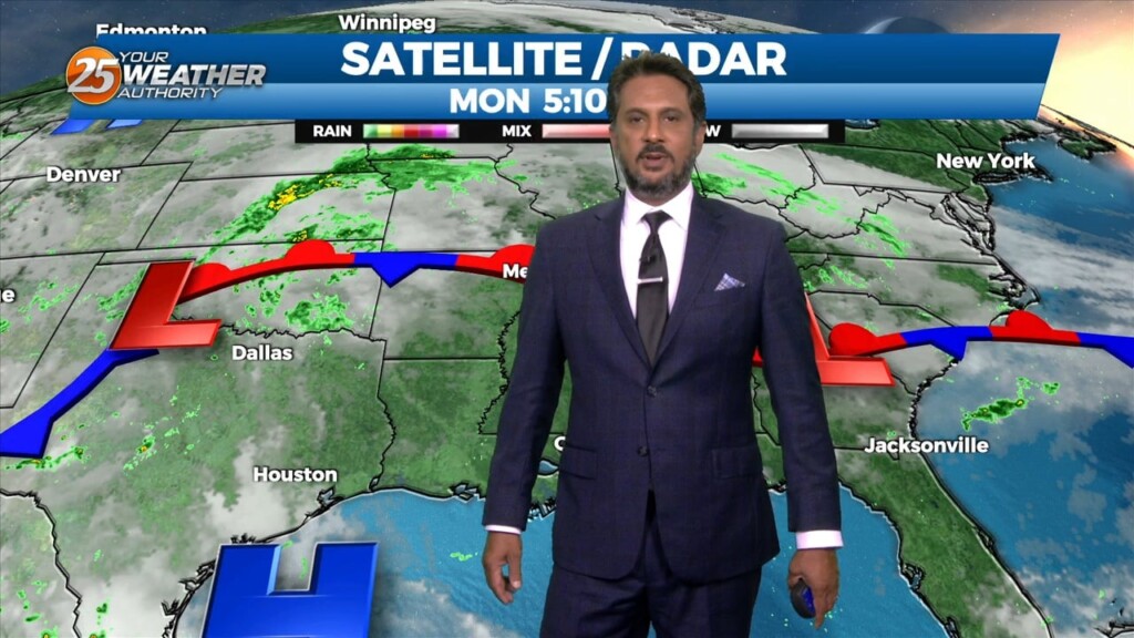
Currently there is a stationary front to the north of the I-20 corridor with showers and thunderstorms to the south of it. This afternoon will bring partly cloudy…
Currently there is a stationary front to the north of the I-20 corridor with showers and thunderstorms to the south of it. This afternoon will bring partly cloudy…
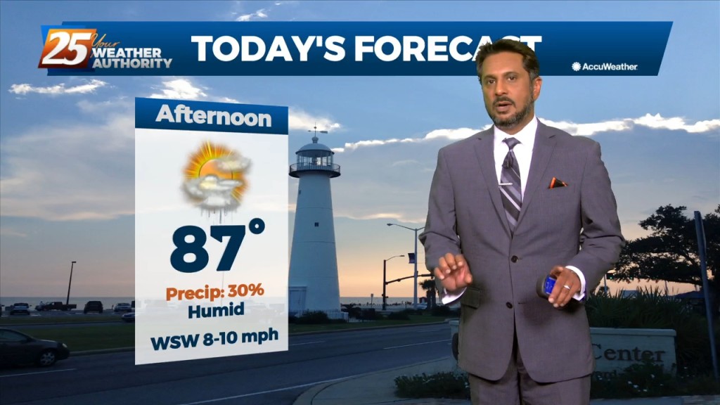
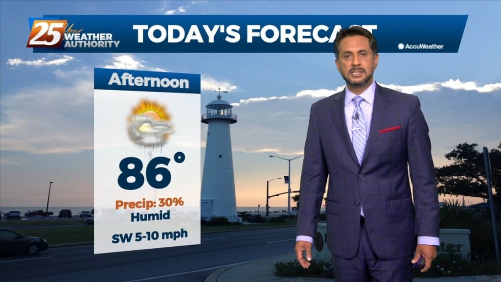
Another day of mid/late afternoon showers/t-storms, as high pressure to the south will continue to pump in the moisture. Temperatures may be a little higher than forecast...but…
Surface warming will once again commence bringing us to convective temperatures in the upper 80s by noon, however, more abundant high clouds may just keep us…
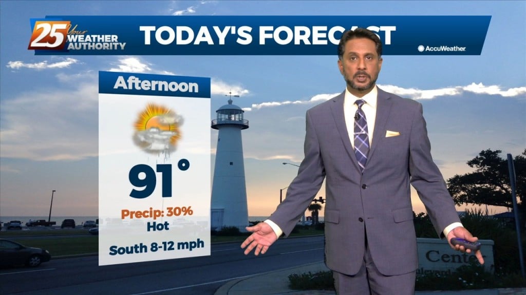
More of the same summer-like weather will persist today despite the mid-level high pressure gradually waning. Convective temperatures in the upper 80s to low 90s will be…
An upper-level high pressure that has been parked over the area should break down throughout the course of today. Although the ridge should be breaking…
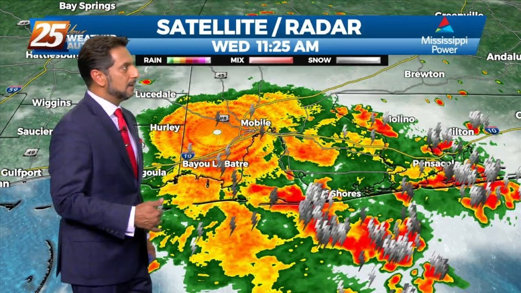
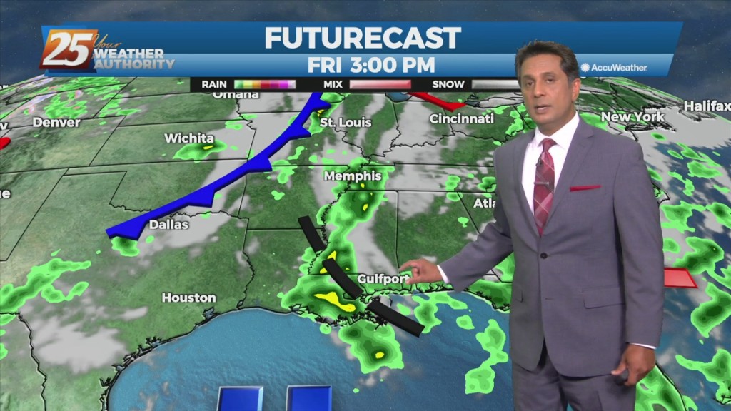
A trough of low pressure along the NW'tern Gulf of Mexico will slowly push SE as an upper low pressure system and training cold front moves through…
The focus this afternoon and evening will be on convective development to our north and east, moving into south Mississippi. A zone of low-level convergence oriented NW…
Today through Friday, the current pattern continues with the upper level high pressure and daily showers and thunderstorms in the afternoon. Very moist air along with erratic…
The area will continue to be dominated by the mid-level high pressure with the more difficult part of the forecast today is coverage of storms. High pressure…
Today through Sunday a broad upper level high pressure will be centered near the 4-corners region extends from Mexico to Canada and CA to around MS.…
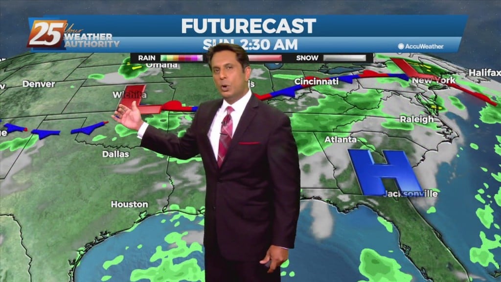
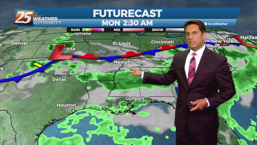
High pressure will continue to shape the forecast into the weekend. As an upper level disturbance digs through the Great Lakes and Ohio River Valley, it will…
At the surface, a nearly stationary frontal boundary remains just to the northwest of our area. To the north of that boundary, high pressure extended from New…
At the surface, weak high pressure extended from Pennsylvania southwestward to the north central Gulf south of Louisiana, with an upper low-pressure to our east.…
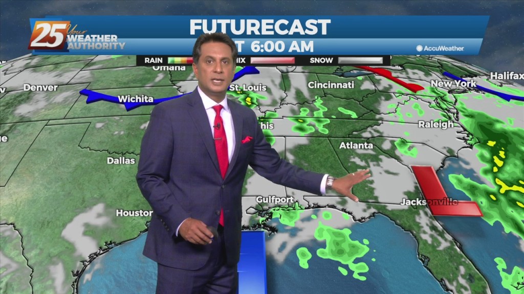
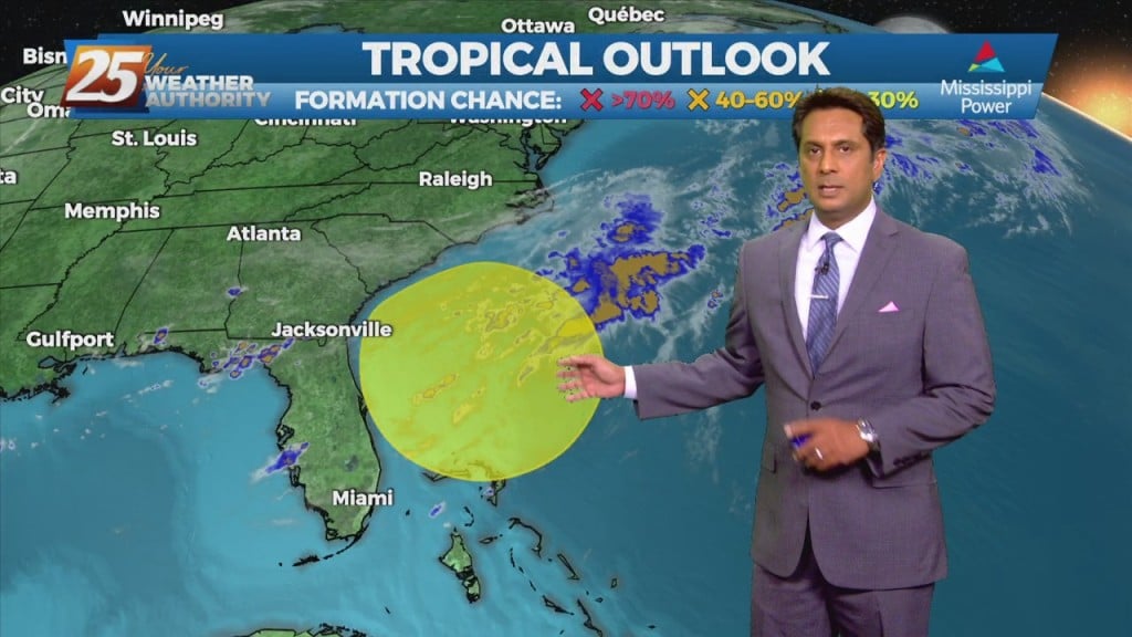
An upper level low-pressure system currently centered in the western Atlantic will move west into FL/GA today. At the same time, an upper level disturbance to the…
A few afternoon showers/t-storms will be possible including this evening as a cold front moves through the area. If the lift can be realized and overcome the dry…
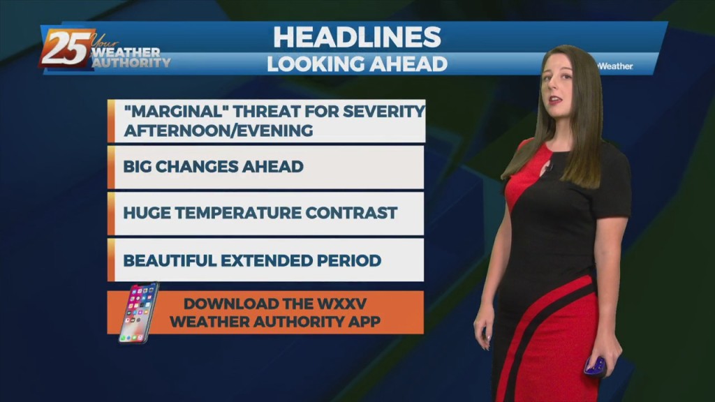
Unseasonably warm weather will continue for the remainder of the workweek. There will be several rounds of potential showers and thunderstorms, with a non-zero threat of…
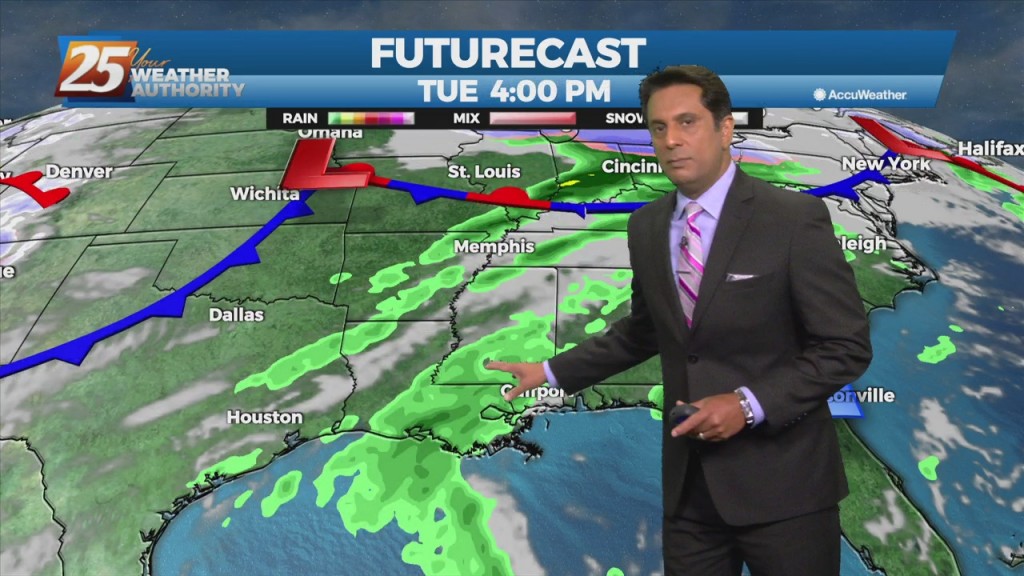
A cold front will continue to push south through the area providing dry air moving into the area. Despite the passing of the front, there will not be any noticeable cool off with highs staying in the upper 80s to…
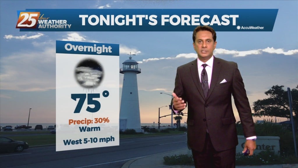
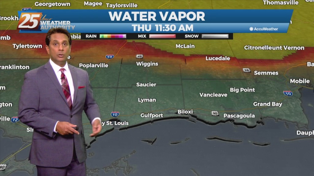
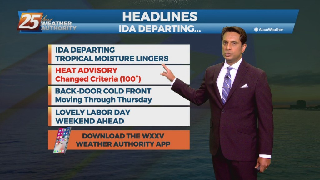
A surface low associated with Tropical Depression Ida will continue to move NE, dragging a weak cold front into south Mississippi Thursday morning. Northwesterly flow aloft will develop across the area today between the upper level High pressure over Texas…
The Gulf sea breeze will keep thunderstorm chances going into the afternoon for areas along and south of I-10. Meanwhile, slightly drier air will attempt to work into southeastern LA which should scatter out some cloud cover areas north of…
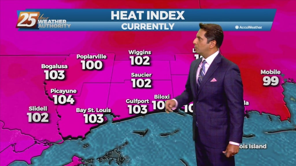
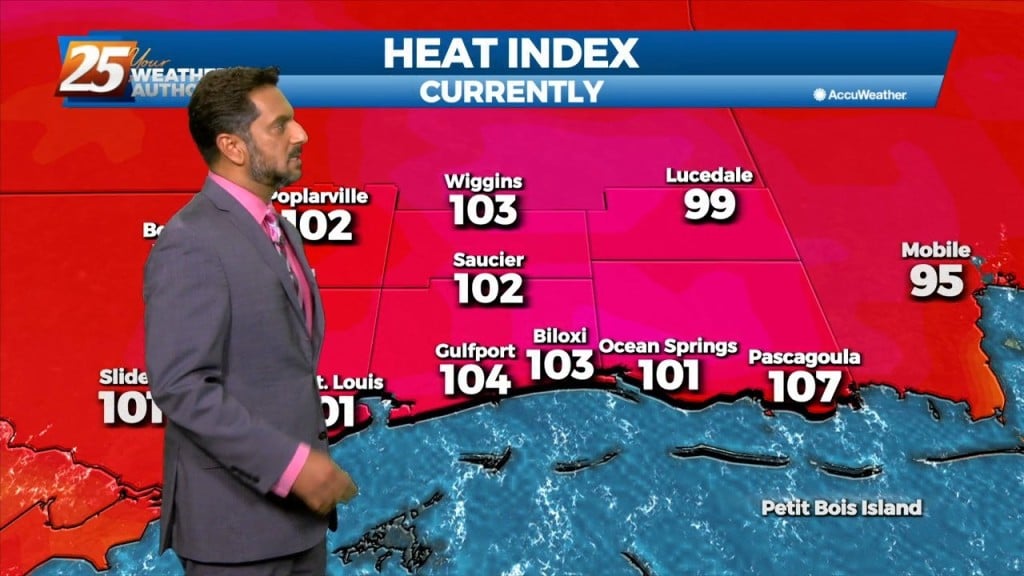
Isolated-Scattered showers and t-storms will be possible each day over the next couple of days, primarily during the peak daytime afternoon heating hours. Locally heavy rainfall will be possible inside thunderstorm development, based on the model consensus and parameters. Heat…
More of the same hot, muggy weather is expected to continue for the next couple of days. Afternoon and early evening showers will be possible over the next few days, with a slight elevation in precip chances into the weekend.…
A stalled frontal boundary from the Carolinas to southeast Texas will slowly shift north and wash out by Thursday afternoon. High-pressure over the mid-section of the country will build slowly eastward by Thursday bringing lower rain chances and a return…
This afternoon-Sunday, convection will initiate along the seabreeze/landbreeze boundary each day with thunderstorms initially forming along the weak landbreeze boundary in the offshore waters and then gradually moving inland through the day as a seabreeze boundary forms and intensifies. The…
A very normal Summer pattern is expected through Saturday night. Temperatures will be near average with highs in the upper 80s and lower 90s and lows in the 70s. Moisture values will be near normal and the convective pattern will be…