7/17 - Brittany's "Typical Summer Pattern" Sunday Evening Forecast
Going into the new workweek, not many changes to note. The region will still be within the H5 weakness between the subtropical/Bermuda high to the east and…
Going into the new workweek, not many changes to note. The region will still be within the H5 weakness between the subtropical/Bermuda high to the east and…
Enjoy the last summer night we'll see until next year as a cold front brings cooler, drier weather for the rest of the week. These changes will be…
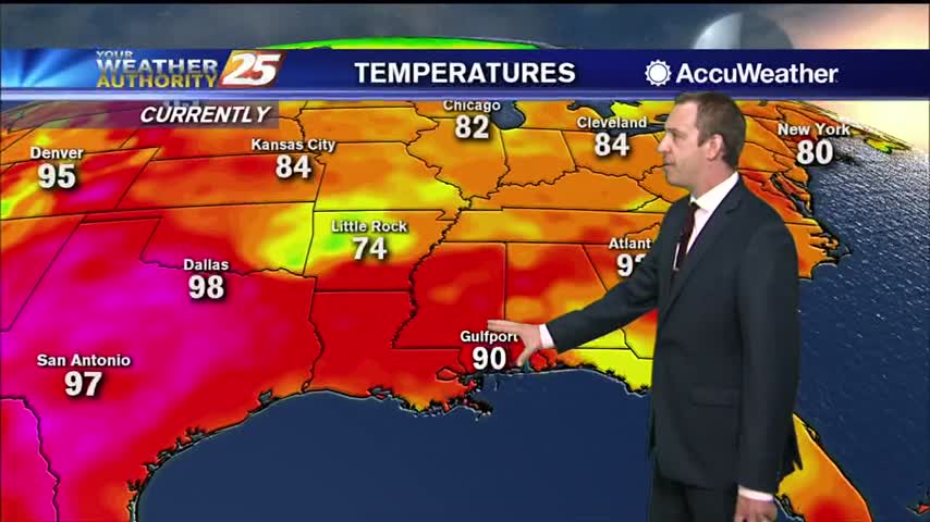
Not much in the way of changes expected over the next few days with high pressure over the Gulf of Mexico. Daily high temperatures generally in the 90 to 95 range and afternoon dew-points in the lower and mid 70s…
We still saw a few afternoon thunderstorms, but drier mid-level air kept them from lingering for long. That's a trend I expect to continue for the next few afternoons, limiting evening activity and cloud cover. That means you can expect…
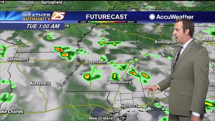
Starting to see more noticeable changes as clouds and more moisture move in, but even light rain still not expected until tomorrow afternoon.

Today was sunny and dry, but more and more clouds will arrive as we head through the weekend.

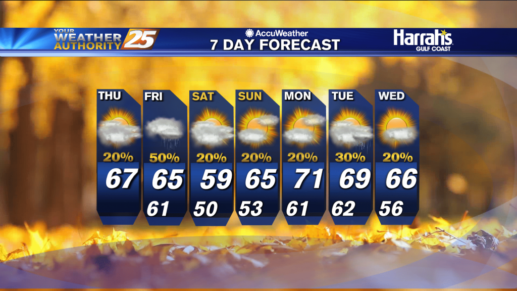
Finally a little cooler and drier, but it is over before it starts as the next few days get quite wet.
It was a few degrees cooler today, but more rain as we head into the weekend will bring highs down even further....
Showers and storms are currently ongoing over east and southeast Mississippi. The rest of tonight will then be quiet weather-wise. Monday looks to be mostly sunny with high temperatures topping out in the mid 90s once again. A few showers…

More evening showers tonight with more on the way over the weekend, but it is making things nice and cool.
Saw more showers and thunderstorms this afternoon, which made things much cooler heading into the night.

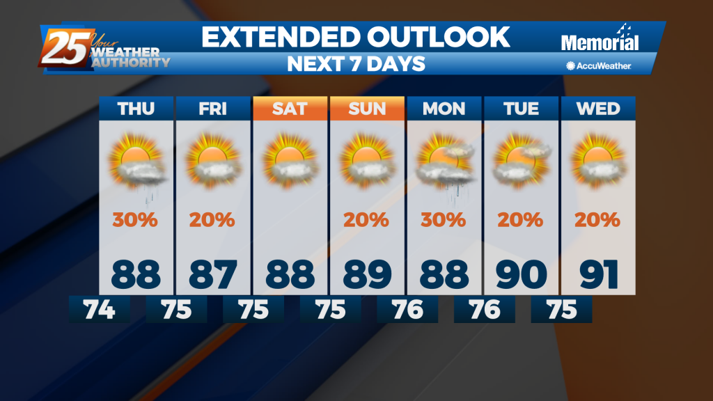
Not cooling far into the 70s each night for the rest of the week, and our afternoons will be just as hot and humid as the last few have been.
Another excessively hot and humid afternoon is in the books, with only a few afternoon showers coming to cool us down....
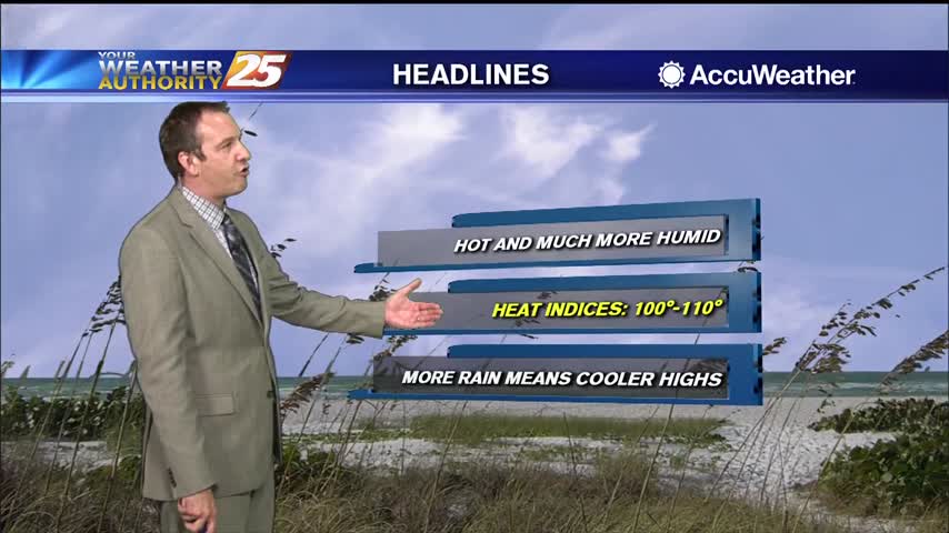
Hot and dry last week, but this week will be much more humid as deep moisture moves in....
The high humidity has returned after a little bit of a break last week, so expect to be getting right back to some uncomfortably hot and humid weather.
Hot and humid again today as our weekend drier trend continues, but that will come to an end later this week.
Still hot and humid, but much drier today...something I expect to see carry through the weekend.
Another active afternoon in the books, but we're in for another quiet night before doing it again tomorrow.
No real surprises in the days ahead, but today's waterspout in Hancock county reminds us to be "weather aware."
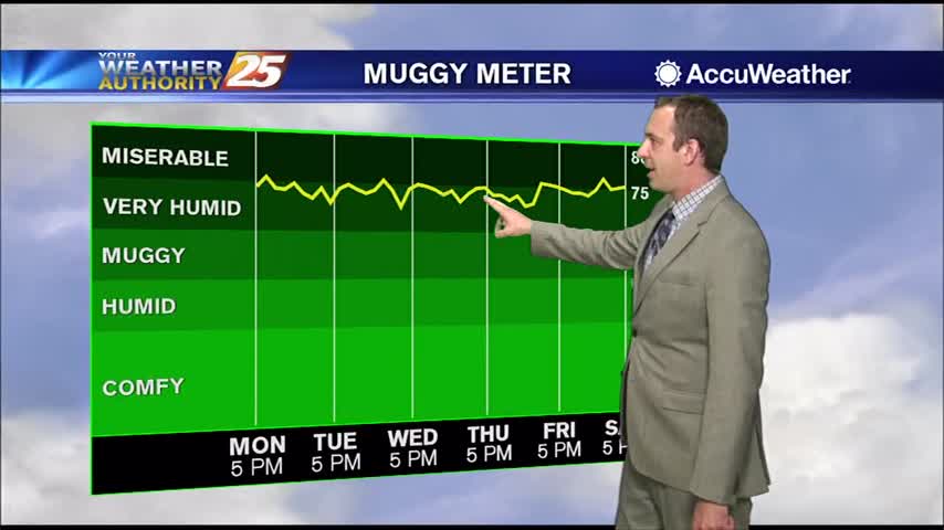
Very similar weather is moving in, so prepare for more hot and humid days and muggy nights.
Things will cool down slightly in the days ahead due to more afternoon rain, but otherwise not much else changes.
Hot and humid start to the week after a miserably hot and humid weekend, but some slight relief is moving in.

We've been stuck in a familiar pattern all week long: showers and thunderstorms pop up in the heat of the day and slowly clear through the night, but drier changes lie ahead.
More muggy, rainy weather ahead, but at least the rain will be drying up soon. Not that lucky on the humidity....