1/10 - Rob's "Warm & Humid" Tuesday "Midday News" Forecast
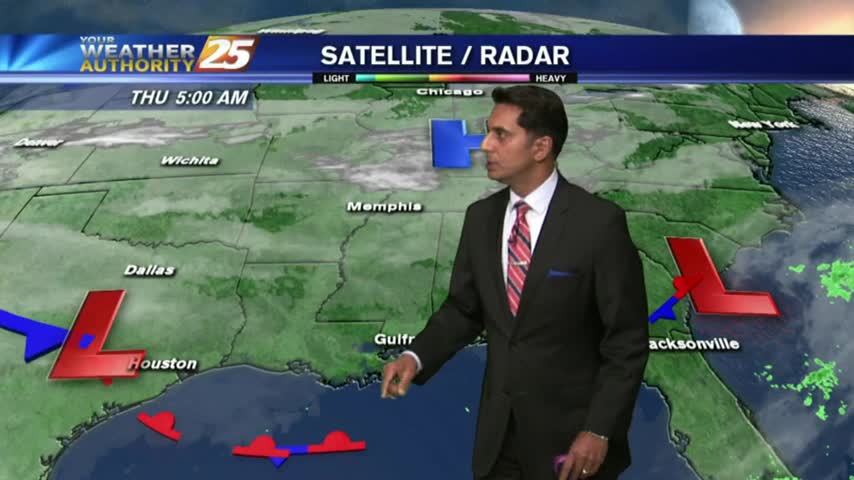
After a good bit of sunshine this morning...the clouds have rolled back in as temps warm to around 70 degrees...
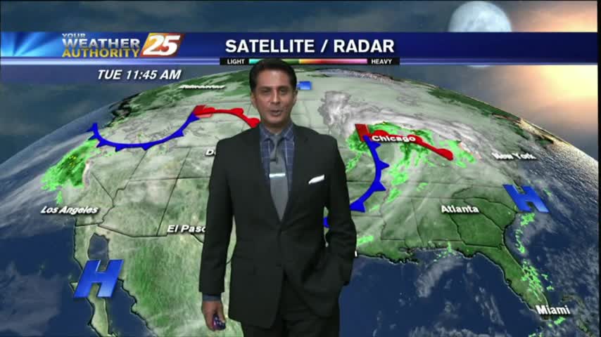
After a good bit of sunshine this morning...the clouds have rolled back in as temps warm to around 70 degrees...
Very slight rain chances are back in the Seven-Day Forecast.
After a FRIGID weekend, it's a VERY COLD start on this Monday morning...with major changes ahead.
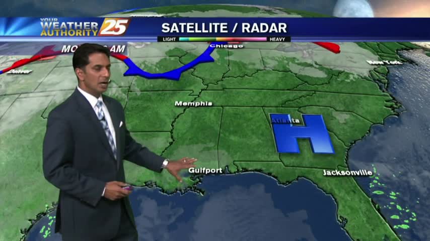
Much warmer weather is on-tap for the Coast this week!
The rain has moved East but the most dangerous road conditions are still ahead. Forecast details inside.

News 25's Hank Davis speaks with emergency officials on what to be cautious of during the winter storm passing through Mississippi. Rupert Lacy with the Harrison County Emergency Management Agency is closely monitoring the winter storm that's passing through our…
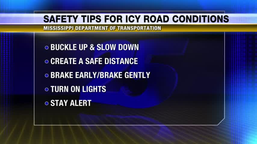
With ice expected to cover a significant amount of roadways throughout Mississippi, News 25's Kendra Turley provides tips on how to stay safe during your weekend commute.
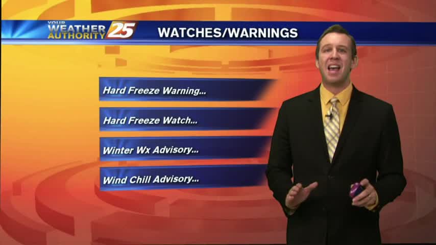
We're still not expecting any significant frozen precipitation in the coastal counties, but a hard freeze will cause icy roads overnight. Click for forecast details.
After light rain early this morning...moderate rainfall will continue with a SLIGHT change for a WINTER MIX late tonight along the coastal counties...
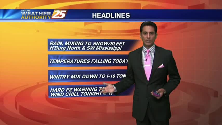
Rain moved in overnight and will become WIDESPREAD through today with it mixing to SNOW/SLEET north of the coast.
Winter weather chances march further and further South, so check out the forecast for the latest.
There's been a lot of talk about the possibility of winter weather in South MS, here's a forecast update with the latest.
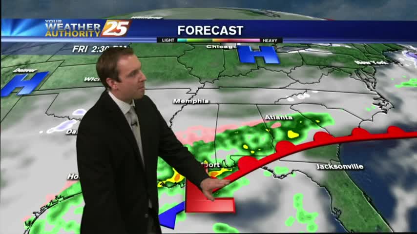
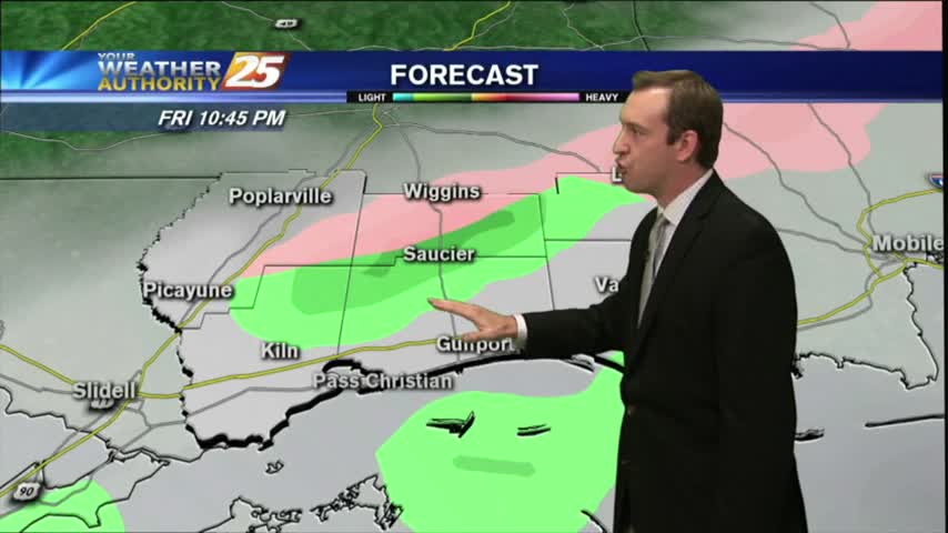
Light rain will start late this afternoon and continue through about midnight Friday night. There's a small chance of snow flurries across southern Mississippi before sunrise on Saturday.
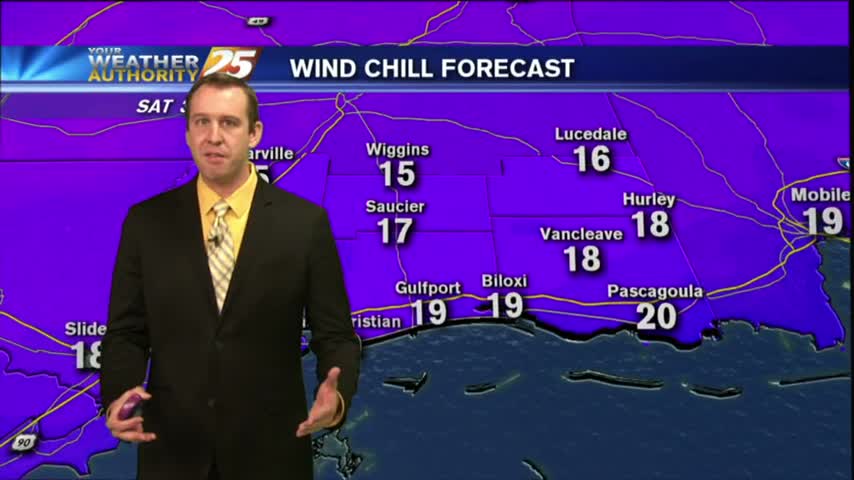
A CHILLY start as a north wind continues to filter cold/drier air into the Gulf coast...
Another rain free and slightly cooler day, but drastically cooler temperatures are only a few days away. Details inside.
While cooler weather resides over southern Mississippi today, much colder weather is coming this weekend, along with the possibility of early-morning snow flurries on Saturday before dawn.

Dense fog has dissipated overnight in the wake of a cold front and colder air moving into the area...

Last weekend's deluge finally ended yesterday, but we'll feel the effects for a few days more. Details within.
Severe weather is gone from the southern states and cooler weather is on the way. In fact, surely winter-like temperatures will be back in force this weekend.

The cold front has cleared the area but not much has changed outside of the rain departing...
Stormy weather this afternoon, but we were spared anything severe this far South. Things dry out a bit this week, but you'll have to watch the forecast for more.

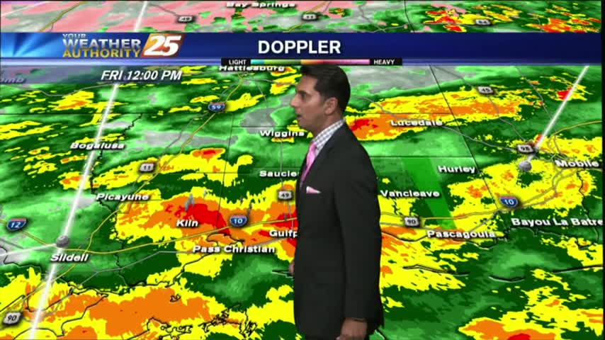
The gray/gloomy continues with rain and t-storms already in the area...and a SEVERE THREAT for this afternoon.
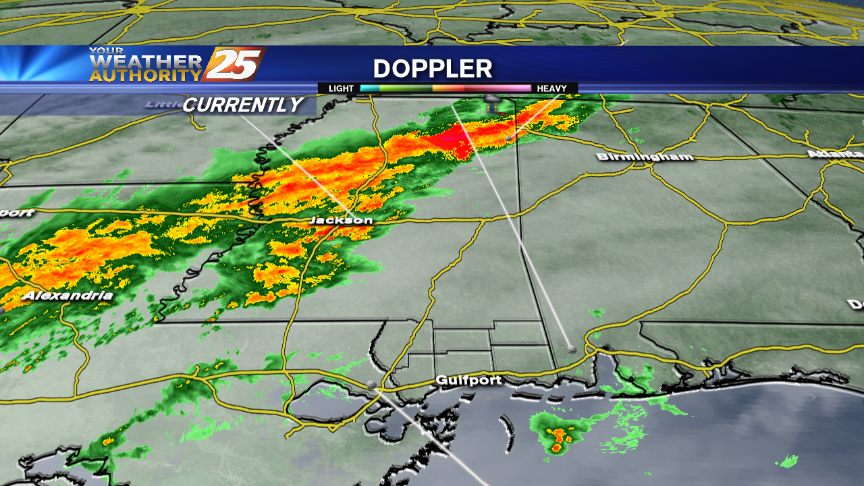
Rain and thunderstorms will affect the area through Monday, when some storms could be severe. With all the rain, there are river flooding issues and that will continue over the coming days.

It was clear and cool today, but cloudy and warm conditions will begin building immediately. Forecast details within.