01/05 Ryan's "Winter Weather?" Thursday Night Forecast
There's been a lot of talk about the possibility of winter weather in South MS, here's a forecast update with the latest.
There's been a lot of talk about the possibility of winter weather in South MS, here's a forecast update with the latest.
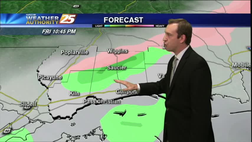
Light rain will start late this afternoon and continue through about midnight Friday night. There's a small chance of snow flurries across southern Mississippi before sunrise on Saturday.
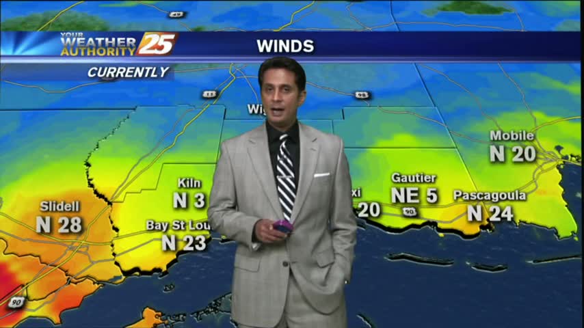
A CHILLY start as a north wind continues to filter cold/drier air into the Gulf coast...
Another rain free and slightly cooler day, but drastically cooler temperatures are only a few days away. Details inside.
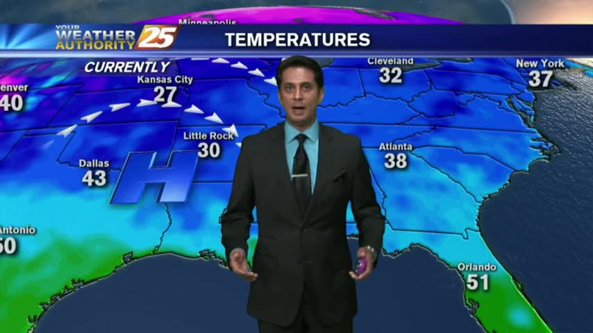
While cooler weather resides over southern Mississippi today, much colder weather is coming this weekend, along with the possibility of early-morning snow flurries on Saturday before dawn.
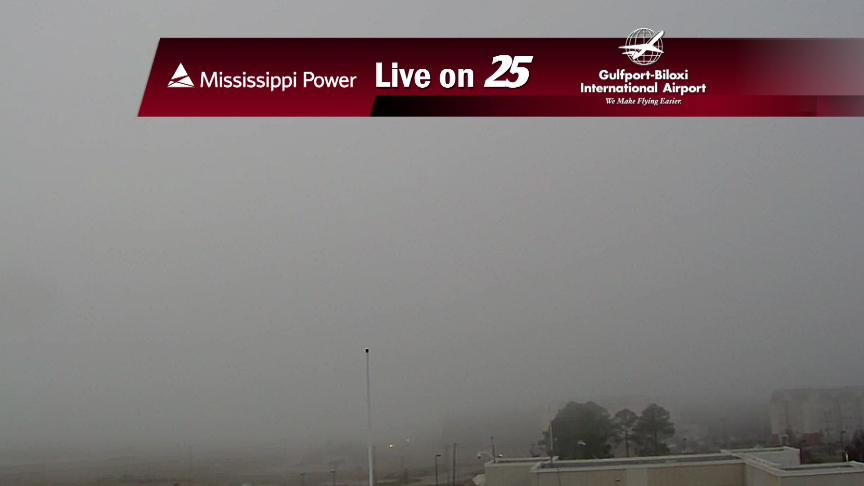
Dense fog has dissipated overnight in the wake of a cold front and colder air moving into the area...
Last weekend's deluge finally ended yesterday, but we'll feel the effects for a few days more. Details within.
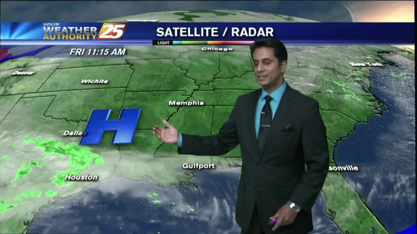
Severe weather is gone from the southern states and cooler weather is on the way. In fact, surely winter-like temperatures will be back in force this weekend.

The cold front has cleared the area but not much has changed outside of the rain departing...
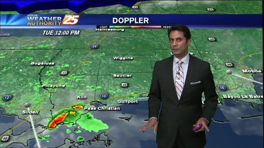
Stormy weather this afternoon, but we were spared anything severe this far South. Things dry out a bit this week, but you'll have to watch the forecast for more.

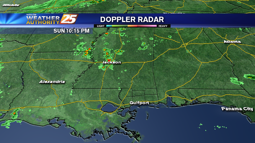
The gray/gloomy continues with rain and t-storms already in the area...and a SEVERE THREAT for this afternoon.
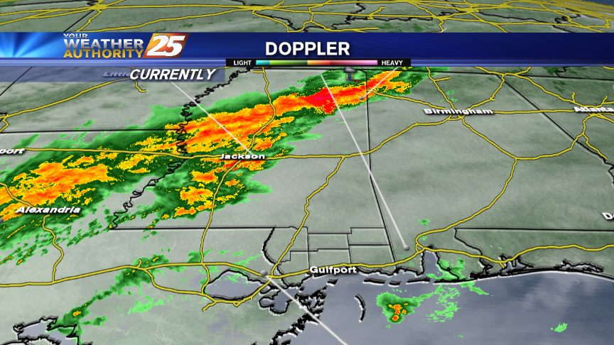
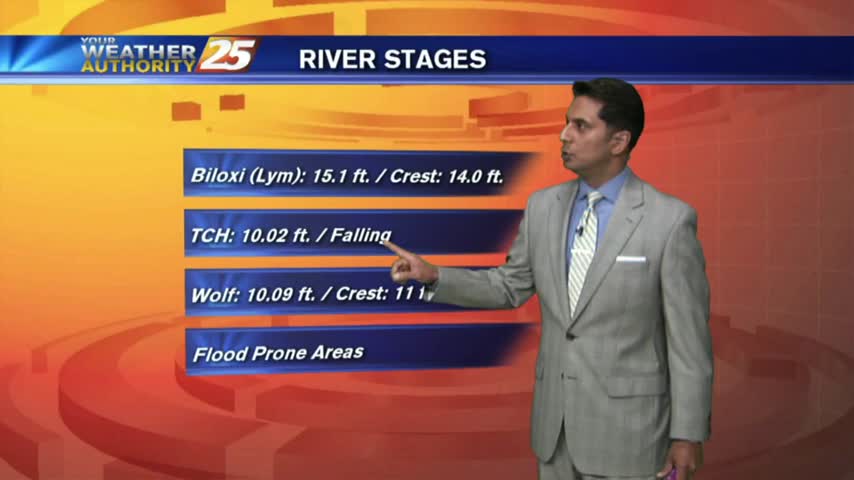
Rain and thunderstorms will affect the area through Monday, when some storms could be severe. With all the rain, there are river flooding issues and that will continue over the coming days.
It was clear and cool today, but cloudy and warm conditions will begin building immediately. Forecast details within.
After a CHILLY start to the day, temps have warmed into the 50s with continued warming into and through the New Years celebration...
The humid air and foggy conditions are out of the area temporarily, with COLD and CLEAR start to the final Friday of the year...
Chilly and (actually) seasonable weather on-tap for the Coast tonight. Rain is back in abundance on the holiday weekend.
After a few showers associated with frontal passage earlier this morning...clearing skies have begun with VERY WINDY CONDITIONS.

An approaching cold front in C-Mississippi will bring showers and t-storms to the area this morning...
Rain and thunderstorms are possible tonight through early Wednesday. We also talk about a very wet holiday weekend coming up.
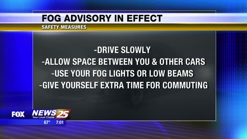
A fog advisory is issued whenever visibility are lowered to one fourth of a mile or less. Now this fog will begin to slowly lift after noon, but still be in the area. In the meantime, there are some safety…
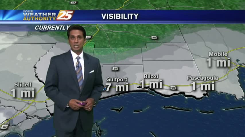
As the southerly flow continues in advance of an approaching cold front...DENSE FOG is in the area with an ADVISORY through this afternoon.
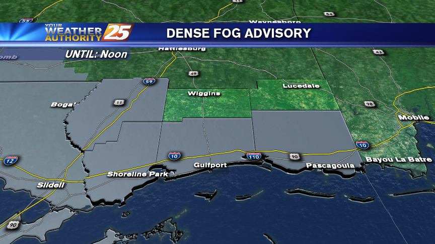
There is a Dense Fog Advisory for all Coastal counties tonight, lasting through Noon Wednesday. There are also a few thunderstorms rumbling in the area tonight.
There's a Dense Fog Advisory tonight for the Mississippi Gulf Coast. There's also a LOT of rain in the forecast for the upcoming weekend.
After DENSE MORNING FOG...light fog remains with warm and humid continues and a few showers this afternoon...