4/5 - Rob's "Frontal Passage" Improving Afternoon Forecast
After early morning showers/t-storms with a slight threat for SEVERE...the brunt of the activity has moved to our east.
After early morning showers/t-storms with a slight threat for SEVERE...the brunt of the activity has moved to our east.
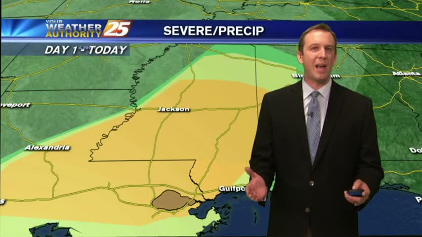
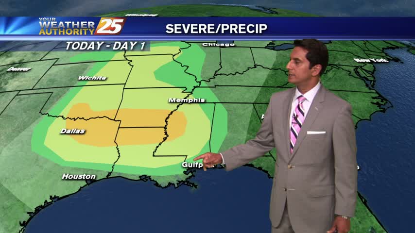
Showers & t-storms moving into and developing along the Southern 6 with a TORNADO WATCH in effect...
Tonight's storms will be the last we'll see for several days, but their "slight" risk of severe weather is worrying. Watch the forecast for storm details and the upcoming week's forecast.
PATCHY DENSE FOG around sunrise has burned off leaving beautiful blue skies through this afternoon...

Residual moisture from yesterday has areas of PATCHY DENSE FOG, then sunny and warm conditions through today...

After last night's cloudy/windy conditions and this morning's storms, it seems unlikely that tonight would be as calm and cool as it is. Pleasant weather doesn't last long though. Details inside.
This morning's storms roared through early, bringing sunny and clear weather for the afternoon. These pleasant changes don't last long though, so be sure to watch the full forecast for details.

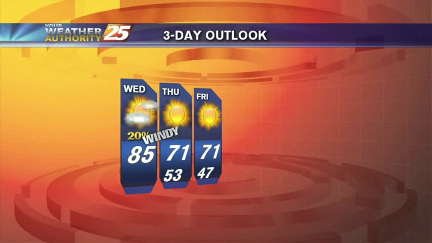
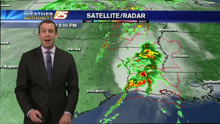
After a BUMPY start with NUMEROUS showers/t-storms earlier this morning, conditions are improving...
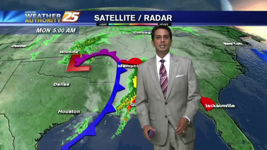
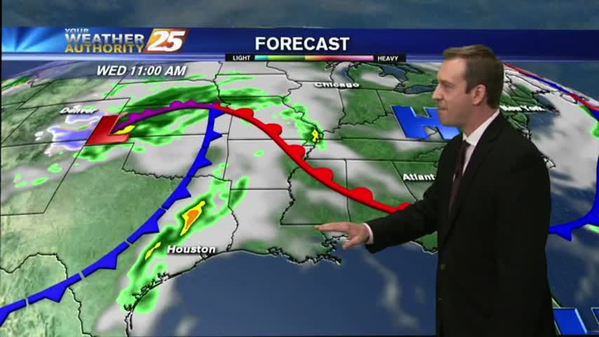
A BUMPY start on this Monday morning as weather with associated with a vigorous cold front approaches from the west...
The clouds moved in early today and winds have been increasing throughout. Severe storms expected to inch into the area overnight, so be ready for a rough Monday morning. Click the forecast link for more information.
Today was as beautiful as advertised, and tomorrow is on pace to be even better. Great weather doesn't last forever though, so watch the full forecast for all the details.

After bumpy weather yesterday, the final Friday of March is starting out much better...
Severe storms moved in around noon today, but began clearing out rather early. Expect a clear night becoming a sunny and gorgeous afternoon; click the forecast link for details.

News 25’s Shelby Myers brings us an update on the weather.

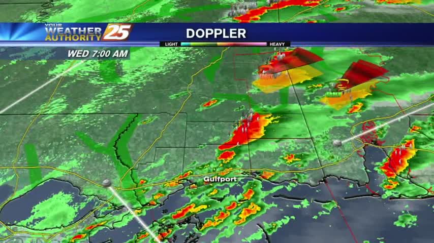
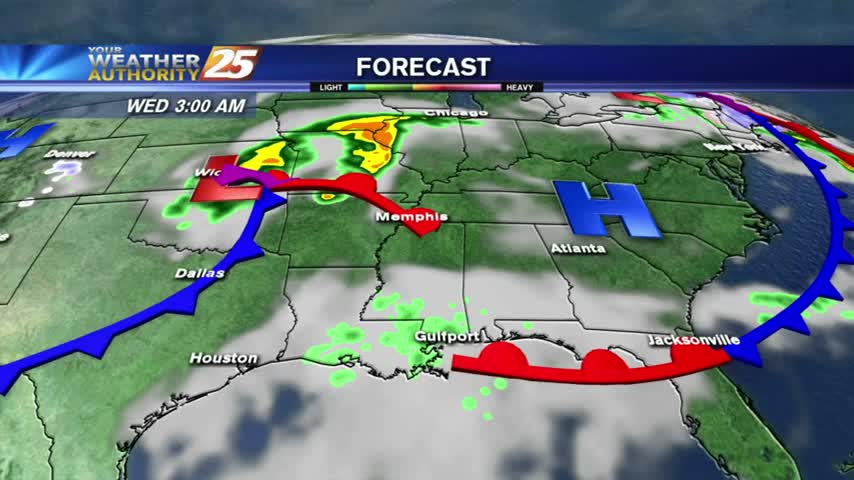
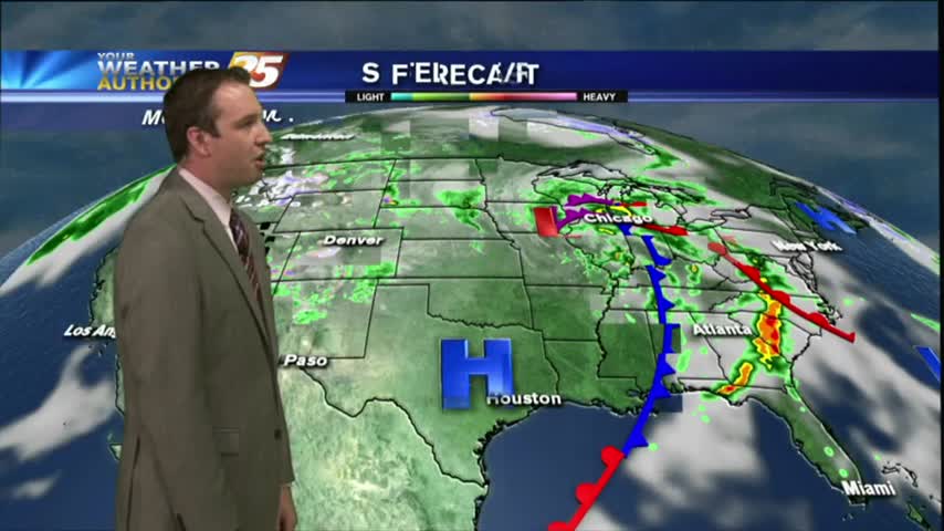
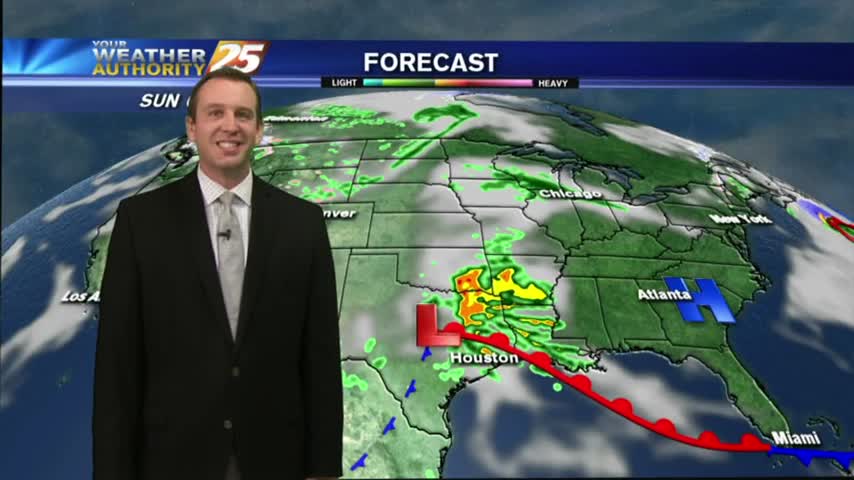
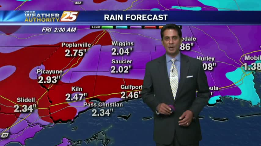
SEVERE WEATHER continues to move across the Southern 6...
With a VERY UNSTABLE airmass moving into the region, a stationary front to the south coupled with an approaching cold front from the west will make for VOLATILE conditions. The Storm Prediction Center (SPC) has the entire area in a…

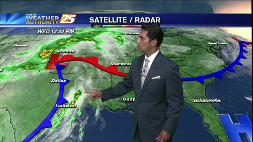
Showers/T-Storms moving in from the west with an associated cold front...SLIGHT THREAT for SEVERE STORMS...
Clouds are increasing ahead of Thursday's storm system, and while it seems to be weakening, South Mississippi remains under a "slight" threat of severe weather. Watch the forecast for more.
With a batch of low-level moisture from earlier this morning now to the east, skies have thinned to partly cloudy...

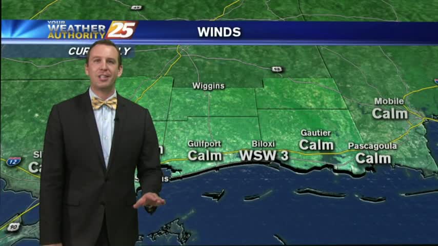
As a WARM/HUMID flow continues from the Gulf of Mexico, areas of patchy dense fog has along the southern 6.

Another dry day in the books with another on tap for tomorrow. Rain is moving in soon though, with storms that could be severe. Watch the full forecast for details.

After a few very light showers earlier this morning, drier conditions are moving into the area...
A warm and humid start with a cold front in central Mississippi and a few light showers along the Southern 6...
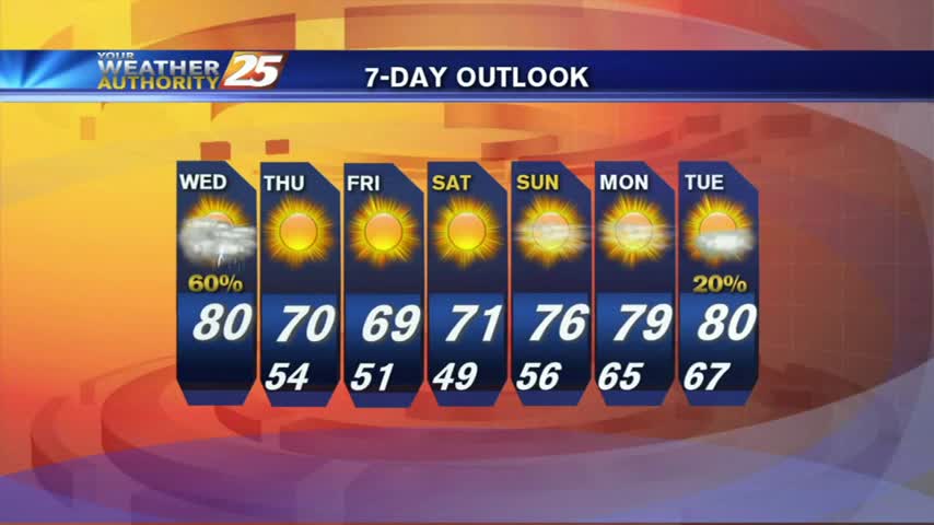
Mostly cloudy skies and a few showers came and went today, but the next few days will be drier and a little clearer. Watch the full forecast for details.