09/20 Ryan's "Summer Hump Day" Wednesday Forecast
The local weather has returned to our normal "Summertime" pattern, but there's only about a day and a half of Summer left! Don't expect any sudden changes, but cooler days are ahead. Details inside.
The local weather has returned to our normal "Summertime" pattern, but there's only about a day and a half of Summer left! Don't expect any sudden changes, but cooler days are ahead. Details inside.
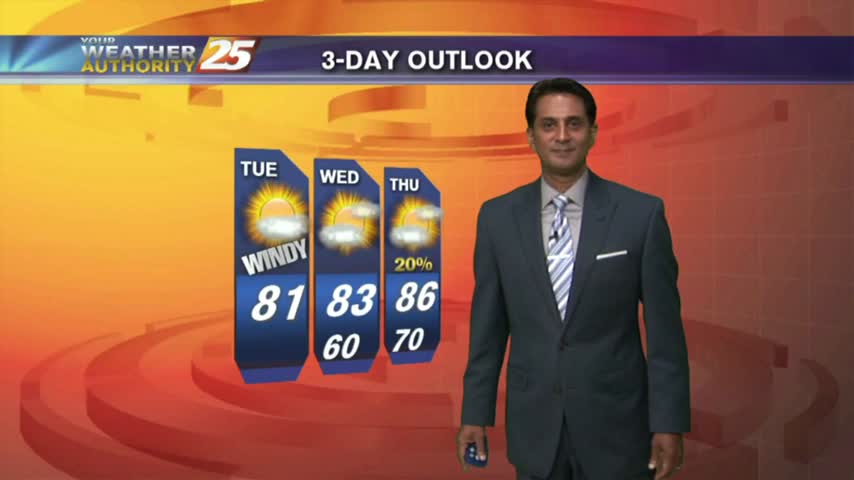
We're still expecting more predictable "summertime" weather for the rest of the week, but Fall officially begins on Friday so changes are on the way. Details within.
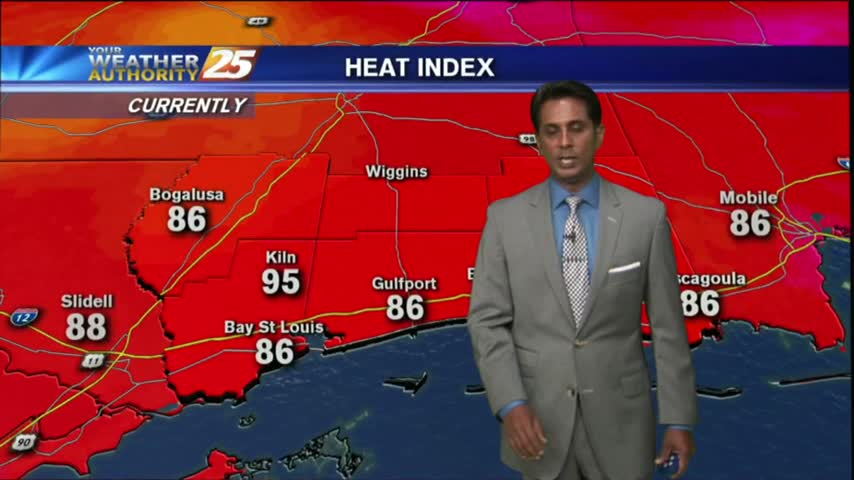
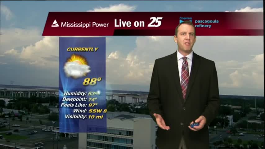
It's a HOT late summer afternoon as temperatures area climbing into the upper 80s...BUT, the HEAT INDEX is much higher...
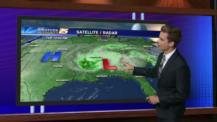
As high-pressure dominates east of the continental divide, its'a warm/humid start with isolated showers/t-storms to start off the day...
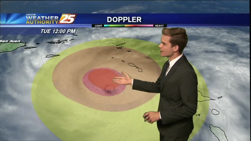
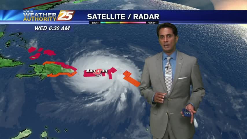
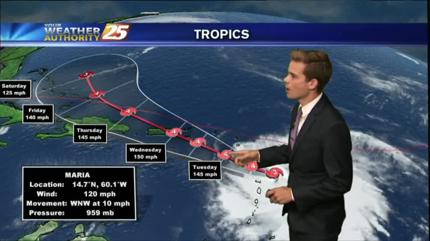
HURRICANE MARIA: CATEGORY 5 (MAJOR HURRICANE) EXPECTED TO MAKE LANDFALL IN PUERTO RICO WEDNESDAY MORNING...
Another WARM/HUMID start to the day with areas of patchy fog and isolated rain moving in from the Gulf/Sound...
Hurricane Maria dominates the Atlantic weather headlines, while local weather remains consistently hot & humid. Watch the full forecast for details.
It's now officially the home stretch for Summer, as Fall arrives just in time for the weekend. Don't expect any drastic changes right away though; forecast details within.
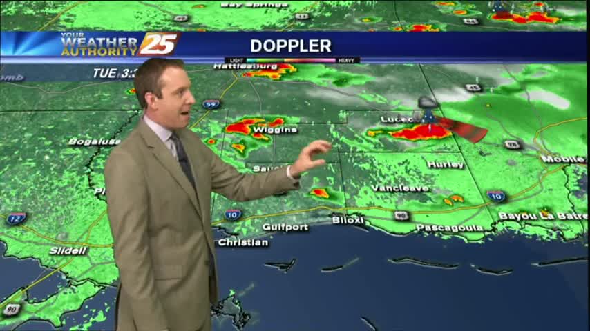
We continue to see a few showers and thunderstorms popping across the area as High-pressure centered directly over the Gulf.

A warm/humid start to the day, along with light wind flow has areas of patchy fog along the coastal continues...
It was a hot & muggy weekend with occasional isolated showers and thunderstorms.
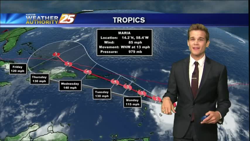
Sadly, the humidity returned as expected today, and that will lead to some muggy conditions in the coming week. The tropics are getting crowded again as well, so watch the forecast for details.
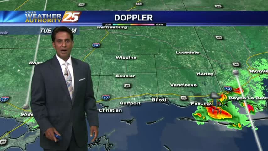
Showers and thunderstorms have started to develop late this morning across Jackson and Harrison County.
A much more typical summer day in store for South Mississippi as the cooler drier air is no longer around.
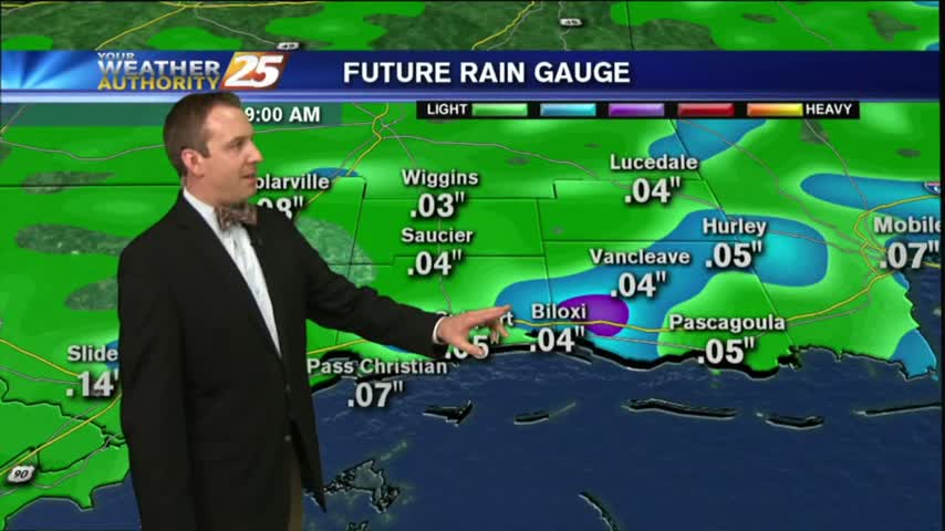
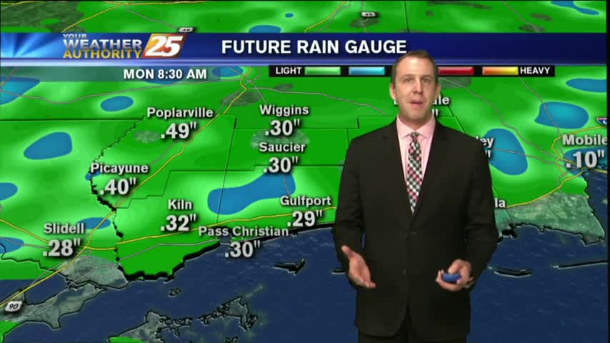
It's clear now, but clouds will begin to move in overnight and we'll see a little rain over the weekend. Watch the forecast for details.
We promised one last day of nearly perfect, fall-like weather and today did not disappoint, but we're already feeling the humidity increase & rain is on the way. Details inside.
Temperatures this afternoon are in the mid 80s and we continue to see southerly winds increase moisture in the area, but ran will hold off until tomorrow.
One final day of nice weather across South Mississippi before the rain returns.

We have at least one nearly perfect day left before the humidity goes back up and we cloud even see some rain over the weekend. Watch the full forecast for more.
Winds have started out of the southwest and this means moisture, temperatures and rain chances will be on the increase for South Mississippi.
It was a chilly and dry start to the morning with temperatures in the mid 50s to lower 60s.
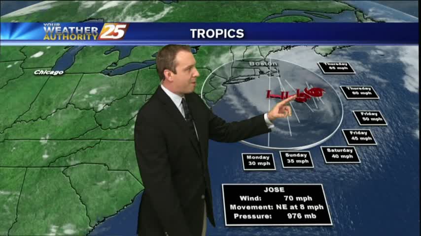
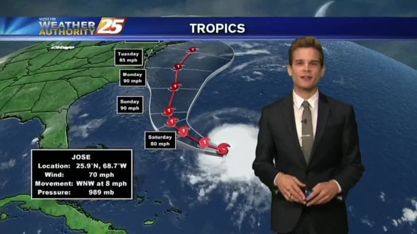
Irma is no longer a tropical system and Jose continues on its "path to nowhere," but the season isn't over just yet. Locally things are looking good though, full details inside.
As IRMA continues its track to the NW…now moving through N’tern Alabama as a low pressure system, the lovely conditions will continue here in South Mississippi.
IRMA, now a TROPICAL DEPRESSION moving through N'tern Alabama continues to bring lovely conditions and a dry north wind to south Mississippi.