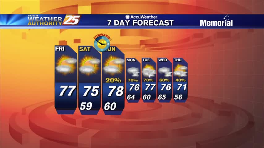
03/19 Ryan's "Cloudy, But Dry" Friday Night Forecast
Weird we only saw one clear day after Wednesday's front, but these clouds won't last much longer before the sun returns.
Weird we only saw one clear day after Wednesday's front, but these clouds won't last much longer before the sun returns.
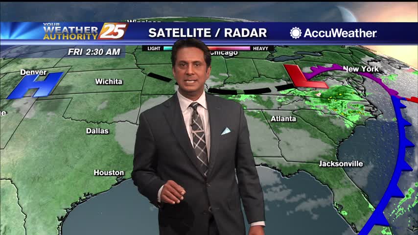
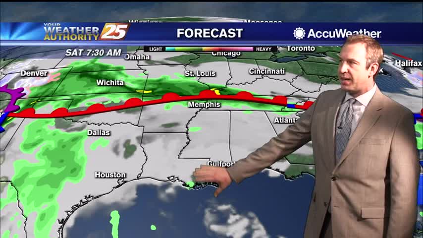
Wrap around moisture and cloud coverage will continue heading into the weekend...
A cool start to the day as low-level clouds continue to move through the area...
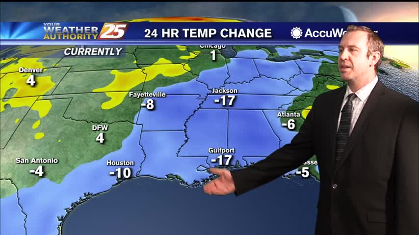
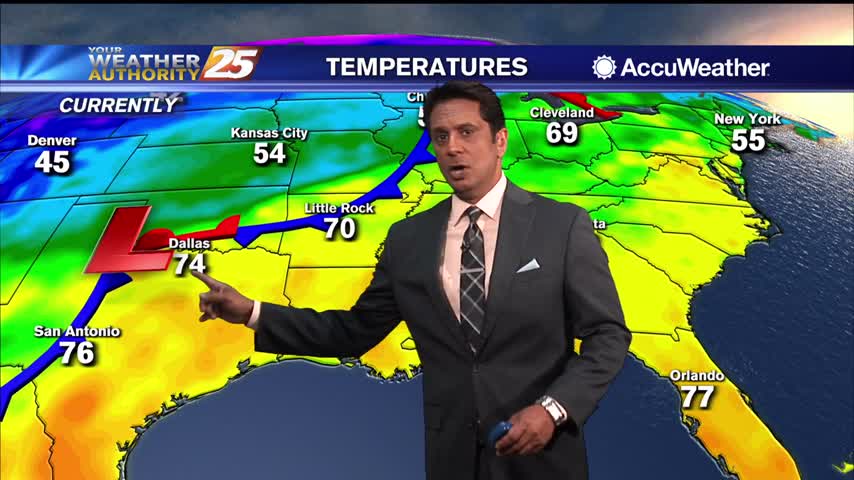
No severe weather last night, but that cooler and drier air is moving in rapidly after yesterday's front.
lovely afternoon ahead with breezy conditions...
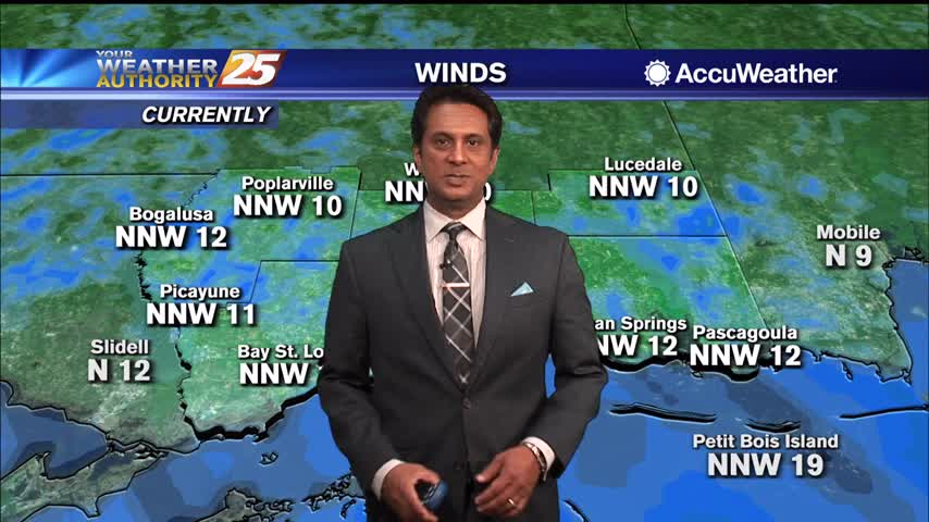
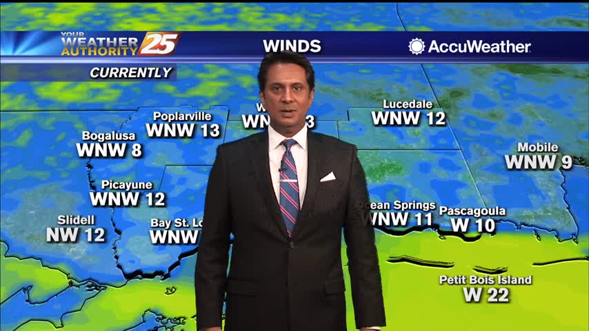
After a stormy night, a much cooler and drier airmass is now moving over the Gulf Coast in the wake of a cold front. Expect breezy conditions today as westerly winds shifts to more northwest to north at about 10…
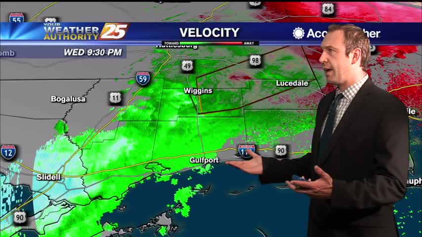
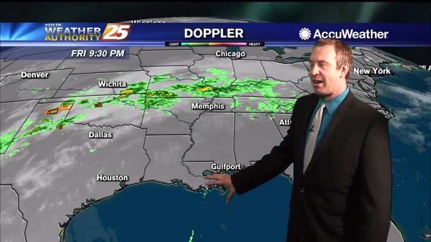
The line of storms expected tonight has sped up some, and will be quickly leaving the area through the early morning hours.

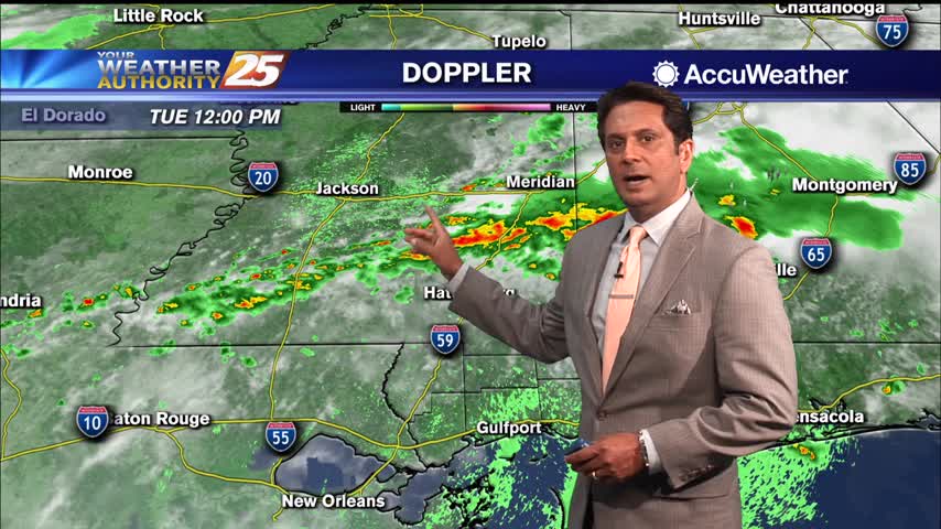
The threat for SEVERE WEATHER will be in the area this afternoon though mid-evening...
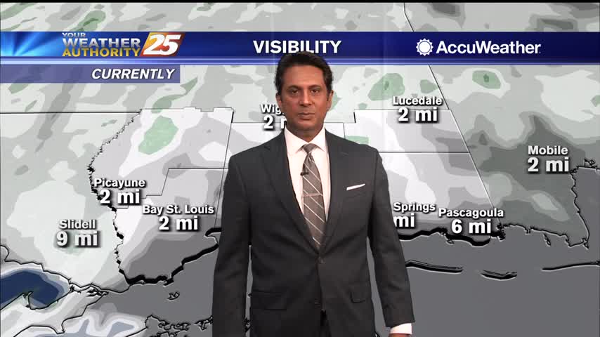
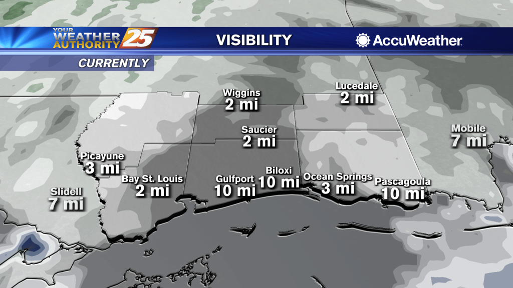
Areas of DENSE fog this morning, then the possibility for SEVERE WEATHER this afternoon/evening...
Areas of DENSE fog this morning, then the possibility for SEVERE WEATHER this afternoon/evening...
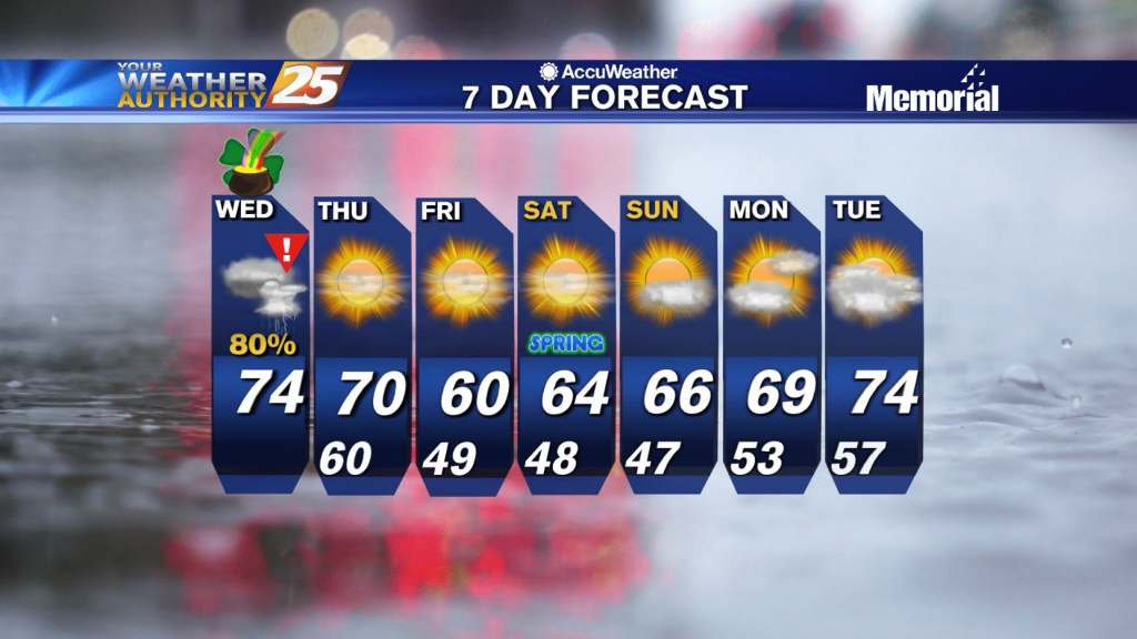
Scattered showers and a few thunderstorms will continue on and off through Thursday afternoon. Expect rain chances to be at about 60 percent during the morning Wednesday, rising to about 80 or 90 percent by Wednesday evening. High temperatures will…

Scattered showers and a few thunderstorms will continue on and off through Thursday afternoon. Expect rain chances to be at about 60 percent during the morning Wednesday, rising to about 80 or 90 percent by Wednesday evening. High temperatures will…
Even warmer temperatures this afternoon with a cold front draped across N'tern Mississippi...

Areas of DENSE FOG this morning with isolated rain ahead...
Just more of the same from the end of last week as we begin this one, but more rapid changes will be moving in soon.
A warm and humid afternoon ahead with isolated t-storms expected...
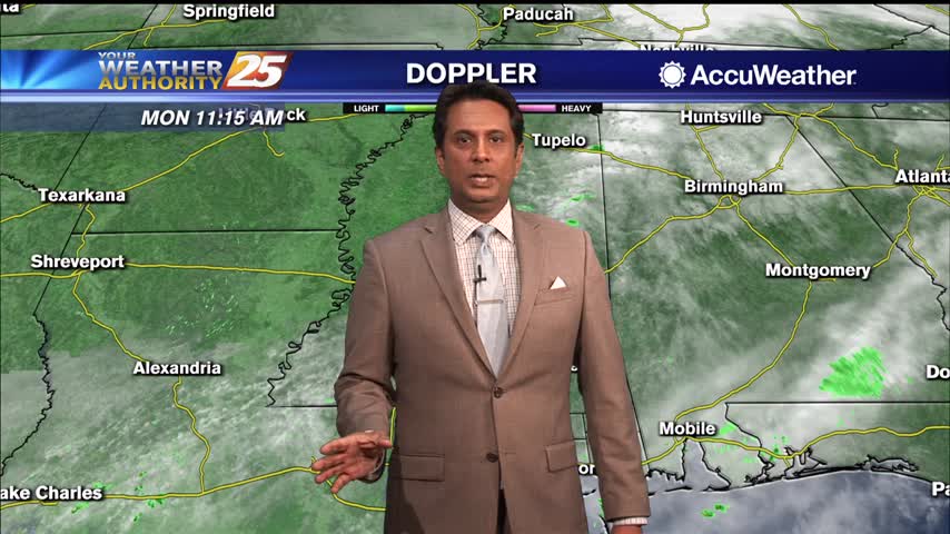
Cloudy skies will continue for the next few days as we enter an unsettled weather pattern. Highs Monday afternoon will then be similar to today, in the upper 70s to lower 80s north of I-10 and in the mid to…
Cloudy skies will continue for the next few days as we enter an unsettled weather pattern. High temperatures stay warm in the upper 70s through Wednesday and rain chances will gradually rise from 40% Monday to about 70% Wednesday as…
Another amazingly foggy night ahead, with little change expected until next week.
A beautiful sunny Friday afternoon ahead with a few upper-level clouds...
A mild and humid start to the day with widespread fog affecting your morning commute...
All of the trends we've had since the beginning of the week are still in effect, so expect more cloud cover, higher temperatures, more humidity, and more fog in the next few days.
Warm temperatures this afternoon with upper level clouds moving in...
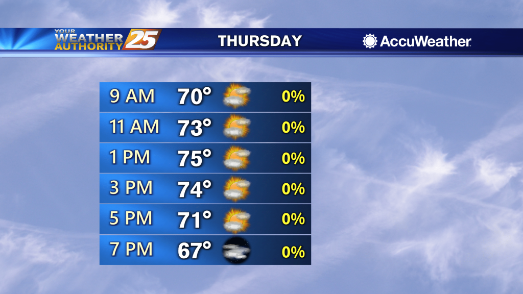
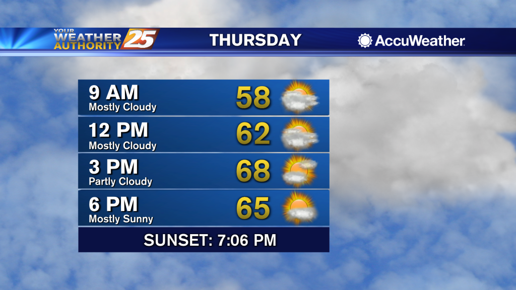
Temperatures for your Thursday may be a degree or two warmer over most places compared to yesterday, but overall a pretty similar pattern to what we’ve seen most of the week. An area of high pressure across the southeastern states…