Weather Headlines

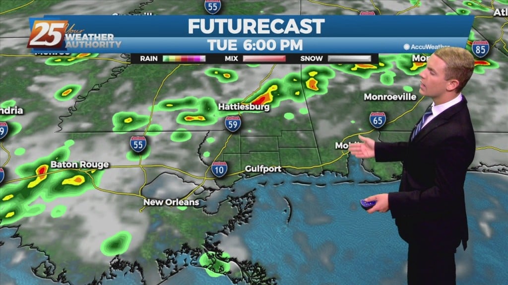
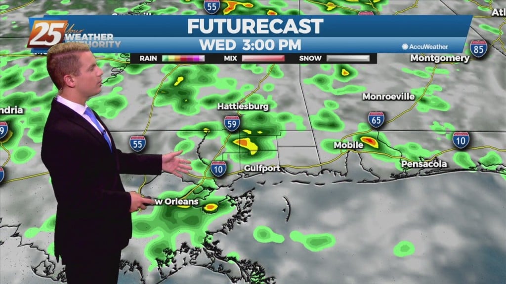
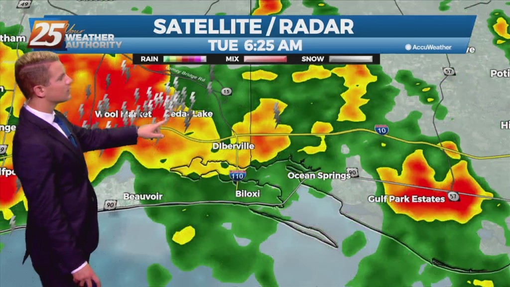
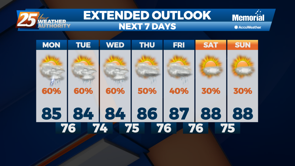
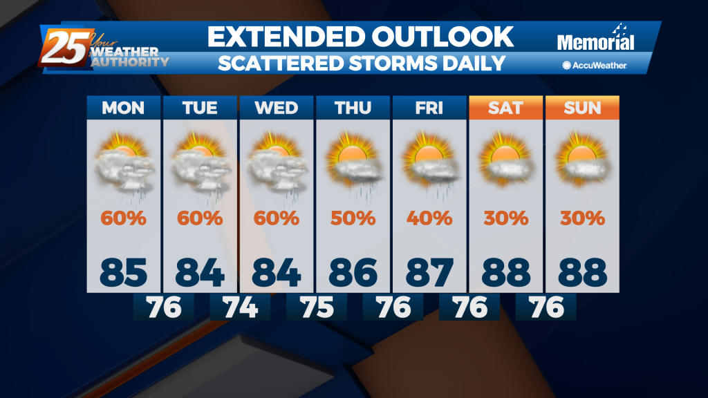
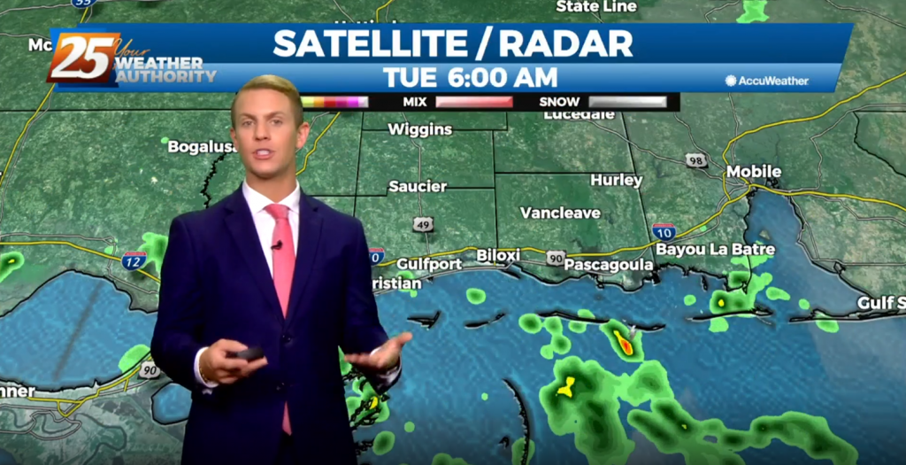
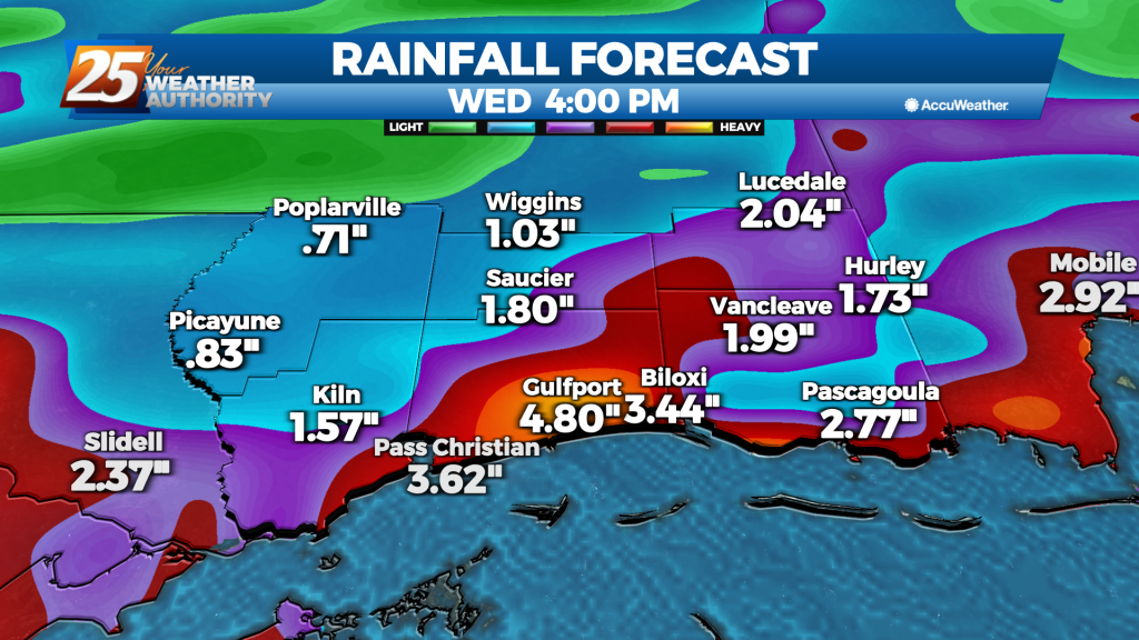
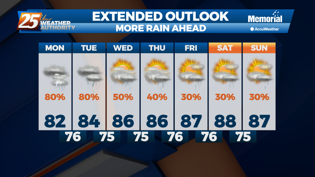
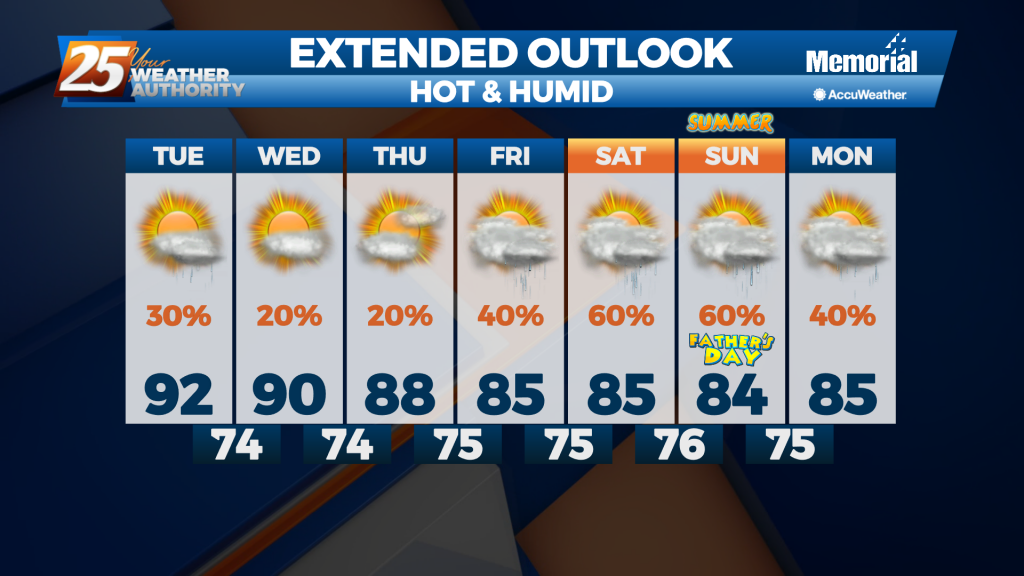
7/13 - Rob's "Hot & Hazy" Tuesday Morning Forecast

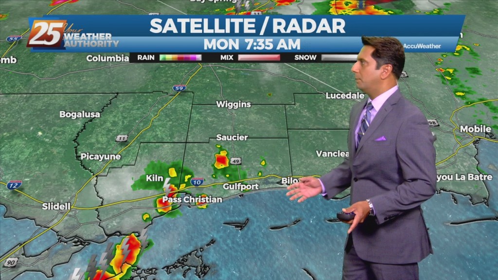
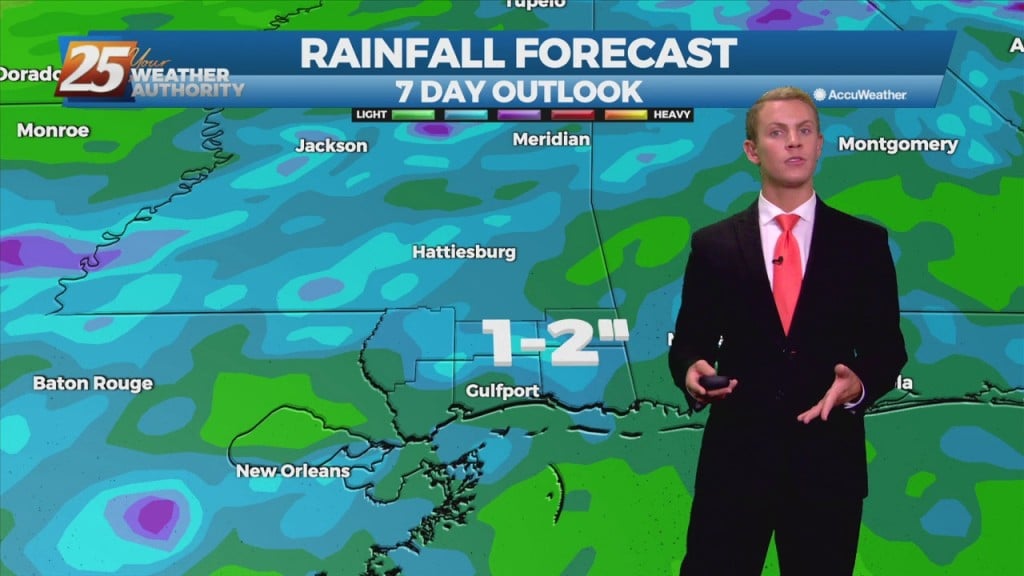
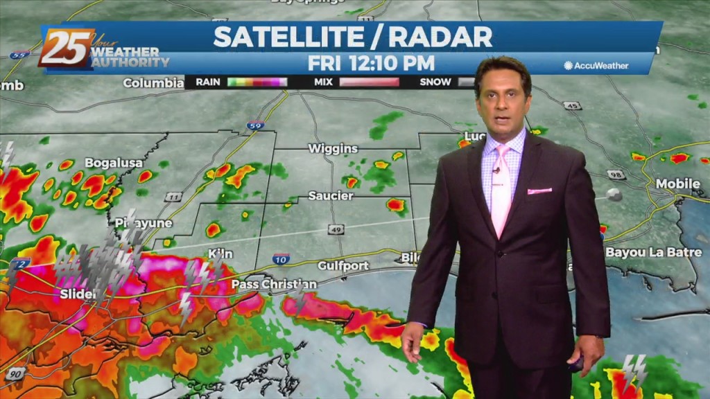
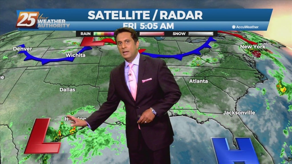
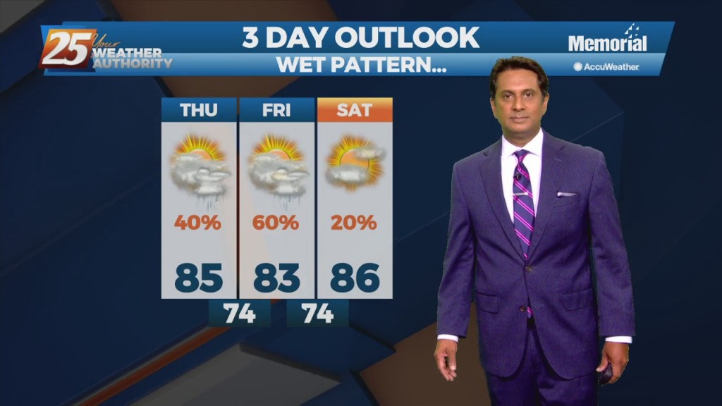
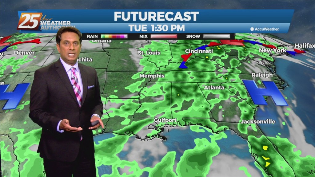
Today will bring much less in the way of rainfall than we have seen over the past several weeks. We will need to watch just how much coverage of convection develops across the coastal areas. The good news is we…

7/12 - Rob's "Hot & Humid" Afternoon Forecast...

With daytime heating, afternoon showers/t-storms will affect the area with the activity diminishing around sunset. By Tuesday, the upper-level dynamics supporting showers/t-storms upstream of the zonal deep-layer flow exits towards our north, as we settle into overall weaker moisture flow.…

7/12 - Rob's "Warm & Humid" Monday Morning Forecast

Another day, another wet forecast as focus will be out towards our west at a disorganized cluster of showers and storms ongoing across central LA and eastern TX. This activity remains supported by noticeable instability denoted by a broad unstable warm…

7/9 - Rob Knight's "Lower Rain Chances" Weekend Forecast

This afternoon will bring scattered showers and t-storms. A southerly surface winds will help to enhance the warm air and moisture advection into the area, which will enhance the lifting in the environment. Models indicate the possibility for locally heavy…

7/9 - Rob Knight's Friday Morning "Hot/Humid" Forecast

Today through Sunday, scattered showers and t-storms and enhanced rain chances will be possible, especially each afternoon. Southerly surface winds will help to enhance the warm air and moisture advection into the area, which will enhance the lifting in the…

7/8 - Rob's Friday-Eve Afternoon Forecast

The interaction of outflow boundaries and sea/land breeze boundaries have been the focus of some recent instances of high rainfall amounts and that will likely be the case as well this afternoon. So while the overall threat for flash…

07/06 – Brantly's "Showers/T-Storms" Tuesday Forecast

Some showers and storms that develop through the day will likely be efficient rain makers. Additionally, with weak wind flow, storms will be very slow moving. This causes a concern for localized areas receiving brief periods of very heavy rainfall…

07/05 – Brantly's "More Showers/T-Storms" Monday Forecast

With Elsa moving into the Gulf, deep layer southerly flow becomes re-established over the Southeast and Gulf moisture moves inland. Scattered to numerous showers and thunderstorms are expected. Increased cloud cover over the forecast area will combine with increased storm…

06/22 – Brantly's "More Wet Weather" Tuesday Forecast

Wet weather will continue linger along the Gulf Coast, keeping scattered to numerous showers and thunderstorms in the forecast for the local area today through at least Wednesday. Coverage is expected to decrease somewhat tonight, but showers and storms will…

Tropical system in Gulf could dump rain over the weekend

Cooler temperatures and lower humidity on Thursday morning will be giving way to hotter temperatures and more humid weather as a tropical system moves northward through the Gulf of Mexico. "We started off with really nice conditions this morning with…