08/13 Ryan's "Average" Friday Night Forecast
There weren't any weather surprises today as our active weather was once again driven by the sea breeze. That's when showers and thunderstorms develop due to the heating differences…
There weren't any weather surprises today as our active weather was once again driven by the sea breeze. That's when showers and thunderstorms develop due to the heating differences…
There weren't any weather surprises today as our active weather was once again driven by the sea breeze. That's when showers and thunderstorms develop due to the heating…
The forecast today through the weekend will be similar to the last few days however there is one hiccup that may keep convection from being as widespread. High-pressure in the western Atlantic and over the western CONUS west of the…
Today was slightly wetter in terms of rain amount and coverage, but we'll be drier again by tomorrow. Friday will also be one of the sunniest…
Today was slightly wetter in terms of rain amount and coverage, but we'll be drier again by tomorrow. Friday will also be one of the sunniest days of…
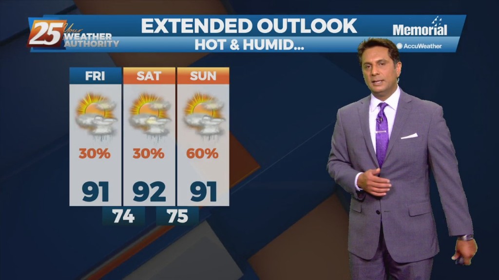
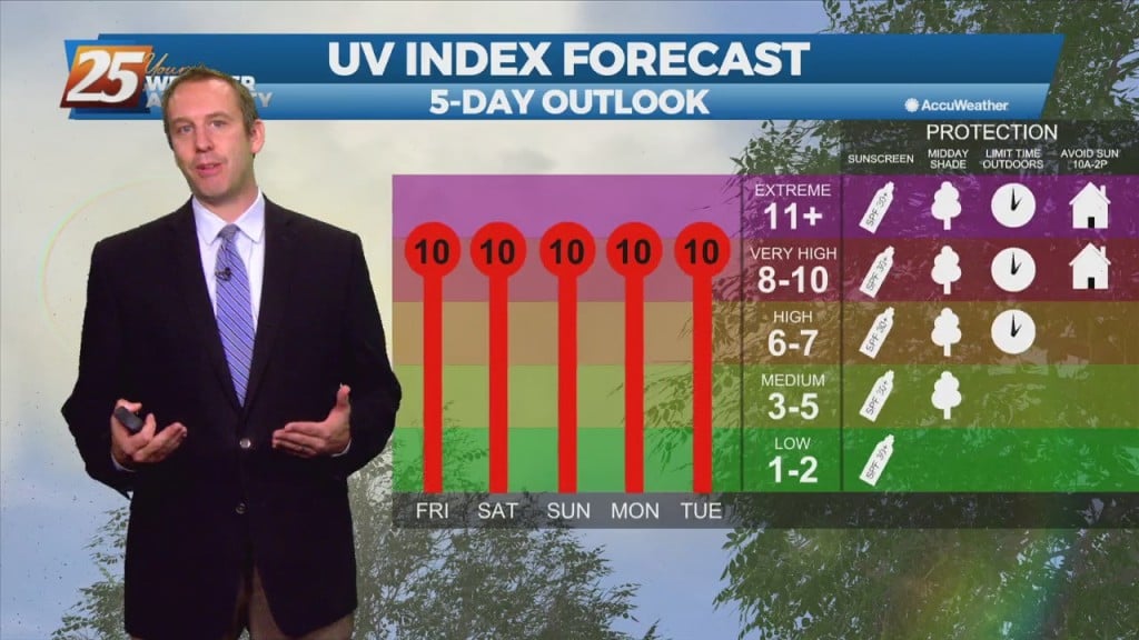
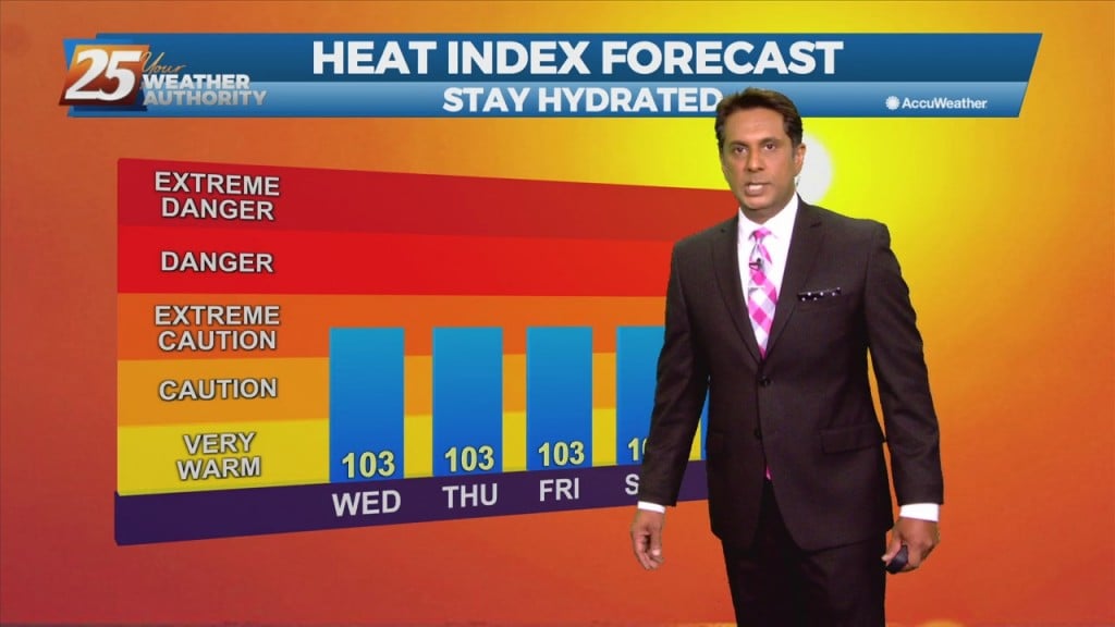
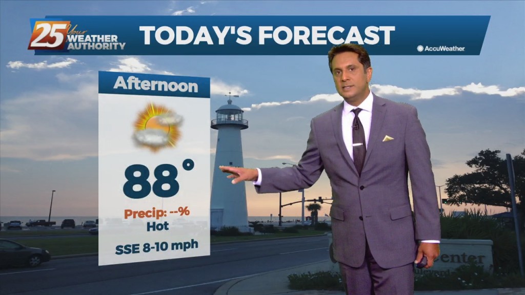
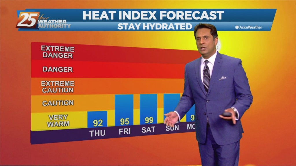
Daily highs have been quite steady from day to day, topping out in the low to mid 90s. With dewpoints in the mid 70s, should see heat indices in the low 100s to 107. Short term isolated timeframes of 108+…
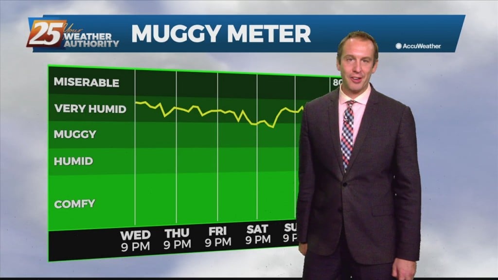
They say the only sure things in life are death and taxes, but I'd also push for adding our consistently humid summer weather. Once again today the temperature…
They say the only sure things in life are death and taxes, but I'd also push for adding our consistent South Mississippi summer humidity. Once again today the temperature…
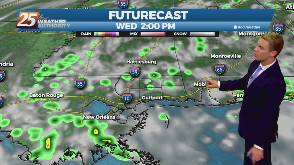
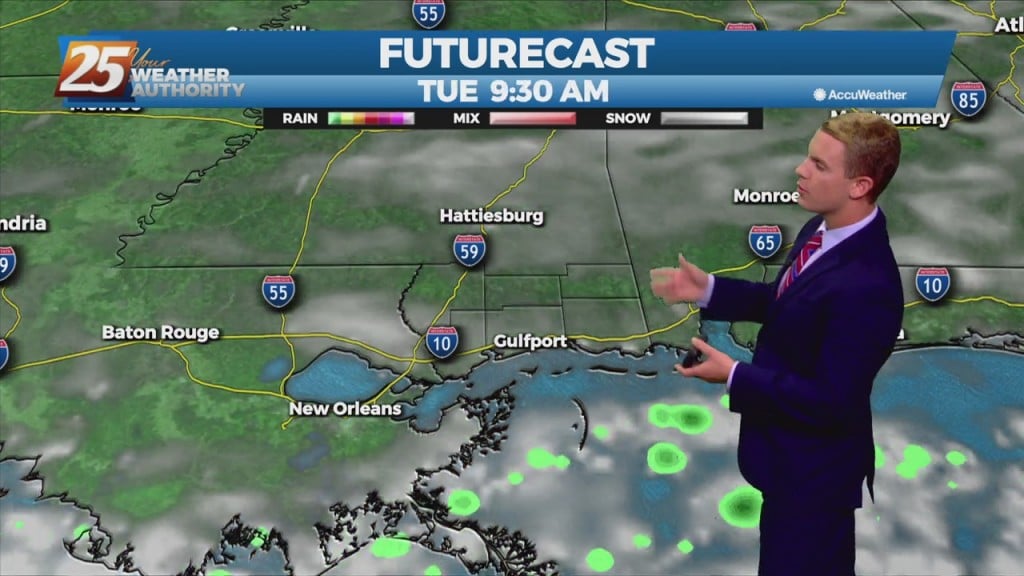
Another day of afternoon shower and thunderstorm activity is on tap with precipitation chances a good deal higher overall than they were yesterday, mainly during the peak heating of the afternoon hours. The main concern with the rainfall today will…
Another day of afternoon shower and thunderstorm activity is on tap with precipitation chances a good deal higher overall than they were yesterday, mainly during the peak heating of the afternoon hours. This should in turn help to keep temperatures…
Summer just keeps on keeping on with another toasty day with showers and thunderstorms likely during the afternoon. This persistent upper level ridge will continue over the area and dominate the weather through Thursday. Winds overall will be relatively weak…
Good to be back after a few weeks off, and it's no surprise it's still hot and humid though it will be drier. That isn't going to change…
Good to be back after a few weeks off, and it's no surprise it's still hot and humid. That isn't going to change anytime soon since…
Along the Mississippi Gulf Coast, high temperatures will be in the lower 90s each day with overnight lows in the mid to upper 70s. Showers and a few thunderstorms will be possible daily with rain chances ranging between 20 and…
The normal summertime pattern will be dominate the region through Thursday. Southerly to southeasterly surface winds will help to enhance warm air advection and moisture advection over the next few days, which will help with lifting in the environment. Scattered…
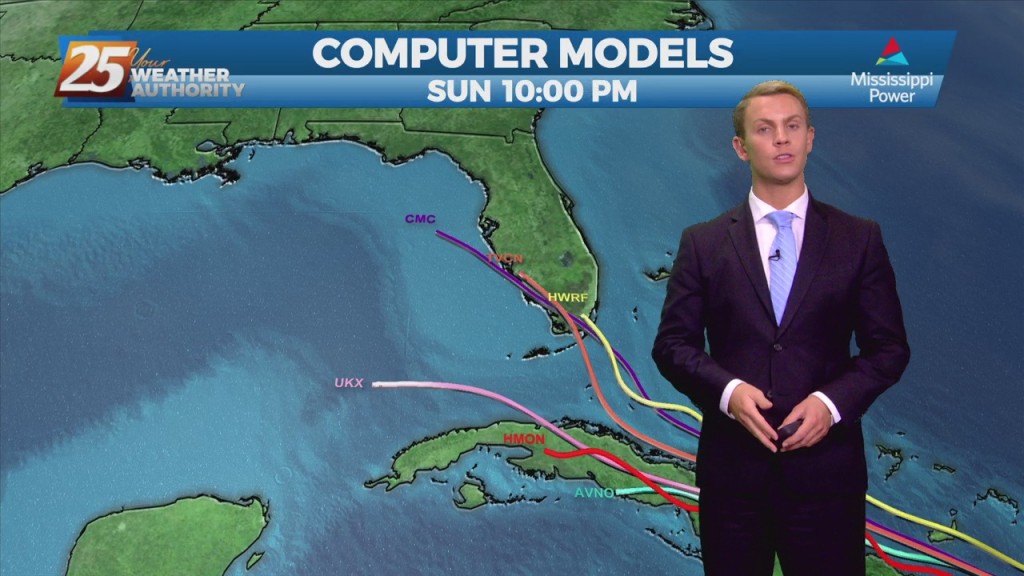
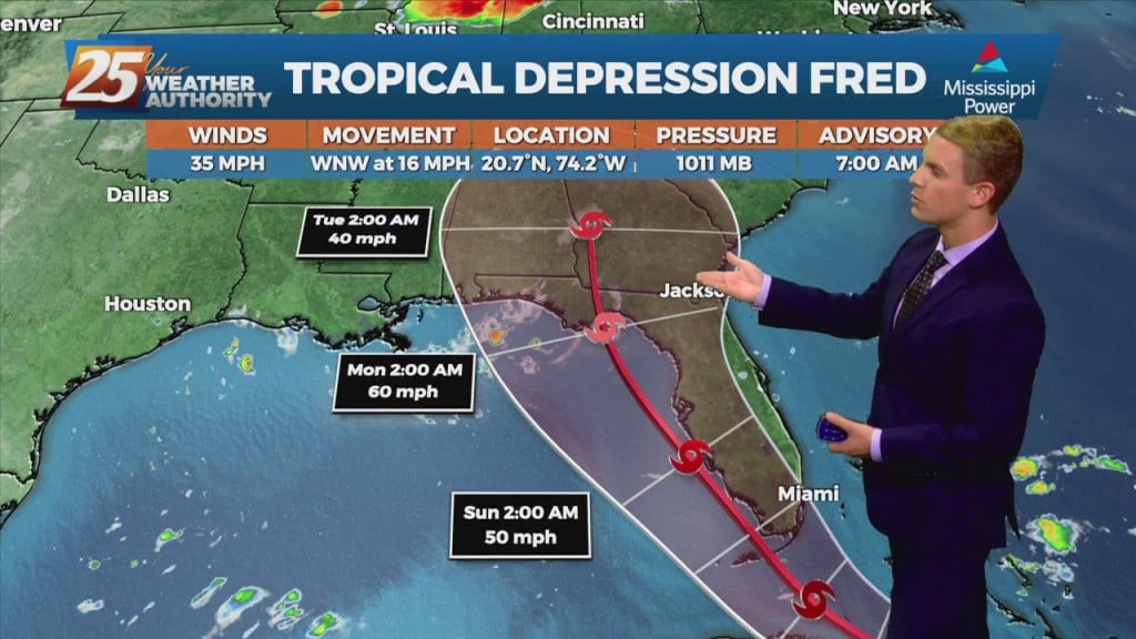
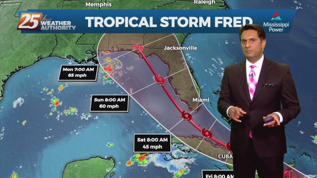
The tropical disturbance we’ve been watching is now very near the Leeward Islands and it is expected to produce gusty winds and heavy rains across portions of those islands during the next several hours. Satellite and radar data indicate that…

With high-pressure shaping the forecast, daily high temperatures generally in the 90 to 95 range and afternoon dew-points in the lower and mid 70s will make for somewhat uncomfortable conditions. Moisture flow south of the interstate will be more abundant than…
Not much in the way of changes expected over the next few days with high pressure over the Gulf of Mexico. Daily high temperatures generally in the 90 to 95 range and afternoon dew-points in the lower and mid 70s…
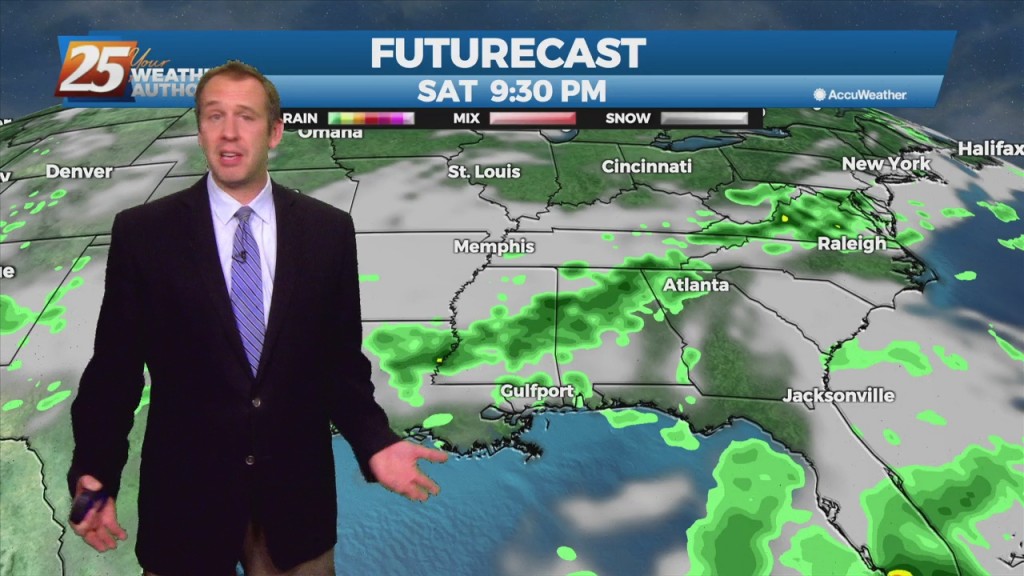
Expect the typical summertime pattern of late morning into early evening isolated to scattered showers and storms inland, with late evening into overnight isolated shower and thunderstorm activity over the marine zones Monday night through Wednesday night. Showers and storms…
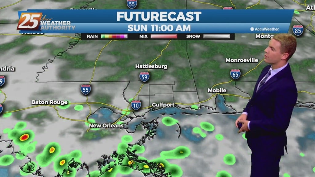
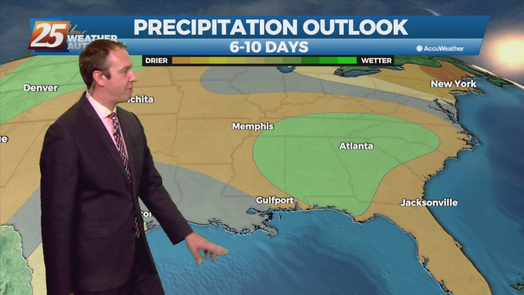
Moisture levels will continue to increase on Saturday and Sunday. No significant rain system is expected to impact the area over the weekend and with the higher moisture levels, we’ll be in a more "normal" summertime pattern with a small…
The less humid pattern will begin a slow transition later today through the weekend. An area of high-pressure will move into the GOM as a warm front over the N'tern GOM moves north Saturday. The moisture flow will be felt…
Calm conditions continue along the Gulf Coast overnight. Low temperatures should drop into the mid 70s for locations along the immediate coastline, while interior areas dip into the lower 70s. There is a low rain chance for Friday with just…
Today and Friday, the lingering frontal boundary will continue to move southward into the open Gulf waters. Upper level high-pressure will build in on Thursday followed by a short wave upper level weakness moving through Friday overnight. Overall rain chances…
Thursday and Friday, the lingering frontal boundary will continue to move southward into the open Gulf waters. Northerly surface winds Thursday will help dry weather to persist. High temperatures will be fairly close to normal over the next few days…