Weather Headlines

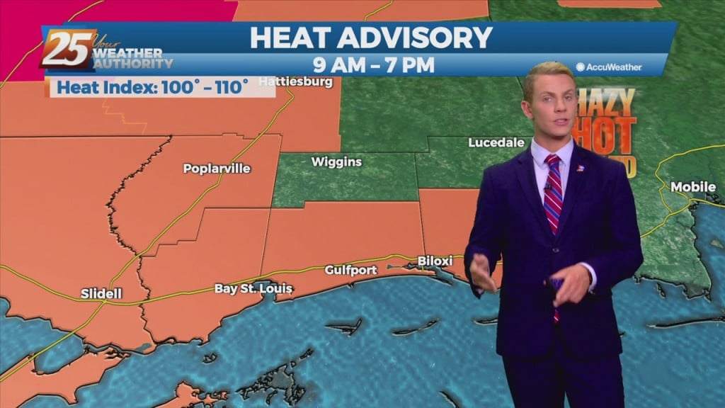
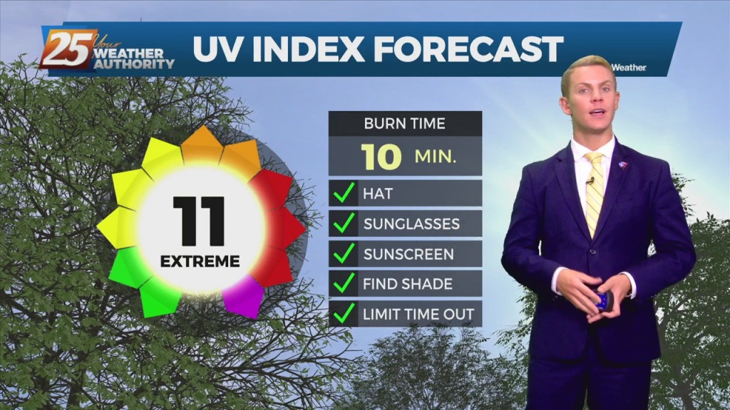
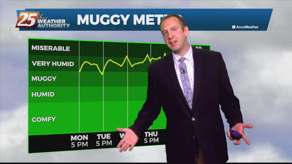
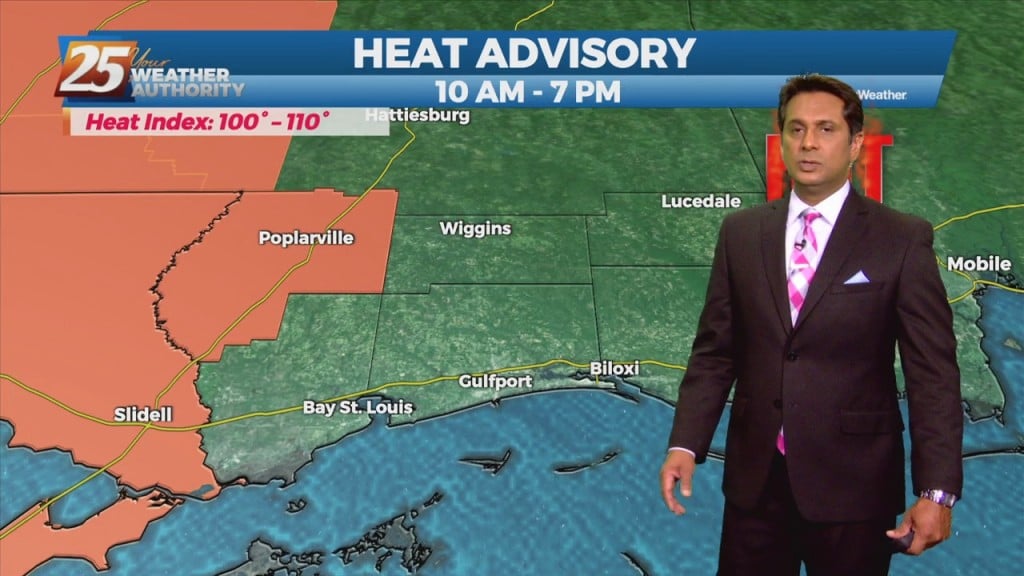
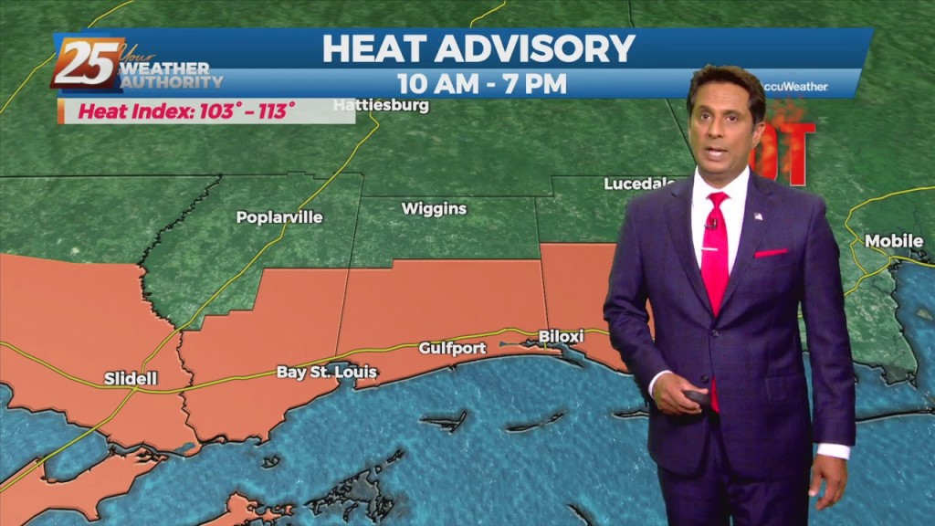
8/4 - Rob Knight's "Less Humid" Morning Forecast

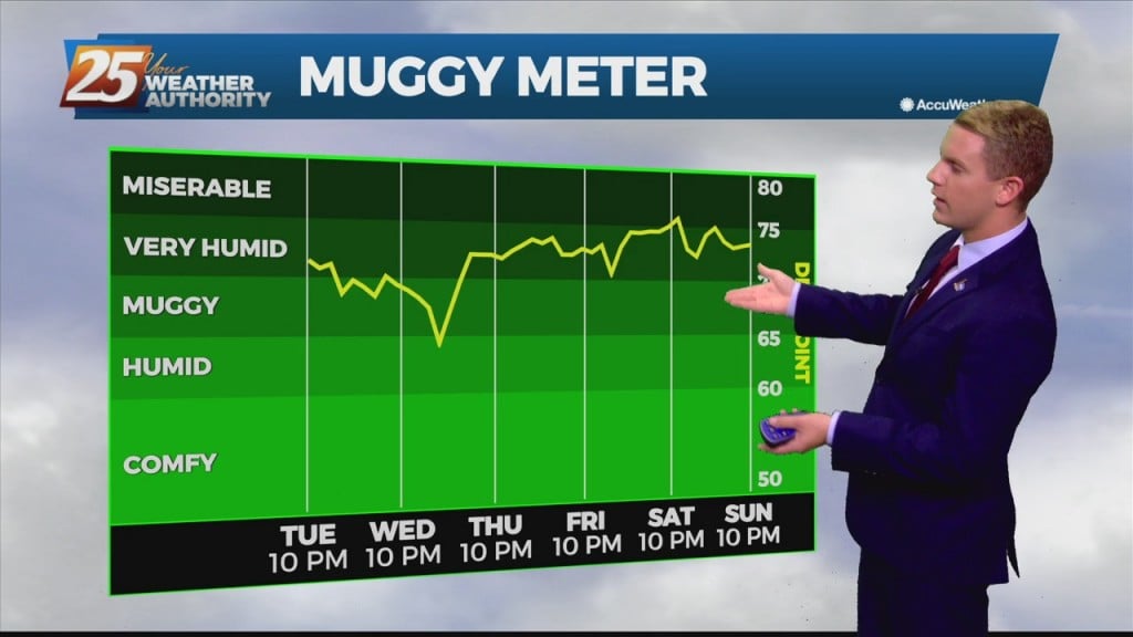
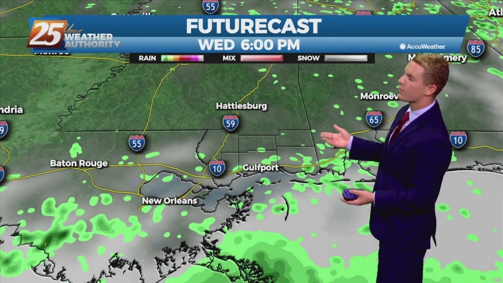
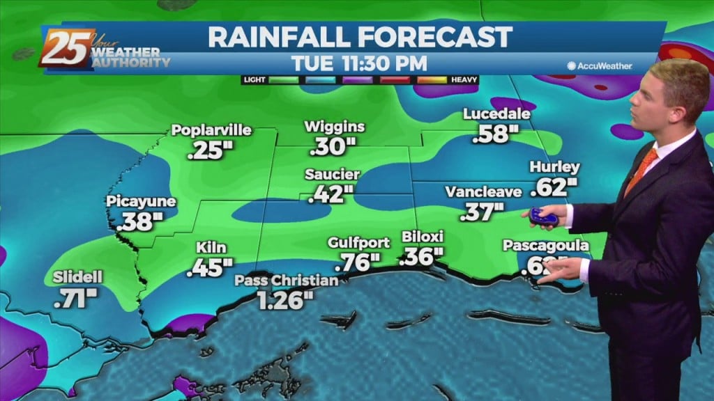
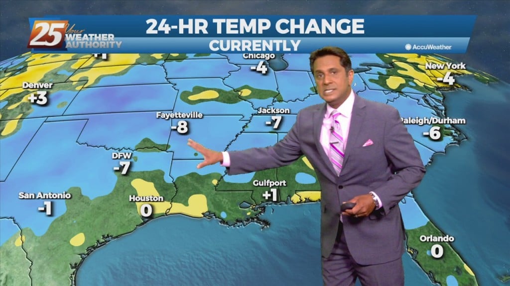
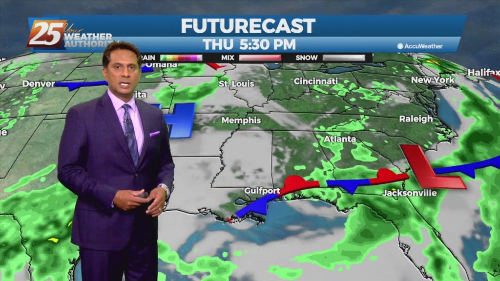
Early this morning, what is left of a weak stationary front remains draped across our area. The front is now south of the area making a transition to a stationary front. This will bring a drier air mass into the…

8/3 - Rob's "T-Storms Continue" Tuesday Morning Forecast

Now that we've broken the back of the heat wave, our concern returns to thunderstorms and heavy rain. The frontal boundary currently along the interior counties will gradually work its way southward over the sound by tonight. The potential for another…

8/2 - Rob Knight's "Big Changes" Monday Morning Forecast

The words "cold front" and "August" are not often associated together in the Gulf coast. The persistent high-pressure over the west will allow a cold front to lag across the region through mid/late workweek. The stretch of heat and humidity…

7/29 - Rob's "Heat Advisory" Thursday Morning Forecast

More of the same hot, muggy weather is expected to continue for the next couple of days. Afternoon and early evening showers will be possible over the next few days, with a slight elevation in precip chances into the weekend.…

7/27 - Rob's "Heat Continues" Tuesday Morning Forecast

Humid air, warm temperatures, and light winds will keep the current heat advisory posted through today. The main hope for cooling will be any thunderstorm development which will be embedded in a deep easterly flow. Afternoon seabreeze should provide a…

07/27 – Brantly's "Hot" Tuesday Forecast

 Rain chances over the next few days will be close to normal for this time of the year, ranging from 20 to 50 percent. Showers and thunderstorms will be largely driven by daytime heating with storm activity peaking in the…