3/14 - Brittany's "Warmer" Monday Afternoon Forecast
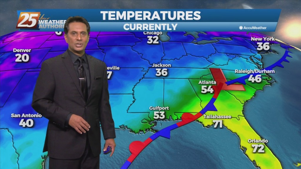
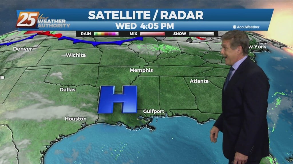
The primary forecast concern through Wednesday will be the passage of a potent upper level low-pressure and associated surface cold front across the Lower Mississippi Valley tonight into Tuesday.…
The primary forecast concern through Wednesday will be the passage of a potent upper level low-pressure and associated surface cold front across the Lower Mississippi Valley tonight into Tuesday.…
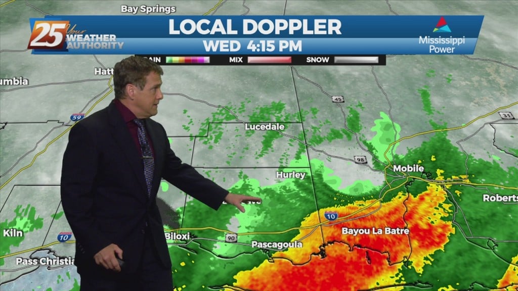
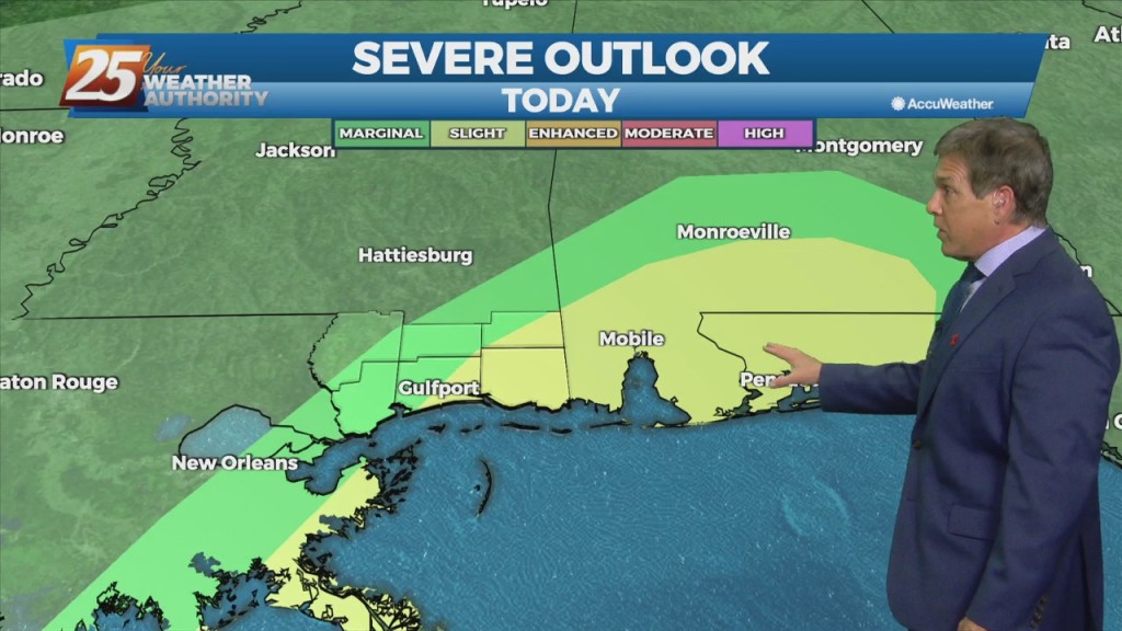
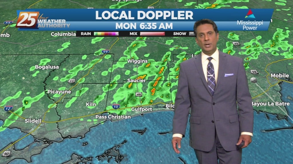
Thunderstorms to increase in number and intensity tonight. Strong to possibly severe storms will be possible along the MS coastal areas and east. The more favorable parameters for strong storms will be in place along the MS coast as the system moves…
Scattered to numerous showers and storms will be possible this afternoon/tonight. Strong to possibly severe storms will be possible along the MS coastal areas and east.…
Today, an upper level disturbance/frontal boundary is expected to influence the area. Scattered to numerous showers and storms will be possible, mainly in the afternoon hours looking…
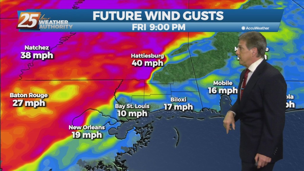
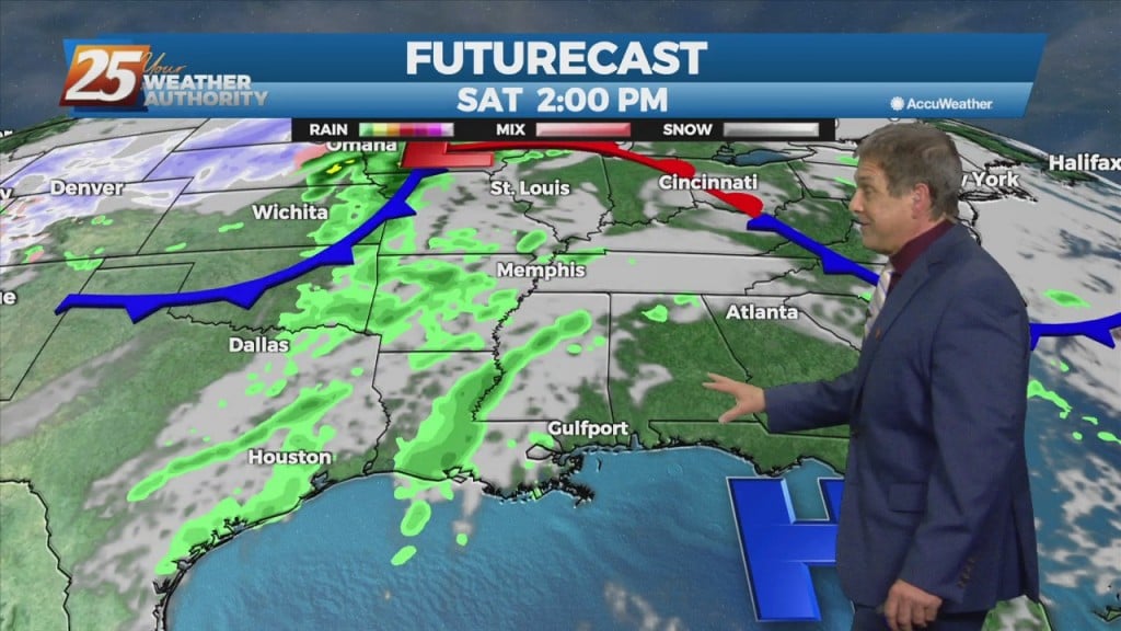
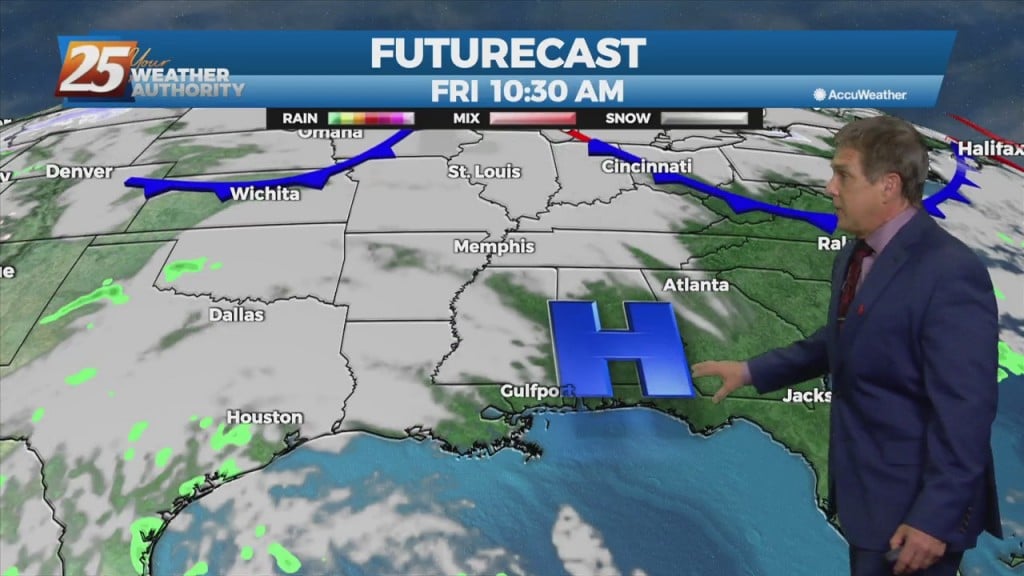
We’re looking good early tonight, but a vigorous cold front approaching from the NW tomorrow. Rain will move back in overnight with elevating rain potential Friday afternoon/night. The stationary front will begin to dissipate with the approaching cold front NW…
A brief dry period today will change overnight as the stationary front drifts north, along with a vigorous cold front approaching from the NW. Rain will move back…
The same front that’s been bringing the rain and thunderstorms is still hanging around just off shore. We’re on the cooler, more stable side of it, so we’re looking at mainly just occasional showers through tonight. Any development over land…
A stationary front to the east will continue to be the focal point for showers and t-storms again today. The development over land will be elevated so we are…
A stationary front to the east will continue to be the focal point for showers and t-storms again today. The development over land will be elevated…
The cold front that brought morning showers returns northward as a warm front tonight, with steady or rising temperatures. Models indicate a weak surface low developing along the northward drifting warm front tonight. Activity will ramp up overnight with scattered…

The frontal boundary will stall just off the northern Gulf Coast thanks to high-pressure to the SE. Isolated rain with a few t-storms possible this morning with…
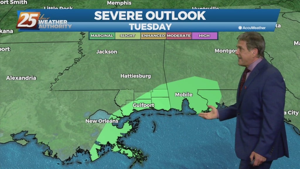
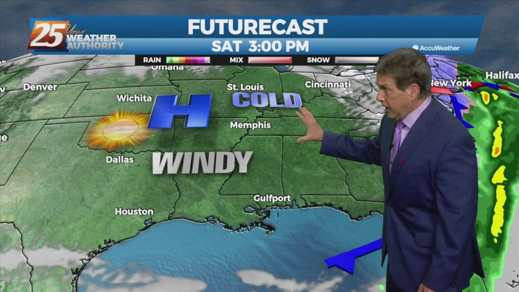
A more-active weather pattern is shaping up this week. A cold front moves slowly through the area tonight with some early showers. As the surface low continue to lift northeastward, the cold front will continue to get pulled eastward today…
Low pressure is currently over southern Indiana with a cold front southwestward to near Memphis and Shreveport. As the surface low continue to lift northeastward, the cold front will…
Low pressure is currently over southern Indiana with a cold front southwestward to near Memphis and Shreveport. As the surface low continue to lift northeastward, the cold…
Over the course of the evening a front will move closer to the region and is expected to start impacting the area with increased shower and thunderstorm activity tomorrow.…
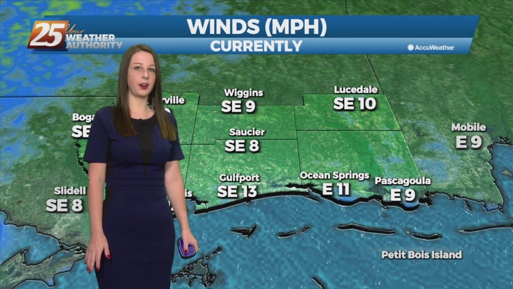
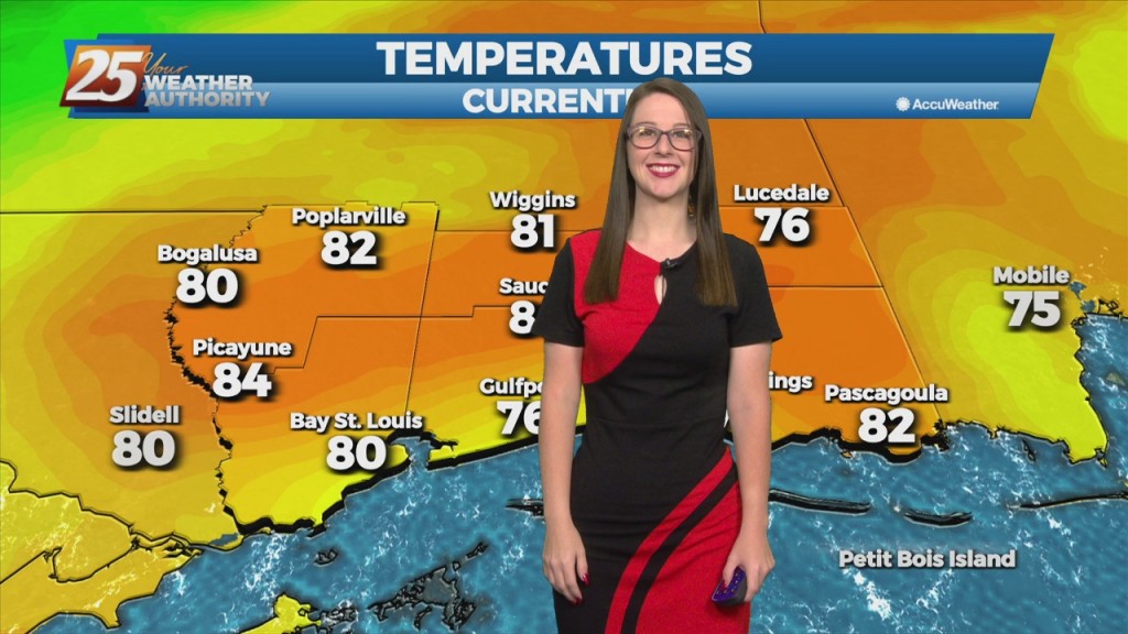
Bit by bit this weather pattern changes heading into next week. The calm wind regime, for starters, is over. Winds have come around to the southeast, keeping coastal areas from warming up a lot compared to yesterday, plus bringing back…
This afternoon winds will gradually come around to the southeast by this afternoon. Little in the way of cloud cover is expected today, and high temperatures should…
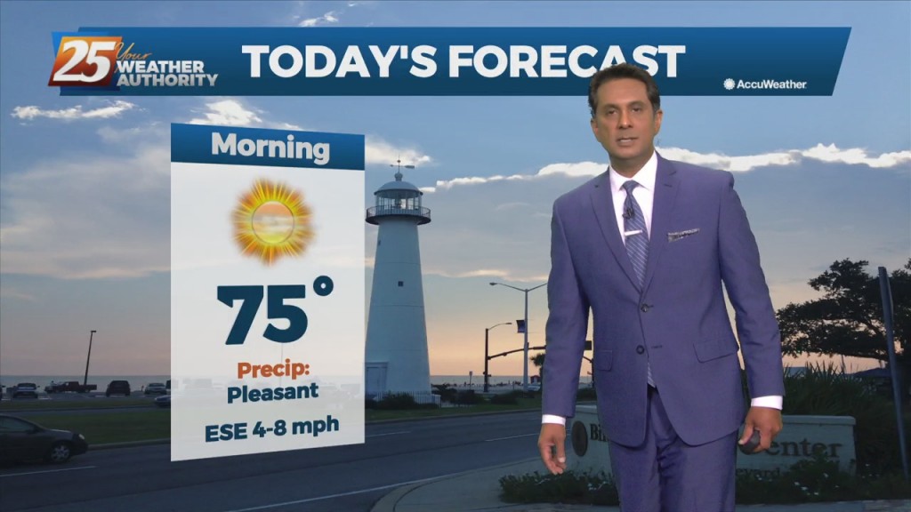
As the high pressure continues to shift east of the area today, winds will gradually come around to the southeast by this afternoon. Little in the…
Dominant high pressure that has brought splendid weather will finally nudge to the east, bringing up those Thursday-night temps up a few more degrees. This will gradually allow our surface flow to turn onshore and allow moisture levels to increase.…
High-pressure currently over the Rockies will move eastward across the Gulf of Mexico Friday and Saturday. This will gradually allow our surface flow to turn onshore and…
High-pressure currently over the Rockies will move eastward across the Gulf of Mexico Friday and Saturday. This will gradually allow our surface flow to turn onshore and allow moisture…
Southwest flow aloft will slowly break down leading to zonal flow by tonight as a weak disturbance to our west continues to fill in. Thursday, an area of high pressure will strengthen across west TX and extend north over the…
Southwest flow aloft will slowly break down leading to zonal flow by tonight as a weak disturbance to our west continues to fill in. Thursday, an area…
The next few days will be mainly a temp and dew-point forecast. No rain anywhere in sight during the workweek with the greatest impacts likely to the fire weather community as relative humidity values could be quite low again this…