4/5 – Rob Martin’s “Cold Front on the Way” Tuesday Evening Forecast
The severe weather stalled out to our north this morning, sending just the tail end our way as the low pressure area responsible picked…
The severe weather stalled out to our north this morning, sending just the tail end our way as the low pressure area responsible picked…
The threat for severe weather and flash flooding has diminish by isolated showers and even a few late afternoon t-storms. Tonight will bring a lull in activity until…
The warm front is now to the NE placing the area under the warm/moist unstable sector of this system. The synoptic and mesoscale pattern continues to support…

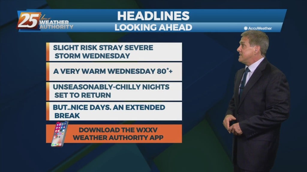
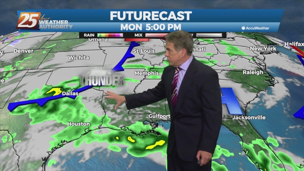
The last two severe weather events were afternoon/evening scenarios, but this next one is set for tomorrow (Tuesday) morning. Severe weather is back on the slate…
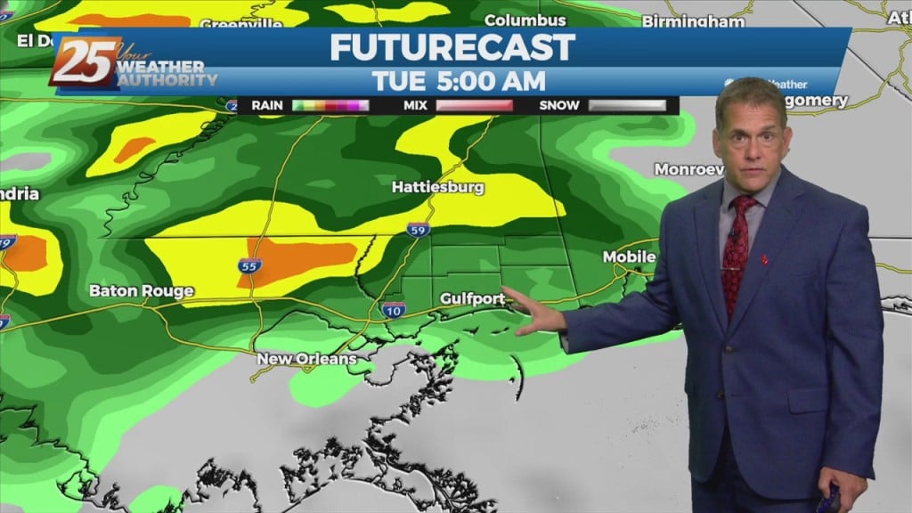
Severe weather is back on the slate, following the recent trend of about one per week. Showers arrive late tonight followed by thunderstorms entered from the…
No April fools from Mother Nature this April 1st. It was an awesome day, and expect that to extend through tonight with more of an easterly…
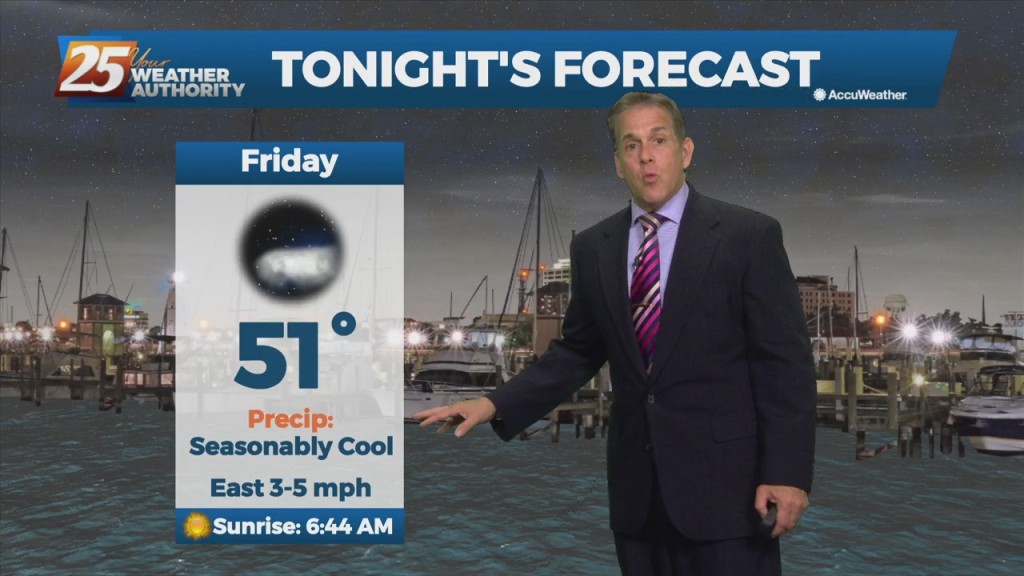
After a chilly start early this morning (lows were in the 40s..below our seasonal norms in the mid 50s) it’s been a splendid April 1st, and…
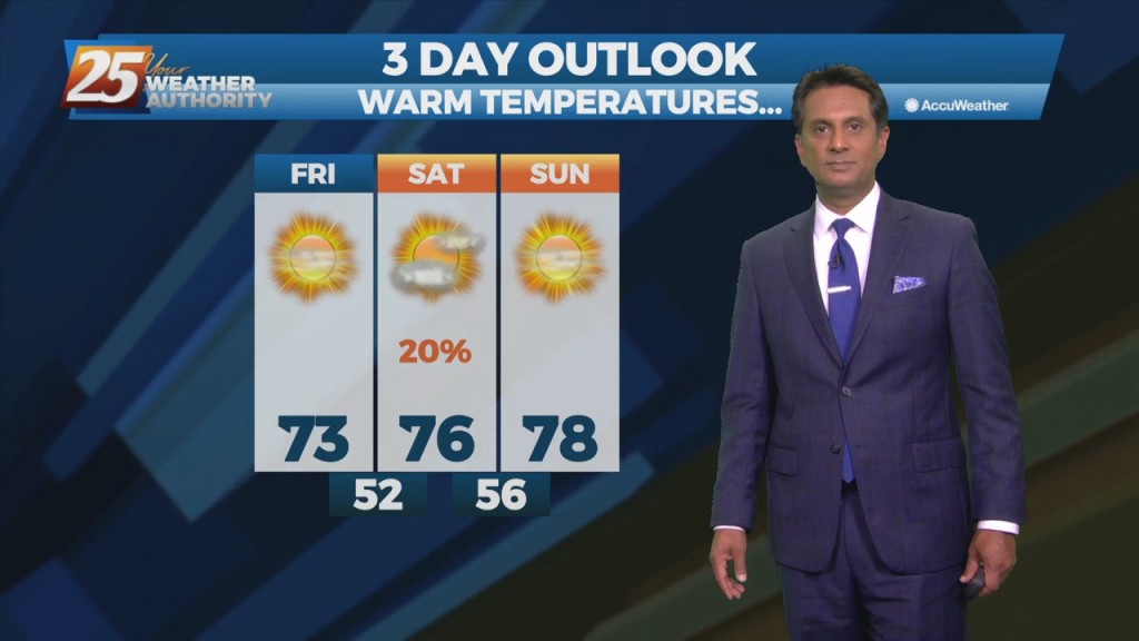
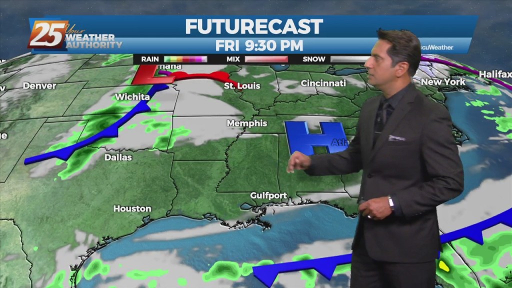
High pressure building in will bring a much drier air mass...a few degrees below our normal lows. Over the next 3 days there will be about a…
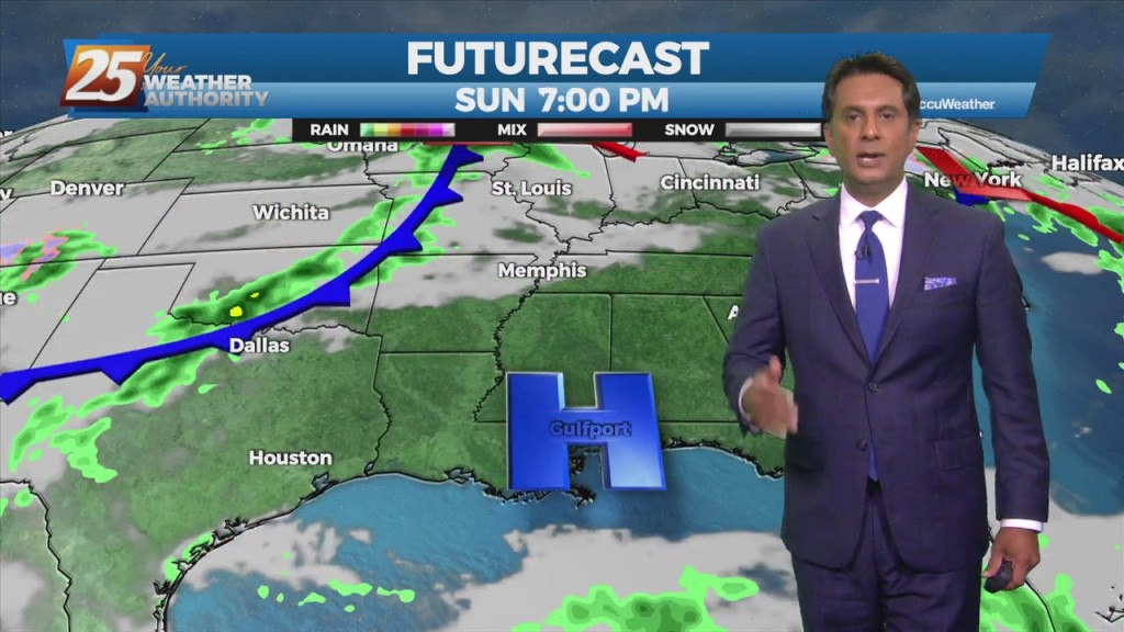
Much quieter night than the previous and we will likely remain quiet for the next 24 to 30 hrs and then we should start to see some rain…

A northwest flow has plummeted humidity and cleared out the skies. We’re back to cool nights and seasonable, sunny days in the short term. This will…
We’re back to cool nights and seasonable, sunny days in the short term. High-pressure will begin moving in from the NW, ushering a cooler/drier air mass.…
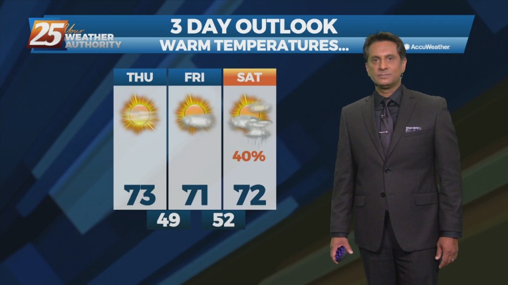
High-pressure will begin moving in from the NW, ushering a colder/drier air mass. Pleasant condition will continue through Friday before high-pressure moves SE allowing for the next system…
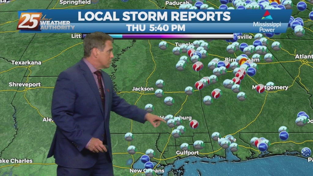
The front is now well east of the area after leaving extensive damage through the region including South Mississippi. Multiple areas were hit by damaging straight…
MULTIPLE ADVISORIES CURRENTLY IN PLACE. SEVERE WEATHER STILL EXPECTED. WE REMAIN UNDER A MODERATE (LEVEL 4 OF 5) SEVERE POTENTIAL THROUGH TONIGHT… A cold front to the…
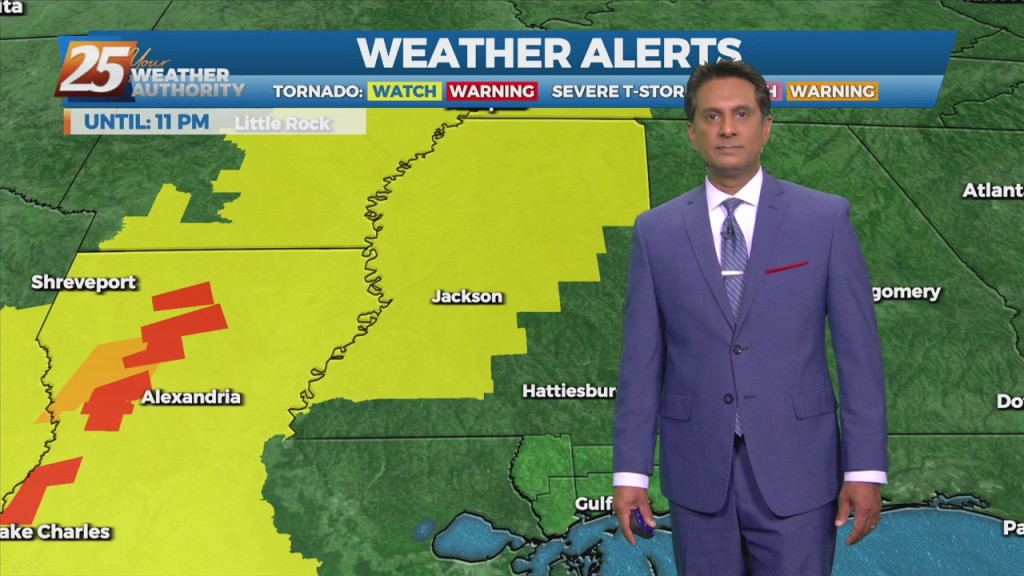
THE AREA/STATE IS UNDER A MODERATE (LEVEL 4 OF 5) SEVERE POTENTIAL THROUGH TONIGHT... A WIND ADVISORY and a HIGH WIND WARNING is in effect with wind…

With severe weather forecast for this afternoon and evening, schools and other entities are making decisions about whether activities will be cancelled or rescheduled. MGCCC All MGCCC locations and centers will be closed at 5 p.m. today and all events…
THE AREA/STATE IS UNDER A MODERATE (LEVEL 4 OF 5) SEVERE POTENTIAL THROUGH TONIGHT... A cold front to the west with a squall line in advance…
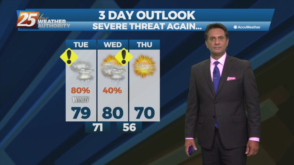
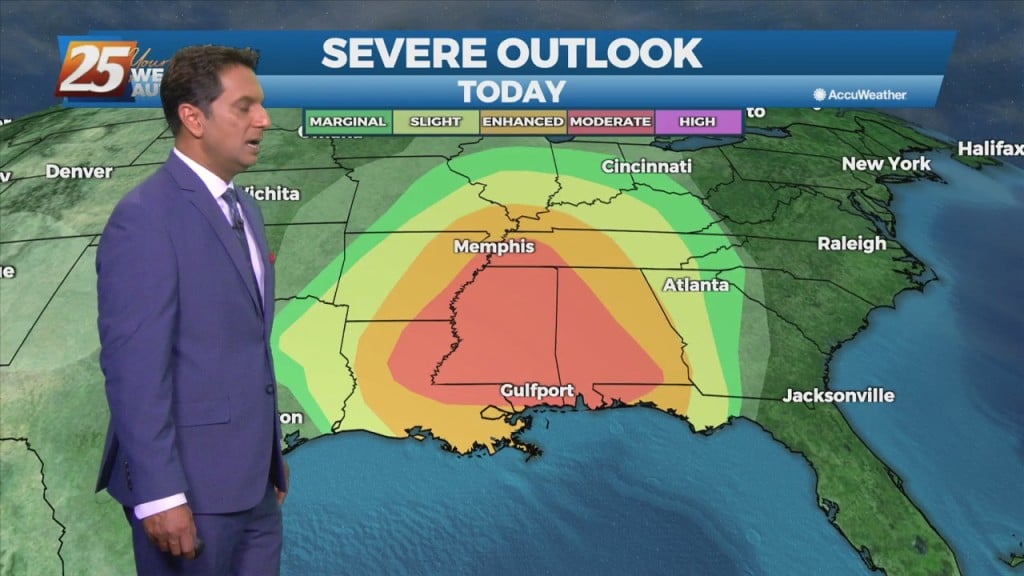
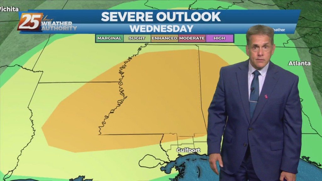
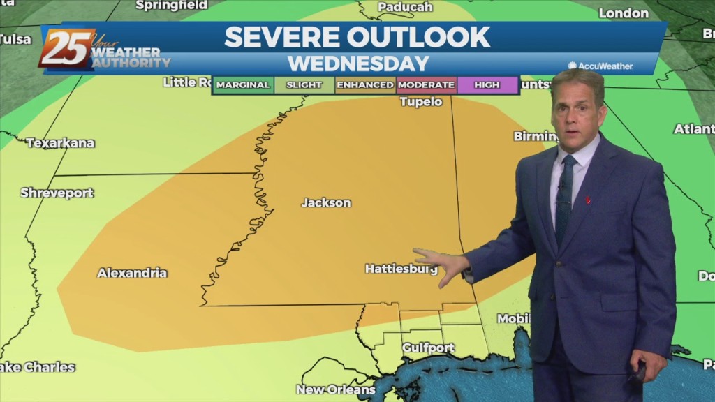
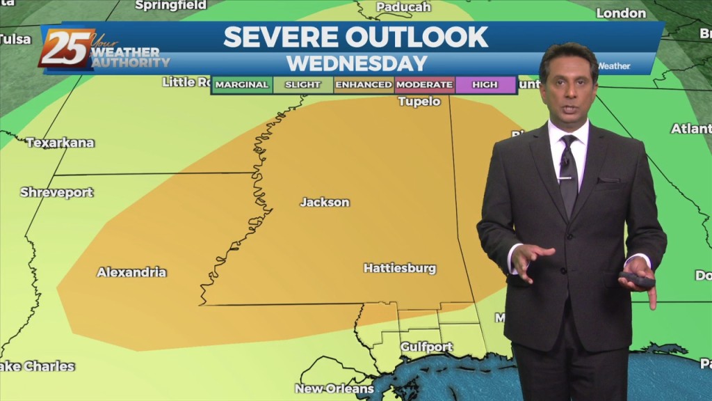
SEVERE STORM THREAT INCREASING FOR WEDNESDAY. The entire forecast area is now in a category 4 (out of 5) for severe potential Wednesday evening and night. Rarely do we see that 4th category, let alone in all the way to…
SEVERE STORM THREAT INCREASING FOR WEDNESDAY. The entire forecast area is now in a category 4 (out of 5) for severe potential Wednesday evening and…
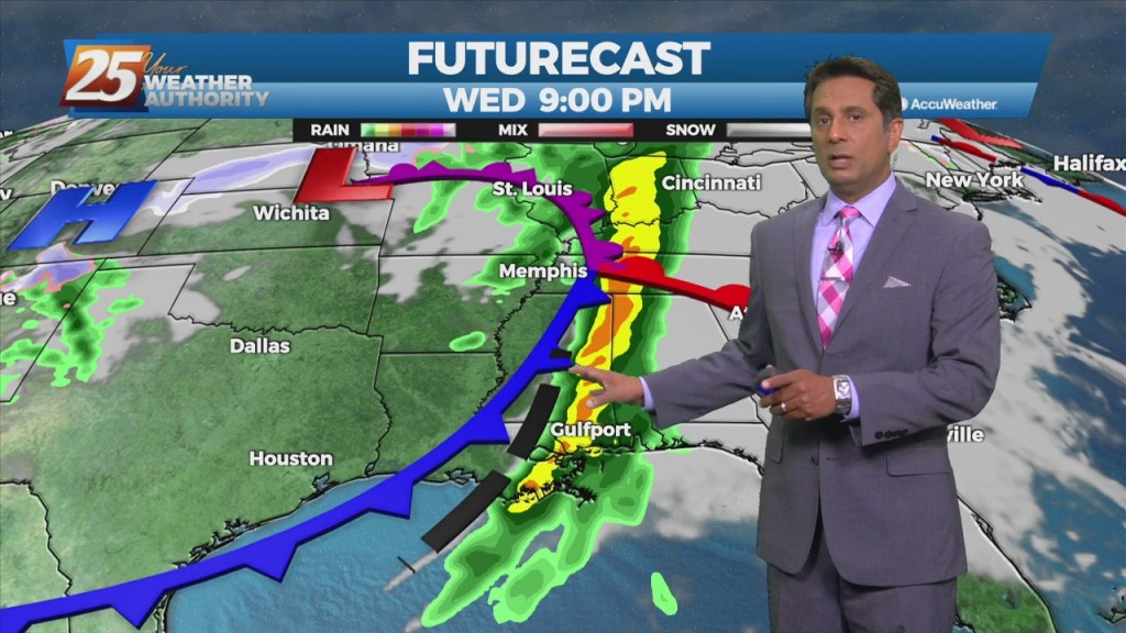
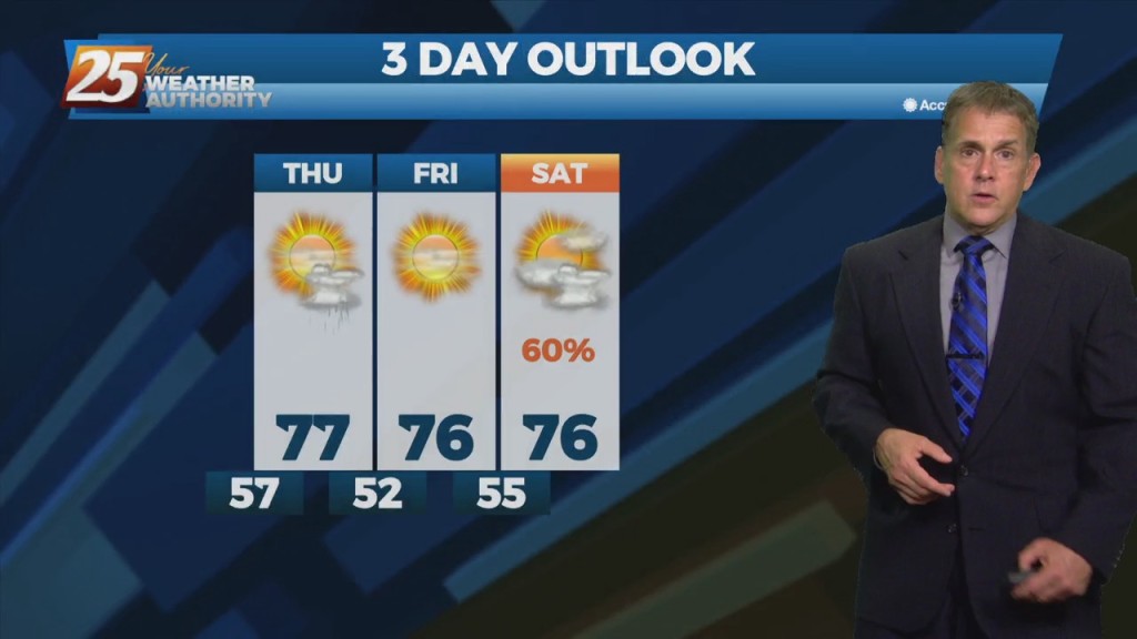
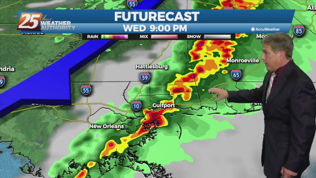
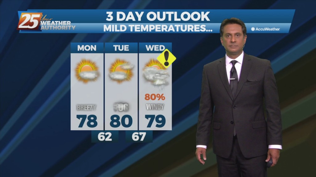
Very strong wind event and severe weather potential is expected Wednesday and Wednesday night... A quiet day with the exception of fog this morning but…
Expect a pleasant Monday night and Tuesday with a few clouds through the night and more passing clouds Tuesday. Fog will be a factor Tuesday morning but…
Above-normal temperatures have arrived and will stay with us early this week. Expect a pleasant Monday evening and Tuesday with a few clouds through the night…
A pleasant afternoon with a few clouds and plenty of sunshine. Fog will be a factor the next few morning but not in every location and may be…
A weak stationary front overhead will drift north with cloud coverage this morning then sunshine this afternoon. Fog will be a factor the next few morning but not in…