6/29 - The Chief's "Tracking The (GOM) Tropics" Wednesday Morning Forecast
A northern stream has become somewhat more progressive with high-pressure moving east of the Rockies and disturbances along the west coast and moving across the…
A northern stream has become somewhat more progressive with high-pressure moving east of the Rockies and disturbances along the west coast and moving across the…
George and Stone counties again received the heaviest showers today. Spotty downpours popped up again, an increasing trend as we head through the week. Broad…
Spotty downpours popped up again today, an increasing trend as we head through the week. Broad low pressure over the western gulf combined with high pressure…
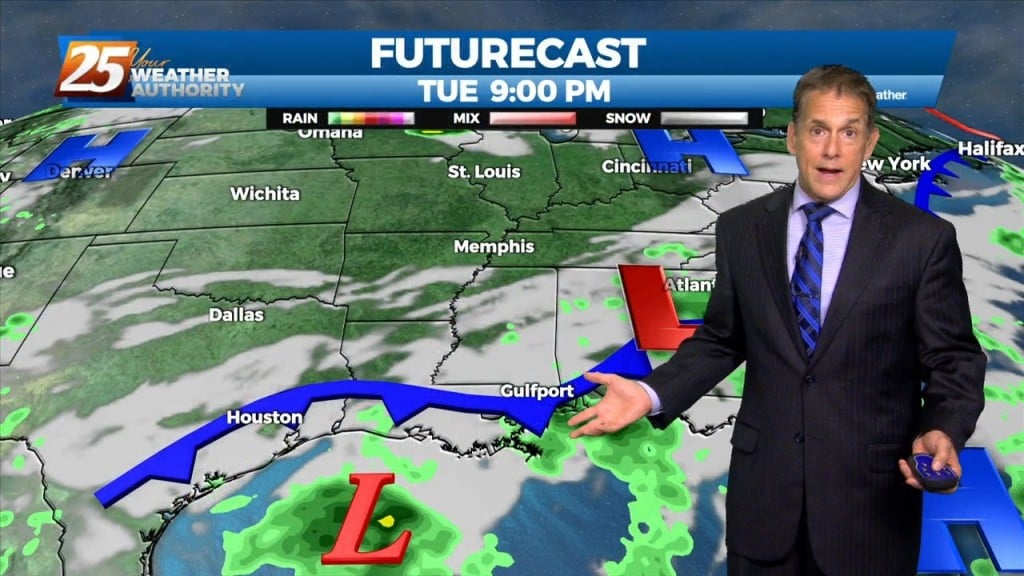
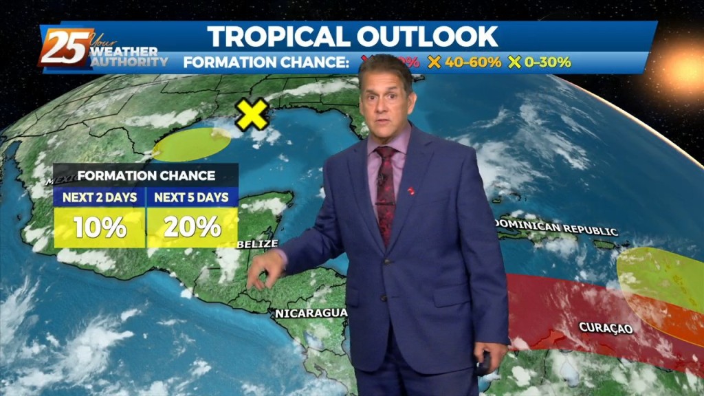
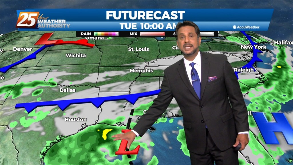
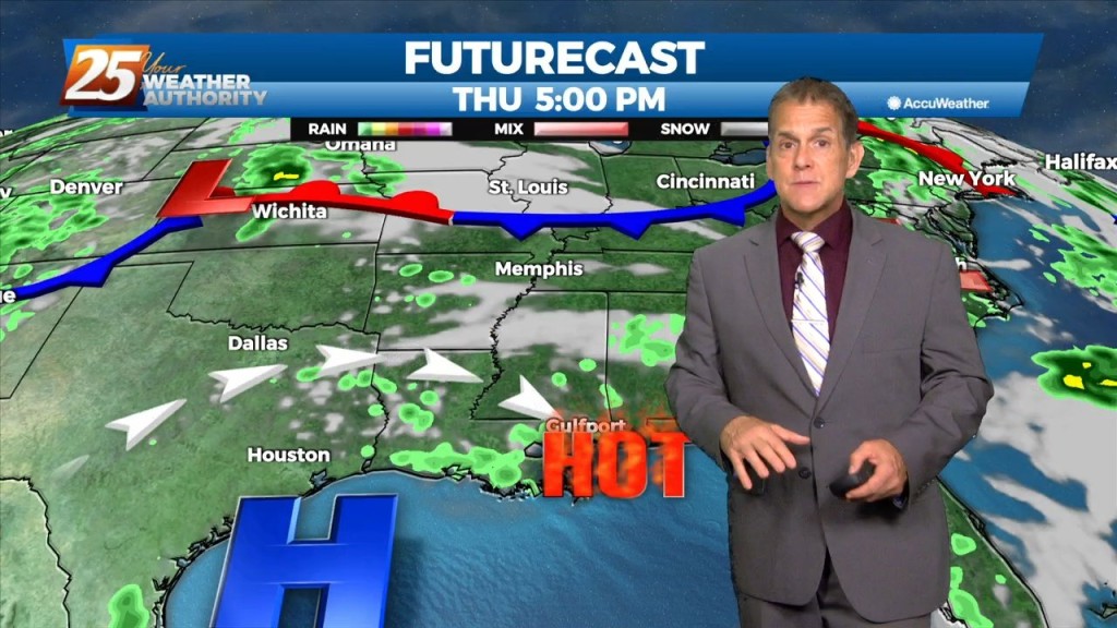
The area of disturbed weather over the Gulf of Mexico appears to be centered south of Lake Charles, which will drift slowly westward over the next…
High-pressure is currently over the Rockies, with low-pressure along the Atlantic Coast. The area of disturbed weather over the Gulf of Mexico appears to…
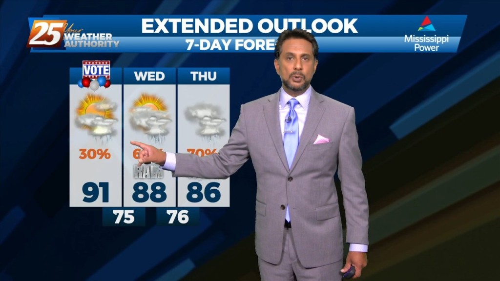
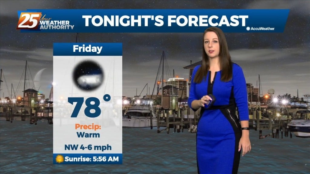
Spotty, heavy showers popped up again Monday afternoon, and we’re expecting increased coverage as we head through the week. On top of that we’re done with…
We’re finally going to get some much-needed rain around here. On top of that we’re done with heat advisories for a while as temperatures return…
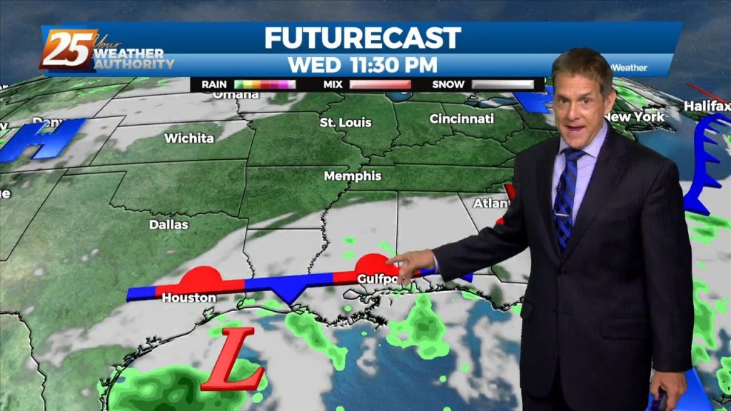
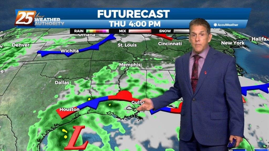
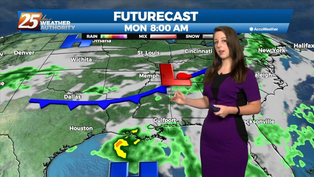
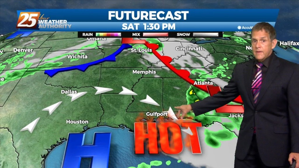
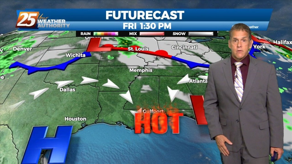
An Upper level low-pressure over the north central Gulf of Mexico will continue to drift slowly westward over the next few days, with blocking pattern finally breaking…
The good news is that the threat of heat related issues has diminished for the next several days. However, that also means dealing with showers…
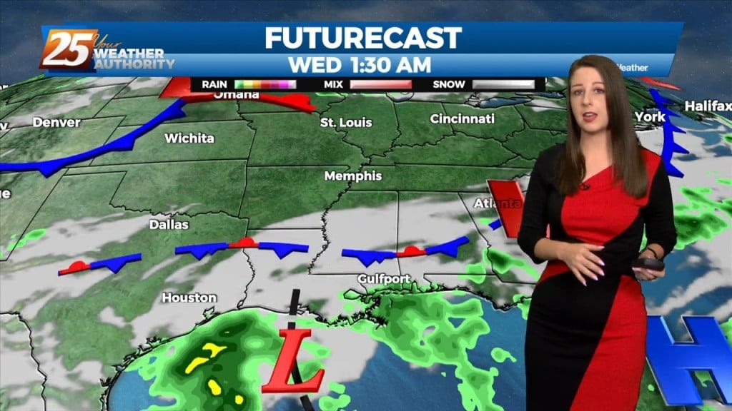
Tonight through Tuesday, an approaching frontal boundary mixed with Gulf moisture influx will enhance rain chances for our area tonight. And a lingering boundary will set up…
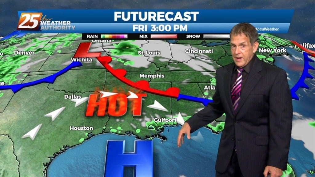
Heat will be the biggest concern through Saturday. There will be the potential for an isolated to scattered shower/storm tomorrow late afternoon and early evening, which could limit…
Heat will be the biggest concern this afternoon through Saturday. The high pressure is still building/staying over our area, and general convection appears to be similar to yesterday,…
Heat will be the biggest concern this afternoon through Saturday. The high pressure is still building/staying over our area, and general convection appears to…

High pressure continues to dominate the upper level pattern. Heat will be the biggest concern tonight through Saturday. The high pressure is still building/staying over our…
Not a lot is going to change between now and Saturday other than subtle changes. The heat will remain into the weekend but some changes are on the way…
Not a lot is going to change between now and Saturday other than subtle changes. The heat will remain into the weekend but some changes are on the…
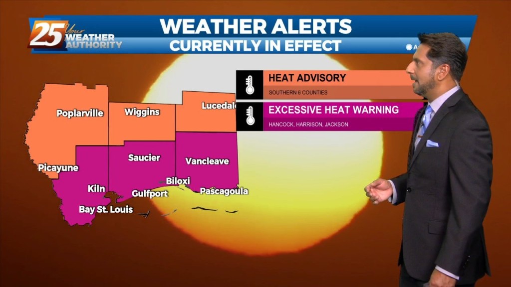
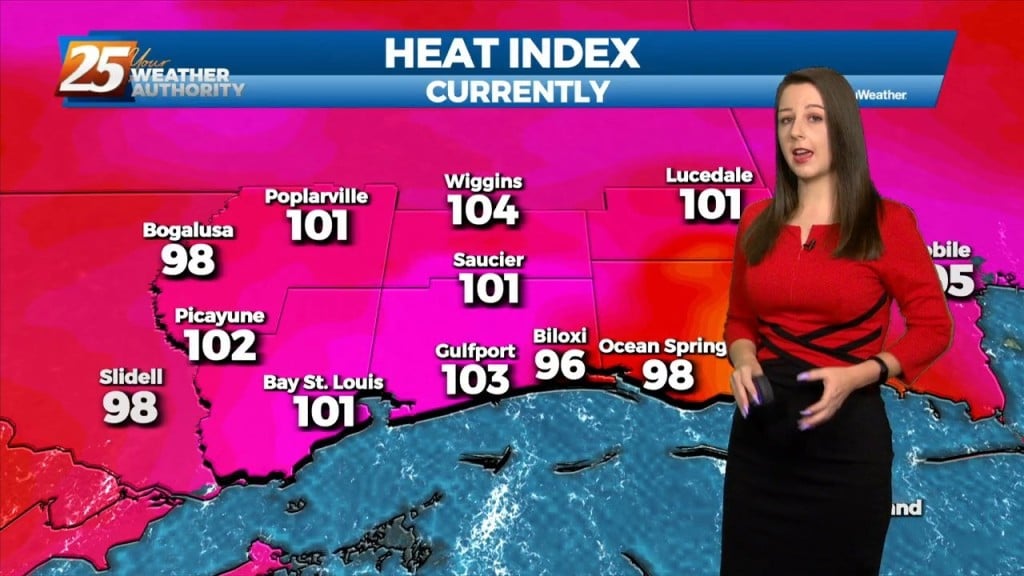
HEAT ADVISORY IN EFFECT - 7PM This afternoon most showers/t-storm activity should be found west of the Miss River close to the coast. A sea-breeze boundary…
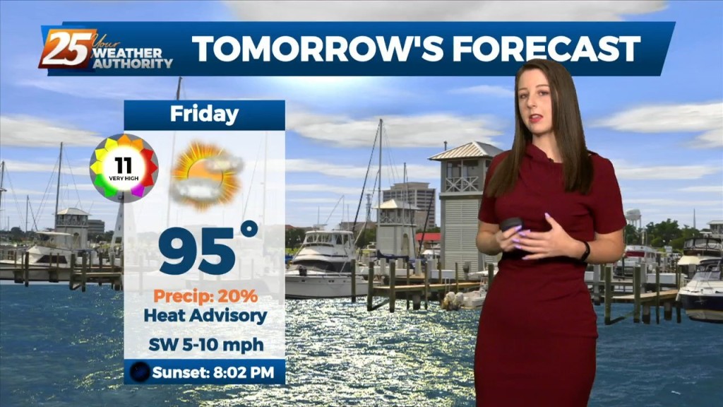
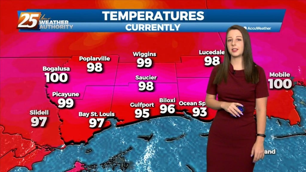
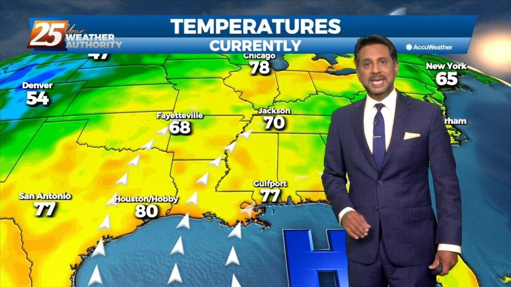
Day one of heat advisories is in the books, and day two comes Thursday. It was certainly hot this afternoon, but we were actually a…
Hot this afternoon yes, but we’ve had hotter this season. The humidity wasn’t as oppressive as it could have been, and that kept that heat index…
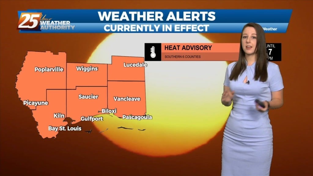
A HEAT ADVISORY IS IN EFFECT This afternoon will bring somewhat warmer Heat Index temps and lower number of showers/t-storms. Placement of highest concentration will also…
There are some subtle differences from yesterday as a heat advisory for today with somewhat warmer Heat Index temps and lower number of showers/t-storms. Placement of highest…
All in all not too bad of a first day of summer. Afternoon scattered storms and showers again put somewhat of a lid on the budding…
Some afternoon scattered storms and showers again put somewhat of a lid on the budding heat, but relief won’t last long. High pressure will build…
The HEAT WAVE CONTINUES... Seems hard to believe, but normal highs this time of year should only be about 90 degrees, but the area will continue…