6/22 – Night Rob’s “Heat Through The Week” Wednesday Night Forecast
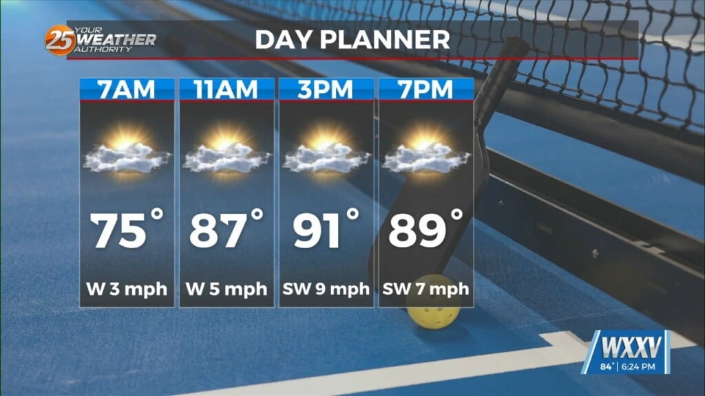
Day one of heat advisories is in the books, and day two comes Thursday. It was certainly hot this afternoon, but we were actually a bit hotter at the end of last week. The humidity wasn’t as oppressive as it could have been, and that kept that heat index “down” a bit compared to what it could have been. However, real-feel temperatures did nudge that heat advisory criterion of 108, and remember this is only day one of several advisories. Pascagoula led the way when their real-feel briefly hit 114. Most of the t-storm activity has been to our north today, so expect less relief in that regard. Heat index values could approach warning criteria for the next several days and could get into the lower end of these numbers (113+) over the same time frame, especially Friday and Saturday.
Remember, heat is cumulative, so it’s very important to take frequent breaks in shade or cooling area when working or otherwise outdoors. Overnight temperatures will also remain elevated, and by Friday and Saturday might not even dip below 80 degrees.
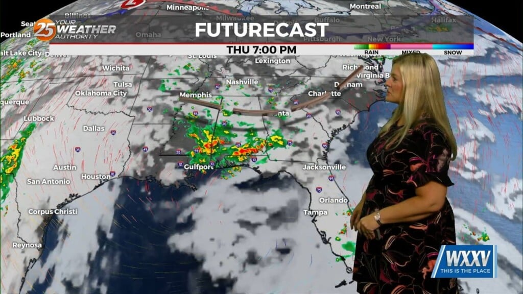
As for showers/t-storms, the area that should have the best coverage will be the northern half of the area especially once the sea-breeze kicks up this afternoon. Thursday looks similar with heat indices number and showers/t-storms developing. But the placement looks to be back in line with the sea breeze boundary along and west of the Mississippi River, so again little to no relief. High pressure that has been keeping the temperatures above normal will shift eastward slightly on Friday, giving us no relief from the heat though. On Saturday, the center of it actually moves directly over the area, raising temps just slightly. By Sunday, the ridge will weaken enough to allow a minor disturbance to move under it and create the best chance of rain for the next few days.
As for long-term temperatures, Sunday should be a bit cooler with highs in the mid 90s, mainly due to storms and more cloud cover. We could cool a tad more next week, but even then temperatures will remain above normal.