11/9 - Rob's "Improving Conditions" Thursday Morning Forecast
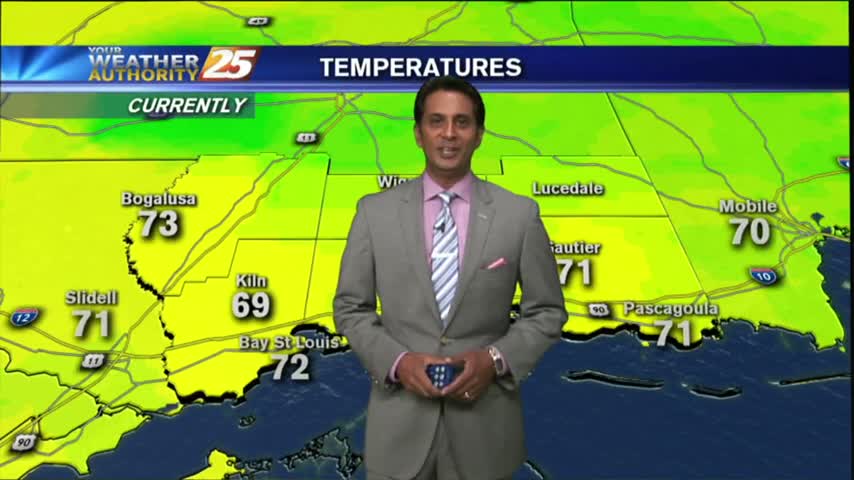
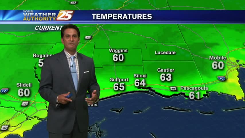
With cloudy skies and light rain moving across the region, cooler temperatures have moved into the Mississippi Gulf Coast...
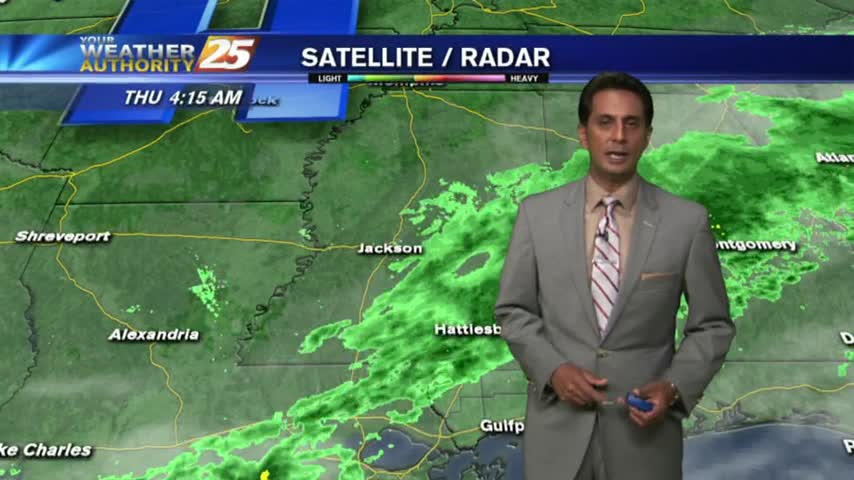
With cloudy skies and light rain moving across the region, cooler temperatures have moved into the Mississippi Gulf Coast...
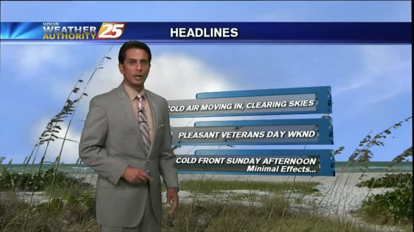
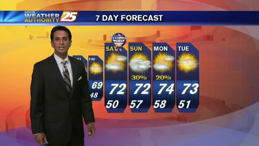
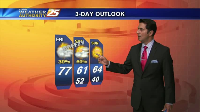
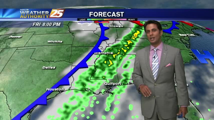
After a cloudy and cooler start to the day with light rain moving across the area, skies have cleared with BREEZY conditions moving in...
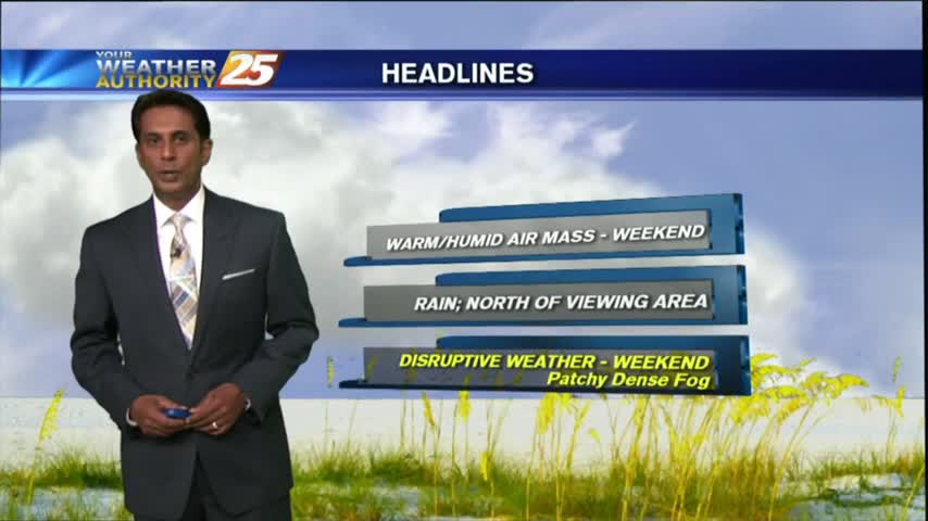
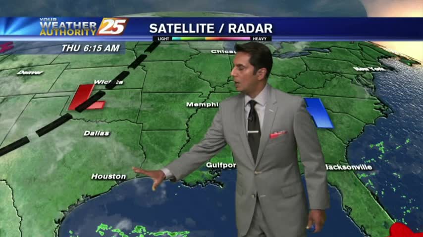
Disruptive weather (Fog) continues as a cold front is now overhead...providing for isolated rain through the region.
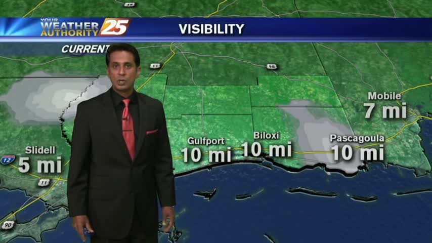
After a FOGGY start to the day, visibility has improved considerably with cloudy skies and light rain in the area/region...
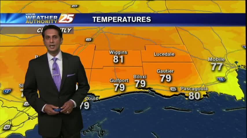
This morning started off with warm/humid conditions along with DENSE FOG, this afternoon and the weekend will bring Summer-like conditions...

Another warm & humid start with above seasonal conditions and areas of DENSE FOG. A DENSE FOG ADVISORY is in effect through mid-morning...
After a warm/humid start to the day, above seasonal temperatures continue with mostly cloudy skies along the viewing area...
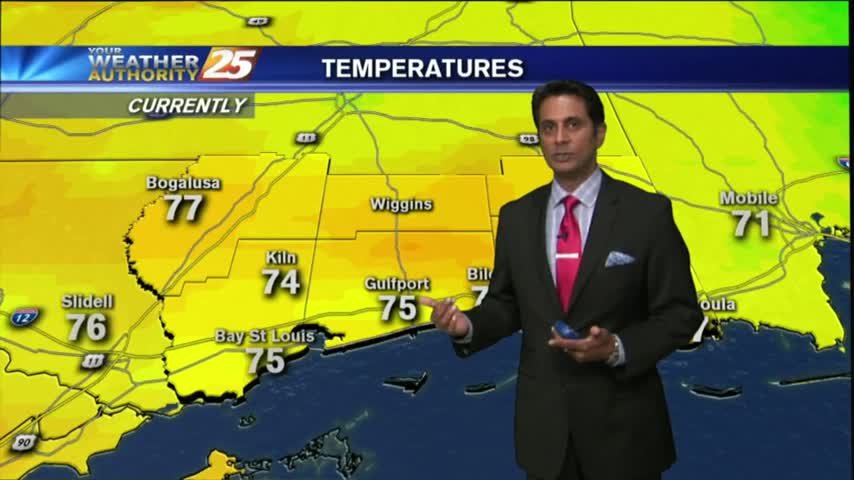
A cool but warmer start to the day as the pattern has begun to shift...bringing warmer more humid conditions to the region...

After a COLD weekend, it's another COLD start to the day but the air mass will begin to modify as early as this afternoon...
After a mostly clear start to the day, clouds continue to increase in advance of an approaching cold front along with warm & humid conditions...
As the south wind from yesterday afternoon continues in advance of the approaching cold front, it's a WARMER more humid start to the day...
After another CHILLY morning...changes in the patter is bringing a more humid and unstable air mass in advance of an approaching cold front...
Another CHILLY morning along the Gulf Coast...but major changes on the way will bring the warm-up to the area beginning this afternoon...
After a CHILLY start to the day, temps continue to struggle to get into the 70s as an abundance of sunshine dominates the region...
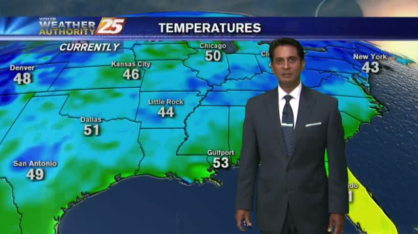
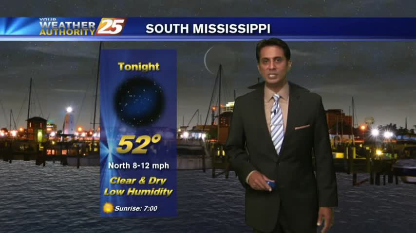
With clear skies and a north wind overnight, some of the COLDEST temperatures of the season thus far has settled along the Mississippi Gulf Coast...
After a chilly night, COLDER air is on the way with a dry front overhead moving east. A reinforcing shot of COLD/DRY air will begin moving into the area...
In the wake of yesterdays BUMPY cold front, the front and activity is now east with clearing to occur this morning...
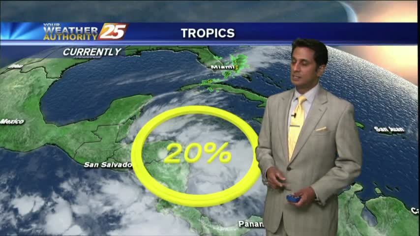
A warm and humid Friday afternoon heading into the weekend which could bring a SLIGHT THREAT for SEVERE Weather...
As the pattern begins to shift, it's a cool start to the day with a humid air mass beginning to move into the region...

After a clear start to the day, warming temps and low-level moisture flow has developed a few clouds along the coastal counties...
Another cool start to the day but the humidity has already begun to increase heading into the weekend...
In the wake of yesterdays cold front, a cooler/drier air mass in now dominating the region with CHILLY morning temps...
With a cold front clearing the area, this morning brings cloudy skies and isolated showers/t-storms moving east...

After a BEAUTIFUL start to the day with drier air providing for lower humidity, a LOVELY Friday afternoon is on-tap...