9/16 - Rob's "Hot & Cloudy" Midday Forecast
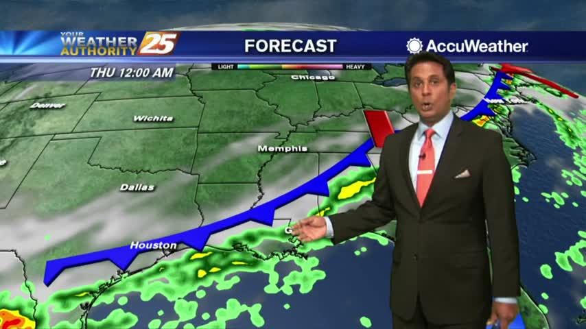
Upper level clouds continue to stream across the area as temps climb into the mid/upper 80s...
Upper level clouds continue to stream across the area as temps climb into the mid/upper 80s...

A beautiful start to the day with clear skies and nice temperatures in the upper 60s to low 70s...
A very nice start with clear skies and temperatures in the low/mid 70s...
As the tropical moisture continues to flow into the area, spotty rain is moving north through south Mississippi...

A very warm start to the day along with areas of PATCHY FOG...

After a BEAUTIFUL clear start earlier this morning, daytime heating has developed a few clouds along the coastal counties...
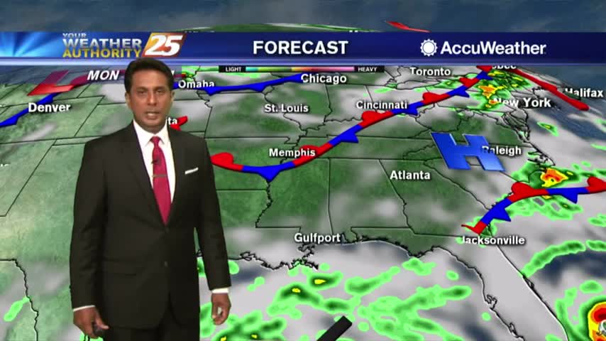
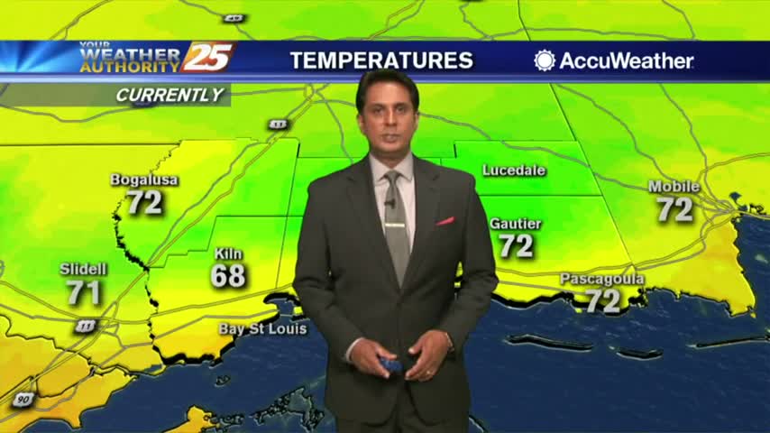
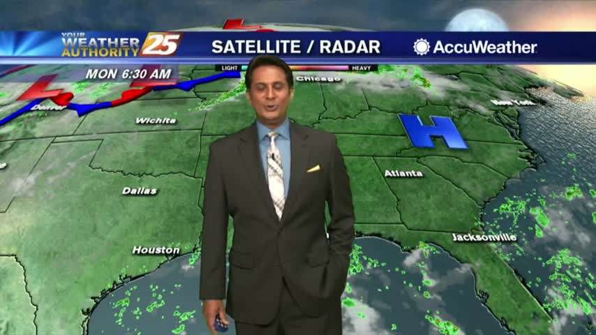
With a cold front NW of the area, it's a warmer and humid start to the workweek...
A DRY front moved through last night with very low humidity and chilly temps through the state this morning...

A CHILLY start to the day with upper-level clouds from the SW moving into the area...

After a FRIGID start to the day, it's still cool but an abundance of sunshine dominates...

The cold air is back in the region as an area of high-pressure to the NW brings extensive cloud coverage...
It's a chilly start to the day with thin upper/level clouds moving across the area...
After a TON of rainfall Saturday, COLDER air moving is will begin to clear the cloud coverage...

The cold front continues to move further east as the cloud coverage lingers back to our west...

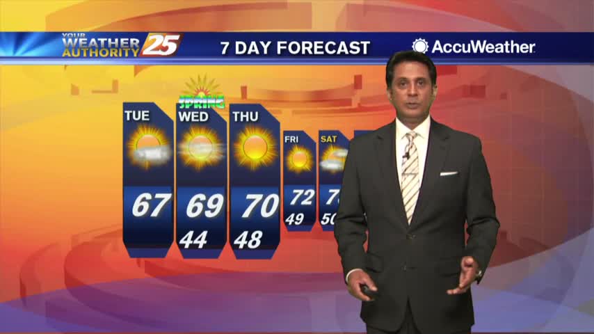
The cooler air mass from this past weekend has modified with a stationary front just to our south...

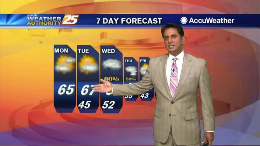
After a chilly weekend, the air mass has begun to modify with warmer temps in the area to kick-off the workweek...
the first day of October is starting off with warm/humid conditions under mostly cloudy skies...
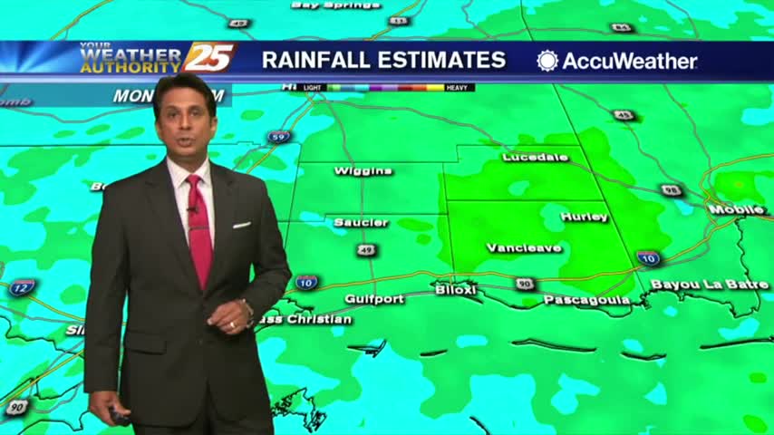
Another rainy morning along the viewing area with warm and humid conditions...
A wet start to the day/workweek with showers moving in from the Gulf of Mexico...
A lovely start to the workweek under clear skies and mild temperatures in the 70s...

Showers and t-storms moving in from the GOM, have the rain gear handy heading out the door...
A humid start to the week with light patchy fog and a few light showers moving in from the south...

It's a warm start to the day with mid/upper level clouds moving in from the NW and thinning...
Under a good bit of cloud coverage, we have warm temperatures to kick-off the workweek...