1/1 - Rob Knight's New Year's Day "Morning News" Forecast
Another wet and foggy start to the day and the New Year as the cold front has stalled to the east of the viewing area...

Another wet and foggy start to the day and the New Year as the cold front has stalled to the east of the viewing area...

Spotty rainfall continues to move across the area as temps have not bugged from the overnight low of around 70 degrees...
Much warmer temperatures this afternoon in advance of an approaching warm front later this evening...
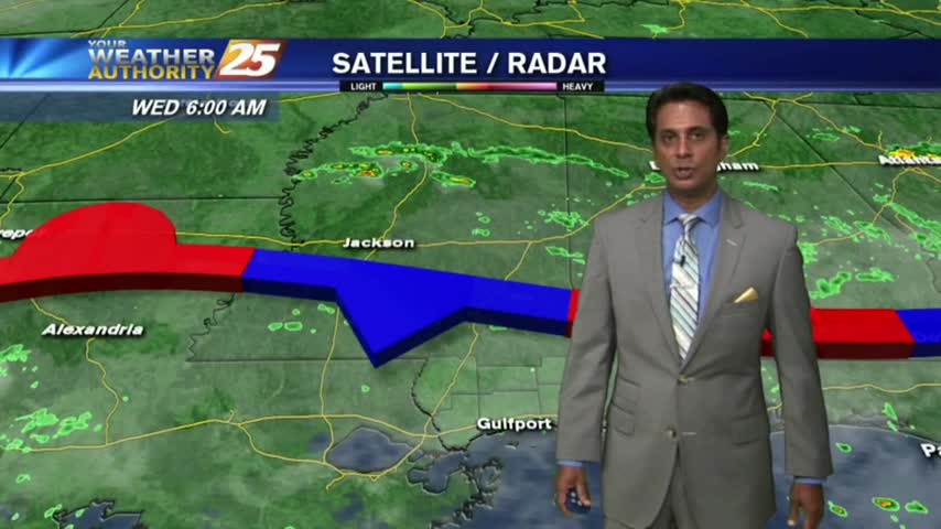
A cold front to our north has brought light rain and patchy dense fog for your morning commute...
A warm and humid start under mostly cloudy skies and a few light showers moving in from the SW...

Shortly before 9 a.m., a single car rollover accident led to the driver being rescued by multiple units on Interstate 10 during today’s heavy rains. The passenger and driver of the vehicle were taken by AMR to an area hospital…
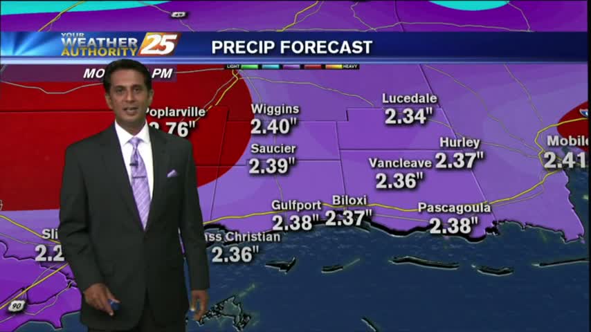
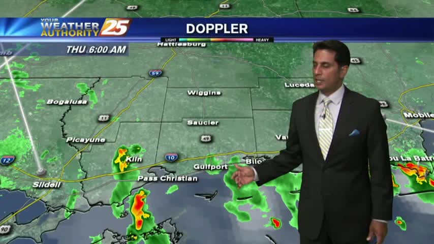
HEAVY RAINFALL has already moved across the viewing area this morning, with more to come...
A humid start to the week with light patchy fog and a few light showers moving in from the south...

A similar start to yesterday morning with isolated shower/t-storms over the sound, which will move ashore later this morning...
Isolated showers/t-storms south of the area overnight has been slowly moving north into the coastal counties...

This morning we have isolated activity south, moving into the viewing area...
Overnight activity has dissipated but activity will redevelop this morning and then again this afternoon...
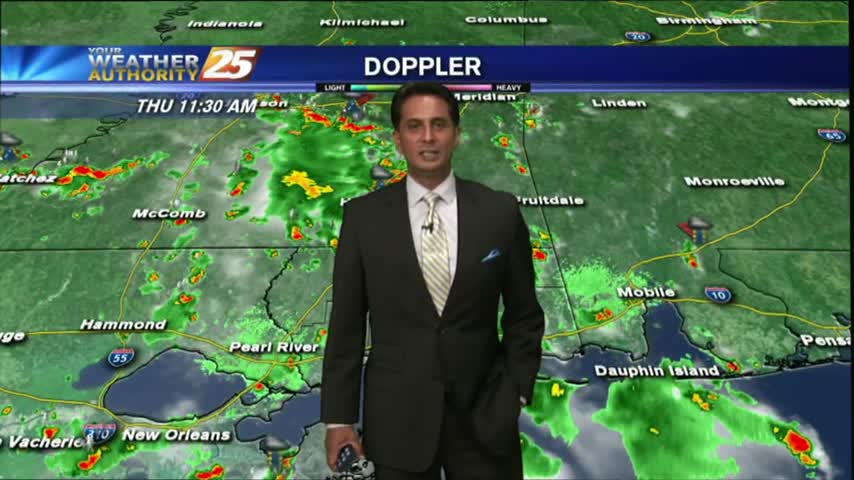
Isolated showers/t-storms are in the area this morning with the threat for HEAVY RAINFALL today...
As TS Franklin moves west across the bay of Campeche, it's a warm/humid start to the day with light rain moving in from the GOM.
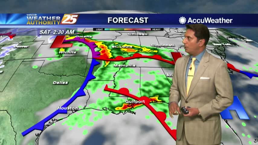
The stationary front from the south has moved into the area as a warm front with widespread rain through the region...
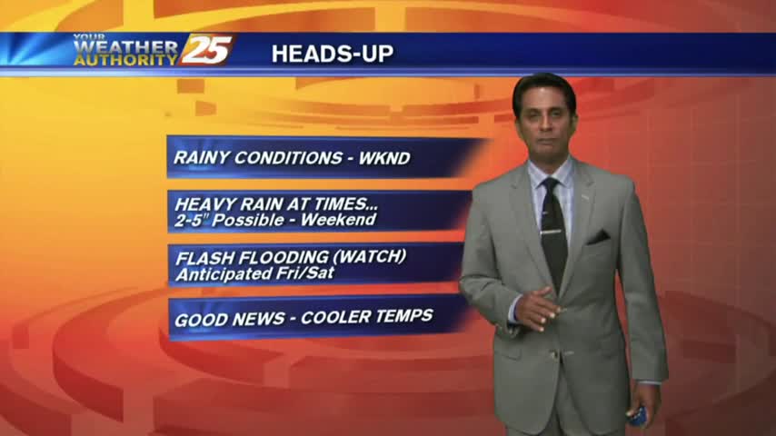
A quasi-stationary front will move into the area from the central Gulf of Mexico later this evening...the WET PATTERN will begin.

A DRIER start to the day but similar to yesterday, activity will develop and move across the viewing area from west to east...

As the tropical air mass continues to dominate the region, showers/t-storms from last night continues to move in from the south...
Showers have been hugging the coast since prior to sunrise...with the activity moving onshore, continuing to develop...
Another warm/humid start to the day with overnight showers/t-storms over the n'tern GOM/Sound moving north into the Southern 6...

With showers, storms in tonight and tomorrow’s forecast, police say they’re expecting to see accidents hike up. News 25’s Gina Tomlinson spoke with authorities about how to make the safest commute when the roads are slippery. Wet roads are responsible…
Isolated morning rain is moving in from the Gulf/Sound, with the activity expected to increase...

Partly cloudy skies this morning with slight cooler temps from showers and t-storms overnight...

The heavy rain has subsided temporary...