03/26 Ryan's "Technically Drier" Friday Night Forecast
This week started clear and sunny but will end grey and damp, a trend we'll continue into next week.

This week started clear and sunny but will end grey and damp, a trend we'll continue into next week.
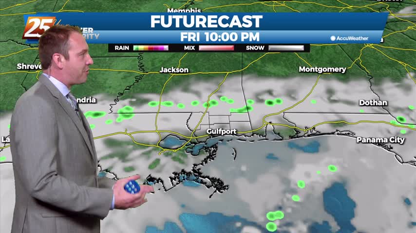
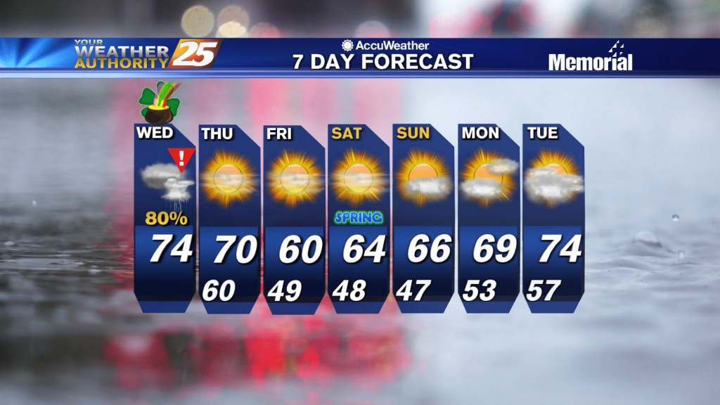
It's been a wet and stormy few days, but things are finally calming as we head into the weekend.
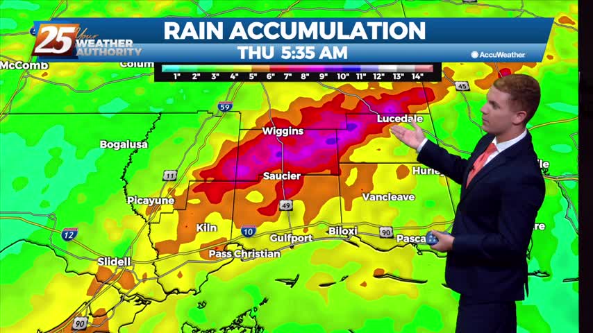
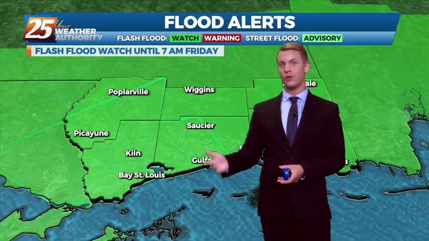
The threat for widespread flash flooding has come to an end, and thus the flash flood watch has been cancelled early. Isolated heavy rain showers and thunderstorms are still expected Thursday, and could still lead to an isolated threat for…
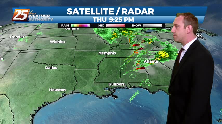
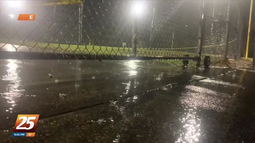
After even more rain today, flooding issues are becoming more and more obvious with another stormy day ahead....

The Harrison County Emergency Management Agency warns residents that flooding is one of the biggest concerns during the rain event. The water from the rainfall has to go somewhere, meaning low-lying areas like rivers. All of the…

News 25’s Lorraine Weiskopf is in Harrison County with an update from Harrison County EMA.
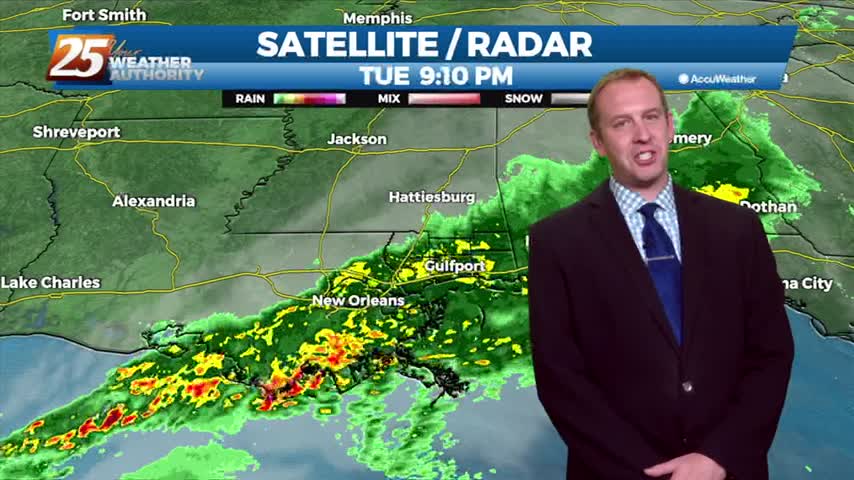
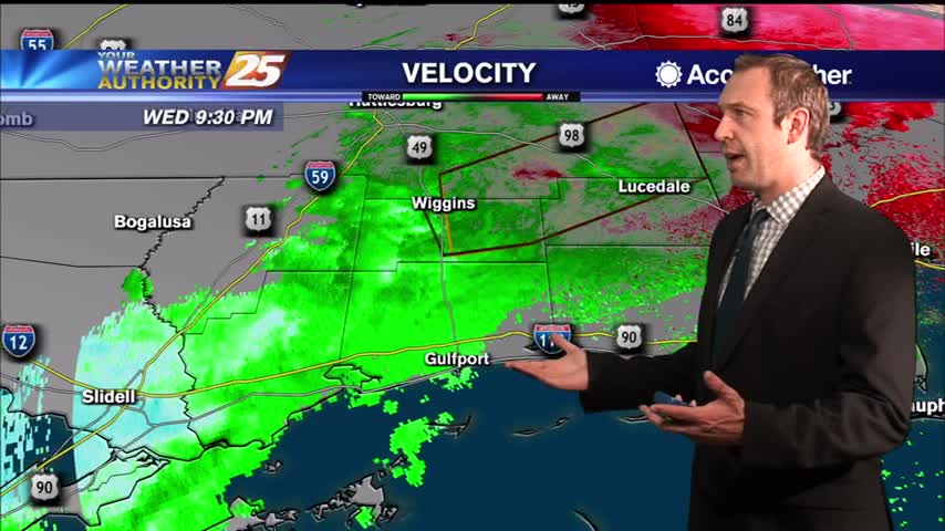
Showers and thunderstorms with heavy rainfall continue to push into the area from the southeast with deep Gulf moisture. Doppler radar indicated heavy rain due to thunderstorms. This is causing urban and small stream flooding. As of early this morning,…
Today was a complete 180 after yesterday's clear skies, and the bad news is the rain isn't stopping anytime soon....
News 25’s Grace Boyles has more on the weather conditions around the Coast.

With the predicted rainfall, the Harrison County Emergency Management Agency warns residents of potential flooding in low lying areas, creeks, and rivers. Residents should monitor weather and take the necessary precautions to make sure their property is…

In anticipation of what could be a three-day weather and rain event for Harrison County, self-serve sandbags will be available at the following locations. Harrison County Road Department: 10076 Lorraine Road in Gulfport District 1 Work Center, D’Iberville: 10085 Doris…
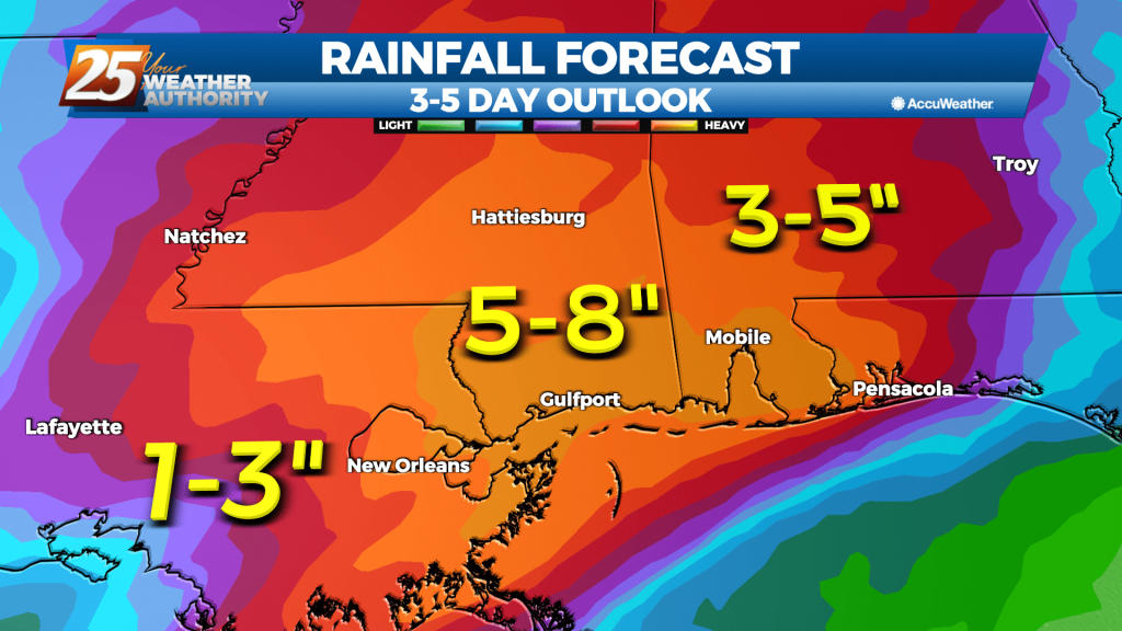
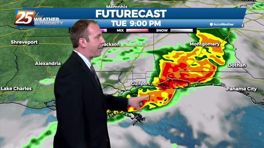
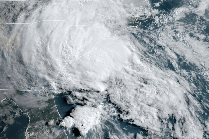
Heavy rain may lead to flash flooding along the Mississippi Gulf Coast over the next couple of days. Tuesday, expect scattered showers through the morning. By Tuesday afternoon, widespread showers and thunderstorms with heavy downpours will move into the area.…
Today was a beautiful start to the week after cooler, drier weekend, but heavy rain will return to the Gulf Coast sooner rather than later....
High pressure will linger over the area tonight through Monday, which will help to limit rain chances. Winds will be shifting from northerly to southerly during the next day or two, so some moisture and warm air will be able…
High pressure will linger over the area tonight through Monday, which will help to limit rain chances. Winds will be shifting from northerly to southerly during the next day or two, so some moisture and warm air will be able…
Weird we only saw one clear day after Wednesday's front, but these clouds won't last much longer before the sun returns.
No severe weather last night, but that cooler and drier air is moving in rapidly after yesterday's front.
After a stormy night, a much cooler and drier airmass is now moving over the Gulf Coast in the wake of a cold front. Expect breezy conditions today as westerly winds shifts to more northwest to north at about 10…
The line of storms expected tonight has sped up some, and will be quickly leaving the area through the early morning hours.
By SETH BORENSTEIN The Atlantic hurricane season seems to be changing and so are some assumptions about it, with meteorologists dumping the Greek alphabet for busy seasons like last year. Meteorologists Wednesday eliminated Greek as back-up if there are more…
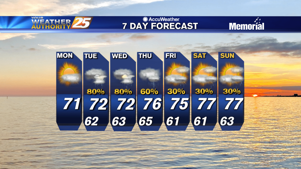
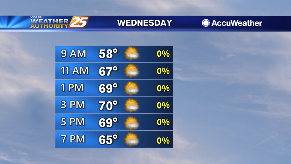
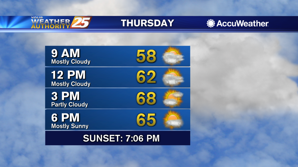
Scattered showers and a few thunderstorms will continue on and off through Thursday afternoon. Expect rain chances to be at about 60 percent during the morning Wednesday, rising to about 80 or 90 percent by Wednesday evening. High temperatures will…

Scattered showers and a few thunderstorms will continue on and off through Thursday afternoon. Expect rain chances to be at about 60 percent during the morning Wednesday, rising to about 80 or 90 percent by Wednesday evening. High temperatures will…
Just more of the same from the end of last week as we begin this one, but more rapid changes will be moving in soon.
Cloudy skies will continue for the next few days as we enter an unsettled weather pattern. Highs Monday afternoon will then be similar to today, in the upper 70s to lower 80s north of I-10 and in the mid to…