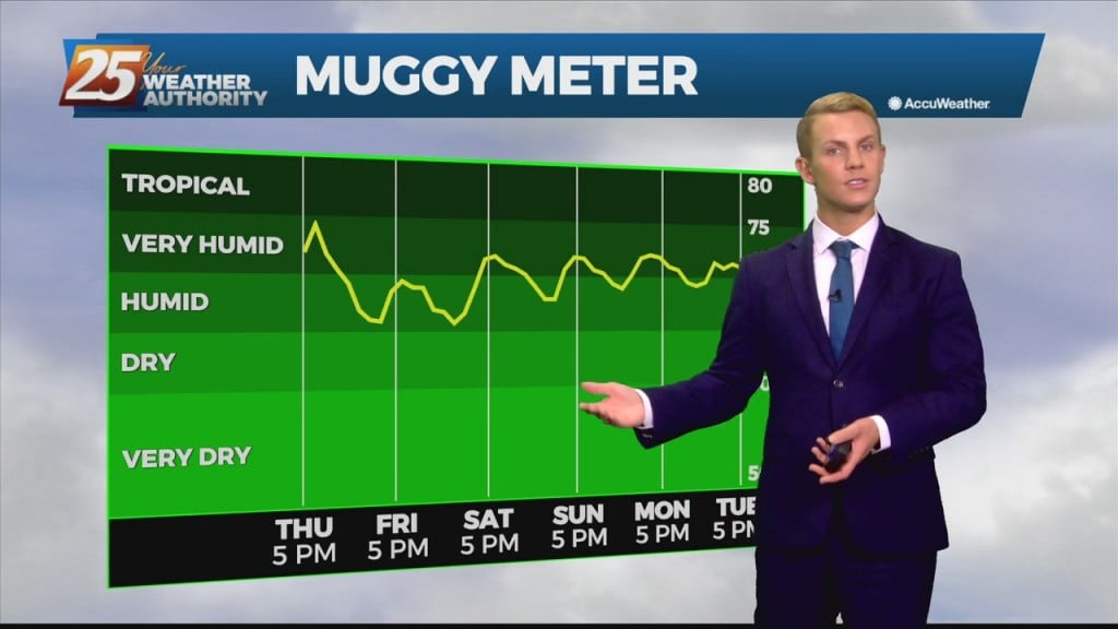
09/13 Ryan's "Grey & Muggy" Monday Evening Forecast
The end of last week was sunny and dry, but muggy air and grey skies have moved in. This was bound to happen eventually, but has been enhanced…
The end of last week was sunny and dry, but muggy air and grey skies have moved in. This was bound to happen eventually, but has been enhanced…
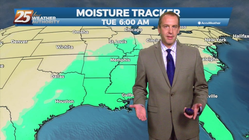
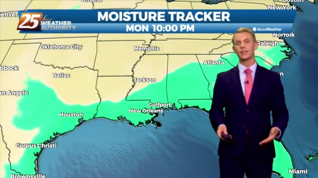
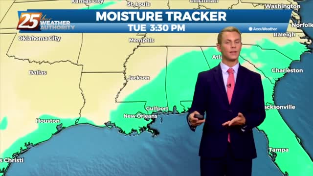
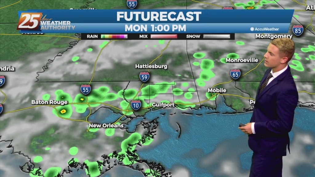
Deep tropical moisture has begun to move north through the area allowing for a return of showers and thunderstorms today. Showers and thunderstorms will continue to increase in coverage as we move into Monday. The day for the most efficient…
Deep tropical moisture has begun to move north through the area allowing for a return of showers and thunderstorms today. Showers and thunderstorms will continue to increase in coverage as we move into Monday. The day for the most efficient…
Last night and today have been a nice teaser of fall weather, but sadly it won't last too much longer. We still have one nice fall-like night left…
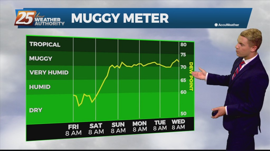
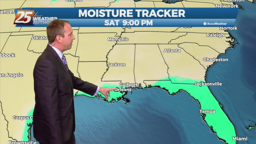
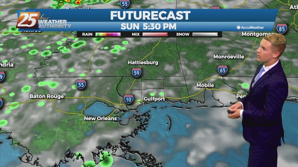
Dry air moving into the Gulf Coast behind yesterday's cold front is giving the area much needed break from the oppressive heat and humidity. These conditions will last through Saturday. Sunday will be a transition day with deep tropical moisture…
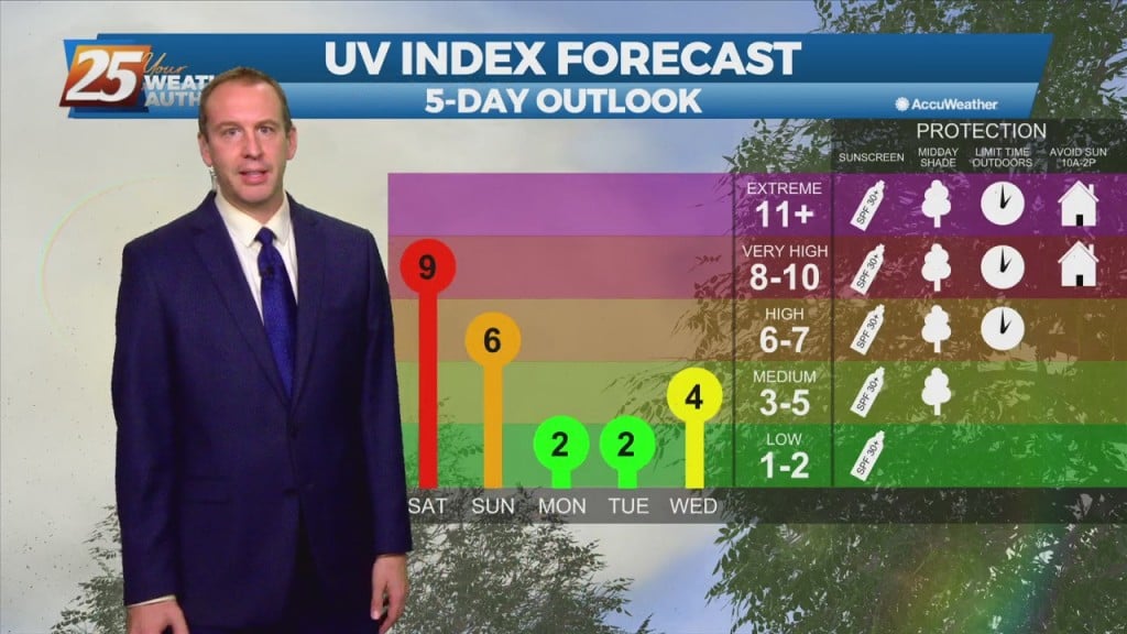
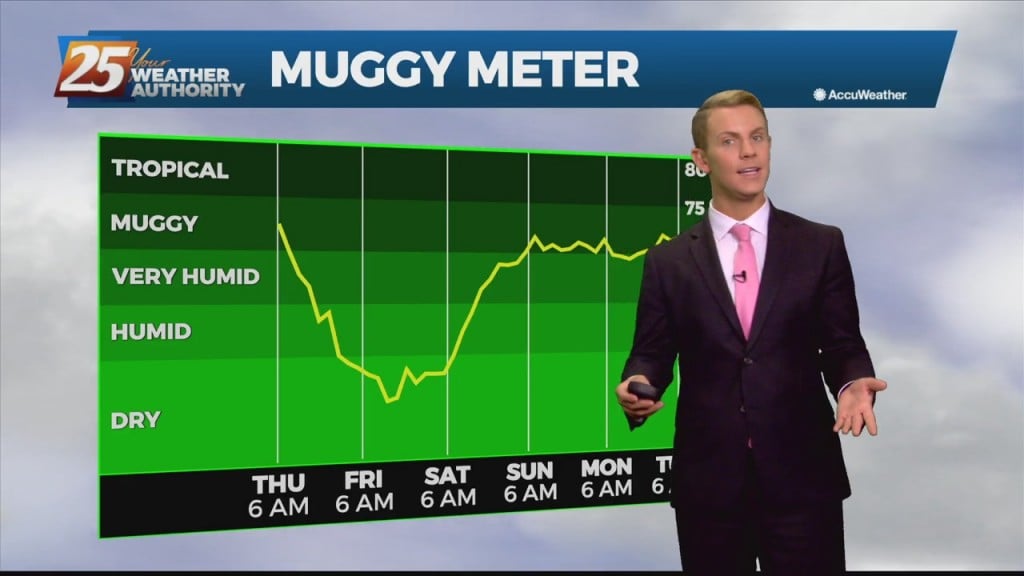
The next few days may be "fall-ish" with hot days and low humidity, but the nights will be much more "fall-like!" Expect tonight to fall into the mid 60s…
Good news is on the way, as the cold front moves through the region during the morning on Thursday and should be south of the area by Thursday afternoon. This will turn the winds northwest to northerly during the course…
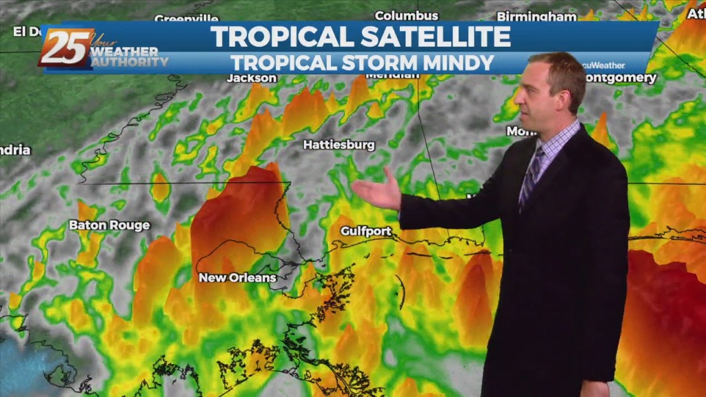
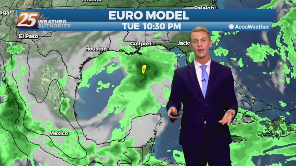
As unexpected as it was from last night's forecast, Tropical Storm Mindy formed today in the Northern Gulf. It's disorganized, and moving rapidly, but will still bring heavy…
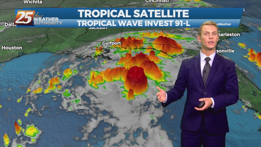
The disturbance over the central Gulf of Mexico is becoming a little better organized this morning, and more models seem to be in a little better agreement with regard to a brief, minimal development of the disturbance. This system is…

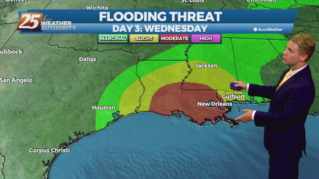
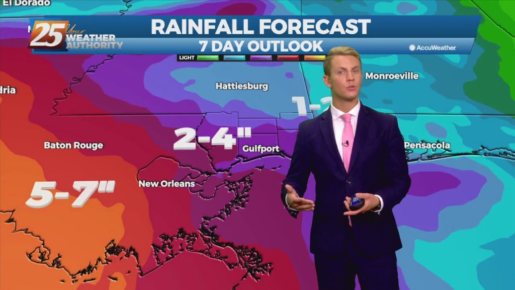
We have more rainy, damp weather ahead, but a cold front will bring drier, less humid weather for the weekend. Probably more prudent to call it a "tepid" front…
We have more rain ahead for the short-term, but a cold front will bring drier, less humid weather for the weekend. Probably more prudent to call it a…
An upper level trough will otherwise continue to dig southwestward and extend across Louisiana into central Mississippi tonight, and then become oriented from near the TX/LA coast through southeast MS during the day Tuesday. The surface front will meanwhile continue…
An upper level trough will otherwise continue to dig southwestward and extend across Louisiana into central Mississippi tonight, and then become oriented from near the TX/LA coast through southeast MS during the day Tuesday. The surface front will meanwhile…
A cold front will approach from the northwest Monday morning with increasing chances for showers and thunderstorms. Isolated to scattered showers and thunderstorms will be possible over the western and northwestern portion of the area through late tonight. Coverage of…
Quieter conditions continue through Sunday as high pressure remains in control over the area. The drier weather will likely come to an end by Monday and Tuesday as the upper ridge breaks down in response to a weak upper trough…
Quieter conditions continue through Sunday as high pressure remains in control over the area. The drier weather will likely come to an end by Monday and Tuesday as the upper ridge breaks down in response to a weak upper trough…
An area of upper-level high pressure will continue to expanding eastward over the entire southeast U.S. through Friday afternoon. The surface boundary will be pushed southward with the storms overnight toward the coast, but then meander back north throughout the…
An area of upper-level high pressure will continue to expanding eastward over the entire southeast U.S. through Friday afternoon. The surface boundary will be pushed southward with the storms overnight toward the coast, but then meander back north throughout the…

A stationary weak trough boundary from the remnants of Ida is still stalled along the northern Gulf coast of LA and MS this afternoon. With this system, there`s enough moisture in the region to support a few storms into the…
A stationary weak trough boundary from the remnants of Ida is still stalled along the northern Gulf coast of LA and MS this afternoon. With this system, there`s enough moisture in the region to support a few storms into…

The end of August signifies the end of our meteorological summer, but the heat lingers for a while longer. In a real world sense that doesn't mean much…
The end of August signifies the end of our meteorological summer, but things won't feel fall-like for some time. In a real world sense that doesn't…
It has been a rough 36 hours for SE Louisiana and South MS, but things will improve rapidly after tonight and tomorrow's last gasp showers. We’re still…
It has been a rough 36 hours for SE Louisiana and South MS, but things will improve rapidly in our post Id phase. We're still going to see…