7/3 - Sam's "Warmer and Drier" Thursday Evening Forecast
It has been a hot and dry day across South Mississippi as we get ready for another hot day on the 4th of July. Expect overnight temperatures in…
It has been a hot and dry day across South Mississippi as we get ready for another hot day on the 4th of July. Expect overnight temperatures in…
Starting out the new work week tomorrow fairly similar to today. Warm again with highs flirting with records in some locations yet again. Breezy at times…
A cold front will move through the central plains and come to an abrupt stall near the Texarkana region late Thu. This will be close enough for…
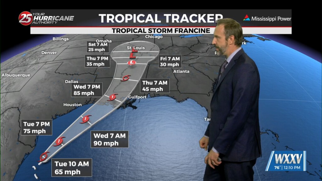
The National Hurricane Center did issue a special 1 PM forecast update for Francine, but no with no significant changes. Francine continues to struggle to organize, but is showing…
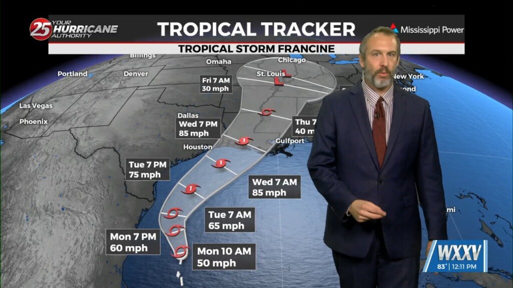
Here's the latest on Tropical Storm Francine, which formed late this morning out of Potential Tropical Cyclone Six: The last few updates have seen little change to the central track.…
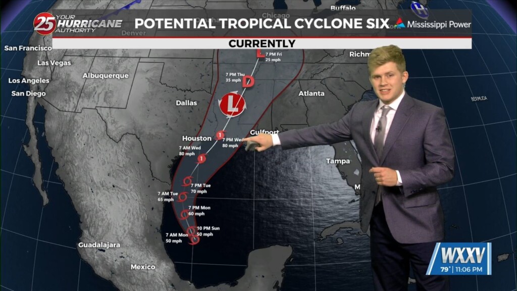
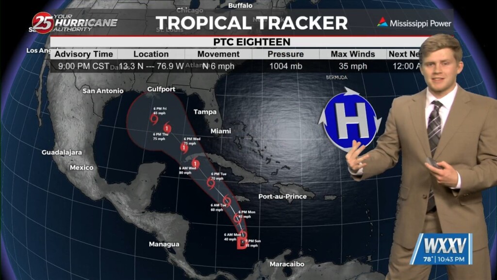
All eyes now shifting towards the tropics as potential tropical cyclone in in the Gulf of Mexico and if forecasted to strengthen into a category 1…
Several locations reached heat indices of 110 F or higher today, few clouds were above our heads this afternoon too. Expect one change for the…
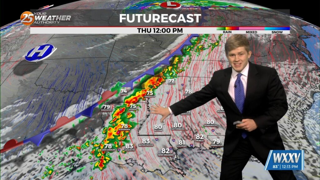
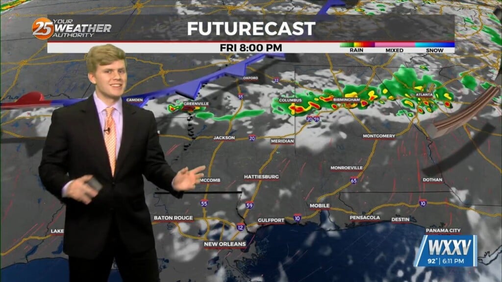
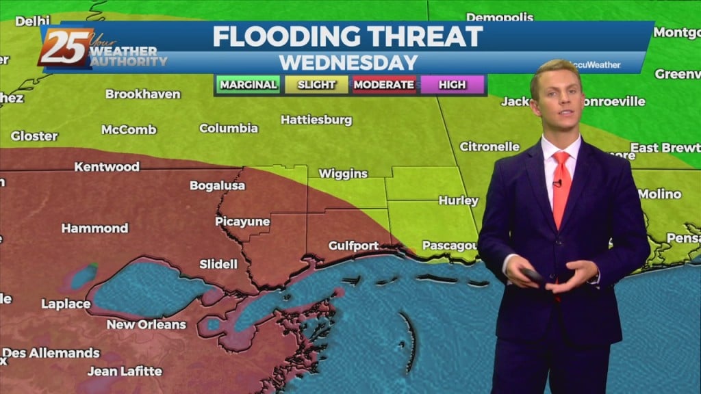
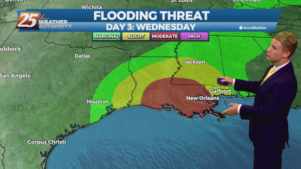
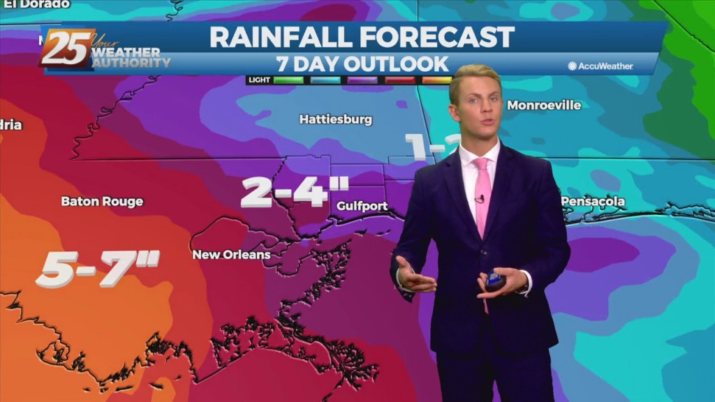
Our brief period of pleasant weather comes to an end for much of the area as we head into Tuesday and Wednesday. Rain chances today move up to about 50 percent for much of the Mississippi Coast, with areas in…
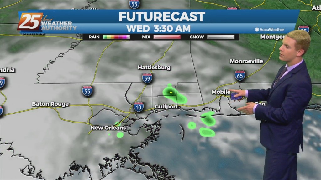
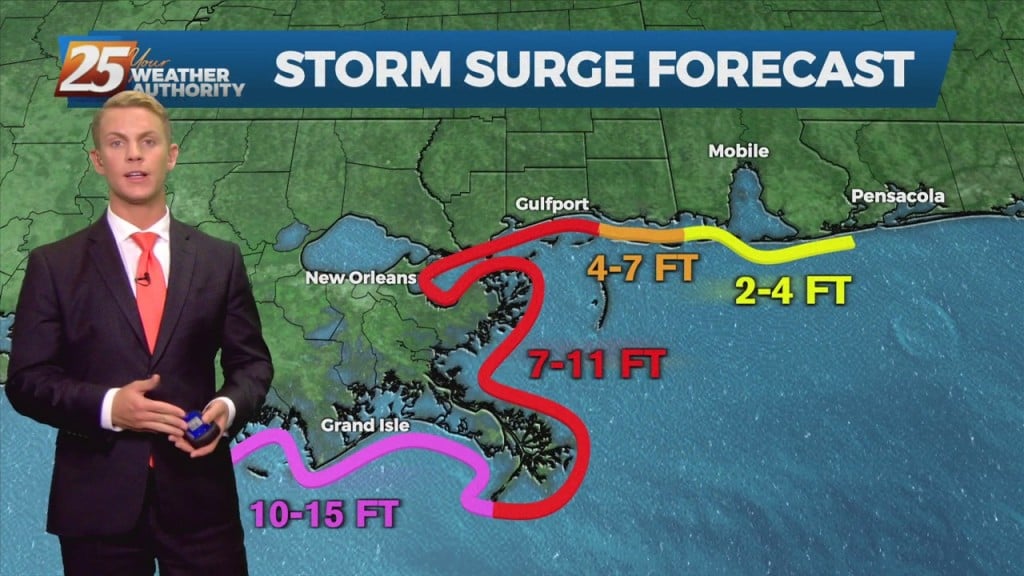
It is not important to just focus on the eventual dissipation of any tropical cyclone. Some of the most damaging and life threatening variables can still be associated with it. Flooding rains and gusty conditions will still be an…
Deep tropical moisture has begun to move north through the area allowing for a return of showers and thunderstorms today. Showers and thunderstorms will continue to increase in coverage as we move into Monday. The day for the most efficient…
Deep tropical moisture has begun to move north through the area allowing for a return of showers and thunderstorms today. Showers and thunderstorms will continue to increase in coverage as we move into Monday. The day for the most efficient…
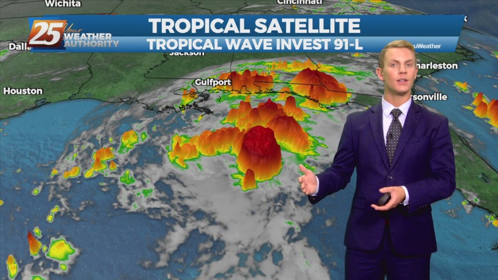
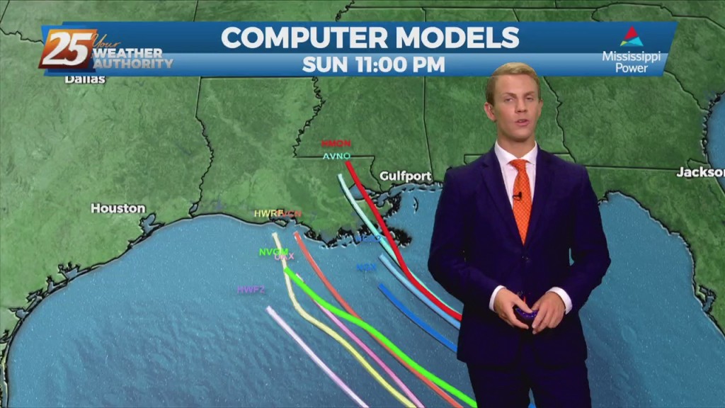
The disturbance over the central Gulf of Mexico is becoming a little better organized this morning, and more models seem to be in a little better agreement with regard to a brief, minimal development of the disturbance. This system is…
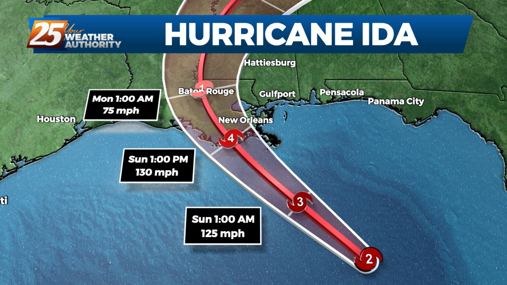
The satellite presentation of Ida has continued to improve this morning with the center embedded within a fairly symmetric Central Dense Overcast and hints of the eye in both visible in infrared satellite imagery. Earlier imagery revealed a well-defined low-to…
Radar data from Cuba indicate that the inner core of Ida has remained intact after its passage over western Cuba with a well-defined eye and relatively symmetric eyewall evident. In addition, satellite images show deep storm activity increasing in both…
Winds from the east and southeast will continue to bring moisture from the Gulf -- a primary ingredient for increased rainfall across the area today. A strong tropical wave will move right across the area today and tomorrow bringing pretty…
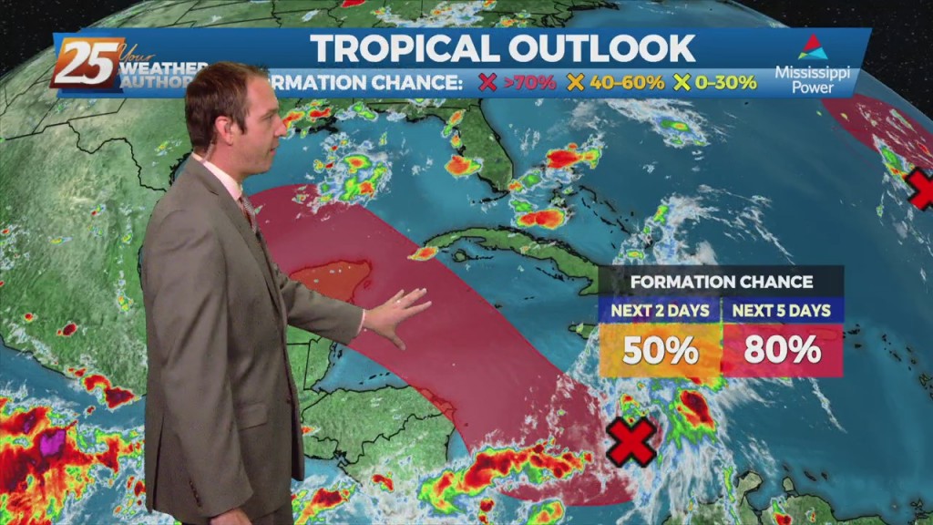
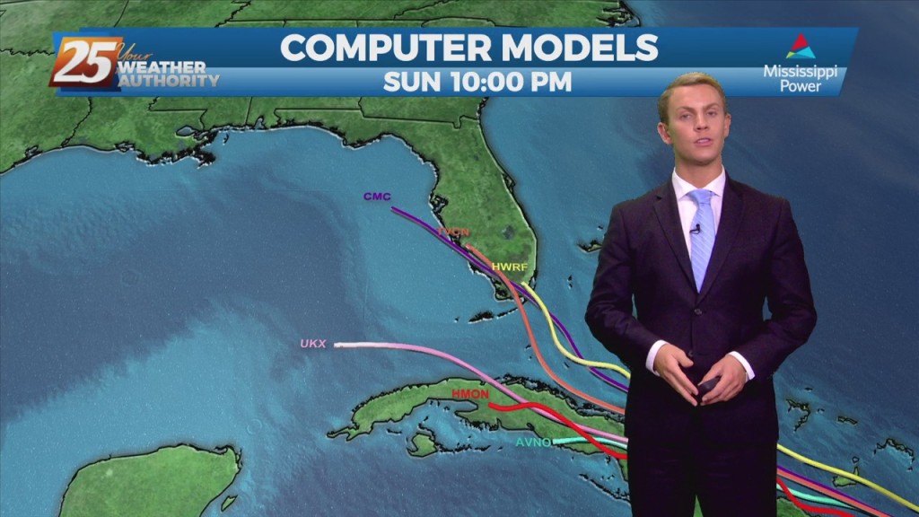
Starting off with the Mississippi Power tropical update today since a developing system has a chance to impact the Gulf Coast. Statistically it's on the lower end in…
The tropical disturbance we’ve been watching is now very near the Leeward Islands and it is expected to produce gusty winds and heavy rains across portions of those islands during the next several hours. Satellite and radar data indicate that…
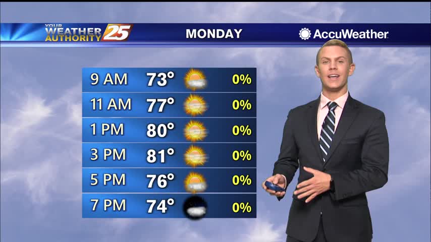
We start off the work week with warm temperatures here across the Gulf Coast. Highs today will be above normal once again, topping out in the lower 80s. Tonight should be rather warm as well with lows only getting down…
After a warm day, expect temperatures to be mild overnight with lows dropping to the lower 60s inland and mid 60s along the coast. Skies will be partly cloudy. Clouds will start to clear out early Monday morning. We start…
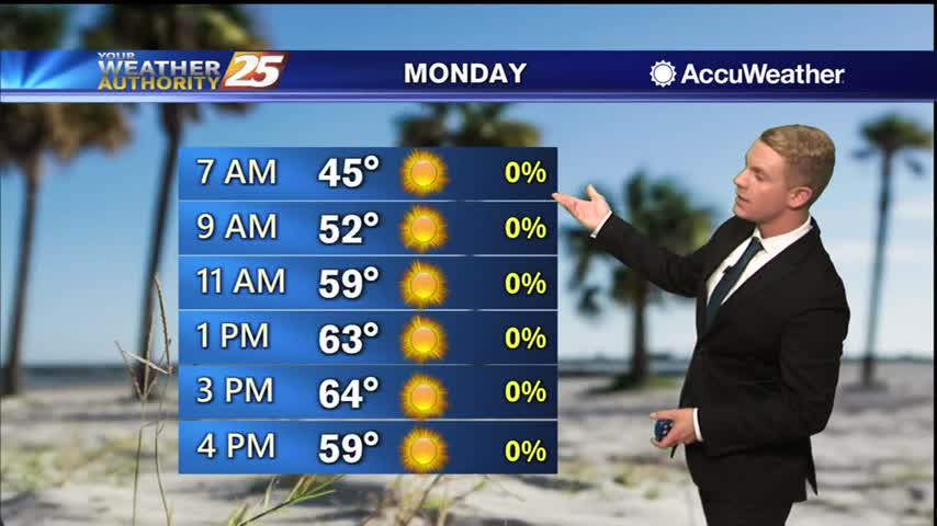
Coldest overnight lows of the week are expected Monday night into Tuesday morning as skies remain clear and winds turn very light to calm across inland areas. Temperatures will plummet into mid to upper 30s across most inland communities Monday…
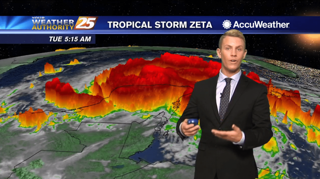
(WXXV) — As of 7 a.m. Tuesday, Tropical Storm Zeta had maximum sustained winds of 70 mph with higher gusts. Zeta is forecast to re-strengthen when it moves over the southern Gulf of Mexico later this morning, and become a…

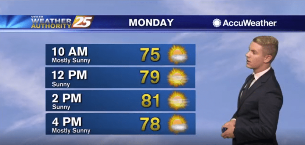
A BEAUTIFUL Monday afternoon ahead with sunshine mix with clouds and warm temperatures in the low 80s...
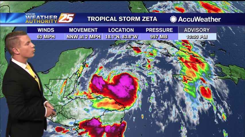
(WXXV) — As of 11 p.m. Sunday, Tropical Storm Zeta was drifting toward the north-northwest near 2 mph but a faster northwestward motion is expected over the next couple of days, followed by a turn to the north. On the…
Starting off early this morning, we are starting to see a steady increase in flow off the Gulf thanks to a weakening area of high pressure pulling to the east. Another pleasant day is on tap for the Gulf Coast.…