2/25 - Payton's Sunday Night Forecast
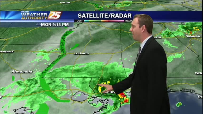
Heavy showers and few thunderstorms tonight, but drying is in the forecast.
Heavy showers and few thunderstorms tonight, but drying is in the forecast.
Beautiful weather today, but rain and colder air is on the way.
The fog cleared this afternoon and the skies even opened up for a while, but dense fog is already forming in the Southern coastal counties and Dense Fog Advisories have been issued. Click here for details.

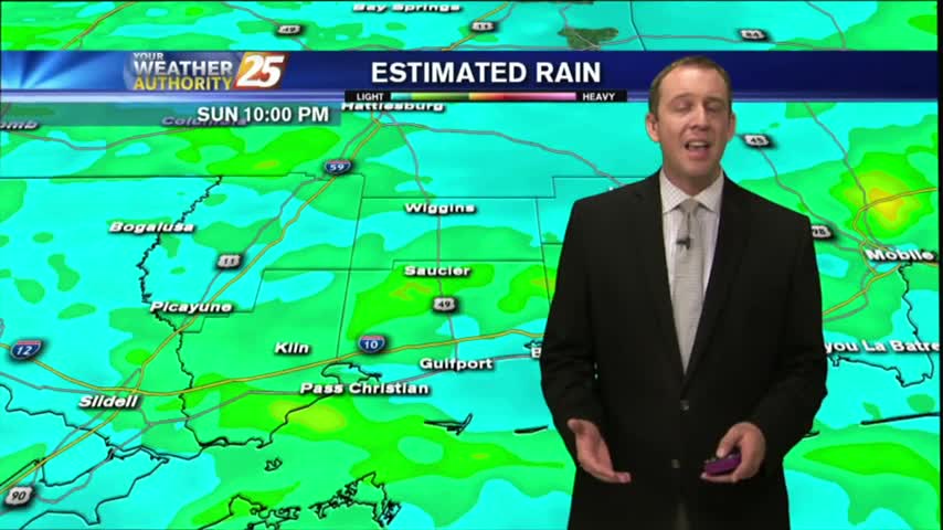
Dense fog for your morning commute and a few thunderstorms in the area.

8:00 Storm Update! 8:00 Storm Update! #mswx pic.twitter.com/bGUGhyCRLr— Ryan Mahan (@wxxvryan) February 24, 2016
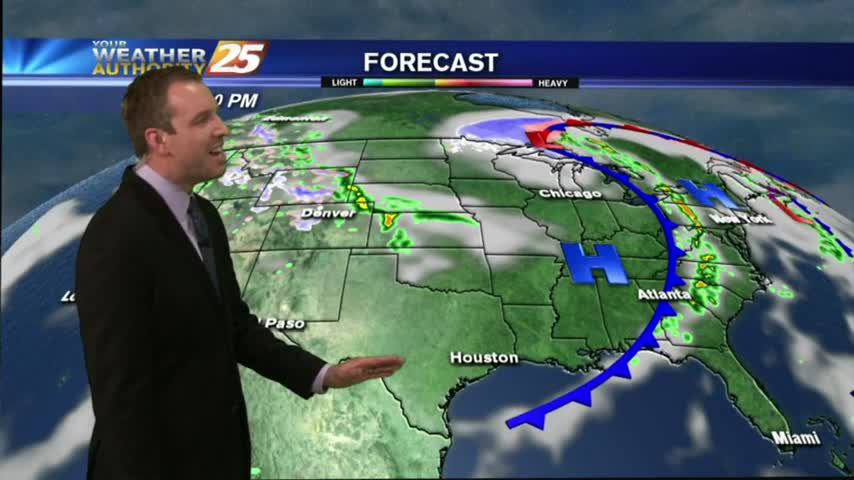
Drier are has moved into the area, and that means nice weather for the next few days, but changes are on the way.
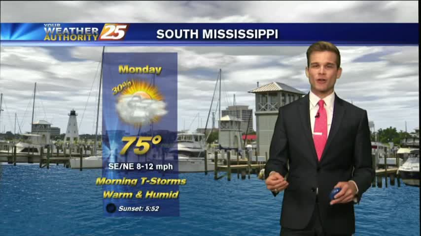
Expect overcast and on and off showers and thunderstorms for your Monday.
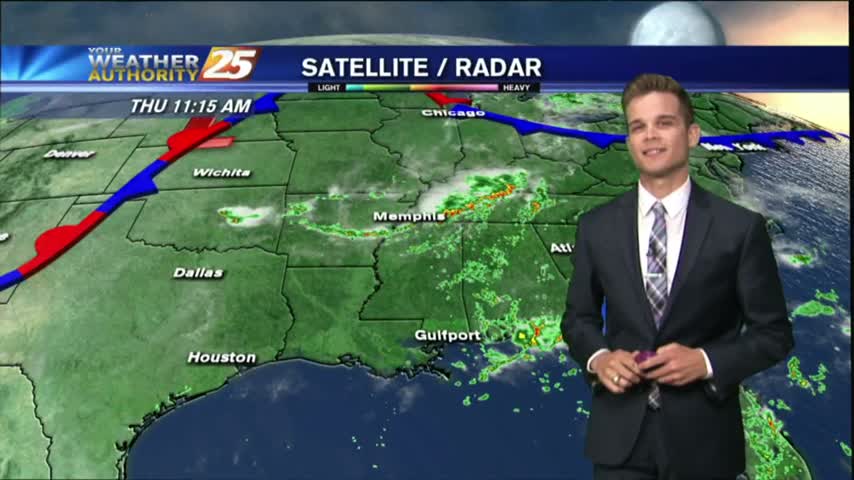
Showers and thunderstorms have started to develop late this morning across Jackson and Harrison County.

A much more typical summer day in store for South Mississippi as the cooler drier air is no longer around.

Showers and thunderstorms will develop this afternoon because of fairly typical August weather.

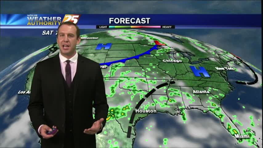
Expect more hot and humid days with afternoon showers and thunderstorms, but a front is expected to move in over the weekend. Watch the forecast for details.
A very active day across South Mississippi as an area of low pressure sits overhead.
A very active day across South Mississippi as an area of low pressure sits overhead.
Today brought the first significant rain since Cindy left, and even a few Tornado Warnings this morning! Expect it to continue for a few days, but dry & hot weather is ahead. Click for details.

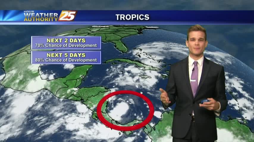
Dry air working its way into Tropical Storm Cindy has created a few "rain-free" areas, we're still expecting a few inches over the next day or so. Watch the full forecast for the details.
South Mississippi saw way less rain throughout the day than we did over the last few, but storms are moving in from the North and will bring some over the next few hours. Click for the full forecast.

Some stronger storms moved into the area today, but don't expect much more of that the next few days. We finally start seeing some drier days next week, but you'll have to watch the forecast for details.
The tropical airmass that has been sitting over the area for the past week remains in place today through tomorrow, which will continue the rain chances for the afternoon hours.
We have another warm & rainy night ahead, with another round of stronger showers and storms expected just after noon. A sunny day has appeared on the 7-Day forecast though, click the link for more info.
Memorial day was muggy & wet, and sadly similar conditions will be felt in South Mississippi nearly all week long. Watch the forecast for full details.
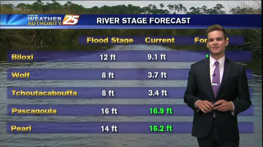
Another round of rain moved through South MS this afternoon, adding more to our already saturated ground. Flooding will be the likely issue going forward, so be sure to watch the forecast for details.

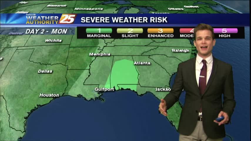
Storms are pushing into the area now and will continue over the next few hours. Our severe threat was lowered from "enhanced," "to slight," and now to "marginal," so little damaging weather is expected though we will see some strong storms. Watch the forecast for details.
Storms are beginning to creep in from the NW, and despite our "marginal" threat for severe weather, conditions are trending for weaker storms in South MS. Watch the full forecast for more details.
Tonight's storms will be the last we'll see for several days, but their "slight" risk of severe weather is worrying. Watch the forecast for storm details and the upcoming week's forecast.