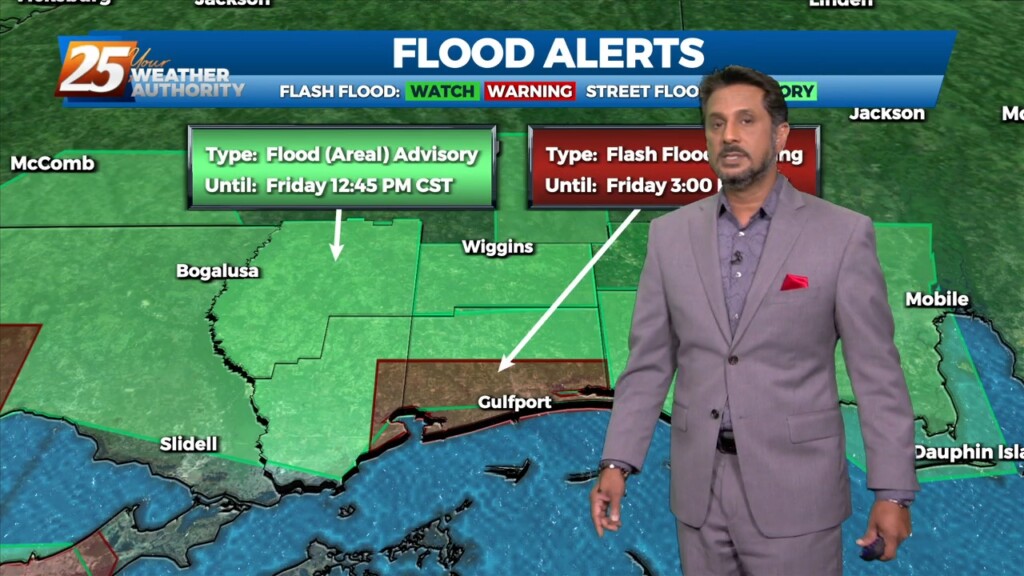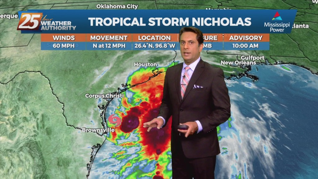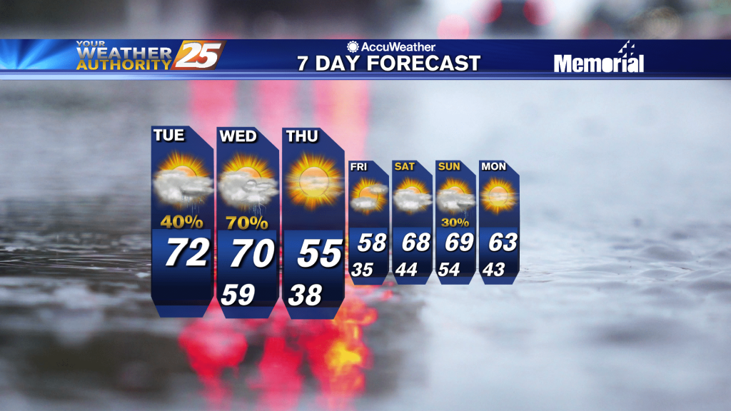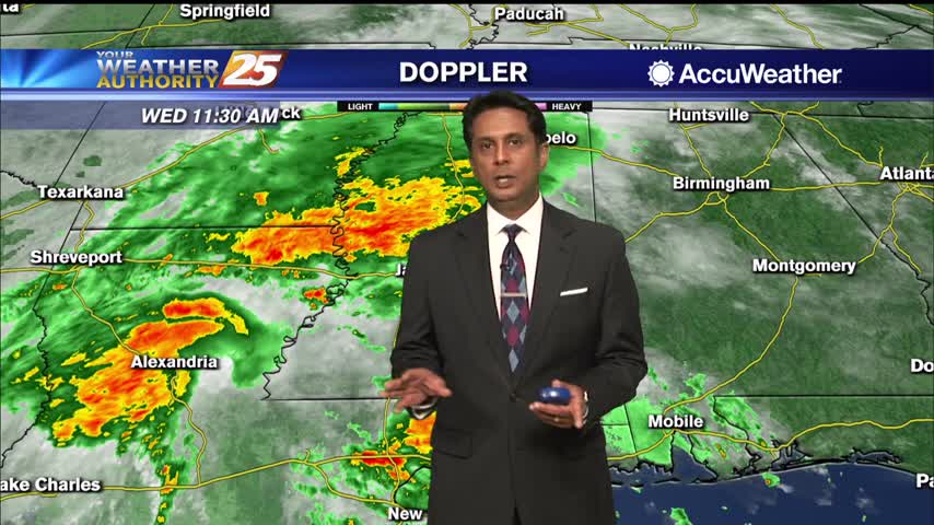
3/5 - The Chief's "Rainy/Breezy" Tuesday Morning Forecast
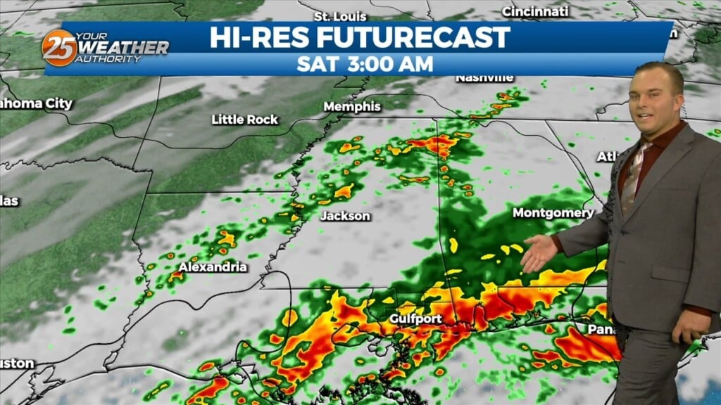
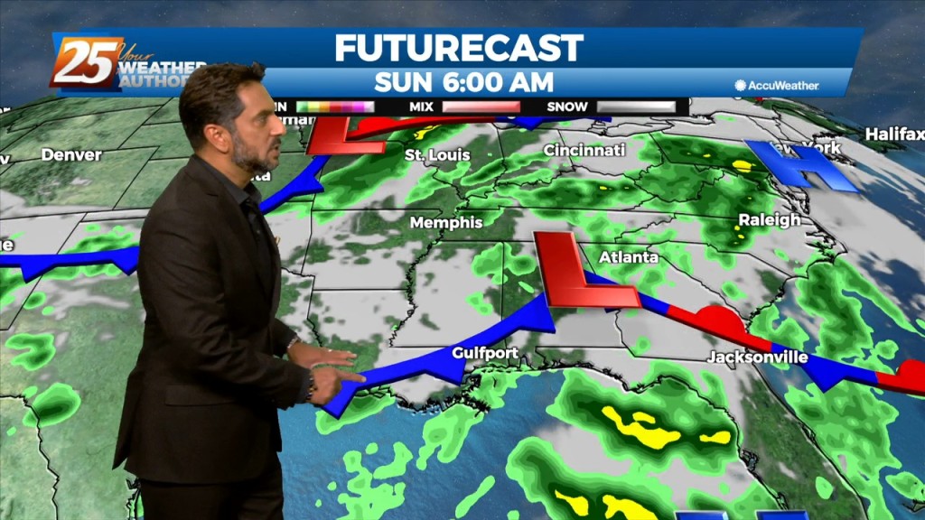
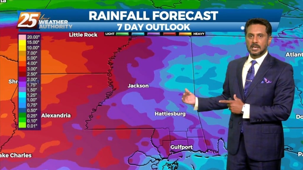
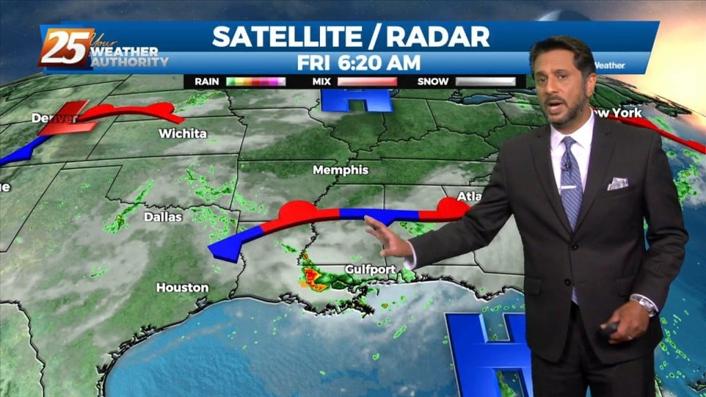
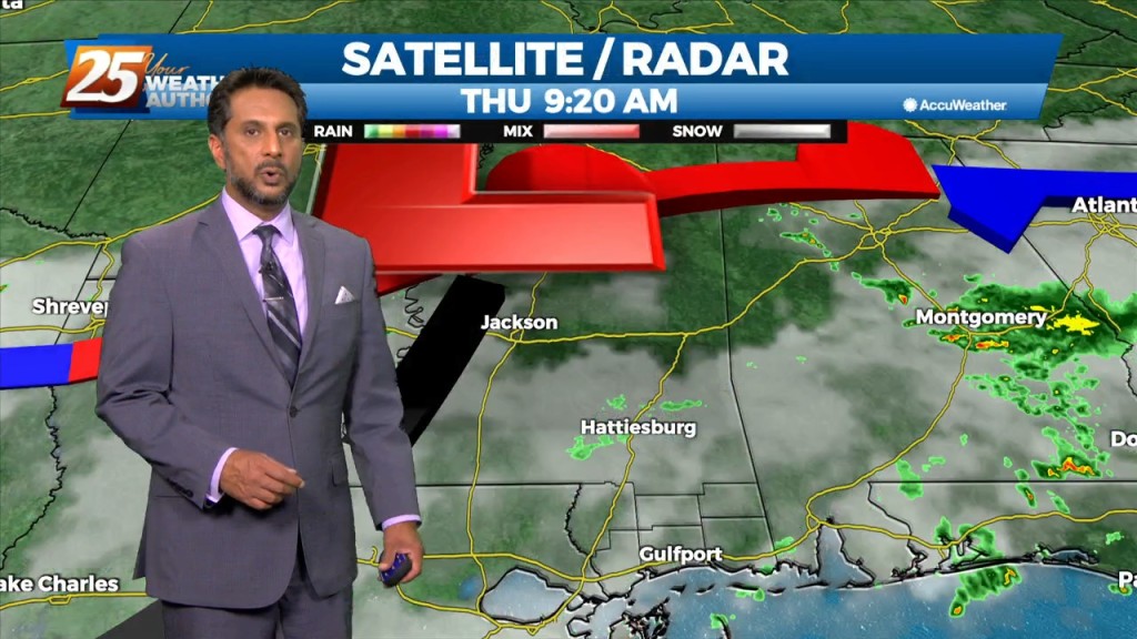
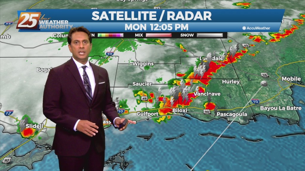
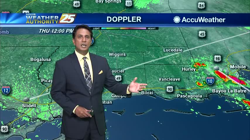
Multiple disturbances are moving through west-southwesterly mid-level flow across the northern Gulf Coast. Most of the thunderstorms with these impulses are expected to track south of the area.…