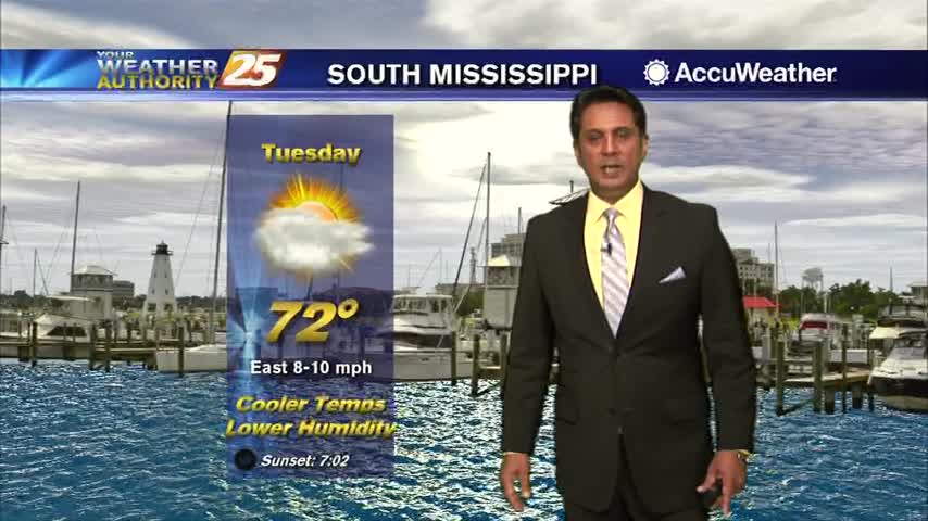
3/12 - Rob Knight's Tuesday Morning Forecast
A MUCH better start to the day with a cooler/drier air mass in place...
A MUCH better start to the day with a cooler/drier air mass in place...

A warm and humid start to the day with an area of high-pressure to our east...
Another CHILLY start to the day but the warm-up will begin later this afternoon...
It has turned out to be a BEAUTIFUL afternoon...
With an area of high-pressure closer to the area, a north wind continues to bring frigid temperatures to start off the day...

A COLD start this morning in the wake of yesterday's cold front...

Sunshine has broken through the cloud coverage and the fog has dissipated...
Activity from last night continues to move out of the area off to our east...

Cloud coverage continues as DENSE FOG has developed along the coast...
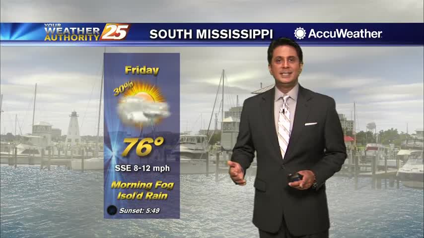
A few stray showers across south Mississippi with a disturbance north of the area moving east...
With the colder/drier air mass still in place, it's a CHILLY start on this Final Monday of February...

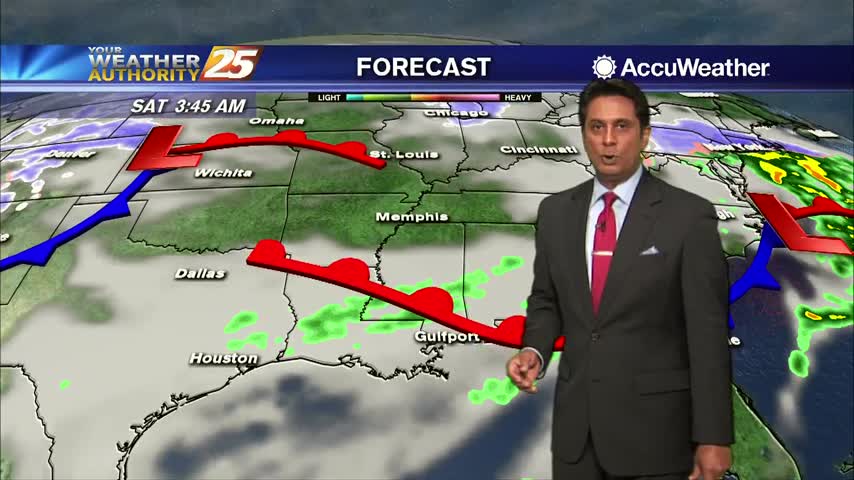
We are still dealing with areas of DENSE FOG as isolated rain is moving in from the south...
A warm front north of the area had a very warm air mass in south Mississippi with areas of DENSE FOG...
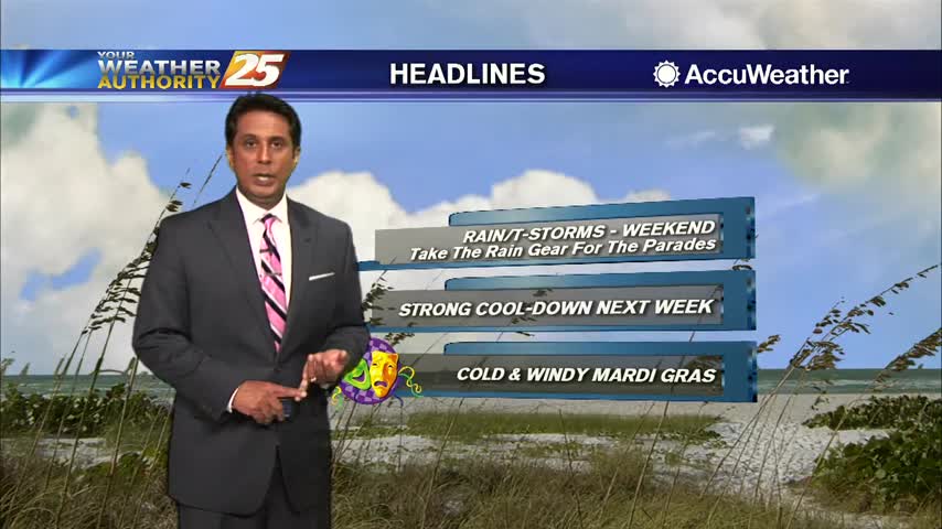
Isolated rain including t-storms continues through the area but it seems like the SEVERE THREAT has ended...
Patchy fog this morning as line of showers and t-storms beginning to develop and move into the area...

Cloudy skies continue with a few spots of very light rain across the Southern 6 counties...
Extensive cloud coverage continues through the region with MUCH WARMER temperatures than yesterday morning...

A COLD start to the day with a lot of upper-level clouds streaming across the area...
Beautiful blue skies continues as temperatures warm...now in the mid/upper 50s...

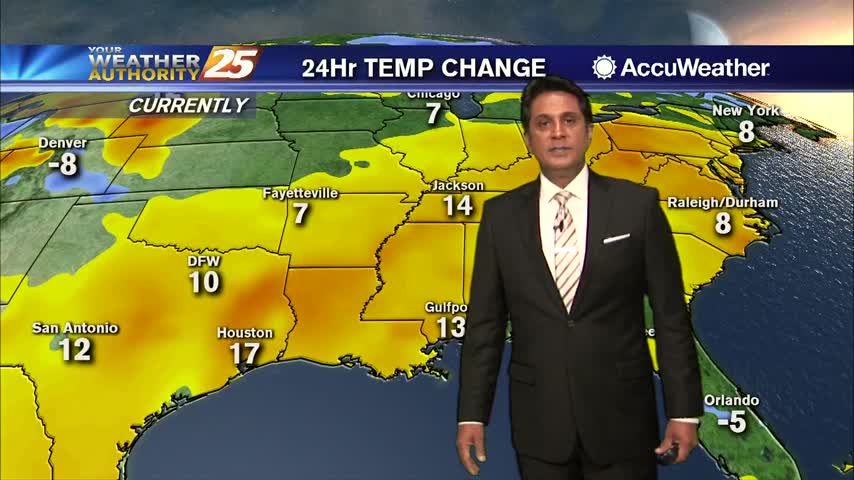
Major changes this morning with a colder/drier air mass moving into the region in the wake of yesterday's cold front...

A foggy and wet start to the day as a cold front is moving into the area from the west...
A warmer start to the day with areas of light fog and light rain moving in from the south...
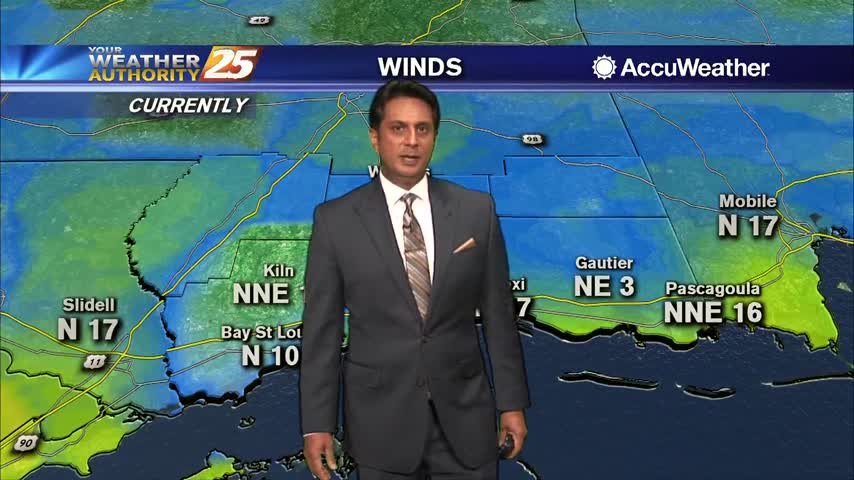
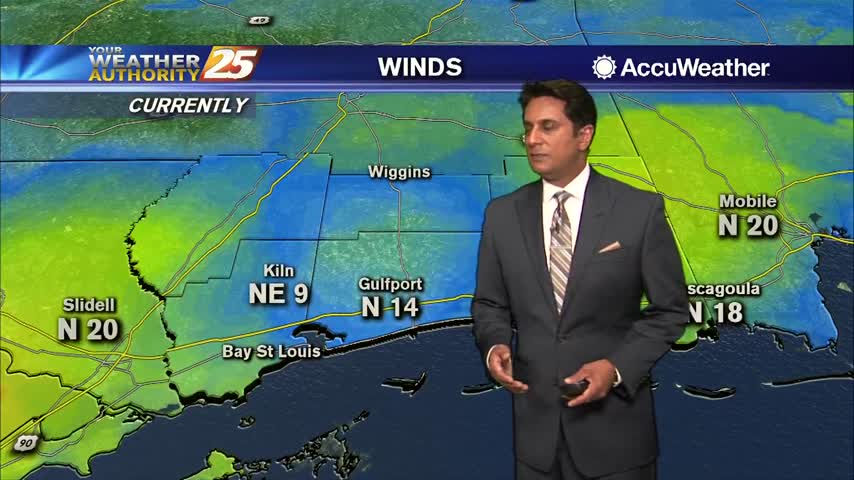
Cloud coverage is still in the area as winds continue to gust into the upper teens to low 20 mph range...
A colder and windy start to the day in the wake of last night's cold front...