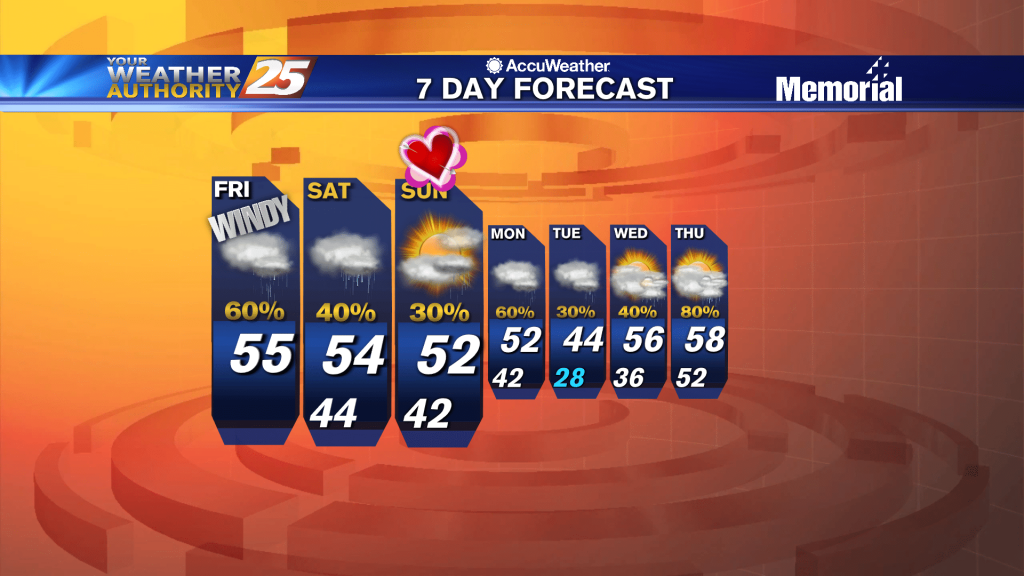
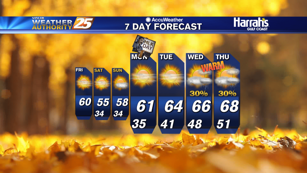
2/12 - Rob Knight's "Wet & Cold" Valentine's Day Weekend Forecast
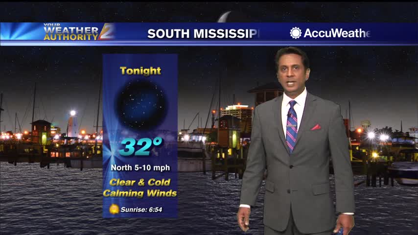
A cold north wind will continue to gust into the 20 mph range through early Saturday morning...
A cold north wind will continue to gust into the 20 mph range through early Saturday morning...
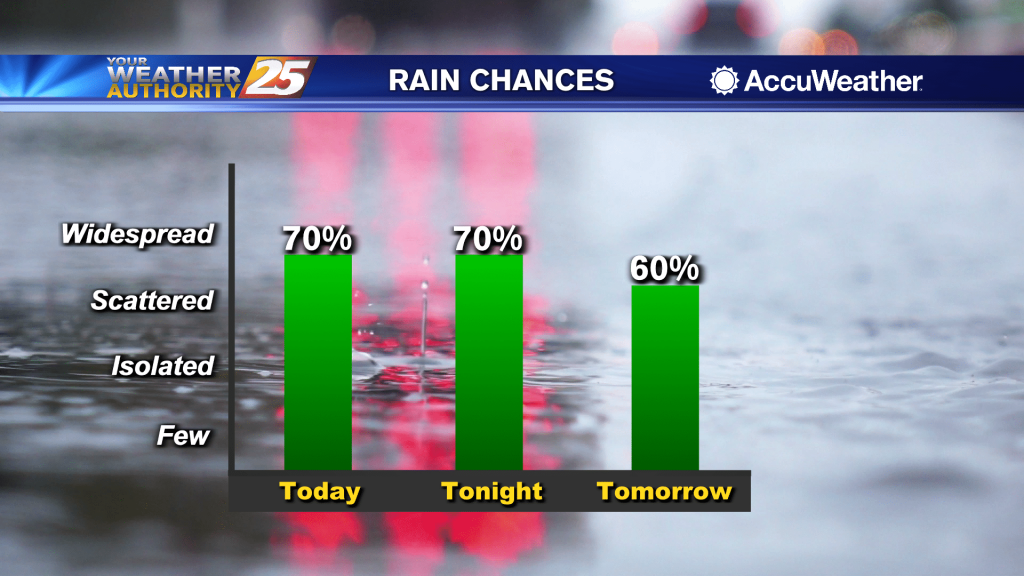
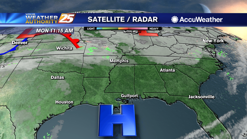
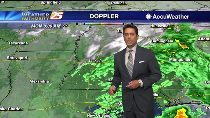
Rainfall is moving east across south Mississippi with pockets of fog...
Rainfall is moving east across south Mississippi with pockets of fog...
A warmer start to the day with spring-like conditions ahead...
Another very cold start but the air mass will begin to modify later today...
Upper level clouds continue to move out of the area with sunny skies ahead...

A very cold start to day day with light winds continuing from the NNW...
Clouds will continue to move across the area until late afternoon...
A sunny & cool after ahead as high-pressure will bring huge changes this weekend...
A very cold start this morning with rebounding temperatures later today...
As high-pressure begins to move in from the NW, skies will gradually clear...
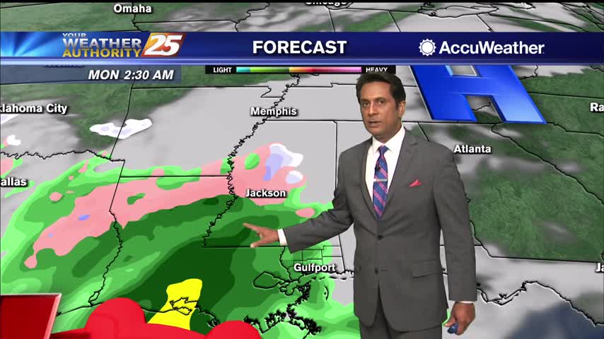
A bit of sunshine this afternoon but rain will continue to be in the area...
Cloudy skies continue with patchy fog as more rain begins to move in...
A band of rain continues to affect the area heading into this afternoon...
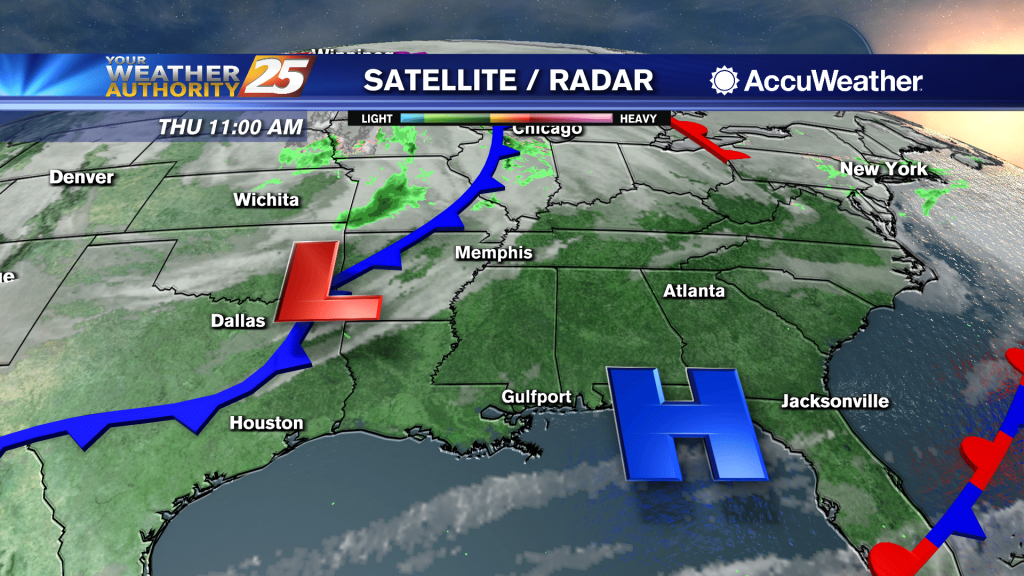
A band of rain will continue to sag slow south through the area this morning...
Cloudy skies continue as rain with a few embedded t-storms possible this afternoon...
Warmer temperatures and plenty of sunshine heading into this afternoon...
Sunshine with MUCH warmer temperatures ahead through the workweek...
A much warmer start to the day with the cold front now to the east...
A lovely sunny afternoon with warmer temperatures...
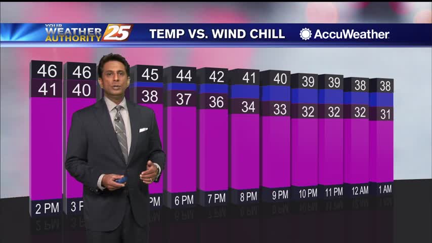
A cloudy afternoon as the wind chill will be in the upper 30s...
A cold and wet start to the day as the rain/snow line is well north of the area...
Clearings skies will begin this afternoon as below seasonal temperatures continue...
A cold start as cloud coverage continues trough much of the region...