12/26 - The Chief's "Sunny & Cool" Monday Afternoon Forecast
The word for the next couple of days is moderation. As the high pressure shifts off to the east today, winds will come around to the…
The word for the next couple of days is moderation. As the high pressure shifts off to the east today, winds will come around to the…
While the main upper level disturbance is moving off the East Coast, another minor feature is diving down the west side of the trough over…

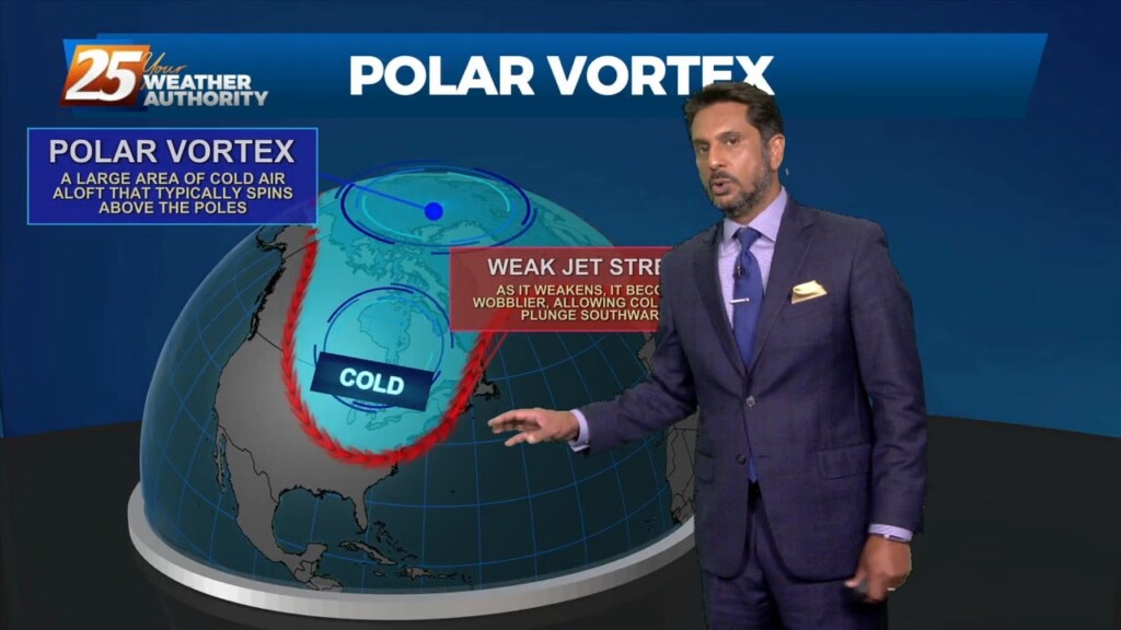
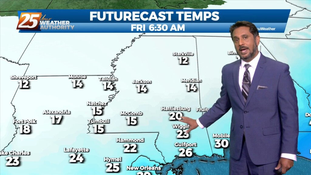
This bitter cold Arctic air mass will continue through the Christmas weekend as an upper disturbance will move to New England by Saturday afternoon, but…
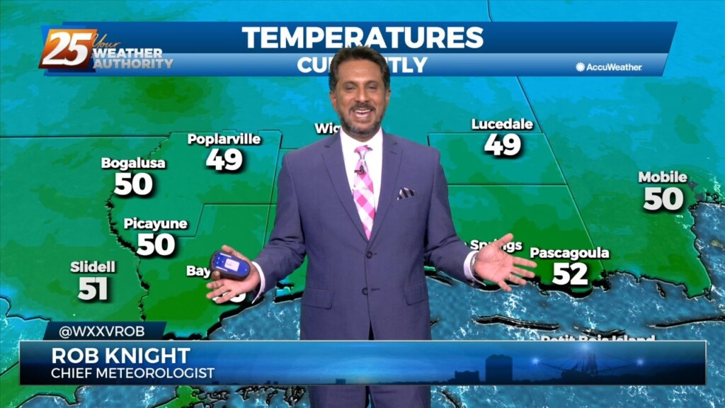
A vigorous cold front is now to the east with a bitter cold air mass moving into the region. Temperatures have been plunging all night,…
An Arctic front and a very cold air mass to the NW continues to move SE. Current expectation is that cold front will reach…
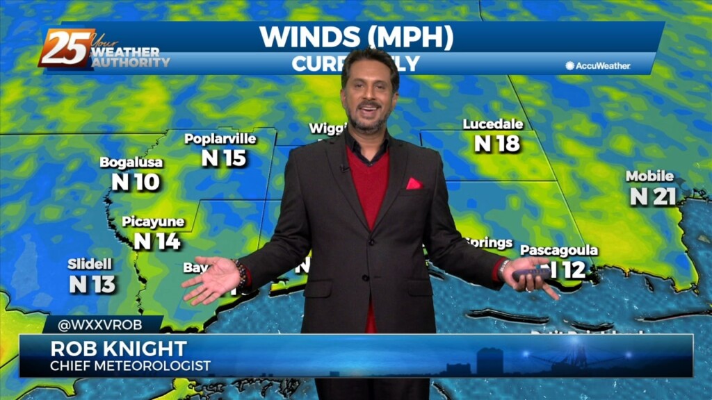
A cloudy and breezy day ahead with winds expected to continue gusting into the 20 mph range. The main weather feature finally makes its…
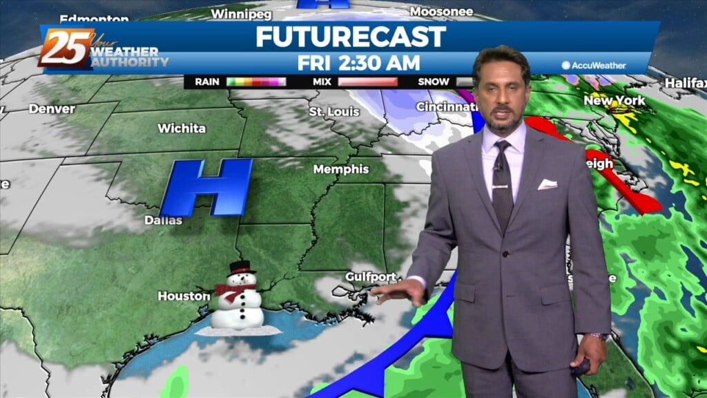
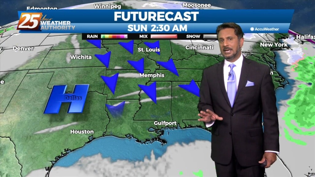
The surface low-pressure south will approach the LA coast and ride along it as it progresses eastward. This brings a second round of showers, more to…
Today a surface high pressure will shift eastward as a disturbance pushes into the region. A second disturbance will follow quickly behind into Tuesday. This…
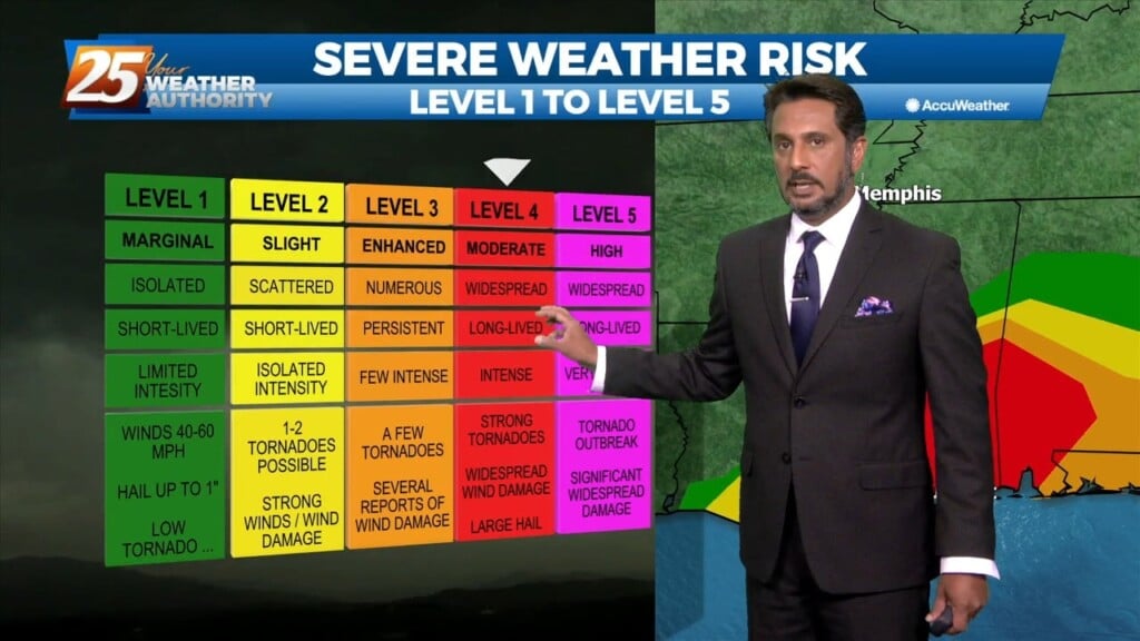
Significant severe weather and excessive rainfall threats can be expected this afternoon into mid-evening...especially from the Interstate 10 corridor northward. A vigorous system just to the…
The main forecast issues for the entire forecast package occur in the first 18 hours of the forecast...today and this evening. Significant severe weather and excessive…
A very complex forecast through the period, with a potent storm system starting to develop across the high plains just east of the front…
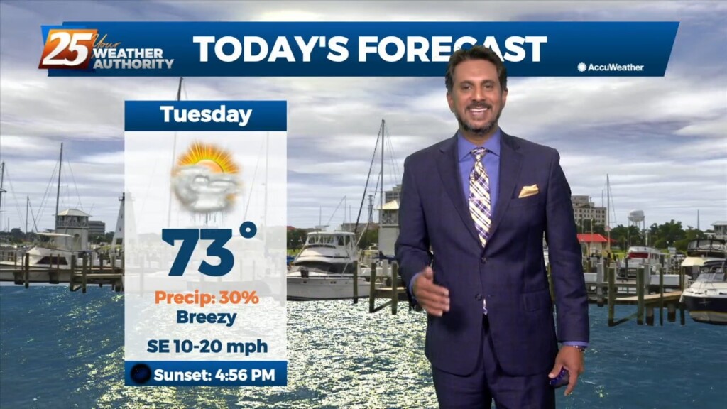
This warm , humid air mass will continue as a high pressure spreads east over the Mid Atlantic. The southerly/southeasterly winds really begin to ramp as…
The warm front yesterday retreated quickly and even by this morning was already north of the area and we are now in a warm air regime. This could set the…
Overall a much quieter day ahead with far less impacts for most of the area. Once again the main problem has been more commerce impacted due to…
A mid latitude disturbance will be tracking east across the Central and High Plains Friday, crossing the upper/mid-Mississippi River Valley Friday night. As surface ridge north of the…
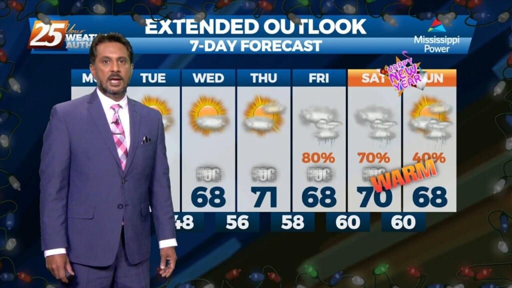
Temperatures will quickly rebound to normal for this time of year on Friday as the upper level trough ejects east and ridge centered over the Gulf of…
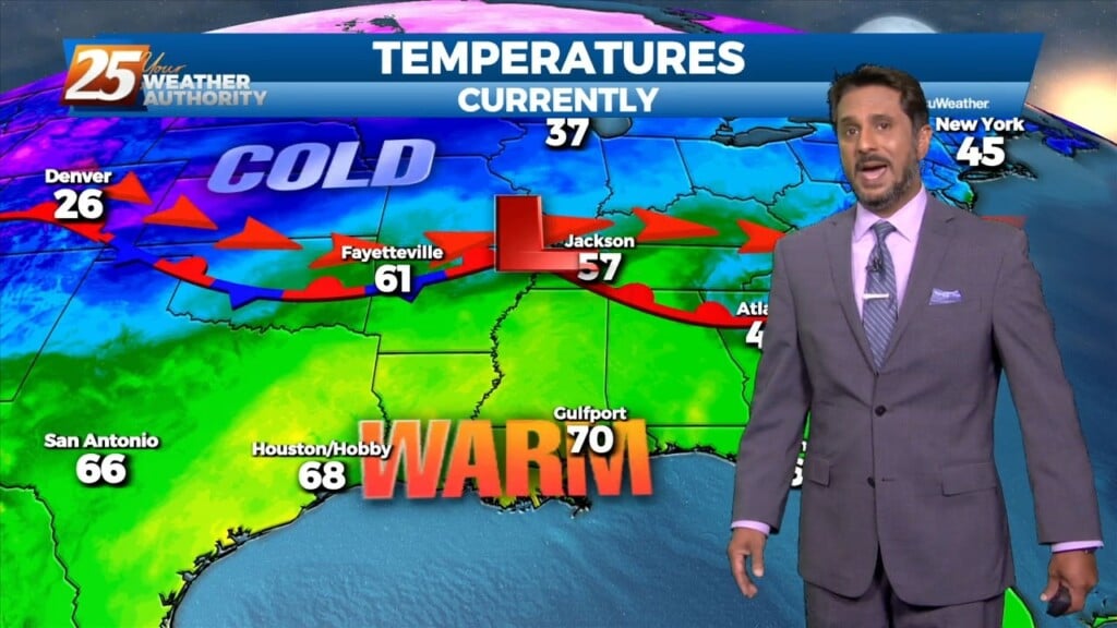
A drier/cooler northerly wind will develop across the region today behind the departing storm system. Temperatures will slowly cool back into the mid-60s this afternoon.…
Ongoing activity will begin to settle down this morning as a front moves through the region. A drier/cooler northerly wind will develop across the region…

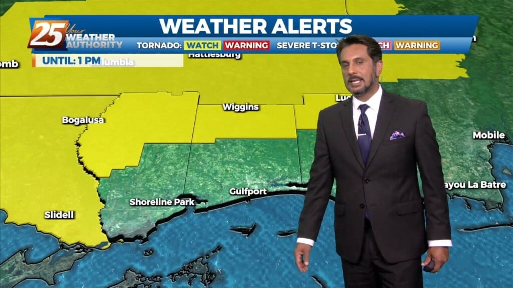
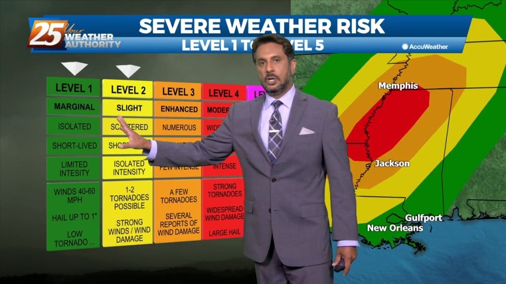
A SEVERE THREAT WILL BE IN THE AREA this afternoon and overnight... There is now a slight risk for severe storms capable of producing damaging winds,…
The latest trends in models have increased confidence in the risk for severe weather to our area and there is now a slight risk for…
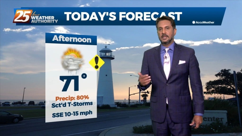
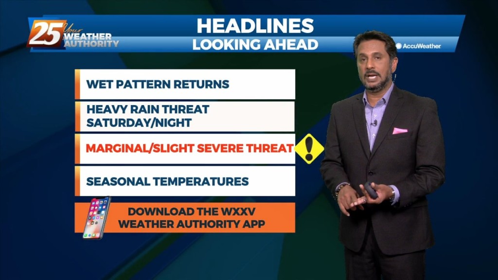
A pleasant day ahead with high-pressure to the NW shaping the short-term forecast. The primary headline to monitor beyond today is severe weather and excessive rainfall potential…
Cloudy skies will continue this afternoon with breezy conditions from the North at 10-20 mph. Tomorrow, a stronger system will move across the Southern Plains, finally…
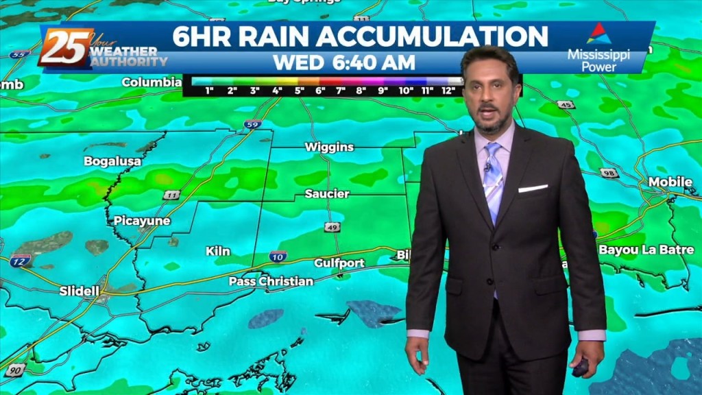
The main issue continues to be the heavy rain threat across the area as showers and thunderstorms continue to move from west to east across the…
This morning and likely into the early afternoon will remain dry and quiet before our next weather maker brings widespread rain showers and isolated…