5/16 - The Chief's "Humidity Returns" Thursday Morning Forecast
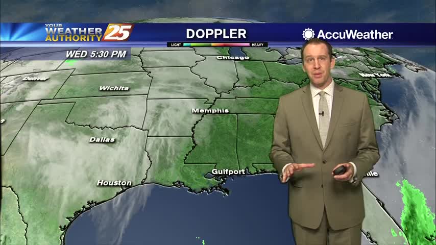
The old frontal boundary is stalled near the coast this morning and drapes inland near Terrebonne Parish westward to Beuregard Parish. The back end of this front…
The old frontal boundary is stalled near the coast this morning and drapes inland near Terrebonne Parish westward to Beuregard Parish. The back end of this front…
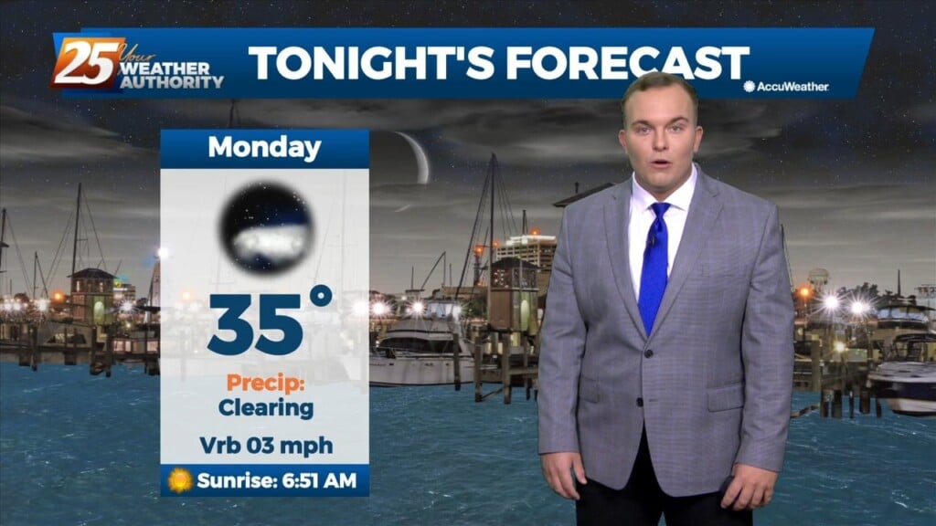
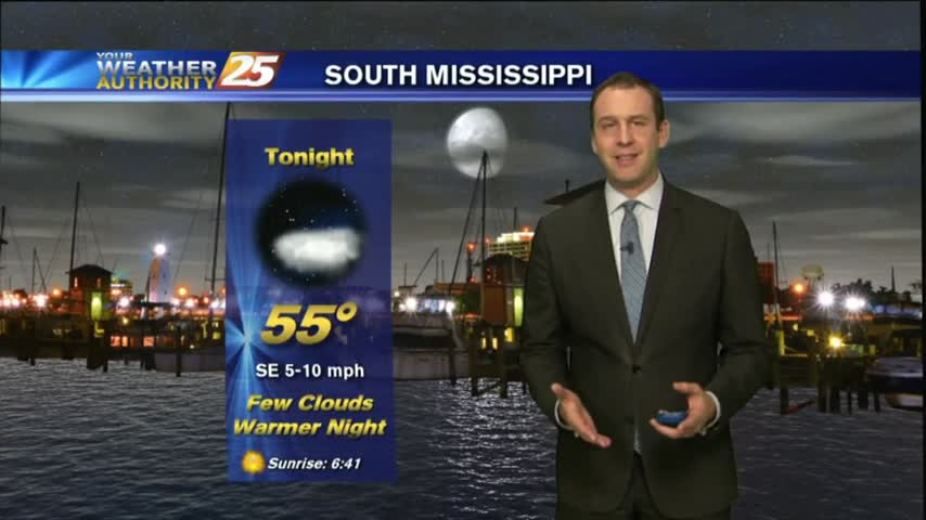
Temperatures are cold, but widespread freezing conditions are not on the table tonight. Clouds will be in the area thanks to a cold front that has made its…
The warm-up is starting to take effect across our area. High temperatures managed to reach the 50s earlier today across South Mississippi. We will see cloud coverage…
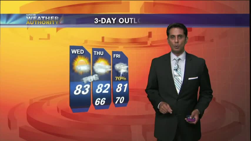
Tomorrow is looking nice to start yet again with some low-level clouds around. Main focus will be the continued return of low-level moisture drifting north adding to that…
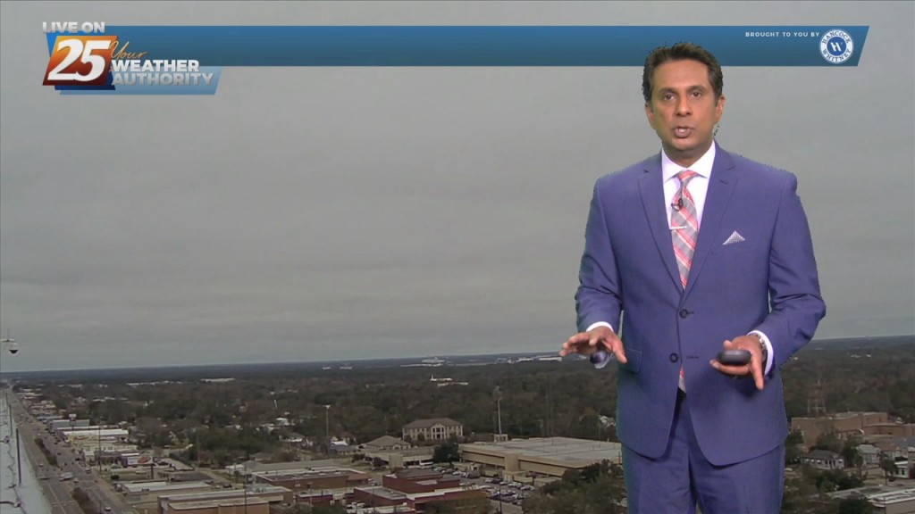
With the return flow beginning this afternoon, warmer temperatures will move in. Now the question is will we test records, it looks like right now we could…
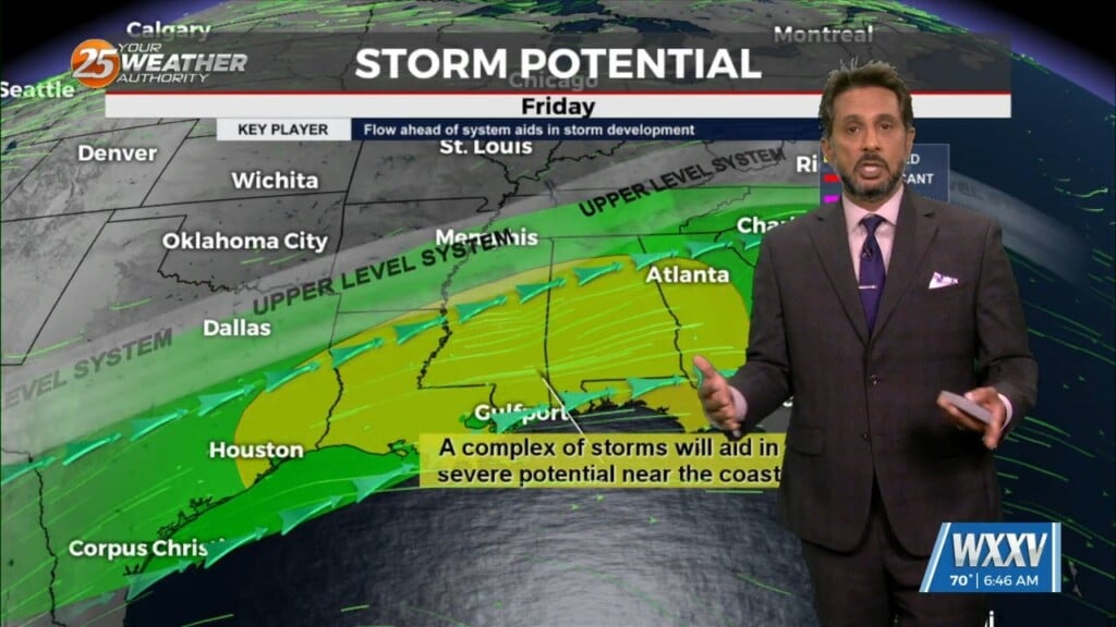
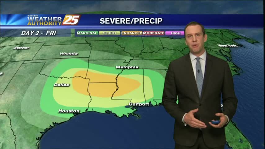
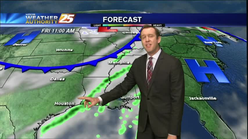
Our next front is closing in and active, potentially stormy weather will be moving in during the wee hours of the morning....
A warm start as the humid flow continue to move into the Mississippi Gulf coast...
Yesterday's cold front is responsible for today's clear and sunny skies, but it doesn't last long....
Today was the last of the drier days, so expect rain to begin showing up each afternoon through the weekend....
Clear skies have moved in and we're in for a chilly night, but temperatures will rise as we approach yet another rainy weekend....
A few clouds were hanging on this morning, but higher pressure has begun to move in and has cleared things out for the next few days!
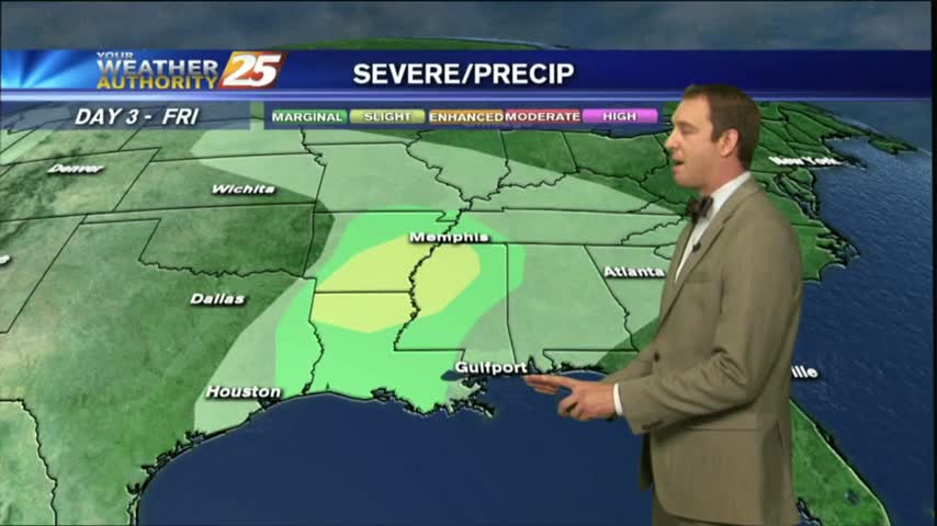
Today's weather was nearly perfect, mild and dry, but another round of potentially severe storms is moving in for the weekend.....
The cooling trend continued this morning, but Southerly winds will begin increasing our temperature and humidity ahead of a weekend storm front....

I hope you've enjoyed the last few sunny days, because they'll be coming to an end for a bit as we finish off the week. Don't worry though, tomorrow will be great, but after that....
It warmed a bit today, but remained on the cooler side and just as dry as the last few days. Changes arrive for the weekend though....

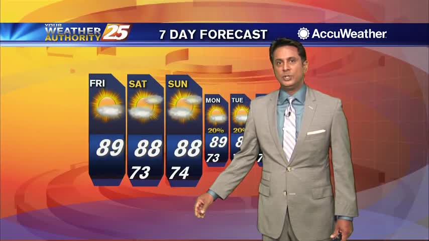
We've tied or broken temperature records every day, with the exception of last Sunday, since last Friday; a trend I expect to continue through the rest of this week and the weekend. Watch the full forecast for details.
Another day down, and another high temperature record tied or exceeded. Expecting more of the same ahead with a little rain mixed in, so watch the full forecast for the details.
Cooling continued this afternoon and will continue into the night, but the thermometer will begin swinging the other way tomorrow. Click the link for the full forecast details.
We cooled into the upper 50s as expected today, but now we'll begin a warming trend which will carry us into the weekend. Click here for the full forecast with Meteorologist Ryan Mahan.
You wouldn't know it from the temperature or satellite presentation, but a cold front is moving through the area and will bring cooler temperatures into the weekend. Watch the full forecast for more.
A cold front passed through South MS during the early morning hours with little fanfare, but we'll feel those chilly and drier conditions tonight...and again a few times this week. Check out the full forecast for details.
Today was the coolest afternoon we've seen since early this year, but we'll see some slightly warmer days ahead, and even some rain by the weekend. Click the link for details.
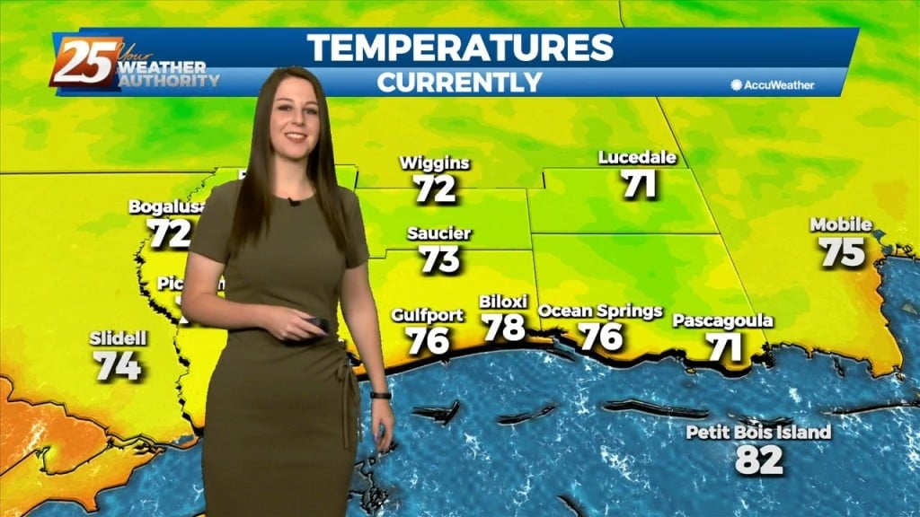
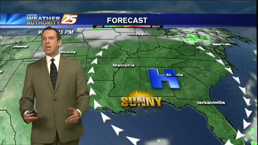
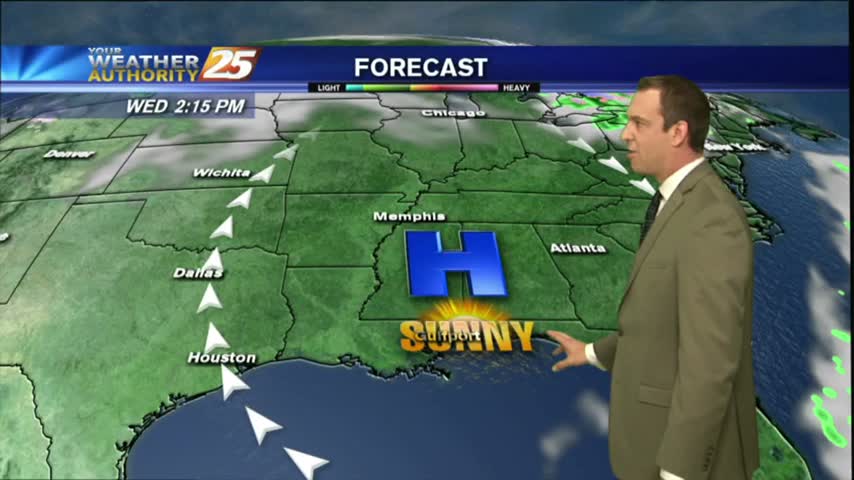
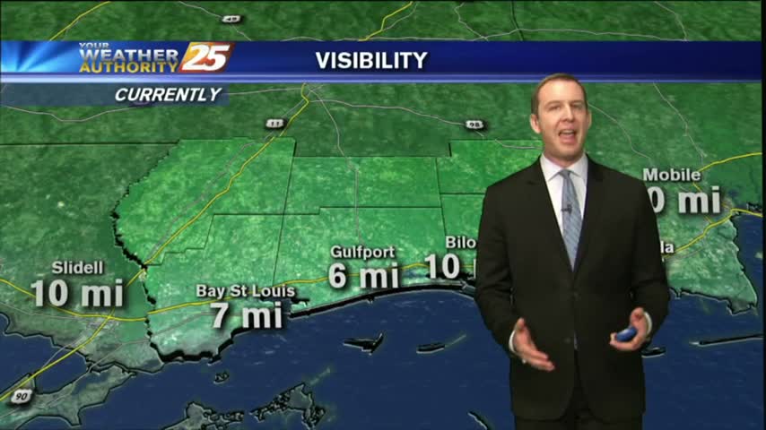
The area of high-pressure overhead has shifted to our east and is now providing for a return-flow from the GOM, with areas of patchy fog this morning...
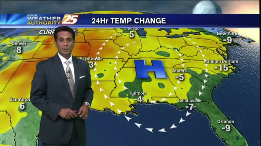
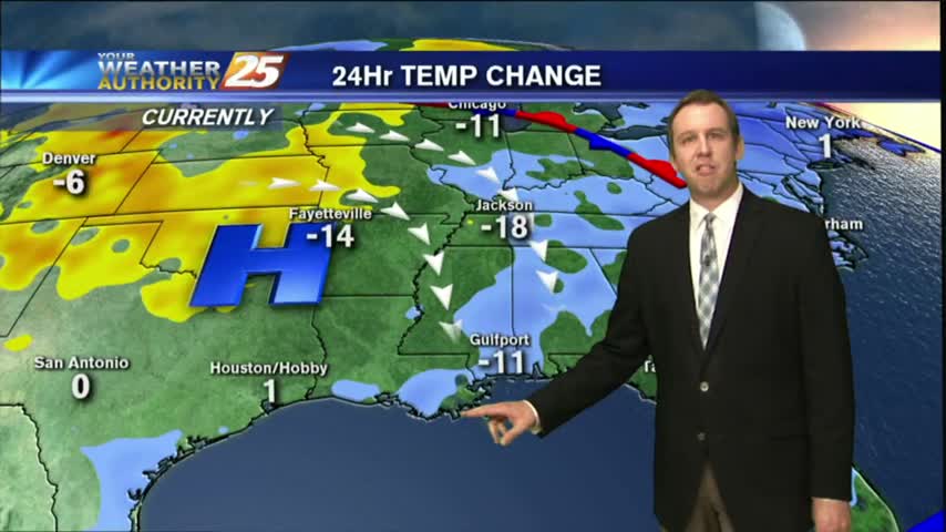
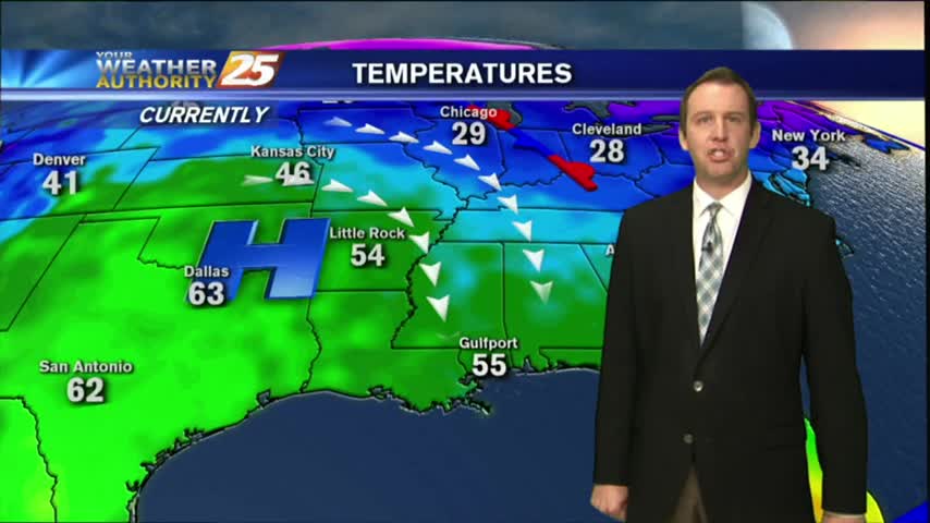
After a COLD start with several locations at the FREEZING POINT, the return flow has begun with the warm up starting this afternoon...