7/31 - Payton's Monday Afternoon Forecast
After a beautiful day yesterday to close-out the weekend, the drier air mass will continue to affect the region through Tuesday, but more rain is on the way.

After a beautiful day yesterday to close-out the weekend, the drier air mass will continue to affect the region through Tuesday, but more rain is on the way.
The beginning of the week will be hot and dry, but with less moisture it won't feel quite as hot as it has the past couple weeks.
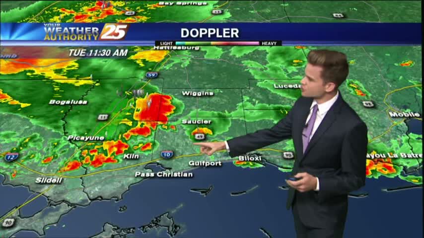
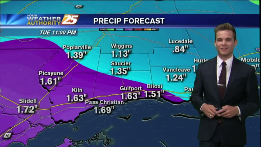
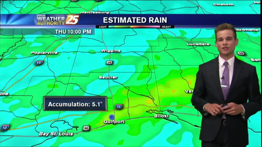
Today will bring the same scenario with the activity in the area. An additional 2-4 inches of rain is not out of the question with the strongest storms.
a FLASH FLOOD WATCH continues until 7 pm Tuesday for much of the area.
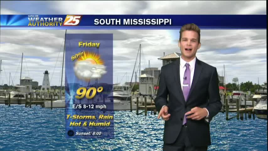
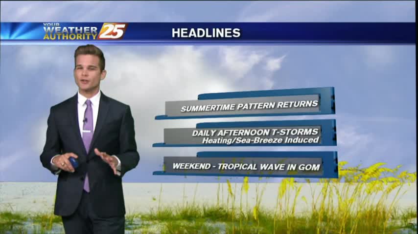
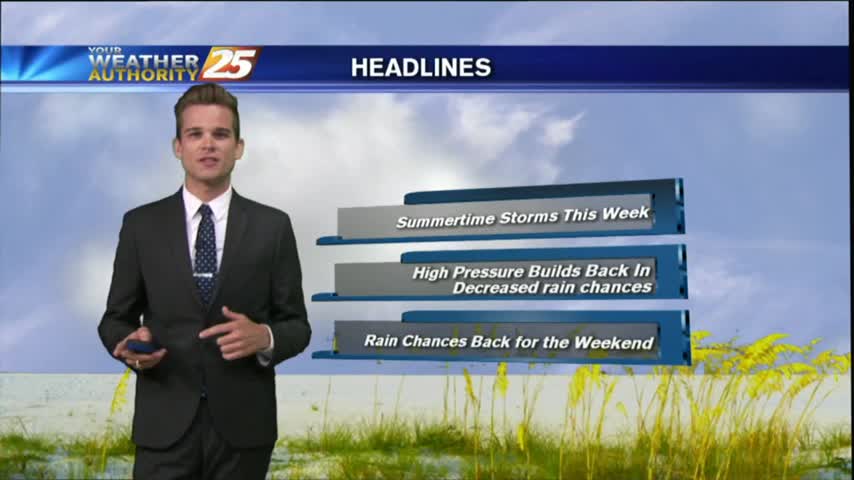
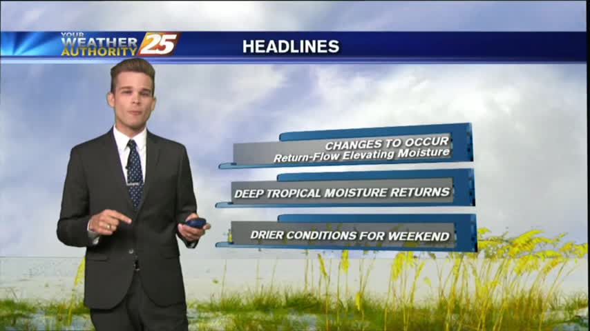
A typical summertime pattern for South Mississippi continues for most of this week.
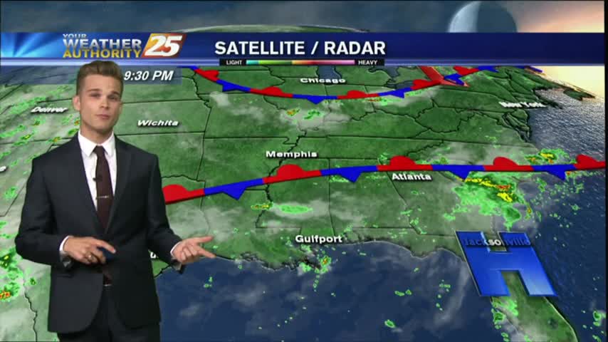
Showers and thunderstorms will continue this afternoon and into the night as strong tropical flow continues through mid week as a trough of low pressure in the upper-levels dominate much of the country.
After a humid and stormy weekend, the summertime pattern will continue this week.
Showers and thunderstorm chances today as a surge of deep tropical moisture into the region.
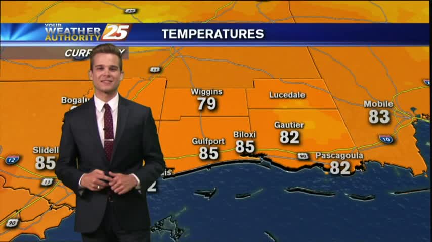
This morning started off dry with a north wind, but south winds have returned to the area this afternoon along with some clouds.
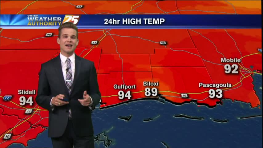
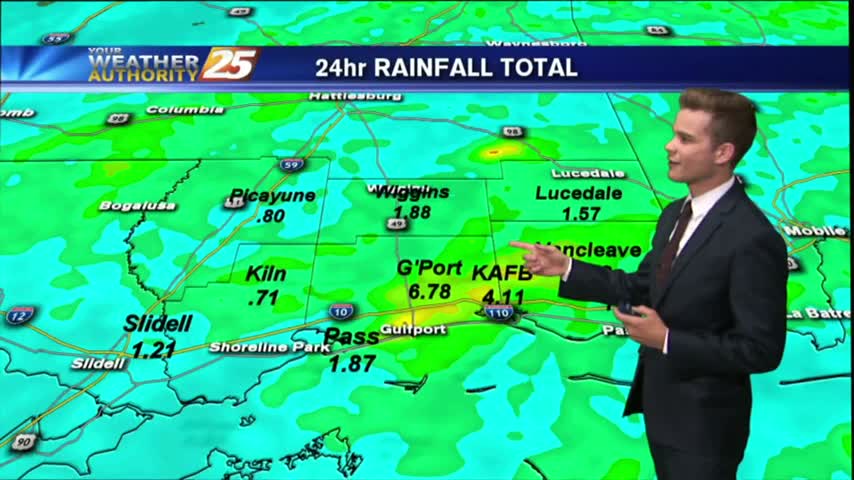
Showers and thunderstorms across the area this afternoon dumped heavy rain across portions of the area, but many did stay dry.

Another typical July day in South Mississippi with afternoon showers and thunderstorms.
Another typical July day in South Mississippi with afternoon showers and thunderstorms.
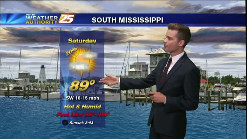
The area of high pressure that has been centered over the Gulf Coast the past few days will start to makes its way out of the area, and rain chance will start to go up toward the weekend.
We're getting into the typical summertime pattern here in South Mississippi where it will be hot, humid & stormy during the afternoon.
Today has been hot and humid. There have been very light isolated showers, but most of the area was dry and will remain that way tonight.

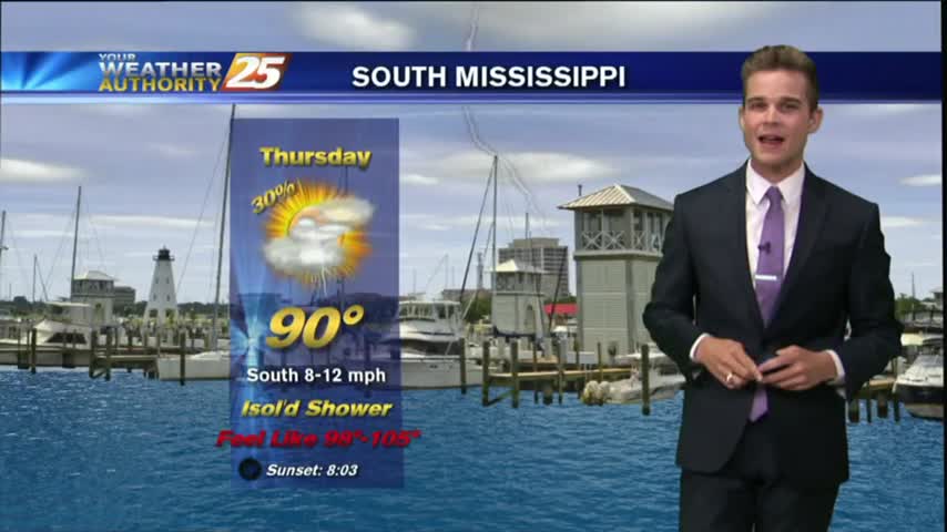
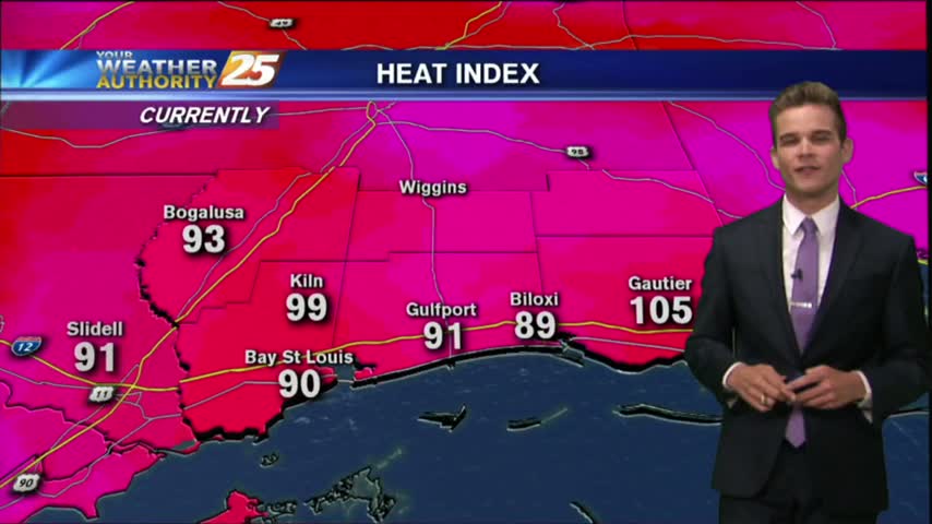
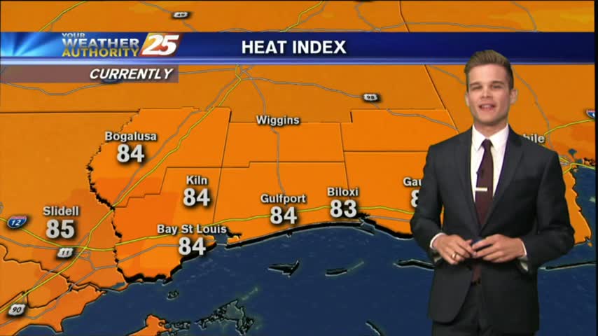
Independence Day will be another day of hot and humid conditions with heat index values running around 100 degrees.

The forecast is stuck on repeat, at least for the next few days.
With an area of high pressure directly overhead today was hot, hazy and humid.
We are ending the month as the wettest June on record.
We are ending the month as the wettest June on record.
A very active day across South Mississippi as an area of low pressure sits overhead.
A very active day across South Mississippi as an area of low pressure sits overhead.
Another day of lower humidity and primarily dry conditions across the area.
A beautiful day in store as drier air continues to filter into the area. With a weak cold front to the south, and high pressure to the north this will continue into Tuesday