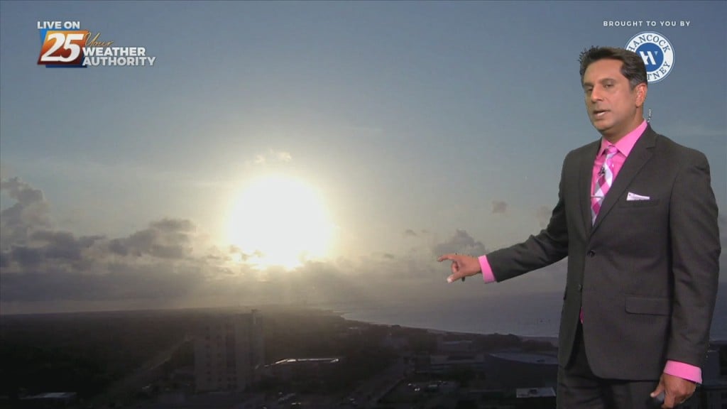
3/21 - The Chief's "Increasing Clouds, Enter Rain Late" Thursday Morning Forecast
At the surface, high pressure is currently over the northeast Gulf of Mexico with low pressure over the Texas Panhandle. Clouds will continue to…
At the surface, high pressure is currently over the northeast Gulf of Mexico with low pressure over the Texas Panhandle. Clouds will continue to…
Despite a fairly vigorous disturbance moving through the Lower Mississippi Valley today into tonight, a lack of moisture in the low to mid-levels of…
With low level moisture continuing to advect into the region from the south a solid low stratus deck of low level clouds has developed across most…
The stubborn high pressure continues to remain centered over the I-35 corridor from Kansas through much of north and central Texas this morning.…
Outflow boundary is firing new cells this morning where it meets the surface front just to the N/NW of our area. Stability should begin to increase over…
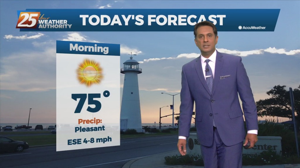
Today will bring a fairly quiet weather pattern with cloud coverage varying through this evening with slightly warmer as low-level winds start turning more onshore flow. The…
The upper low is now beginning to cut off from the base of the upper disturbance and should wobble but remain over or near the TX/LA…
A weak disturbance currently over northern Texas will track east today and tonight, passing through the lower Mississippi Valley. Showers have developed well ahead of that system…
Northerly surface winds will help advect drier and more stable air into the area. Looking at the models, conditions will be dry over the next few days…
Mid level dry air will remain in place today. This will help cap the environment, making it harder for thunderstorms to get started. There will be some…
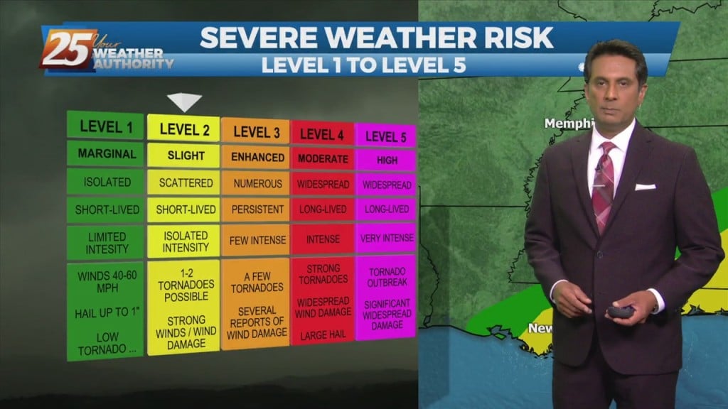
The main concern in the short term will continue to be the potential for thunderstorms and possible severe weather. We’ll remain in northwesterly upper flow…
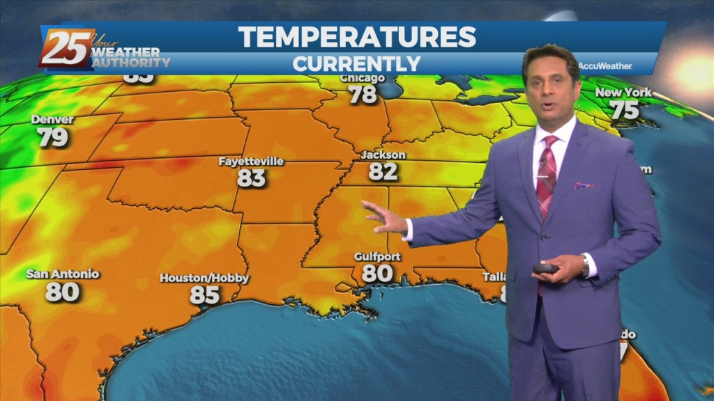
Hot and dry pattern continues as high-pressure extends SW to NE from the western Gulf of Mexico to the Great Lakes. This will easily support…
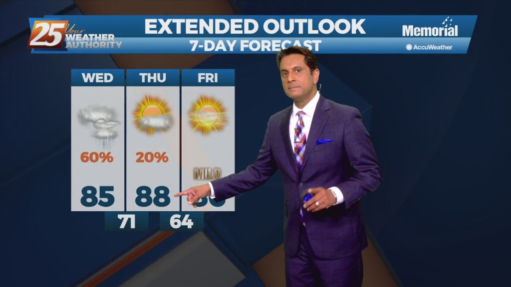
Quiet conditions will continue as the warm and humid flow dominates. A more unsettled weather pattern is expected to take hold on Thursday and continue through…
Today, an upper level disturbance/frontal boundary is expected to influence the area. Scattered to numerous showers and storms will be possible, mainly in the afternoon hours looking…
As the high pressure continues to shift east of the area today, winds will gradually come around to the southeast by this afternoon. Little in the…
High-pressure will slowly move east as a strong cold front will begin moving rapidly SE through the Red River Valley this afternoon, with the return flow…
A west Texas disturbance will slip southeastward off the Texas Coast by Tuesday morning, and will continue to weaken as it moves toward south Florida by Wednesday…
A weak cold front diving southward through the mid-west and lower Tennessee valley will move across the area during the day on Friday, with the upper…
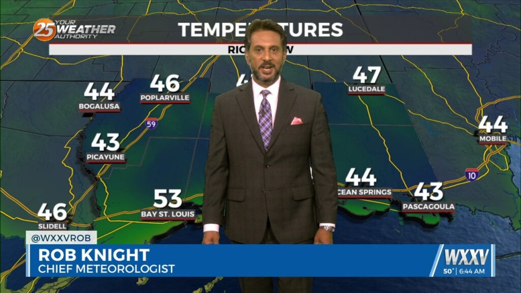
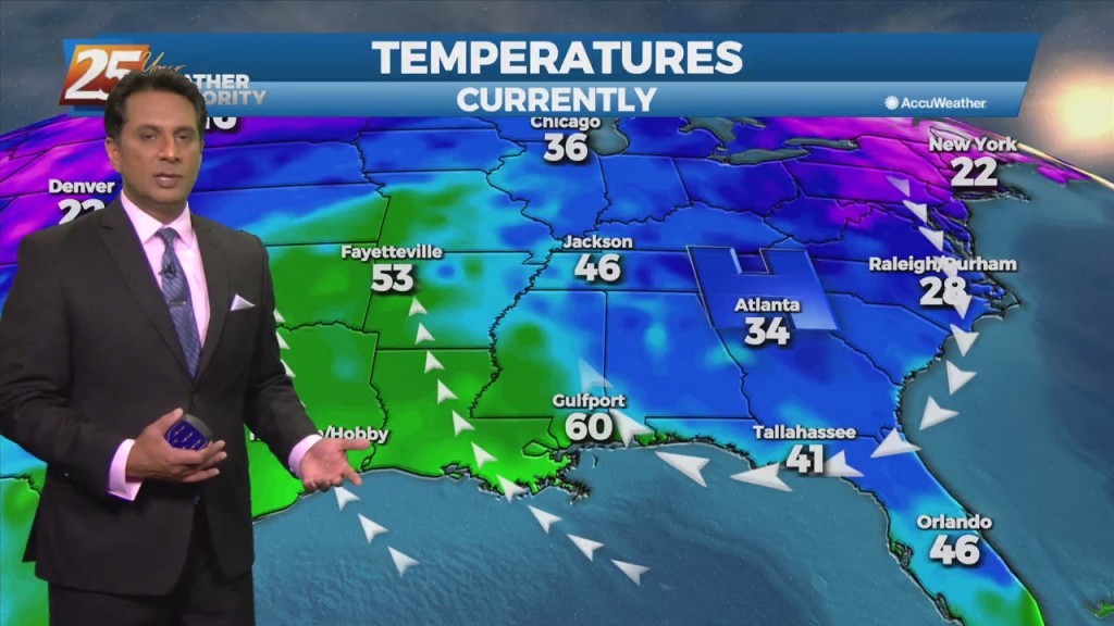
Last night's cold front continues to move east away from the area. High-pressure and strong cold air advection will result in temps struggling to reach mid/upper…
High pressure remains over the area but will be moving towards the northeast. It has warmed up a bit thanks to onshore flow bringing in some modest…
The area of low-pressure is now along the NE'tern GOM moving ENE. Rain is out of the area but clouds will longer today as low-level moisture flow…
The first half of this week will be the end of clear skies and no rain as high-pressure develops and extends along the Mississippi River Valley from the Gulf of Mexico to Canada. Moisture recovery will take some time but…
Any significant weather impacts in the short term for most of the area should be limited to the daytime hours today. As a tropical wave south moves towards the Florida Big Bend area, expect scattered t-storms through today with any…
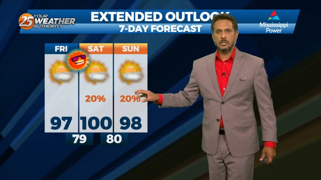
Today and Saturday, a robust high pressure system is expected to build over the region. Southerly to southeasterly surface winds will help to enhance warm air advection and moisture advection into the area. Isolated to scattered showers will be possible…