12/10 Ryan's "More Rain" Tuesday Morning Forecast
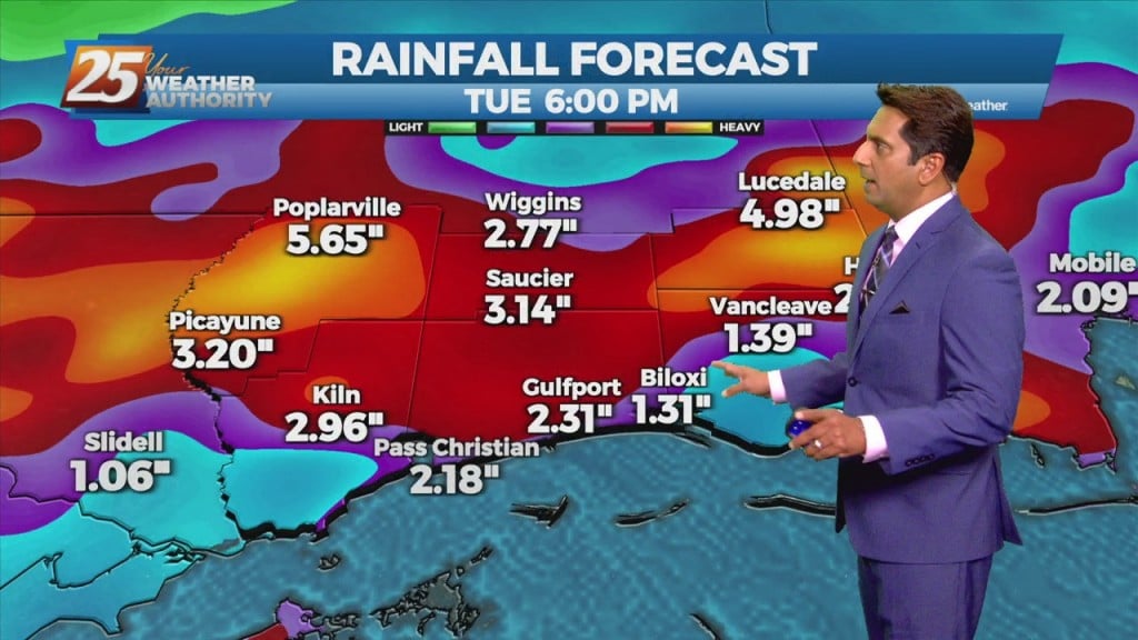
Yesterday saw some local areas end up with a few inches, but we're in for even more rain later today. That's due to a very slow moving front, which…
Yesterday saw some local areas end up with a few inches, but we're in for even more rain later today. That's due to a very slow moving front, which…
With the cold front east of the area and the upper level support moving north-northeast, the front won’t make a lot more progress much further eastward…
Today looks to remain quiet for the first half of the day but storms could begin to fire just to the west and southwest during the early…
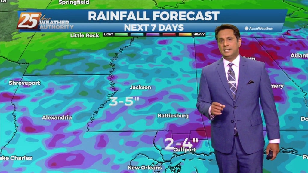
Today saw only isolated evening activity, but there's more rain ahead for South Mississippi starting mid-week. I don't expect much more in terms of coverage for tomorrow, but…
A stationary front will continue to slowly move south and southeastward through the plains to mid/lower Mississippi Valley area, just north of the forecast area during the period. This should lead to widespread coverage of showers and thunderstorms each day.…
The wetter than average summer pattern is expected to continue through the period, and in fact rain chances will be even higher then recent days for much of the short term periods. A stationary front will continue to slowly move/develop…
The interaction of outflow boundaries and sea/land breeze boundaries have been the focus of some recent instances of high rainfall amounts and that will likely be the case as well this afternoon. So while the overall threat for flash…
We really just can't catch a break with this rain as even more falls tonight. There hasn't been much activity over the last few hours, but what we have seen has been heavy,…
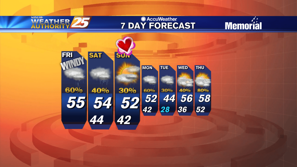
Sad to say we have a wet weekend ahead after our ridiculously wet week, but things will begin drying up quickly as we head into the next....

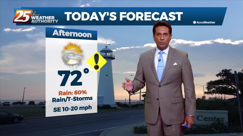
A break from the rain this afternoon as organized activity will begin moving back into the area this evening...
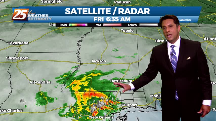
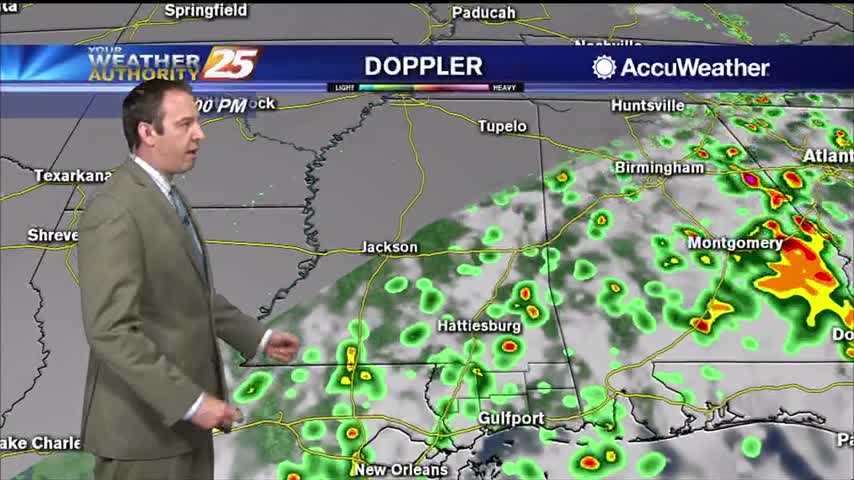
Moderate/heavy rain from the west is beginning to move into south Mississippi...

Strong, gusting winds followed our active afternoon as showers and thunderstorms moved through. The rain will dry up through the night, but come back quickly tomorrow.
Another round of HEAVY RAIN will move into the area this afternoon/evening...
A cold north wind will continue to gust into the 20 mph range through early Saturday morning...
A wet start to the workweek with rain moving in from the SSE...
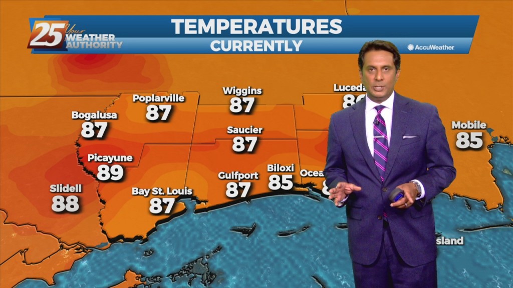
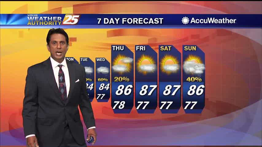
Scattered showers continue in South MS, but these wet, hot, and muggy days are almost over.

It'll be a little drier today due to less rain, but we'll see more in the days ahead before a drastic cool-down....
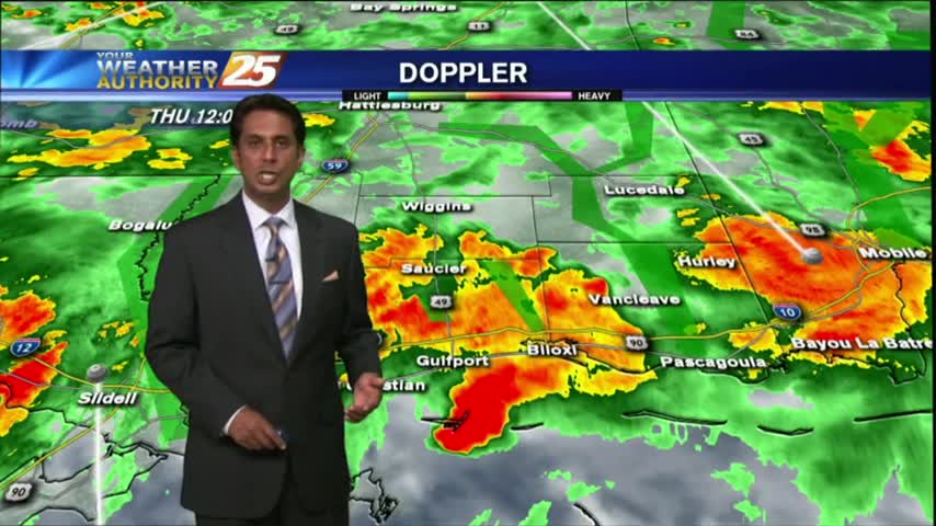
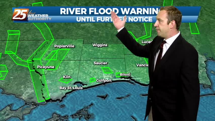
HEAVY RAINFALL has been in the area since last night...and will continue though tonight as a FLASH FLOOD watch continues...
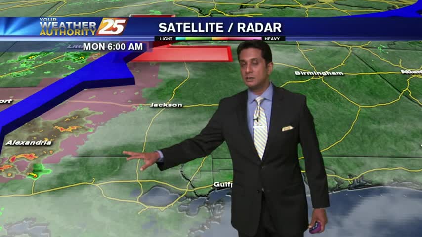
Overcast skies with patchy fog to start-off the workweek...