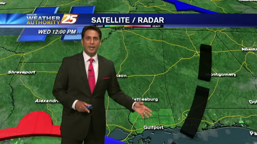
10/21 - Rob's "Changing Pattern" Afternoon Forecast
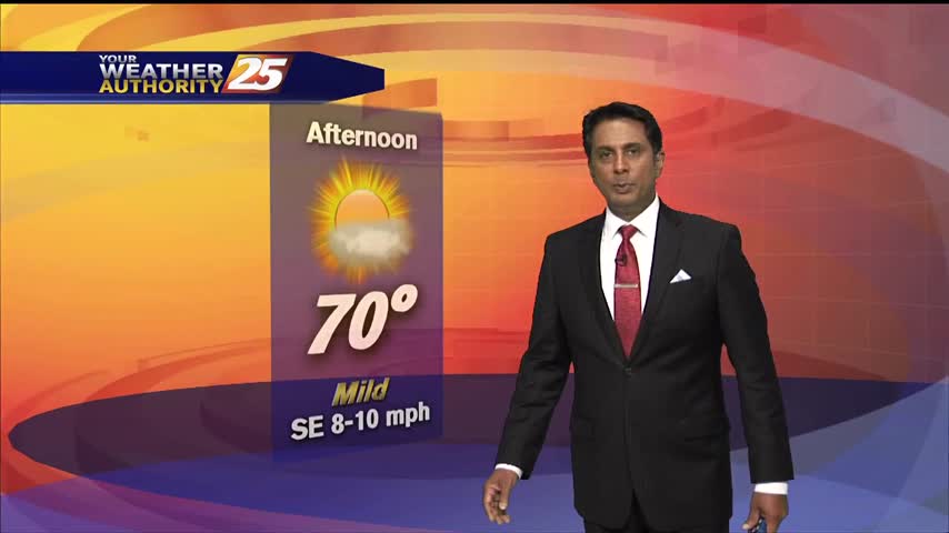
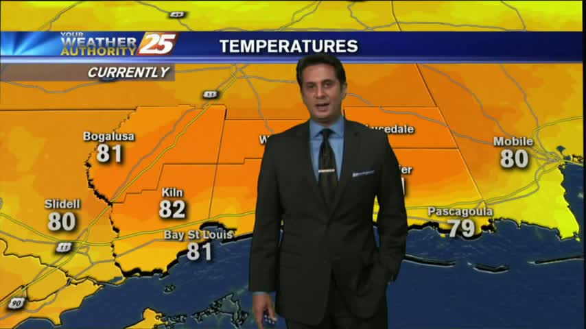
Warm temperatures and a few/party clouds skies heading into this afternoon...

Warm temperatures and a few/party clouds skies heading into this afternoon...

A very muggy morning with areas of light patchy fog north of the interstate...
A slight warmer but more humid start has developed areas of light patchy fog...
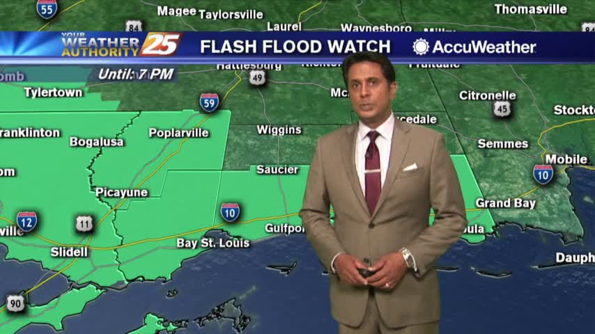
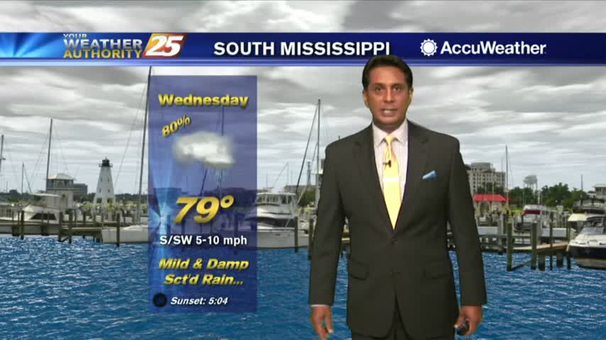
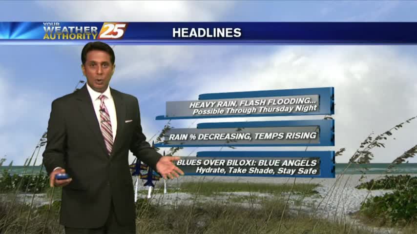
Showers/T-Storms continue to develop and move in from the SW, A FLASH FLOOD Watch is in effect...
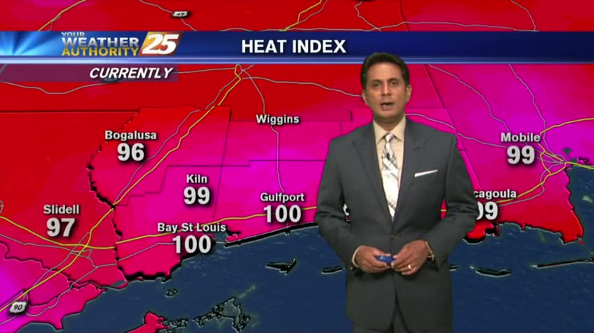
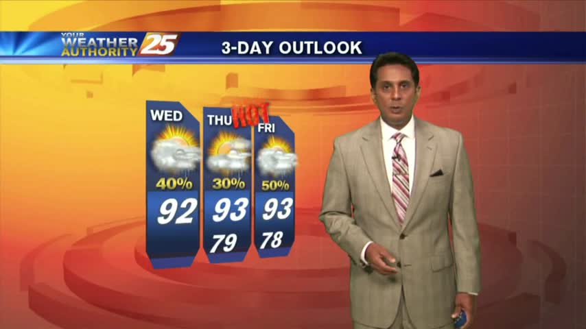
Boy O' Boy is it HOT...and it feels SO MUCH HOTTER with the heat indices...
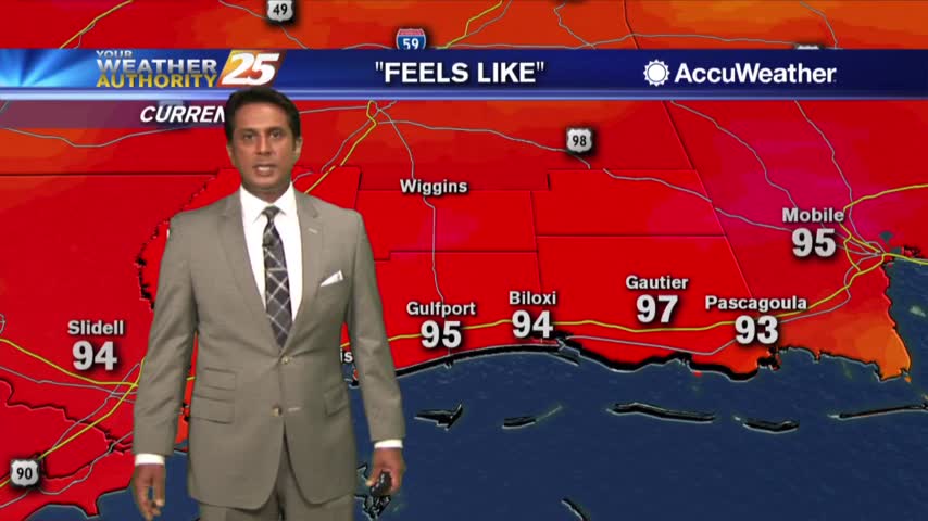
It's ridiculously HOT as temps soar into the upper 80s with HEAT INDICES in the mid-90s...
A much warmer and humid start to the day with a complex of showers/t-storms to our south...
A MUCH warmer start to the day as elevated humidity is flowing in from the SE...
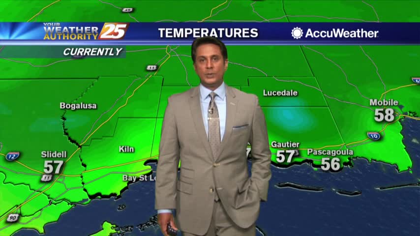
Beautiful blue skies continues as temperatures warm...now in the mid/upper 50s...
A rain-free start to the day under cloudy skies, but light constant rain will move in later this morning...

A better start this morning with only light fog along the viewing area...
A nice start to the day under clear skies with overnight low temps in the low/mid 70s...
A warm start to the day as a few t-storms in the outer-coastal waters are dissipating...
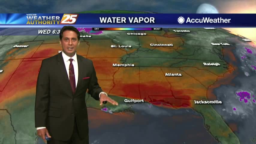
A weak cold front is overhead moving south with a drier air mass beginning to move in...
The clouds have developed along the coastal counties, with showers/t-storms to follow shortly...
Isolated showers/t-storms south of the area overnight has been slowly moving north into the coastal counties...
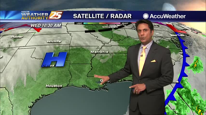
This morning we have another cold front approaching the region which will move the drier air out of the area...
After another afternoon of TORRENTIAL rainfall, this morning is starting off with isolated light rain...
A tad bit warmer this morning with isolated activity south, moving into S. Mississippi...
Isolated showers and cloud coverage prior to sunrise cleared to the SE, with hot temperatures on-tap this afternoon...
A better start to the day as the main focal point for rain has shifted to our SE...
T-storms are developing along the coastal counties, moving very slowly to the NNW...
A much warmer start to the day as an area of high-pressure continues to block the pattern...
A warm/humid and very breezy afternoon is ahead in advance of an approaching cold front...