04/17 Ryan's "Bigger Changes" Friday Night Forecast
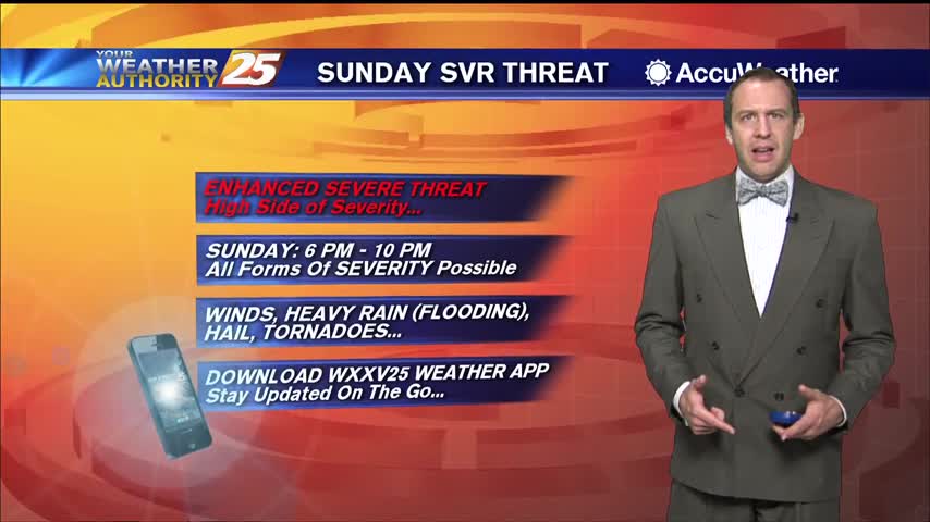
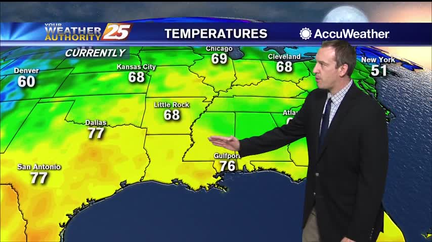
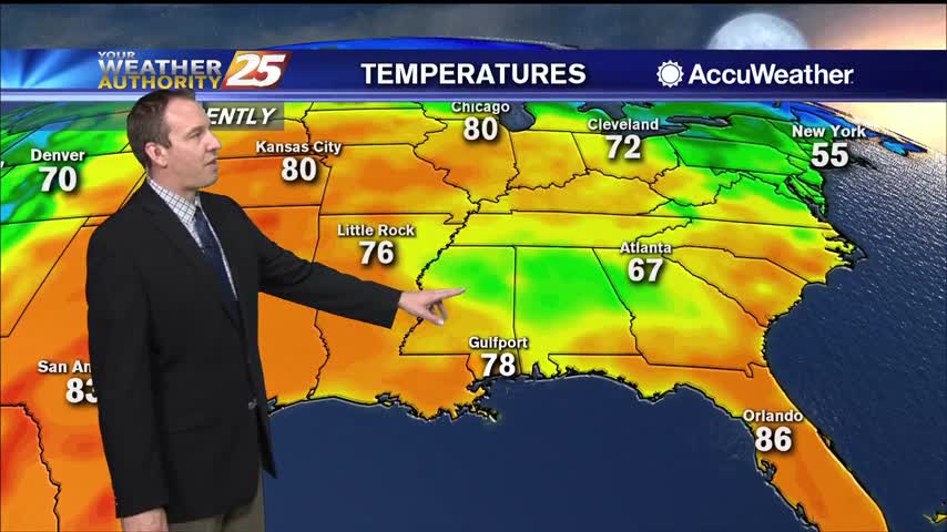
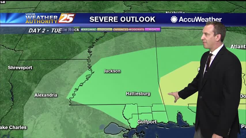
Much warmer and more humid today, and sadly it doesn't improve through the weekend...even gets worse as potentially severe weather moves in to start next week.
Much warmer and more humid today, and sadly it doesn't improve through the weekend...even gets worse as potentially severe weather moves in to start next week.
Hot and humid weather led to some mid 90 heat indices today, but cooler weather is on the way!
One of the hottest days of the year so far and a very warm night ahead, but cooler...relatively drier air is on the way.
Our highest high in quite some time coupled with today's humidity lead to some scary looking heat indices today, but cooler weather is on the way...just looks like it'll be stormy too.
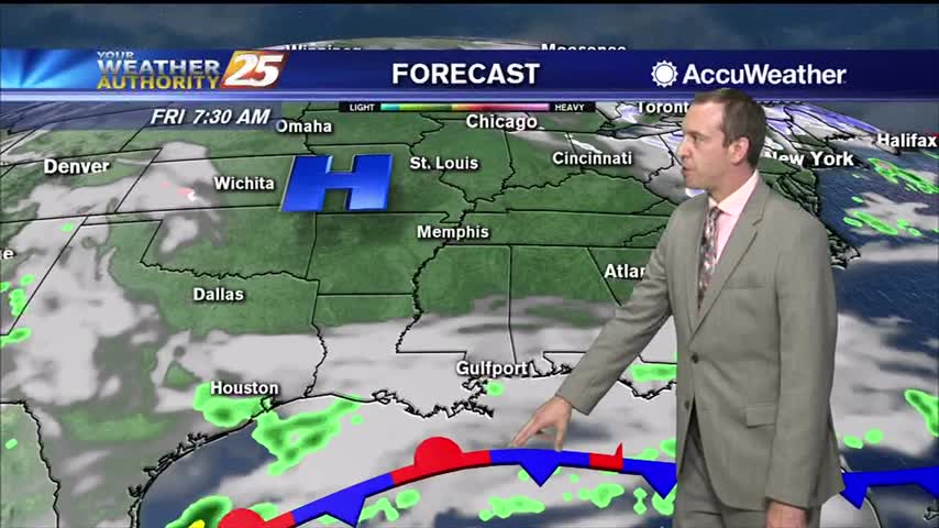
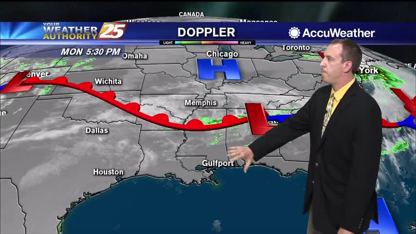
High pressure will maintain its hold over the northeastern Gulf of Mexico throughout today before a cold front advances towards the region by early Thursday morning. While some isolated, light showers are possible this morning, most areas will stay dry. Also…
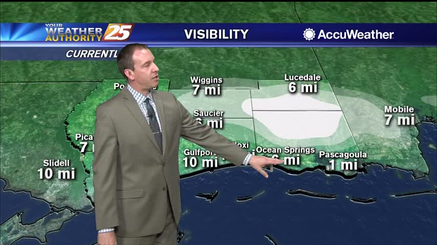
More warm, low visibility conditions moving in tonight with very little change in the days ahead.
More warm and humid conditions tonight, so expect more clouds and another round of patchy fog.
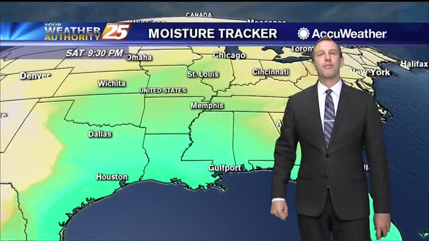
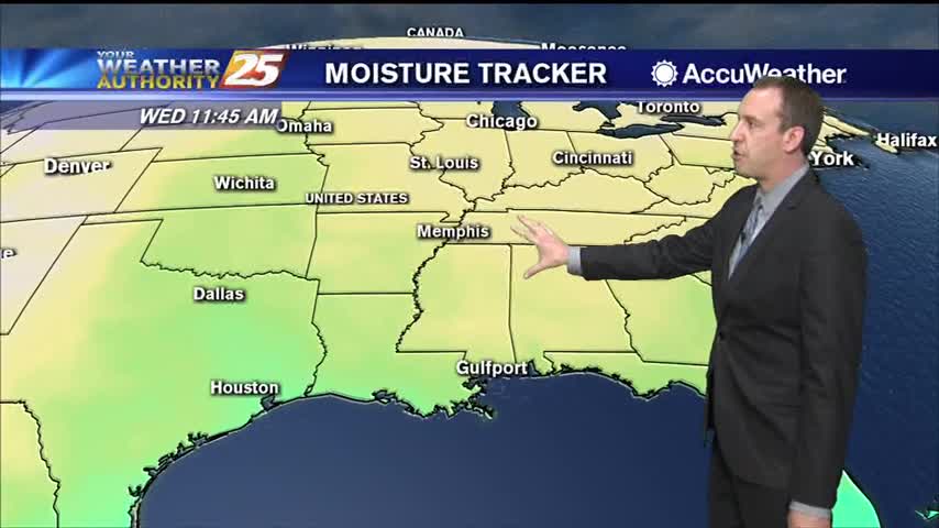
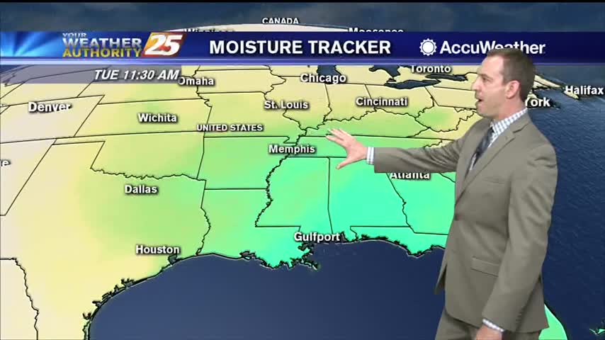
Light southerly winds throughout the weekend have increased the humidity, so get ready for a mild and muggy evening.
Much more humid than how we finished off last week, so expect warmer, foggy nights in the short term.
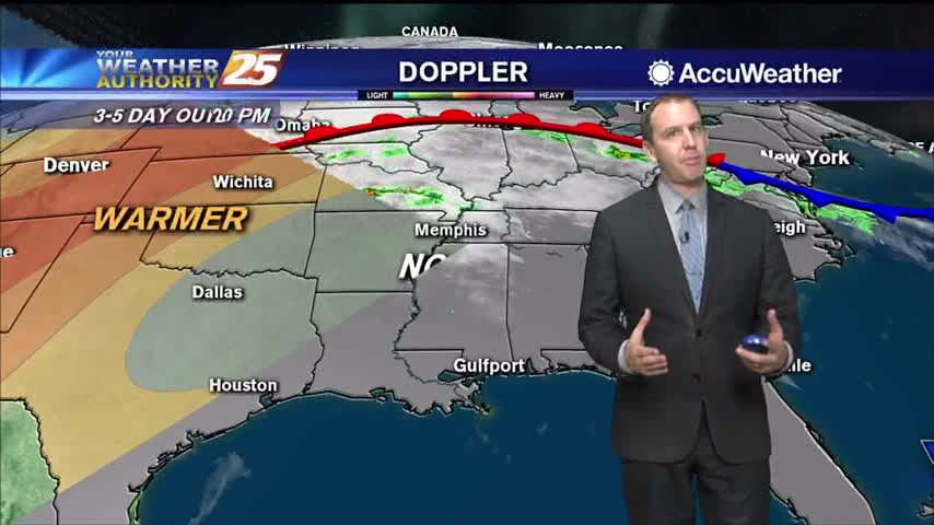
Still playing the waiting game as a front slowly creeps toward us, and we'll see some significantly drier air after it passes.
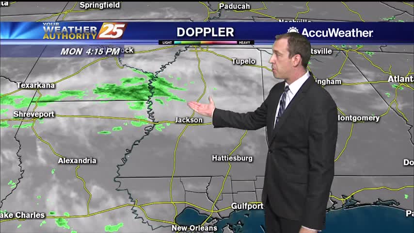
Clouds will continue to build through the night, but we won't see much in the way of rain until around sunrise tomorrow.
Record breaking heat this afternoon with more expected tomorrow, and a warm, humid night with more patchy fog in between.
Today's high temperature barely broke the record set in 2012, but it'll be even warmer tomorrow.
Continued warming will bring us close to or beyond record high temperatures over the next few afternoons, but in between we still have some relatively cooler, foggy nights.
It looks like we just missed today's high temperature record, but even warmer days lie ahead.
A front will move through by lunchtime tomorrow, but we won't see much change. The next front will be a different story.
We'll see some hot afternoons ahead as warm, moist air piles up ahead of a front, but we'll see some slightly cooler and drier days ahead...slightly.
Still a bit on the muggy side, but drier days are ahead...won't be much cooler though.
First significant rain we've seen in a while is moving in, and it'll make it slightly cooler for the weekend.
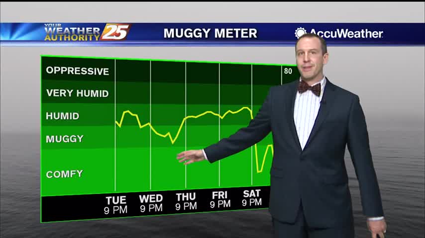
We've seen weeks of similar cloudy, humid days, but changes are finally on the horizon.
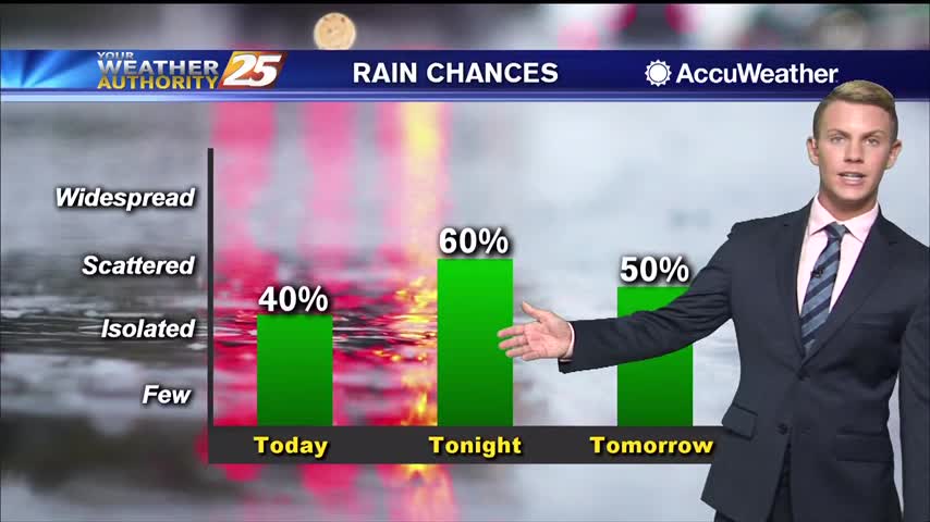
Cloudy skies will continue through the afternoon and early evening with warm and humid conditions. High temperatures will top out in the lower to mid 80s once again. Tonight, rain chances increase to around 60 percent as showers and a…
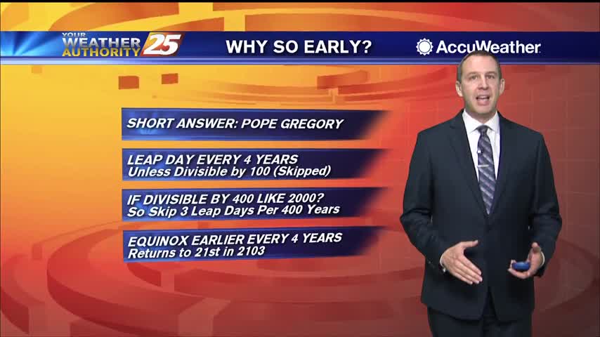
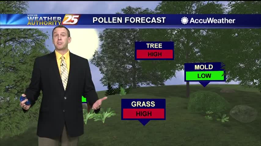
Spring has arrived earlier than usual, and I explain why in the forecast, but cooler weather is on the way as a front moves in.
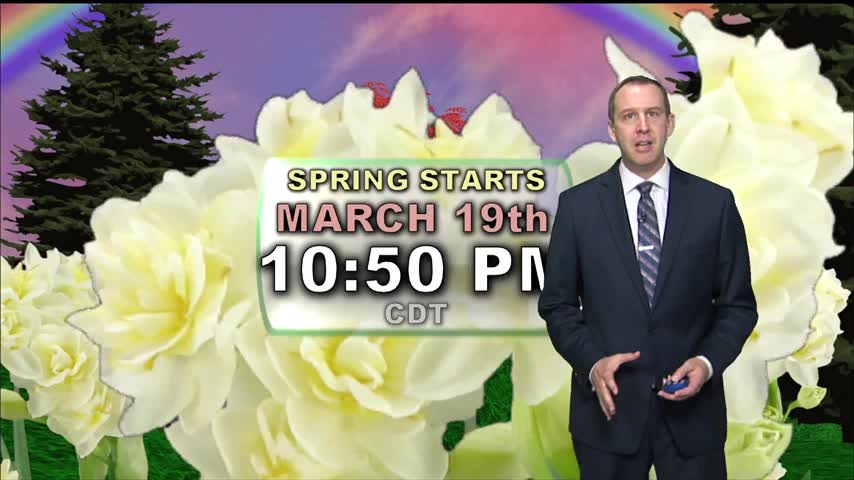
Spring begins tonight just before 11 PM, earlier than it has in nearly 125 years!

Tonight is the last full night of winter, as spring begins tomorrow...the earliest it's been in over a century!