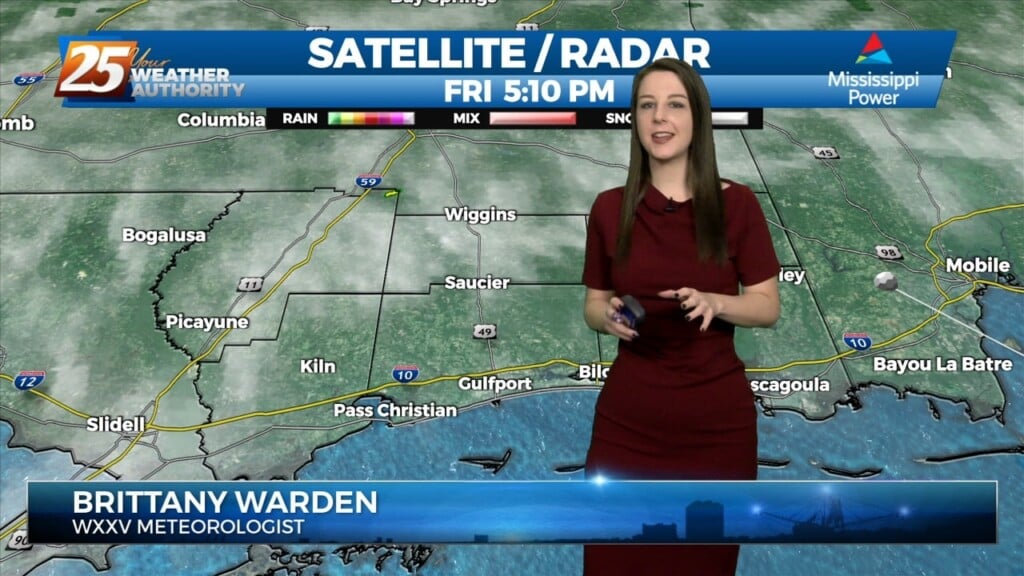
3/3 - The Chief's "Sunny & Breezy Friday Afternoon" Weekend Forecast
TOP TIER WEEKEND AHEAD... Behind the front this afternoon, winds will be gusty and we return back to more normal temperatures. These gusty winds and…
TOP TIER WEEKEND AHEAD... Behind the front this afternoon, winds will be gusty and we return back to more normal temperatures. These gusty winds and…
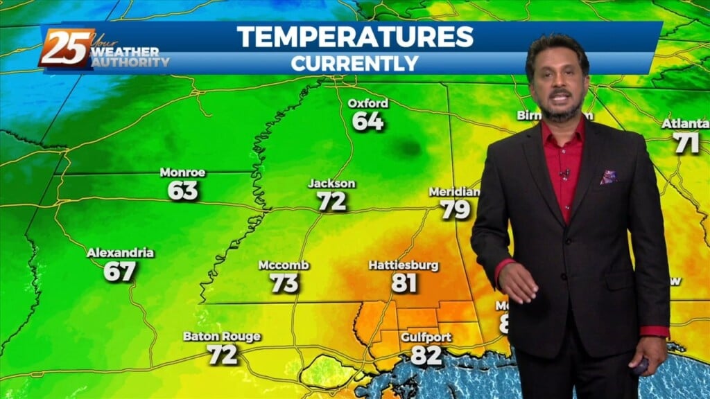
Another warm day across the region with most of the area warming into the lower and middle 80s...which is still well above average for this time of…
Another warm day across the region with most of the area warming into the lower and middle 80s...which is still well above average for this time…
It was definitely another warm one today, even with the amount of cloud cover. As fog the forecast tonight and through the weekend there are mainly just 2 things…
It was definitely another warm one today, even with the amount of cloud cover. As fog the forecast tonight and through the weekend there are mainly just 2…
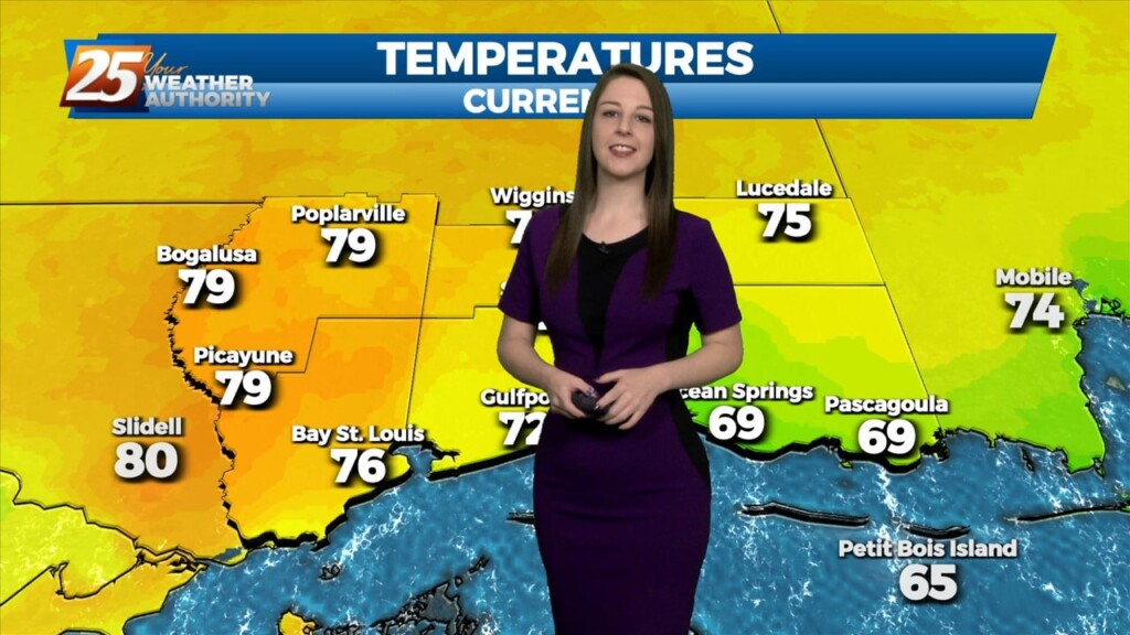
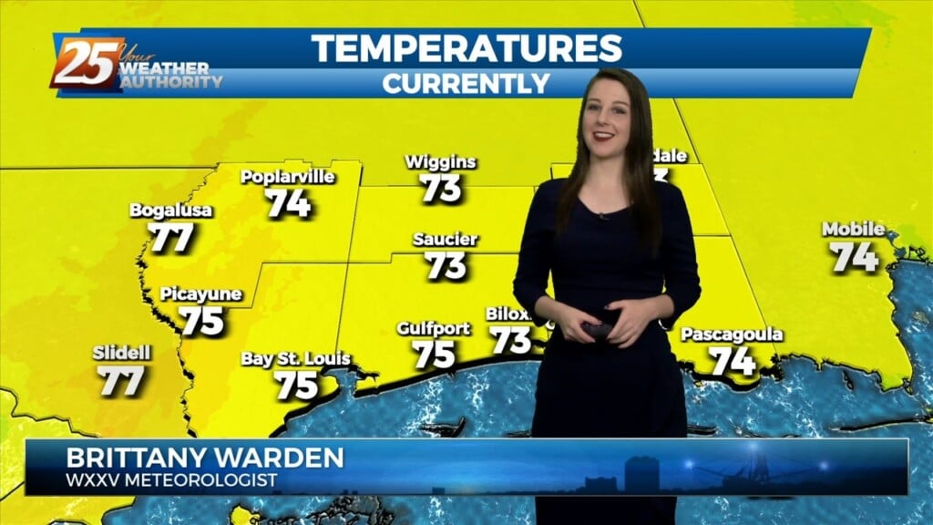
Well-above normal temperatures continue as we close out Mardi Gras with high temperatures in the low 80s across much of the area. Low stratus that developed overnight and held…
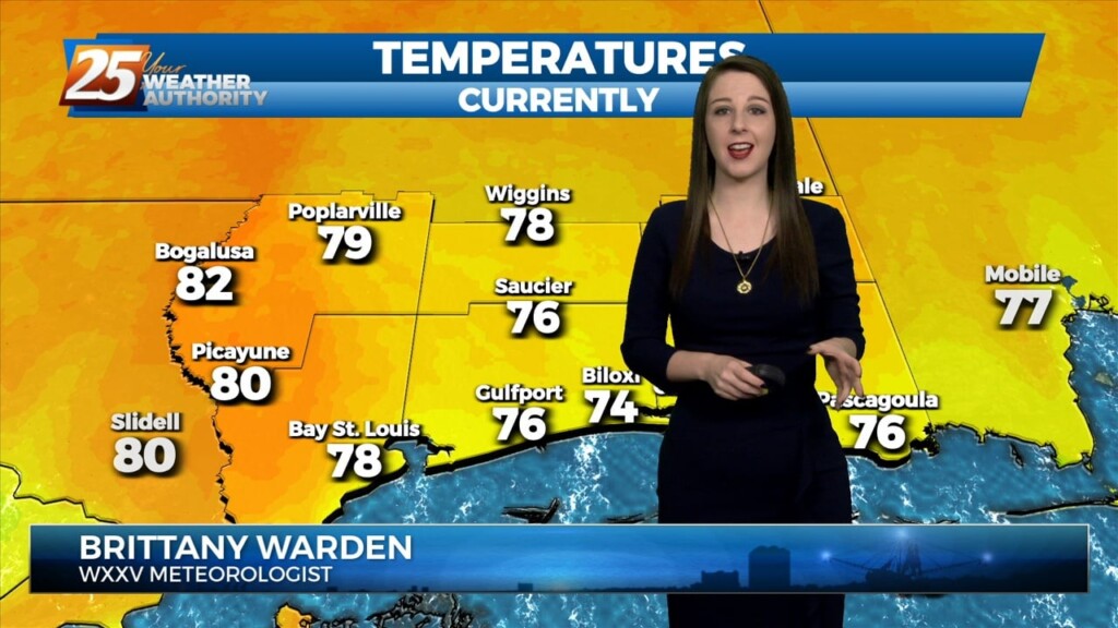
After a quick warm up into the upper 70s, scattered clouds from the west and increasing southwesterly winds have caused temperatures to moderate. Nonetheless, high temperatures still exceeded deterministic…
After a quick warm up into the upper 70s, scattered clouds from the west and increasing southwesterly winds have caused temperatures to moderate. Nonetheless, high temperatures still exceeded deterministic…
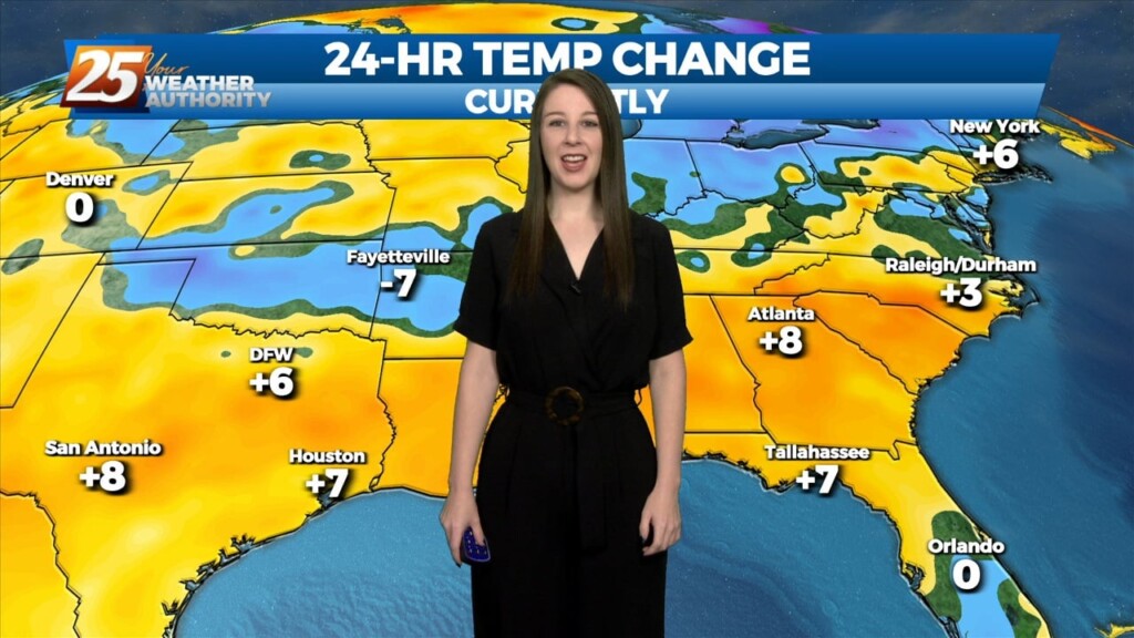
Rising surface pressures and drier air are providing more pleasant conditions across the area today as the upper low, now over the Carolinas, continues off…
Tonight through Wednesday morning... Upper level ridging will dominate the pattern for the next couple of days. Southerly surface winds will help to advect warm…
A beautiful start to our workweek is expected with high pressure remaining in control over the area. Afternoon high temperatures will sit in the low to…
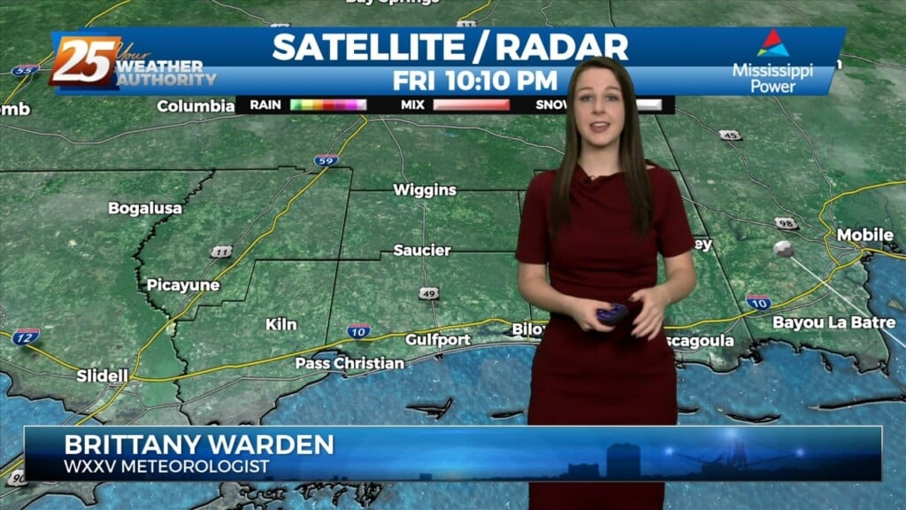
Main forecast problem is rain chances tonight and then morning lows Saturday morning. Today was just another dreary day across much of the area thanks to the stalled boundary…
A transition to a warmer and more humid pattern will take place tonight into tomorrow as a surface ridge centered over the area today begins to shift to the…
A transition to a warmer and more humid pattern will take place tonight into tomorrow as a surface ridge centered over the area today begins to shift to the…
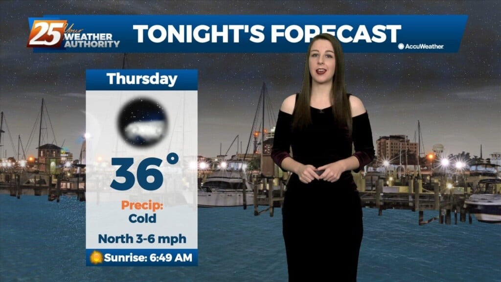
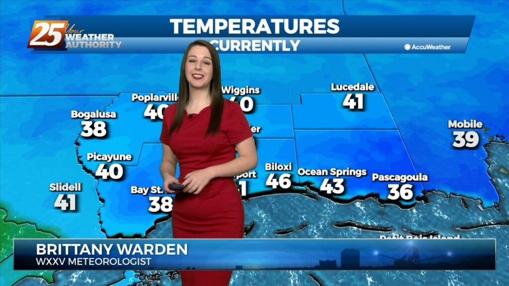
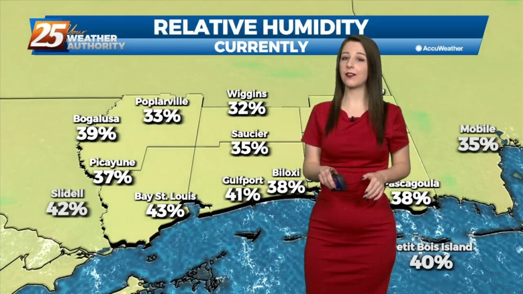
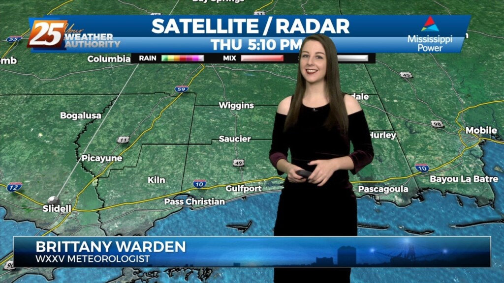
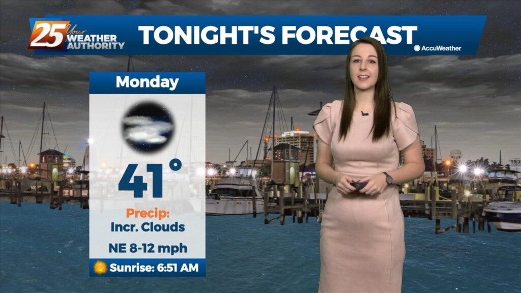
Mostly clear skies and cold temperatures will continue through the night. The only cloud cover expected will be a few high level cirrus clouds passing through on the back…
The region will be dominated by a strong surface high in the low levels, and a largely zonal flow regime in the mid to upper levels…
The cold front associated with yesterday/last night’s system made it through our area before sunrise today. Temperatures remained in the 50s much of today with breezy northwest…
With strong cold air advection and cloud cover, temps will not warm and may actually drop off a few degrees this afternoon. Winds will also…
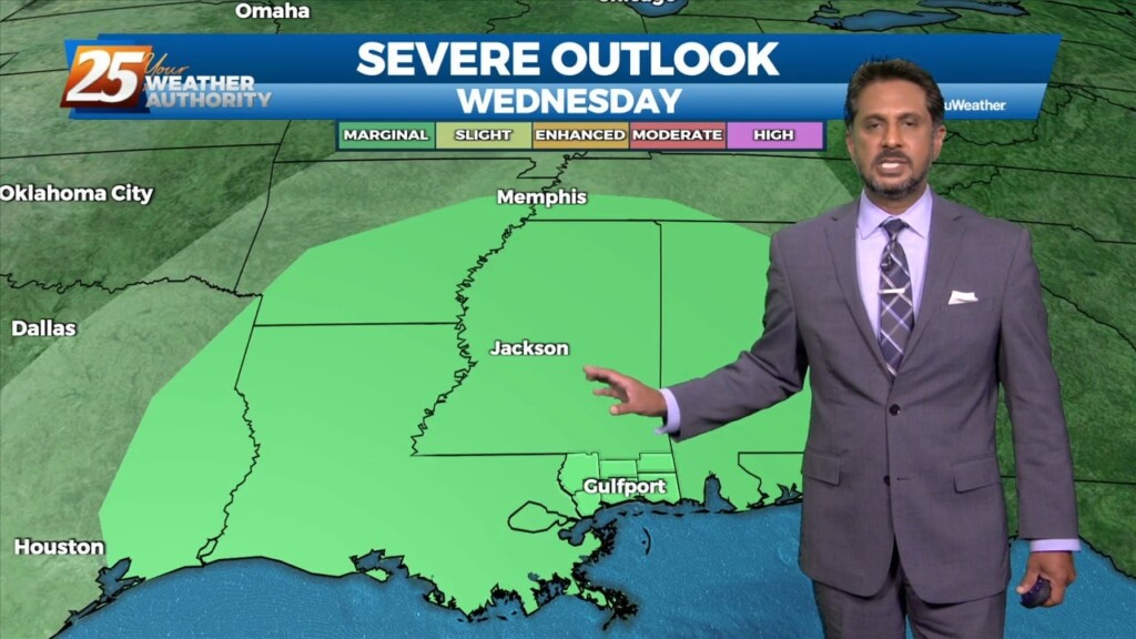
Bottom line up front...main concern for this forecast package will be with the storm system expected to impact the Gulf Coast Tuesday into Wednesday morning,…
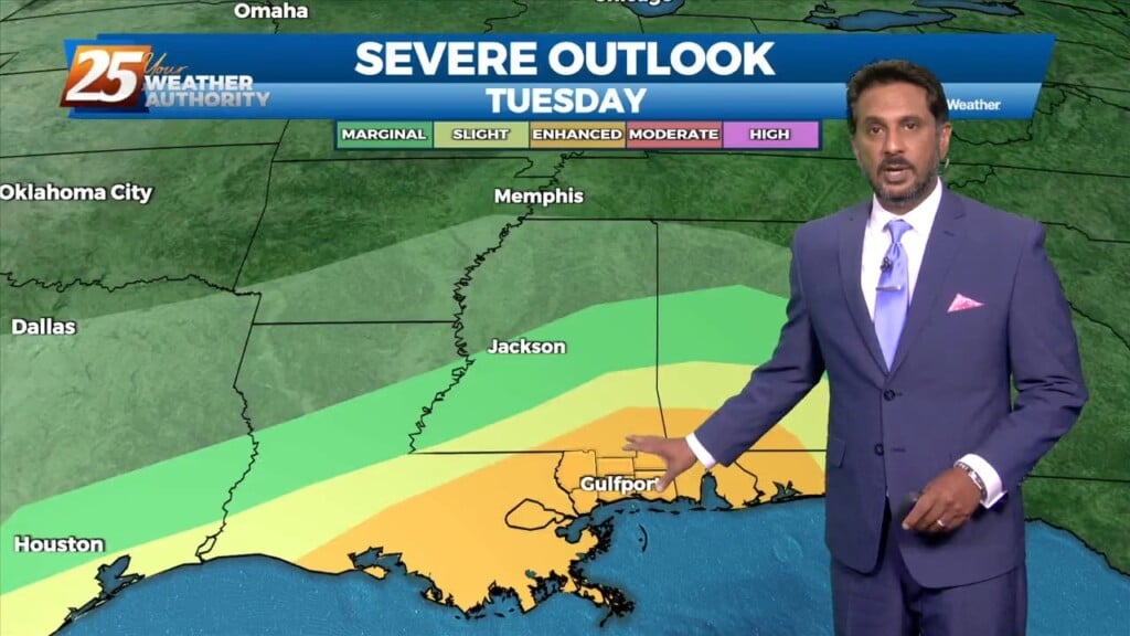
Bottom line up front...main concern for this forecast package will be with the storm system expected to impact the Gulf Coast Tuesday into Wednesday morning, with the…
An upper low currently near the 4-Corners region will deepen as it crosses the southern portion of the Rocky Mountains. As this upper low moves across the Central Plains…
An upper low currently near the 4-Corners region will deepen as it crosses the southern portion of the Rocky Mountains. As this upper low moves across the Central Plains…
High pressure continues to build over the area today and winds will gradually subside over the next 24 hours, at least over land areas. Very…
High pressure continues to build over the area today and winds will gradually subside over the next 24 hours, at least over land areas. Very dry air has moved…