7/19 - Brittany's "Oppressive Heat Ahead" Tuesday Afternoon Forecast
Strong high pressure will continue to shape the forecast with hot temperatures and low rain potential due to the compression of the atmosphere. The best potential for…
Strong high pressure will continue to shape the forecast with hot temperatures and low rain potential due to the compression of the atmosphere. The best potential for…
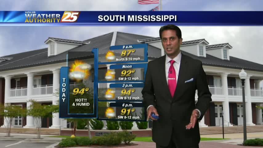
Today will bring a continuation of the past few days and a gradual warming trend as high pressure moves closer to the area. This will also…
The general upper level setup aloft hasn’t changed in the last week or so for all intents and purposes with the exception of small variations. A broad…
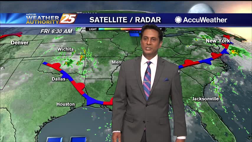
High pressure is centered pretty much over our area as the disturbance that brought the heavy rainfall to portions of the area yesterday, is well…
This afternoon though the weekend, south Mississippi will be in the middle of lower moisture to the east, higher moisture to the west. Convection in the onshore flow should remain isolated to scattered, with the best coverage over the western…
Another beautiful start to the day as the lower humidity continues...
A warm and humid start with a few showers moving in from the S/SE...
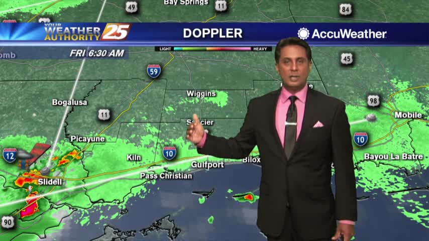
A HUMID start to the day with spotty rain/t-storms develop along the coast and south...
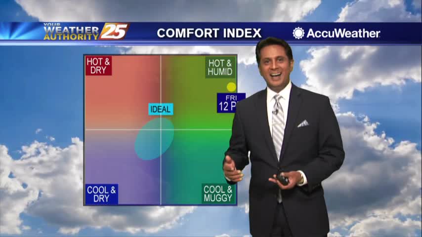
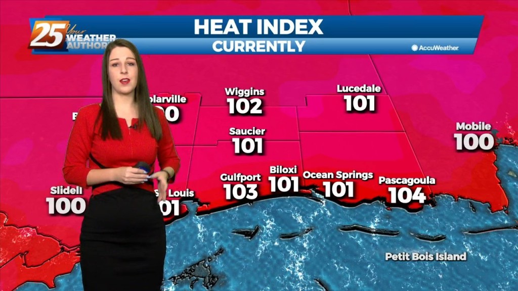
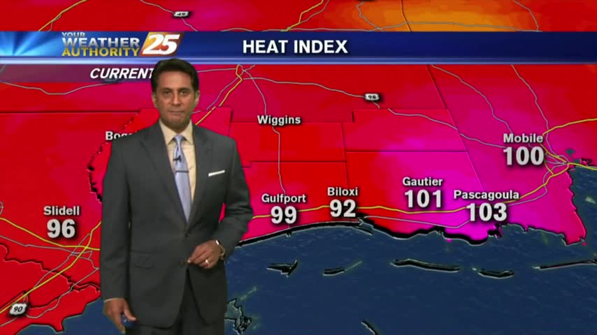
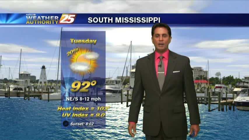
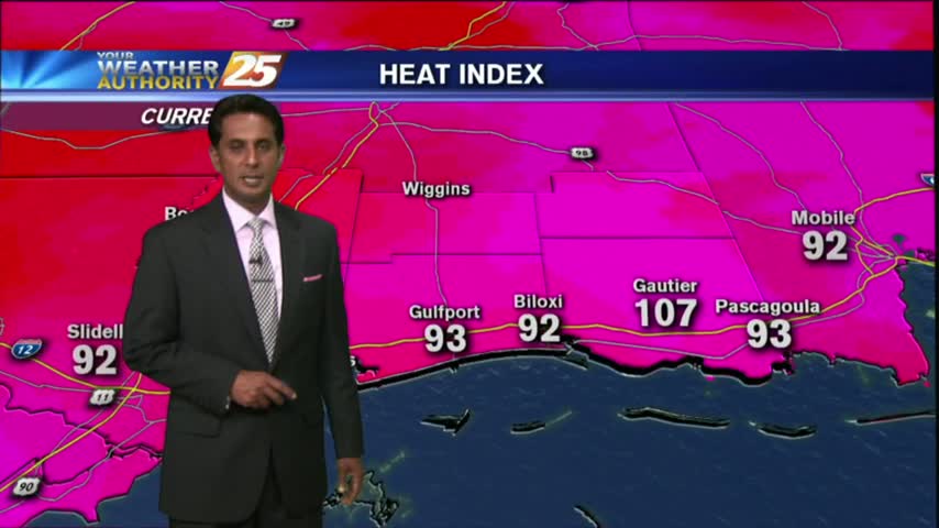
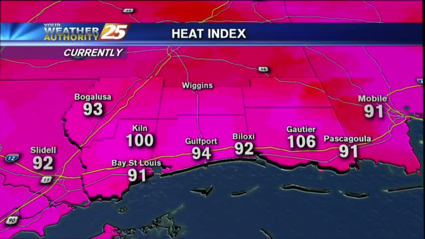
The mercury continues to rise as the heat index has surpassed the century mark...
We're in for many hot and humid days ahead as summer begins today....
Hot and humid today with heat indices climbing into the 105 degree range, and many more similar days area ahead....

A warm and humid start to the day with areas of patchy fog along Jackson county...

A warm & humid start heading into the Memorial Day weekend, with areas of patchy fog...
Hot & humid with the HEAT INDICES pushing 100 degrees. Minimal activity is in the area...
A tad bit warmer this morning with isolated activity south, moving into S. Mississippi...
A WARM start with HOT temps and high heat indices again this afternoon...

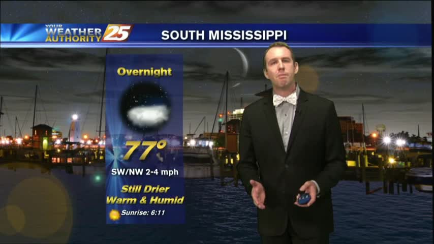
Summer is definitely in the air as morning low temps are in the upper 70s to low 80s...

A HOT day with the sea-breeze developing isolated activity along the southern coastal counties...

Another WARM start to the day with very high HEAT INDICES in play for the weekend...

As the TROPICS continue to heat up, it's a warm/humid start to the day along the Gulf Coast with rain-free conditions...
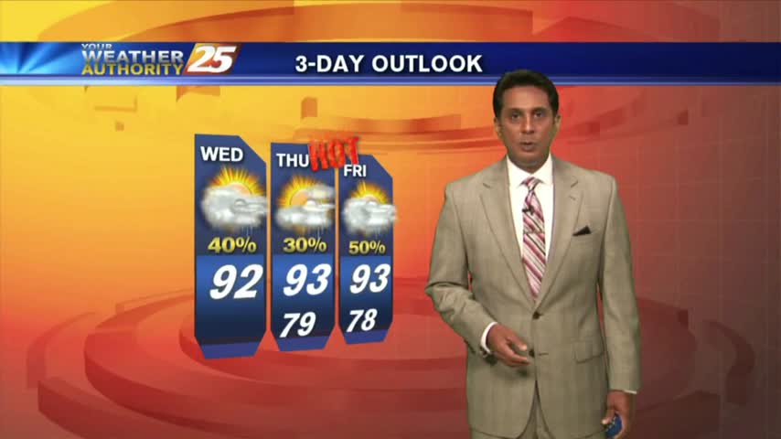
Another warm start to the day with HOT & HUMID conditions. Changes are expected through the final weekend of July with an approaching cold front...
Skies continue to be clear as the mercury climbs into the low/mid 90s...but feels SO MUCH hotter with the heat index.
We saw a few showers pop up this afternoon, and I'm expecting a few more tomorrow, but otherwise it will be very hot and humid. Watch the full forecast for details.
After a rain-free and clear start to the day, heating and moisture flow has triggered a few clouds along the coastal counties.